Ben Stack

Hill, Mountain in Sutherland

Scotland

Ben Stack

Ben Stack Looking towards the summit of Ben Stack from the trig point.
Ben Stack Credit: Raibeart MacAoidh

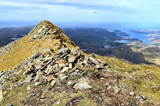
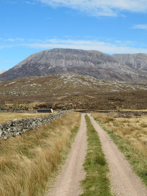
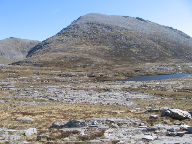
Ben Stack is a renowned hill and mountain located in Sutherland, Scotland. It is part of the North West Highlands and stands at an impressive height of 720 meters (2,362 feet). The peak of Ben Stack offers breathtaking panoramic views of the surrounding landscape, making it a popular destination for hikers and nature enthusiasts.

This distinctive mountain is characterized by its pointed summit and steep slopes, which provide a challenging yet rewarding ascent. The path leading to the summit is well-defined and is suitable for experienced hikers. However, caution must be exercised as the terrain can be rugged and slippery, particularly in wet conditions.

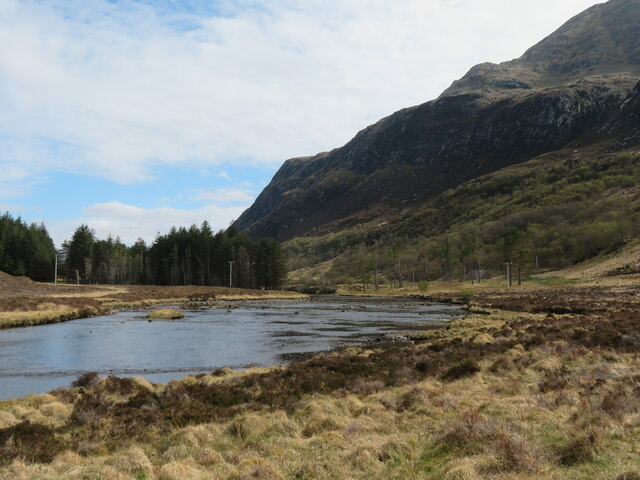
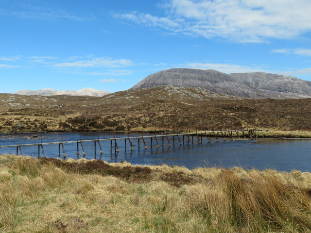
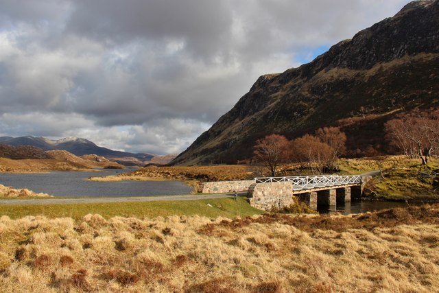
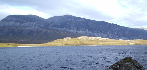
The ascent to the top of Ben Stack presents hikers with stunning views of the surrounding countryside, including the nearby Loch Stack and the vast expanse of wild moorland. On a clear day, it is possible to see as far as the Assynt and Torridon mountains, adding to the allure of this iconic Scottish landmark.

The lower slopes of Ben Stack are covered in heather and scattered boulders, providing a habitat for various species of flora and fauna. The mountain is particularly known for its population of red deer, which can often be spotted grazing in the surrounding glens.

Due to its remote location, Ben Stack offers a peaceful and untouched environment, making it a perfect destination for those seeking solace in nature. Whether it be for the challenge of the hike or the beauty of the surroundings, Ben Stack is a must-visit for anyone exploring the Scottish Highlands.

If you have any feedback on the listing, please let us know in the comments section below.
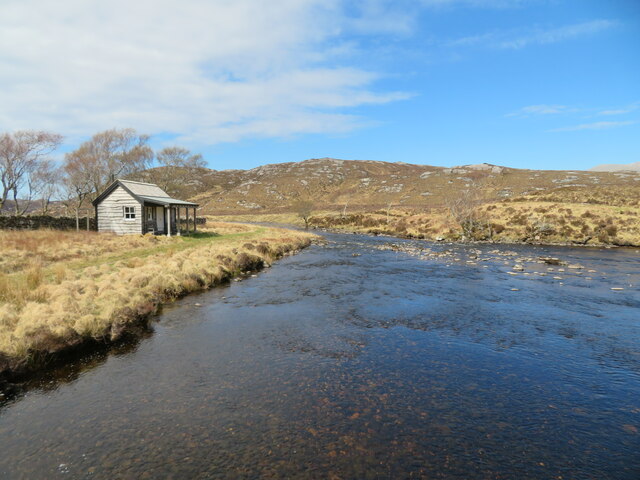
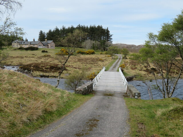
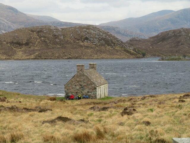
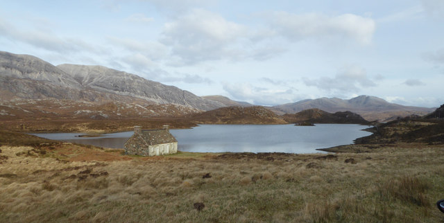
Ben Stack Images

Images are sourced within 2km of 58.334338/-4.9567787 or Grid Reference NC2642. Thanks to Geograph Open Source API. All images are credited.

Ben Stack Looking towards the summit of Ben Stack from the trig point.
Ben Stack
Looking towards the summit of Ben Stack from the trig point.
Ben Stack Looking towards the summit of Ben Stack from the trig point.
Ben Stack
Looking towards the summit of Ben Stack from the trig point.
Ben Stack Looking towards Loch Laxford from the summit of Ben Stack.
Ben Stack
Looking towards Loch Laxford from the summit of Ben Stack.
Ben Stack Looking towards the summit of Ben Stack from the trig point.
Ben Stack
Looking towards the summit of Ben Stack from the trig point.
Celtic Cross on Loch Stack islet Image taken approximately Summer 1976. Can compare vegetation change with other images taken 30 years later.
Celtic Cross on Loch Stack islet
Image taken approximately Summer 1976. Can compare vegetation change with other images taken 30 years later.
Track down to the river Access path to the River Laxford and a footbridge, beyond which rise the steep quartzite slopes towards Arkle's summit ridge.
Track down to the river
Access path to the River Laxford and a footbridge, beyond which rise the steep quartzite slopes towards Arkle's summit ridge.
Upstream along the Laxford A view upstream along the River Laxford just a short way downstream from where it exits Loch Stack. To the right are the dark cliffs that form the ramparts of Ben Stack.
Upstream along the Laxford
A view upstream along the River Laxford just a short way downstream from where it exits Loch Stack. To the right are the dark cliffs that form the ramparts of Ben Stack.
Footbridge over the River Laxford The Laxford is a prime salmon river and has a network of good paths on either bank.
Footbridge over the River Laxford
The Laxford is a prime salmon river and has a network of good paths on either bank.
Fishing hut by the river The River Laxford is noted for salmon fishing and has a series of good footpaths on either bank. There's also superior shelter for fishermen, like this riverbank hut.
Fishing hut by the river
The River Laxford is noted for salmon fishing and has a series of good footpaths on either bank. There's also superior shelter for fishermen, like this riverbank hut.
Estate bridge over the River Laxford The main approach to Laxford Lodge from the main road. The bridge crosses the river at the point where it leaves Loch Stack.
Estate bridge over the River Laxford
The main approach to Laxford Lodge from the main road. The bridge crosses the river at the point where it leaves Loch Stack.
Shelter from the wind A view towards Loch Stack on a day with a fierce east wind, enough for a group of three walkers to take shelter on the lee side of the small building that sits right on the grid line.
Shelter from the wind
A view towards Loch Stack on a day with a fierce east wind, enough for a group of three walkers to take shelter on the lee side of the small building that sits right on the grid line.
Loch Stack and mountains of Reay Forest View eastward on A838 (Durness -Lairg) near Lochstack Lodge, to Arkle (2,580 ft.), Meall Horn (2,548 ft.) etc.
Loch Stack and mountains of Reay Forest
View eastward on A838 (Durness -Lairg) near Lochstack Lodge, to Arkle (2,580 ft.), Meall Horn (2,548 ft.) etc.
Old Croft, Loch Stack A now derelict building at the northern end of the loch.
Old Croft, Loch Stack
A now derelict building at the northern end of the loch.
South side of Ben Stack
Track from Lochstack Lodge
Bridge over River Laxford at Lochstack Lodge
Loch Stack
Loch Stack
Show me another place!

Ben Stack is located at Grid Ref: NC2642 (Lat: 58.334338, Lng: -4.9567787)

Unitary Authority: Highland

Police Authority: Highlands and Islands

What 3 Words

///basics.destroyer.fountain. Near Oldshoremore, Highland

Nearby Locations

Ben Stack

Related Wikis

Ben Stack

Ben Stack (Scottish Gaelic: Beinn Stac) is a mountain in Sutherland, in the northwest of Scotland. It is 721 m (2,365 ft) high. It lies southeast of Laxford...

A838 road

The A838 is a major road in Sutherland, in the Highland area of Scotland. It runs generally northwest from the A836 in the Lairg area to Laxford Bridge...
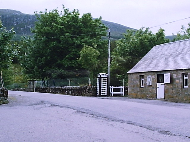
Achfary

Achfary (Scottish Gaelic: Achadh Taigh Phairidh) is a hamlet in the Scottish council area of Highland. To the east of the village lies Loch nan Ealachan...

North West Sutherland National Scenic Area

North West Sutherland is a national scenic area (NSA) covering the mountains and coastal scenery of the northwestern part of the county of Sutherland...

Arkle (Sutherland)

Arkle (Scottish Gaelic: Airceil) is a mountain in Sutherland, in the far north-west corner of the Scottish Highlands. Like its sister Foinaven, the mountain...

Laxford

Laxford is a remote area in the far Northwest Highlands of Scotland around the River Laxford which runs northwest from Loch Stack to Laxford Bay. This...
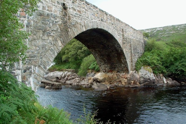
Laxford Bridge

The Laxford Bridge is a stone arch bridge in Sutherland, Scotland which carries the A838 across the River Laxford north to Rhiconich and Durness. The bridge...

Meallan Liath Coire Mhic Dhùghaill

Meallan Liath Coire Mhic Dhughaill (801 m) is a mountain in the Northwest Highlands, Scotland. It lies in the far north of Scotland between Lairg and Durness...

Nearby Amenities

Located within 500m of 58.334338,-4.9567787
Ben Stack
Corbett: no
Ele: 721
Graham: yes
Marilyn: yes
Munro: no
Natural: peak
Prominence: 532
Source: OS7
Wikidata: Q2545603
Wikipedia: en:Ben Stack
Lat/Long: 58.3341301/-4.9564764
The data included in this document is from www.openstreetmap.org. The data is made available under ODbL.

Have you been to Ben Stack?

Leave your review of Ben Stack below (or comments, questions and feedback).