Highgate

Settlement in Kent Tunbridge Wells

England

Highgate

Cottage near Tilden Farm As seen from a farm track leading from Water Lane towards the farm.
Cottage near Tilden Farm Credit: David Anstiss

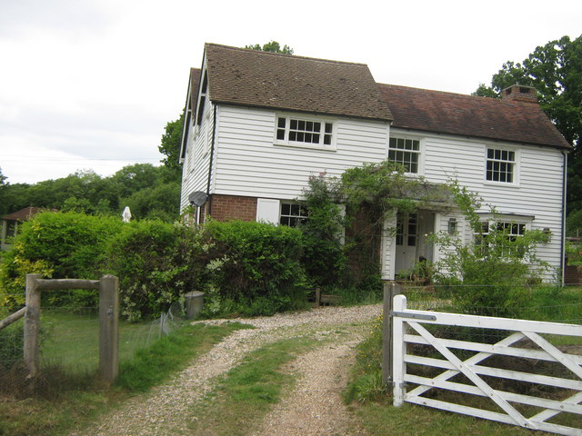
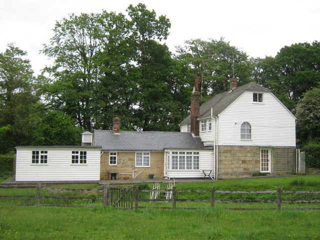
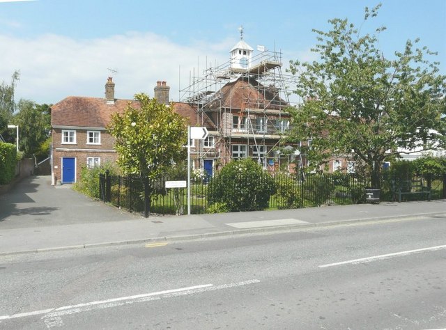
Highgate is a charming village located in the county of Kent, England. Situated in the district of Sevenoaks, it is nestled amidst the picturesque countryside of the Garden of England. The village is known for its idyllic setting, characterized by rolling hills, lush green landscapes, and an abundance of natural beauty.

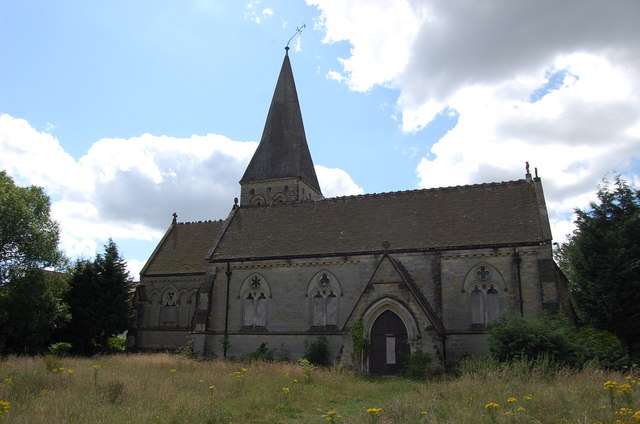
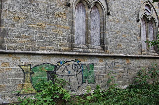
Highgate boasts a rich history that dates back centuries. The village is home to several historic buildings, including a beautiful 12th-century church, St. Mary's Church, which stands as a testament to its long-standing heritage. The church features stunning architectural details and provides a glimpse into the village's past.

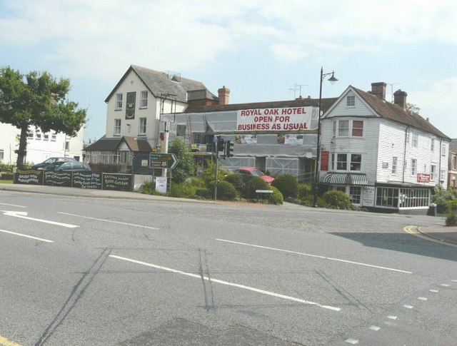
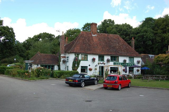
The village itself is small and tranquil, offering a peaceful and serene environment for residents and visitors alike. It is a close-knit community, where locals take pride in their village and its surroundings. Highgate exudes a sense of camaraderie and community spirit, with various events and activities organized throughout the year to bring people together.

Despite its peaceful ambiance, Highgate is well-connected to nearby towns and cities. The village benefits from excellent transport links, with convenient access to major roadways and a nearby train station. This allows residents to easily commute to and from neighboring areas.

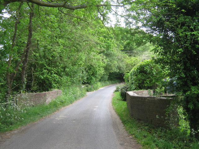
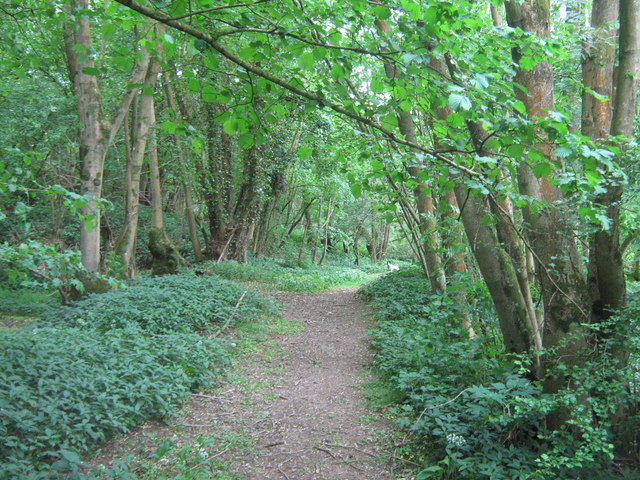
Highgate also benefits from its proximity to the beautiful Kent countryside. The village is surrounded by stunning natural landscapes, offering ample opportunities for outdoor activities such as hiking, cycling, and exploring the nearby woodlands.

In conclusion, Highgate is a picturesque village in Kent that offers a perfect blend of history, natural beauty, and a close-knit community. It provides a tranquil and idyllic setting for residents and visitors to enjoy the best of rural England.

If you have any feedback on the listing, please let us know in the comments section below.
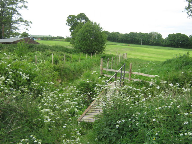
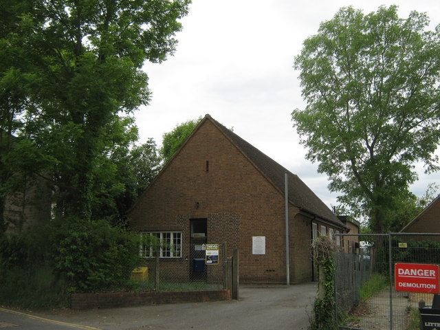
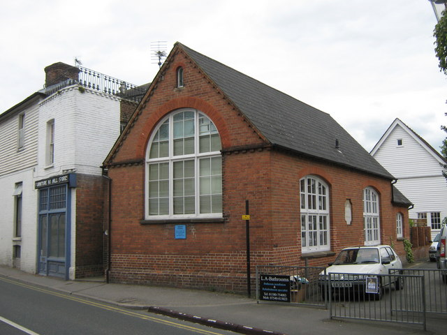
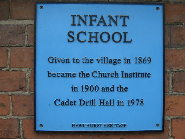
Highgate Images

Images are sourced within 2km of 51.048475/0.512145 or Grid Reference TQ7630. Thanks to Geograph Open Source API. All images are credited.

Cottage near Tilden Farm As seen from a farm track leading from Water Lane towards the farm.
Cottage near Tilden Farm
As seen from a farm track leading from Water Lane towards the farm.
Bridge on Water Lane This road leads from Four Wents to Four Throws.
It leads over the stream from Furnace Mill towards Sopp's Plant Wood.
The bridge is Grade II Listed, same as the next road bridge over another section of the stream.
See <span class="nowrap"><a title="http://www.britishlistedbuildings.co.uk/en-169812-bridge-at-tq-775-314-hawkhurst" rel="nofollow ugc noopener" href="http://www.britishlistedbuildings.co.uk/en-169812-bridge-at-tq-775-314-hawkhurst">Link</a><img style="margin-left:2px;" alt="External link" title="External link - shift click to open in new window" src="https://s1.geograph.org.uk/img/external.png" width="10" height="10"/></span> for more details about the bridge
Bridge on Water Lane
This road leads from Four Wents to Four Throws. It leads over the stream from Furnace Mill towards Sopp's Plant Wood. The bridge is Grade II Listed, same as the next road bridge over another section of the stream. See LinkExternal link for more details about the bridge
Building near Furnace Mill This building is beside one of the mill stream. 
As seen from a footpath leading from Water Lane to Heartenoak Road.
Building near Furnace Mill
This building is beside one of the mill stream. As seen from a footpath leading from Water Lane to Heartenoak Road.
Footpath beside Furnace Mill Stream This track leads through White's Wood towards Heartenoak Road.
Footpath beside Furnace Mill Stream
This track leads through White's Wood towards Heartenoak Road.
Footbridge over Furnace Mill Stream This bridge is on a path leading from Heartenoak Road towards Water Lane near Paul's Farm.
Footbridge over Furnace Mill Stream
This bridge is on a path leading from Heartenoak Road towards Water Lane near Paul's Farm.
Telephone Exchange in Hawkhurst Beside the fire station on Oakley Road.
Telephone Exchange in Hawkhurst
Beside the fire station on Oakley Road.
Infant School, Hawkhurst On the A299 Cranbrook Road.
Was a school now used as a Cadet Drill Hall.
See <a href="https://www.geograph.org.uk/photo/2413364">TQ7630 : Blue Plaque on Infant School</a> for a close-up of the blue plaque on the building.
Infant School, Hawkhurst
On the A299 Cranbrook Road. Was a school now used as a Cadet Drill Hall. See TQ7630 : Blue Plaque on Infant School for a close-up of the blue plaque on the building.
Blue Plaque on Infant School On <a href="https://www.geograph.org.uk/photo/2413358">TQ7630 : Infant School, Hawkhurst</a>.
Blue Plaque on Infant School
Sir Thomas Dunk's Almshouses, Hawkhurst The full name, as given in the title, appears on the rectangular white plate fixed to the railings to the left of the sign post. The scaffolding must have been erected to deal with a maintenance problem.
Sir Thomas Dunk's Almshouses, Hawkhurst
The full name, as given in the title, appears on the rectangular white plate fixed to the railings to the left of the sign post. The scaffolding must have been erected to deal with a maintenance problem.
Royal Oak Hotel, Hawkhurst There are two Tunbridge Wells Borough Council planning applications that may be relevant to this notice: June 2011 11/4000/0678 informal inquiry - insulation and May 2011 11/4000/0501 informal inquiry - repairs to the Royal Oak Hotel, Hawkhurst.
Royal Oak Hotel, Hawkhurst
There are two Tunbridge Wells Borough Council planning applications that may be relevant to this notice: June 2011 11/4000/0678 informal inquiry - insulation and May 2011 11/4000/0501 informal inquiry - repairs to the Royal Oak Hotel, Hawkhurst.
Oak and Ivy Public House
All Saints Church (Derelict), Hawkhurst The Church has been derelict for about 20 years after it was sold off. Its future is uncertain.
All Saints Church (Derelict), Hawkhurst
The Church has been derelict for about 20 years after it was sold off. Its future is uncertain.
Graffiti on disused All Saints Church
Gill's Green Oast Single square kiln oast house. Hoists to roadside. Position of former louvres can be seen to kiln roof.
Gill's Green Oast
Single square kiln oast house. Hoists to roadside. Position of former louvres can be seen to kiln roof.
Gill's Green Oast
Gill's Green Oast
Tesco under construction Not much to see with the hoarding to the front of the site. The construction is due to take 12 weeks (starting from mid August).

Compare with <a href="https://www.geograph.org.uk/photo/2049363">TQ7630 : Arriva Bus Depot - Site of New Tesco</a>
Tesco under construction
Not much to see with the hoarding to the front of the site. The construction is due to take 12 weeks (starting from mid August). Compare with TQ7630 : Arriva Bus Depot - Site of New Tesco
Tesco under construction Not much to see with the hoarding to the front of the site. The construction is due to take 12 weeks (starting from mid August).
Tesco under construction
Not much to see with the hoarding to the front of the site. The construction is due to take 12 weeks (starting from mid August).
Tesco under construction The construction is due to take 12 weeks (starting from mid August).

Compare with <a href="https://www.geograph.org.uk/photo/2049352">TQ7630 : Former Hawkhurst Bus Station and Arriva Bus Depot</a>
Tesco under construction
The construction is due to take 12 weeks (starting from mid August). Compare with TQ7630 : Former Hawkhurst Bus Station and Arriva Bus Depot
Show me another place!

Highgate is located at Grid Ref: TQ7630 (Lat: 51.048475, Lng: 0.512145)

Administrative County: Kent

District: Tunbridge Wells

Police Authority: Kent

What 3 Words

///asterisk.shine.disputes. Near Hawkhurst, Kent

Nearby Locations

Hawkhurst Highgate

Related Wikis

Hawkhurst

Hawkhurst is a village and civil parish in the borough of Tunbridge Wells in Kent, England. The village is located close to the border with East Sussex...

Marlborough House School

Marlborough House School is a co-educational preparatory school situated in 34 acres (14 ha) of countryside in Hawkhurst, Kent. The school currently has...

Beal's Green

Beal's Green is a hamlet north of Hawkhurst in Kent, South East England.

Hawkhurst Moor

Hawkhurst Moor is a village green and sports field at Hawkhurst in Kent. It was the centre of the original village and lies to the south of the modern...

Related Videos

Park Farm Butchers - total traceability in Hawkhurst, Kent

Beef and lamb at Park Farm is raised locally in the pastures surrounding the village of Hawkhurst in the Weald of Kent near Royal ...

THANK-YOU FOR SUBBING TO AKGAMINGVlogs / #1 vlog of 2023

Hey guys I'm soo grateful you've liked my content let's get to 1k subs I wanna share that with u Please share There Is a transcript ...

Nearby Amenities

Located within 500m of 51.048475,0.512145
Bus Stop
Vale Road
Bus: yes
Local Ref: adj
Naptan AtcoCode: 2400102910
Naptan Bearing: SE
Naptan BusStopType: MKD
Naptan CommonName: Vale Road
Naptan Indicator: adj
Naptan Landmark: Vale Road
Naptan NaptanCode: kntjatpj
Naptan RevisionNumber: 1
Naptan Status: act
Naptan Street: Cranbrook Road
Naptan Verified: no
Public Transport: platform
Ref: kntjatpj
Source: naptan_import
Source Date: 2017-12-01
Lat/Long: 51.0512941/0.508928
Bus Stop
British Legion Hall
Bus: yes
Local Ref: E
Naptan AtcoCode: 2400100174
Naptan Bearing: E
Naptan BusStopType: MKD
Naptan CommonName: British Legion Hall
Naptan Indicator: Stop E
Naptan Landmark: British Legion Hall
Naptan NaptanCode: kntgwdgj
Naptan RevisionNumber: 2
Naptan Status: act
Naptan Street: High Street
Naptan Verified: no
Public Transport: platform
Ref: kntgwdgj
Source: naptan_import
Source Date: 2012-05-25
Lat/Long: 51.0479027/0.508343
Bus Stop
British Legion Hall
Bus: yes
Departures Board: timetable
Local Ref: D
Naptan AtcoCode: 2400100176
Naptan Bearing: W
Naptan BusStopType: MKD
Naptan CommonName: British Legion Hall
Naptan Indicator: Stop D
Naptan Landmark: British Legion Hall
Naptan NaptanCode: kntgwdtd
Naptan RevisionNumber: 3
Naptan Status: act
Naptan Street: High Street
Naptan Verified: no
Public Transport: platform
Ref: kntgwdtd
Shelter: yes
Source: naptan_import
Source Date: 2017-12-01
Lat/Long: 51.0476525/0.5086862
Barrier: cycle_barrier
Cycle Barrier: double
Cycle Barrier Installation: fixed
Lat/Long: 51.0478161/0.5102775
Pub
The Royal Oak
Addr City: Cranbrook
Addr Housename: Royal Oak Hotel
Addr Postcode: TN18 4EP
Addr Street: Rye Road
Addr Village: Hawkhurst
Fhrs Id: 1360892
Source Addr: FHRS Open Data
Wikidata: Q26404531
Lat/Long: 51.0471141/0.5100432
Barrier: cycle_barrier
Lat/Long: 51.0474434/0.511451
Cinema
Kino Cinema
Wheelchair: yes
Lat/Long: 51.0472982/0.5109878
Library
Hawkhurst Library
Check Date: 2023-09-16
Wikidata: Q54888897
Lat/Long: 51.0472348/0.511705
Recycling
Lat/Long: 51.0467254/0.511576
Crossing
Crossing: traffic_signals
Crossing Island: no
Crossing Markings: dots
Crossing Ref: pelican
Kerb: lowered
Tactile Paving: yes
Lat/Long: 51.047361/0.5113652
Toilets
Lat/Long: 51.048788/0.5114684
Fire Station
Lat/Long: 51.0488973/0.5115812
Pub
The Queen's Inn
Addr City: Cranbrook
Addr Housename: Queens Inn
Addr Postcode: TN18 4EY
Addr Street: Rye Road
Addr Village: Hawkhurst
Fhrs Id: 624237
Source Addr: FHRS Open Data
Lat/Long: 51.0474949/0.5133429
Post Box
Postal Code: TN18
Ref: TN18 283
Lat/Long: 51.0503956/0.51102
Post Office
Lat/Long: 51.0476582/0.5095499
Hawkhurst
Place: village
Wikidata: Q2744669
Wikipedia: en:Hawkhurst
Lat/Long: 51.0476326/0.5109912
Turning Circle
Lat/Long: 51.045012/0.5093876
Highgate Hill
Bus: yes
Public Transport: stop_position
Lat/Long: 51.0465597/0.509174
Place Of Worship
Hawkhurst Methodist Church
Denomination: methodist
Religion: christian
Lat/Long: 51.0446927/0.5083997
Barrier: cycle_barrier
Cycle Barrier: double
Cycle Barrier Installation: fixed
Lat/Long: 51.0442898/0.5125084
Crossing
Crossing: unmarked
Crossing Markings: no
Lat/Long: 51.0460447/0.5124867
Parking
Parking: surface
Lat/Long: 51.0466946/0.5154722
Recycling
Lat/Long: 51.0467361/0.5153607
Veterinary
Lat/Long: 51.0517849/0.508009
Bank
Lloyds Bank
Brand: Lloyds Bank
Brand Wikidata: Q1152847
Brand Wikipedia: en:Lloyds Bank
Lat/Long: 51.0472812/0.5112998
Bus Stop
Highgate Hill
Bench: no
Bin: no
Bus: yes
Local Ref: C
Naptan AtcoCode: 2400100178
Naptan Bearing: N
Naptan BusStopType: MKD
Naptan CommonName: Highgate Hill
Naptan Indicator: Stop C
Naptan Landmark: Mercers
Naptan NaptanCode: kntgwdjd
Naptan RevisionNumber: 4
Naptan Status: act
Naptan Street: Highgate Hill
Naptan Verified: no
Public Transport: platform
Ref: kntgwdjd
Shelter: no
Source: naptan_import
Source Date: 2017-12-01
Lat/Long: 51.0465643/0.5090982
Bus Stop
Highgate Hill
Bench: yes
Bin: yes
Bus: yes
Local Ref: B
Naptan AtcoCode: 2400100180
Naptan Bearing: S
Naptan BusStopType: MKD
Naptan CommonName: Highgate Hill
Naptan Indicator: Stop B
Naptan Landmark: Mercers
Naptan NaptanCode: kntgwdjm
Naptan RevisionNumber: 4
Naptan Status: act
Naptan Street: Highgate Hill
Naptan Verified: no
Public Transport: platform
Ref: kntgwdjm
Shelter: yes
Source: naptan_import
Source Date: 2017-12-01
Lat/Long: 51.0465313/0.5092969
Bus Stop
All Saints Road
Bus: yes
Local Ref: adj
Naptan AtcoCode: 2400100461
Naptan Bearing: W
Naptan BusStopType: MKD
Naptan CommonName: All Saints Road
Naptan Indicator: adj
Naptan Landmark: All Saints Road
Naptan NaptanCode: kntgtawt
Naptan RevisionNumber: 2
Naptan Status: act
Naptan Street: Rye Road
Naptan Verified: no
Public Transport: platform
Ref: kntgtawt
Source: naptan_import
Source Date: 2017-12-01
Lat/Long: 51.0467044/0.5147131
Bus Stop
Victoria Hall
Bus: yes
Local Ref: G
Naptan AtcoCode: 2400A023300A
Naptan Bearing: E
Naptan BusStopType: MKD
Naptan CommonName: Victoria Hall
Naptan Indicator: Stop G
Naptan Landmark: Church
Naptan NaptanCode: kntawtwg
Naptan RevisionNumber: 6
Naptan Status: act
Naptan Street: Rye Road
Naptan Verified: yes
Public Transport: platform
Ref: kntawtwg
Shelter: yes
Source: naptan_import
Source Date: 2017-12-01
Lat/Long: 51.047302/0.5124608
Bus Stop
All Saints Road
Bus: yes
Local Ref: opp
Naptan AtcoCode: 2400A023310A
Naptan Bearing: E
Naptan BusStopType: MKD
Naptan CommonName: All Saints Road
Naptan Indicator: opp
Naptan Landmark: All Saints Road
Naptan NaptanCode: kntadadt
Naptan RevisionNumber: 4
Naptan Status: act
Naptan Street: Rye Road
Naptan Verified: no
Public Transport: platform
Ref: kntadadt
Source: naptan_import
Source Date: 2017-12-01
Lat/Long: 51.046924/0.5145395
Bus Stop
Victoria Hall
Bench: yes
Bin: yes
Bus: yes
Flag: no
Local Ref: A
Naptan AtcoCode: 2400A023350A
Naptan Bearing: W
Naptan BusStopType: MKD
Naptan CommonName: Victoria Hall
Naptan Indicator: Stop A
Naptan Landmark: Victoria Hall
Naptan NaptanCode: kntawtwt
Naptan RevisionNumber: 4
Naptan Status: act
Naptan Street: Rye Road
Naptan Verified: no
Public Transport: platform
Ref: kntawtwt
Shelter: yes
Source: naptan_import
Source Date: 2014-01-27
Tactile Paving: no
Lat/Long: 51.0473238/0.511111
Bus Stop
Ockley Road
Bus: yes
Local Ref: F
Naptan AtcoCode: 2400A023440A
Naptan Bearing: N
Naptan BusStopType: MKD
Naptan CommonName: Ockley Road
Naptan Indicator: Stop F
Naptan Landmark: Ockley Road
Naptan NaptanCode: kntdadaw
Naptan RevisionNumber: 5
Naptan Status: act
Naptan Street: Cranbrook Road
Naptan Verified: no
Public Transport: platform
Ref: kntdadaw
Source: naptan_import
Source Date: 2017-12-01
Lat/Long: 51.0486115/0.5103414
Bus Stop
Vale Road
Bus: yes
Local Ref: opp
Naptan AtcoCode: 2400A023450A
Naptan Bearing: NW
Naptan BusStopType: MKD
Naptan CommonName: Vale Road
Naptan Indicator: opp
Naptan Landmark: Sandrock
Naptan NaptanCode: kntdadga
Naptan RevisionNumber: 4
Naptan Status: act
Naptan Street: Cranbrook Road
Naptan Verified: yes
Public Transport: platform
Ref: kntdadga
Source: naptan_import
Source Date: 2017-12-01
Lat/Long: 51.0514232/0.5087416
Bank
Barclays
Brand: Barclays
Brand Wikidata: Q245343
Brand Wikipedia: en:Barclays
Operator: Barclays Bank PLC
Lat/Long: 51.0474783/0.5092978
Townhall
Village Hall
Lat/Long: 51.0472195/0.5110193
Toilets
Lat/Long: 51.0472397/0.5109442
Power: pole
Lat/Long: 51.0498877/0.5140489
Power: pole
Lat/Long: 51.0505692/0.5151528
Power: pole
Lat/Long: 51.0510948/0.5159615
Fast Food
Happy Garden
Addr City: Hawkhurst
Addr Housename: 1 The Martins
Addr Street: Highgate Hill
Check Date: 2023-09-16
Cuisine: chinese
Fhrs Id: 18235
Phone: +44 1580 755881
Source Addr: FHRS Open Data
Lat/Long: 51.0471723/0.5093788
Ooh How Lovely
Phone: +44 1580 848303
Shop: houseware
Website: https://www.oohhowlovely.co.uk/
Lat/Long: 51.0475869/0.5100161
Serida Fitness
Leisure: fitness_centre
Phone: +44 7408825000
Website: https://www.seridafitness.co.uk/
Lat/Long: 51.0475966/0.5099368
Addr Housename: Toad Hall
Building: house
Lat/Long: 51.0469752/0.509161
Addr Housename: Mouse Hall
Building: house
Lat/Long: 51.0469142/0.5091213
Power: pole
Lat/Long: 51.0517341/0.507262
The Hawkhurst Local
Addr City: Hawkhurst
Addr Housename: Deanborough House
Addr Housenumber: 2
Addr Postcode: TN18 4JU
Addr Street: Highgate Hill
Opening Hours: Mo-Su 07:00-22:30
Payment Cards: yes
Payment Cash: yes
Payment Coins: yes
Payment Credit Cards: yes
Payment Notes: yes
Payment Visa: yes
Shop: convenience
Lat/Long: 51.0472901/0.5094242
Croft Glass
Addr Street: Highgate Hill
Craft: glaziery
Lat/Long: 51.0473601/0.5094514
Cafe
Hawkhurst Cafe
Addr City: Cranbrook
Addr Housename: Deanborough House
Addr Postcode: TN18 4JU
Addr Street: Highgate Hill
Addr Unit: 4 - 5
Addr Village: Hawkhurst
Fhrs Id: 190344
Internet Access: wlan
Internet Access Fee: no
Phone: +44 1580 388101
Source Addr: FHRS Open Data
Lat/Long: 51.0474181/0.5094819
Freeman Forman
Addr Street: High Street
Office: estate_agent
Lat/Long: 51.0476242/0.5094316
Fast Food
Lovely Of Hawkhurst
Addr Housename: Deanborough House
Addr Postcode: TN18 4JU
Addr Street: Highgate Hill
Addr Village: Hawkhurst
Check Date: 2023-09-16
Cuisine: chinese
Fhrs Id: 23958
Phone: +44 1580 752870
Source Addr: FHRS Open Data
Lat/Long: 51.0472326/0.5094052
Ruffles
Phone: +44 1580 753356
Shop: hairdresser
Lat/Long: 51.0471855/0.5097019
Charging Station
Lat/Long: 51.0473892/0.5119448
Crossing
Crossing: traffic_signals
Crossing Island: no
Crossing Markings: dots
Kerb: lowered
Tactile Paving: yes
Lat/Long: 51.0475419/0.5100316
Post Box
Collection Times: Mo-Fr 17:00; Sa 10:30
Post Box Type: pillar
Ref: TN18 268
Royal Cypher: EIIR
Royal Cypher Wikidata: Q33102113
Lat/Long: 51.0466918/0.5119776
Traffic Signals
Traffic Signals: signal
Traffic Signals Direction: forward
Lat/Long: 51.0475194/0.5095169
Traffic Signals
Traffic Signals: signal
Traffic Signals Direction: backward
Lat/Long: 51.0473523/0.5096367
Traffic Signals
Traffic Signals: signal
Traffic Signals Direction: forward
Lat/Long: 51.0476463/0.5101423
Bus Stop
Copthall Avenue
Bus: yes
Local Ref: opp
Naptan AtcoCode: 2400103089
Naptan Bearing: N
Naptan BusStopType: MKD
Naptan CommonName: Copthall Avenue
Naptan Indicator: opp
Naptan Landmark: Copthall Avenue
Naptan NaptanCode: kntjgtaw
Naptan RevisionNumber: 1
Naptan Status: act
Naptan Street: Highgate Hill
Naptan Verified: no
Public Transport: platform
Ref: kntjgtaw
Source: naptan_import
Source Date: 2012-05-14
Lat/Long: 51.0446637/0.5086457
Ockley Road
Bus: yes
Public Transport: stop_position
Ref: kntdadaw
Lat/Long: 51.048635/0.5103922
Victoria Hall
Bus: yes
Public Transport: stop_position
Ref: kntawtwt
Lat/Long: 51.047382/0.5111179
Victoria Hall
Bus: yes
Public Transport: stop_position
Ref: kntawtwg
Lat/Long: 51.047264/0.5123969
British Legion Hall
Bus: yes
Public Transport: stop_position
Ref: kntgwdtd
Lat/Long: 51.0476989/0.5086892
British Legion Hall
Bus: yes
Public Transport: stop_position
Ref: kntgwdgj
Lat/Long: 51.047842/0.5082637
Generator Method: photovoltaic
Generator Output Electricity: yes
Generator Source: solar
Generator Type: solar_photovoltaic_panel
Location: roof
Power: generator
Lat/Long: 51.0464732/0.518463
Generator Method: photovoltaic
Generator Output Electricity: yes
Generator Source: solar
Generator Type: solar_photovoltaic_panel
Location: roof
Power: generator
Lat/Long: 51.0466503/0.5185823
Generator Method: photovoltaic
Generator Output Electricity: yes
Generator Source: solar
Generator Type: solar_photovoltaic_panel
Location: roof
Power: generator
Lat/Long: 51.0468999/0.5184871
Generator Method: photovoltaic
Generator Output Electricity: yes
Generator Source: solar
Generator Type: solar_photovoltaic_panel
Location: roof
Power: generator
Lat/Long: 51.0469226/0.5182645
Generator Method: photovoltaic
Generator Output Electricity: yes
Generator Source: solar
Generator Type: solar_photovoltaic_panel
Location: roof
Power: generator
Lat/Long: 51.047028/0.5179091
Generator Method: photovoltaic
Generator Output Electricity: yes
Generator Source: solar
Generator Type: solar_photovoltaic_panel
Location: roof
Power: generator
Lat/Long: 51.0469159/0.5178943
Generator Method: photovoltaic
Generator Output Electricity: yes
Generator Source: solar
Generator Type: solar_photovoltaic_panel
Location: roof
Power: generator
Lat/Long: 51.0468156/0.5177173
Generator Method: photovoltaic
Generator Output Electricity: yes
Generator Source: solar
Generator Type: solar_photovoltaic_panel
Location: roof
Power: generator
Lat/Long: 51.0467683/0.5176717
Generator Method: photovoltaic
Generator Output Electricity: yes
Generator Source: solar
Generator Type: solar_photovoltaic_panel
Location: roof
Power: generator
Lat/Long: 51.0466781/0.5173981
Generator Method: photovoltaic
Generator Output Electricity: yes
Generator Source: solar
Generator Type: solar_photovoltaic_panel
Location: roof
Power: generator
Lat/Long: 51.0466495/0.5174799
Generator Method: photovoltaic
Generator Output Electricity: yes
Generator Source: solar
Generator Type: solar_photovoltaic_panel
Location: roof
Power: generator
Lat/Long: 51.0465677/0.5176006
Generator Method: photovoltaic
Generator Output Electricity: yes
Generator Source: solar
Generator Type: solar_photovoltaic_panel
Location: roof
Power: generator
Lat/Long: 51.0464193/0.5174598
Generator Method: photovoltaic
Generator Output Electricity: yes
Generator Source: solar
Generator Type: solar_photovoltaic_panel
Location: roof
Power: generator
Lat/Long: 51.0464808/0.5172117
Generator Method: photovoltaic
Generator Output Electricity: yes
Generator Source: solar
Generator Type: solar_photovoltaic_panel
Location: roof
Power: generator
Lat/Long: 51.0464488/0.5172989
Generator Method: photovoltaic
Generator Output Electricity: yes
Generator Source: solar
Generator Type: solar_photovoltaic_panel
Location: roof
Power: generator
Lat/Long: 51.0462338/0.5151612
Generator Method: photovoltaic
Generator Output Electricity: yes
Generator Source: solar
Generator Type: solar_photovoltaic_panel
Location: roof
Power: generator
Lat/Long: 51.0460787/0.5156735
Generator Method: photovoltaic
Generator Output Electricity: yes
Generator Source: solar
Generator Type: solar_photovoltaic_panel
Location: roof
Power: generator
Lat/Long: 51.046308/0.5152523
Generator Method: photovoltaic
Generator Output Electricity: yes
Generator Source: solar
Generator Type: solar_photovoltaic_panel
Location: roof
Power: generator
Lat/Long: 51.0469378/0.5149774
Generator Method: photovoltaic
Generator Output Electricity: yes
Generator Source: solar
Generator Type: solar_photovoltaic_panel
Location: roof
Power: generator
Lat/Long: 51.0469302/0.5150565
Generator Method: photovoltaic
Generator Output Electricity: yes
Generator Source: solar
Generator Type: solar_photovoltaic_panel
Location: roof
Power: generator
Lat/Long: 51.0469209/0.515129
Generator Method: photovoltaic
Generator Output Electricity: yes
Generator Source: solar
Generator Type: solar_photovoltaic_panel
Location: roof
Power: generator
Lat/Long: 51.0472649/0.5155139
Generator Method: photovoltaic
Generator Output Electricity: yes
Generator Source: solar
Generator Type: solar_photovoltaic_panel
Location: roof
Power: generator
Lat/Long: 51.0472599/0.5156024
Generator Method: photovoltaic
Generator Output Electricity: yes
Generator Source: solar
Generator Type: solar_photovoltaic_panel
Location: roof
Power: generator
Lat/Long: 51.0470887/0.5155796
Generator Method: photovoltaic
Generator Output Electricity: yes
Generator Source: solar
Generator Type: solar_photovoltaic_panel
Location: roof
Power: generator
Lat/Long: 51.0470466/0.515593
Generator Method: photovoltaic
Generator Output Electricity: yes
Generator Source: solar
Generator Type: solar_photovoltaic_panel
Location: roof
Power: generator
Lat/Long: 51.0472557/0.5157472
Generator Method: photovoltaic
Generator Output Electricity: yes
Generator Source: solar
Generator Type: solar_photovoltaic_panel
Location: roof
Power: generator
Lat/Long: 51.047254/0.5158156
Generator Method: photovoltaic
Generator Output Electricity: yes
Generator Source: solar
Generator Type: solar_photovoltaic_panel
Location: roof
Power: generator
Lat/Long: 51.0495776/0.512833
Generator Method: photovoltaic
Generator Output Electricity: yes
Generator Source: solar
Generator Type: solar_photovoltaic_panel
Location: roof
Power: generator
Lat/Long: 51.0497546/0.5126291
Generator Method: photovoltaic
Generator Output Electricity: yes
Generator Source: solar
Generator Type: solar_photovoltaic_panel
Location: roof
Power: generator
Lat/Long: 51.0498002/0.5123556
Generator Method: photovoltaic
Generator Output Electricity: yes
Generator Source: solar
Generator Type: solar_photovoltaic_panel
Location: roof
Power: generator
Lat/Long: 51.0494123/0.513415
Generator Method: photovoltaic
Generator Output Electricity: yes
Generator Source: solar
Generator Type: solar_photovoltaic_panel
Location: roof
Power: generator
Lat/Long: 51.0493988/0.5134794
Generator Method: photovoltaic
Generator Output Electricity: yes
Generator Source: solar
Generator Type: solar_photovoltaic_panel
Location: roof
Power: generator
Lat/Long: 51.0495742/0.5099791
Generator Method: photovoltaic
Generator Output Electricity: yes
Generator Source: solar
Generator Type: solar_photovoltaic_panel
Location: roof
Power: generator
Lat/Long: 51.0495877/0.5100167
Generator Method: photovoltaic
Generator Output Electricity: yes
Generator Source: solar
Generator Type: solar_photovoltaic_panel
Location: roof
Power: generator
Lat/Long: 51.0488812/0.5113873
Generator Method: photovoltaic
Generator Output Electricity: yes
Generator Source: solar
Generator Type: solar_photovoltaic_panel
Location: roof
Power: generator
Lat/Long: 51.0452186/0.510997
Generator Method: photovoltaic
Generator Output Electricity: yes
Generator Source: solar
Generator Type: solar_photovoltaic_panel
Location: roof
Power: generator
Lat/Long: 51.0441638/0.5116555
Generator Method: photovoltaic
Generator Output Electricity: yes
Generator Source: solar
Generator Type: solar_photovoltaic_panel
Location: roof
Power: generator
Lat/Long: 51.0441512/0.5117534
Generator Method: photovoltaic
Generator Output Electricity: yes
Generator Source: solar
Generator Type: solar_photovoltaic_panel
Location: roof
Power: generator
Lat/Long: 51.0441487/0.512605
Generator Method: photovoltaic
Generator Output Electricity: yes
Generator Source: solar
Generator Type: solar_photovoltaic_panel
Location: roof
Power: generator
Lat/Long: 51.0454707/0.5079339
Generator Method: photovoltaic
Generator Output Electricity: yes
Generator Source: solar
Generator Type: solar_photovoltaic_panel
Location: roof
Power: generator
Lat/Long: 51.0454573/0.5079809
Generator Method: photovoltaic
Generator Output Electricity: yes
Generator Source: solar
Generator Type: solar_photovoltaic_panel
Location: roof
Power: generator
Lat/Long: 51.0477835/0.5066183
Generator Method: photovoltaic
Generator Output Electricity: yes
Generator Source: solar
Generator Type: solar_photovoltaic_panel
Location: roof
Power: generator
Lat/Long: 51.0473046/0.5053201
Generator Method: photovoltaic
Generator Output Electricity: yes
Generator Source: solar
Generator Type: solar_photovoltaic_panel
Location: roof
Power: generator
Lat/Long: 51.049183/0.5067149
Generator Method: photovoltaic
Generator Output Electricity: yes
Generator Source: solar
Generator Type: solar_photovoltaic_panel
Location: roof
Power: generator
Lat/Long: 51.0492151/0.5067873
Generator Method: photovoltaic
Generator Output Electricity: yes
Generator Source: solar
Generator Type: solar_photovoltaic_panel
Location: roof
Power: generator
Lat/Long: 51.0445508/0.5090162
Generator Method: photovoltaic
Generator Output Electricity: yes
Generator Source: solar
Generator Type: solar_photovoltaic_panel
Location: roof
Power: generator
Lat/Long: 51.0445272/0.5089666
Generator Method: photovoltaic
Generator Output Electricity: yes
Generator Source: solar
Generator Type: solar_photovoltaic_panel
Location: roof
Power: generator
Lat/Long: 51.0445635/0.508929
Traffic Signals
Traffic Signals: signal
Traffic Signals Direction: backward
Lat/Long: 51.0474487/0.5102595
Crossing
Crossing: traffic_signals
Crossing Island: no
Crossing Markings: dots
Tactile Paving: yes
Lat/Long: 51.0475078/0.5095947
Crossing
Button Operated: yes
Crossing: traffic_signals
Crossing Island: no
Crossing Markings: dots
Kerb: lowered
Tactile Paving: yes
Traffic Signals Sound: no
Traffic Signals Vibration: yes
Lat/Long: 51.0474039/0.5096701
Crossing
Crossing: traffic_signals
Crossing Island: no
Crossing Markings: dots
Kerb: lowered
Tactile Paving: yes
Lat/Long: 51.0474569/0.5101562
Traffic Signals
Traffic Signals: pedestrian_crossing
Traffic Signals Direction: forward
Lat/Long: 51.047366/0.5113067
Traffic Signals
Traffic Signals: pedestrian_crossing
Traffic Signals Direction: backward
Lat/Long: 51.0473565/0.5114221
Fast Food
Hawkhurst Fish Bar
Cuisine: fish_and_chips
Indoor Seating: no
Outdoor Seating: no
Payment Cash: yes
Payment Credit Cards: no
Payment Debit Cards: no
Takeaway: only
Wheelchair: no
Lat/Long: 51.0471151/0.5093621
Fuel
BP
Addr City: Hawkhurst
Addr Postcode: TN18 4HD
Addr Street: Rye Road
Brand: BP
Brand Wikidata: Q152057
Brand Wikipedia: en:BP
Compressed Air: yes
Opening Hours: Mo-Su 06:30-22:00
Website: https://map.bp.com/en-GB/GB/petrol-station/hawkhurst/highgate-s-stn-fs427/4088
Lat/Long: 51.0474901/0.5117842
Barrier: height_restrictor
Maxheight: 1.98
Lat/Long: 51.0481369/0.5089977
Generator Method: photovoltaic
Generator Output Electricity: yes
Generator Source: solar
Generator Type: solar_photovoltaic_panel
Location: roof
Power: generator
Lat/Long: 51.046539/0.5105692
Generator Method: photovoltaic
Generator Output Electricity: yes
Generator Source: solar
Generator Type: solar_photovoltaic_panel
Location: roof
Power: generator
Lat/Long: 51.0486772/0.5090779
The data included in this document is from www.openstreetmap.org. The data is made available under ODbL.

Have you been to Highgate?

Leave your review of Highgate below (or comments, questions and feedback).