Ben Tee

Hill, Mountain in Inverness-shire

Scotland

Ben Tee

Eastern slopes of Ben Tee The eastern slopes of Ben Tee. A rain shower is rolling in from the left. In the distance the forestry plantations on the east side of the Great Glen show up clearly.
Eastern slopes of Ben Tee Credit: Jonathan Venn

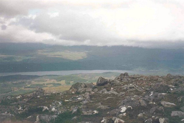
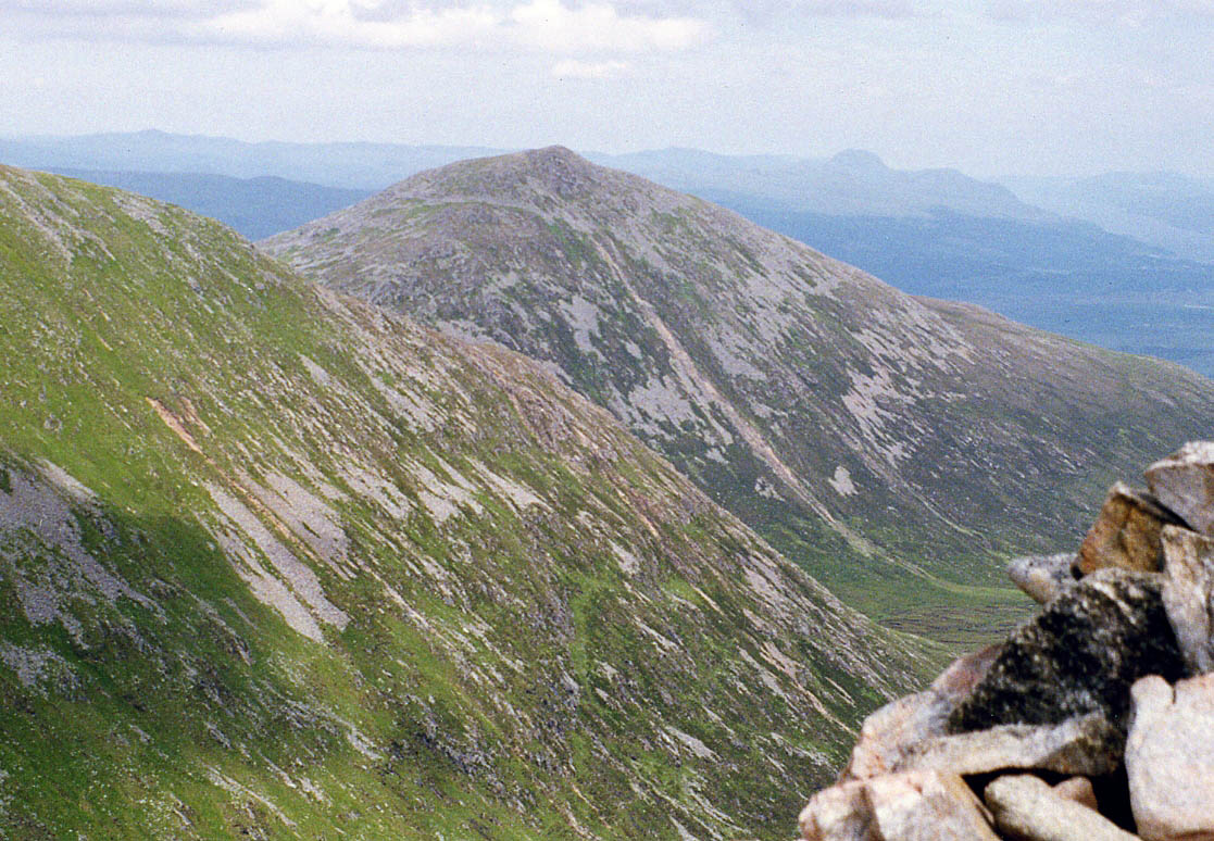
Ben Tee is a prominent hill located in the western part of Inverness-shire, Scotland. With an elevation of 904 meters (2,966 feet), it is considered one of the highest hills in the area. Situated near the Great Glen, Ben Tee provides breathtaking panoramic views of the surrounding landscape.

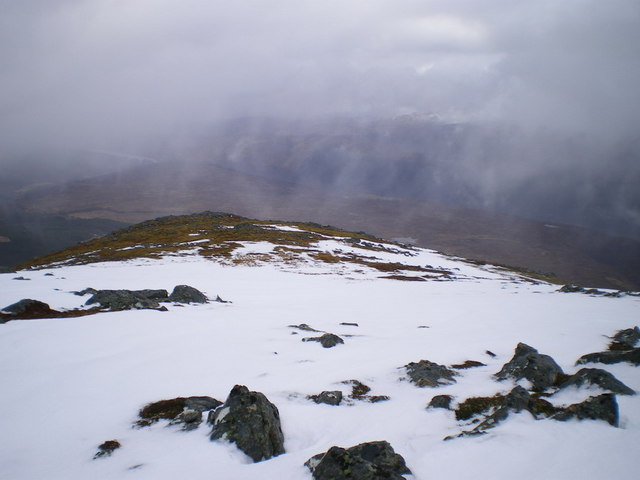
The hill is known for its distinctive shape, resembling a pyramid when viewed from certain angles. It is composed mainly of granite, which gives it a rugged and rocky appearance. The terrain consists of steep slopes and craggy outcrops, making it a challenging climb for outdoor enthusiasts.

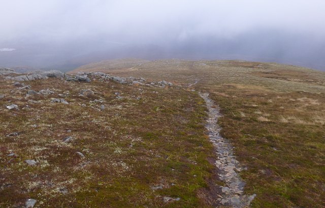
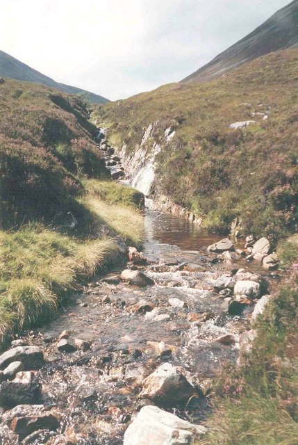
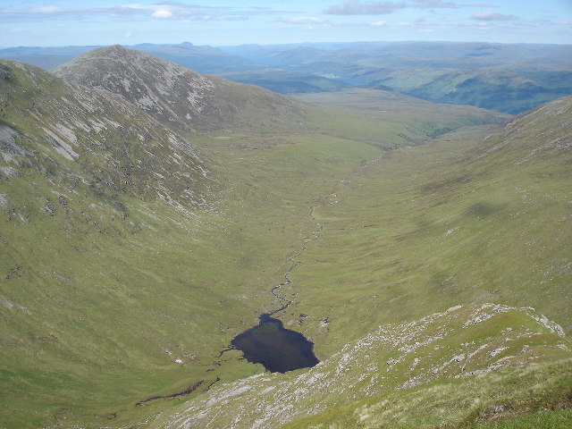
Hikers and mountaineers are drawn to Ben Tee for its stunning vistas and the sense of achievement that comes with reaching its summit. The ascent can be approached from various directions, with the most popular route starting from the north near the village of Roybridge. This path takes climbers through a mixture of heather moorland and boggy ground before reaching the steeper slopes higher up.

From the summit of Ben Tee, on a clear day, one can see the nearby mountains of the Lochaber region, including Ben Nevis, the highest peak in the British Isles. The views extend across the vast expanse of the Great Glen, encompassing Loch Lochy and Loch Linnhe.

While Ben Tee is not as well-known as some of the neighboring peaks, it offers a challenging and rewarding experience for outdoor enthusiasts seeking to explore the beauty of Inverness-shire's mountainous terrain.

If you have any feedback on the listing, please let us know in the comments section below.

Ben Tee Images

Images are sourced within 2km of 57.032211/-4.9007699 or Grid Reference NN2497. Thanks to Geograph Open Source API. All images are credited.

Eastern slopes of Ben Tee The eastern slopes of Ben Tee. A rain shower is rolling in from the left. In the distance the forestry plantations on the east side of the Great Glen show up clearly.
Eastern slopes of Ben Tee
The eastern slopes of Ben Tee. A rain shower is rolling in from the left. In the distance the forestry plantations on the east side of the Great Glen show up clearly.
Summit of Ben Tee On the summit of Ben Tee. Loch Garry and the Great Glen are visible in the distance.
Summit of Ben Tee
On the summit of Ben Tee. Loch Garry and the Great Glen are visible in the distance.
Towards Ben Tee A cairn, at the north-west end of Meall a' Choire Ghlais, part of Sron a' Choire Ghairbh. The hill in the background is Ben Tee.
Towards Ben Tee
A cairn, at the north-west end of Meall a' Choire Ghlais, part of Sron a' Choire Ghairbh. The hill in the background is Ben Tee.
Ben Tee Horizontal sleet and then hail with occasional sunny spells, damp going underfoot.  This distant photo on the way to the summit captured the best view of the day.
Name: Ben Tee
Hill number: 761
Height: 904m / 2966ft
Area: 10C: Loch Arkaig to Glen Moriston
Class: Ma,C
Grid ref: NN 24067 97191
Summit feature: cairn
Drop: 356m
Col: 548m  NN233967
Ben Tee
Horizontal sleet and then hail with occasional sunny spells, damp going underfoot. This distant photo on the way to the summit captured the best view of the day. Name: Ben Tee Hill number: 761 Height: 904m / 2966ft Area: 10C: Loch Arkaig to Glen Moriston Class: Ma,C Grid ref: NN 24067 97191 Summit feature: cairn Drop: 356m Col: 548m NN233967
Eastern slopes of Ben Tee An area of moorland with a mixture of heather and grass, all rather wet on this dreich day. A few sheep roaming around, surprising to see them so far up the hill (about 600m).
Lochan Dìota is visible in the clouds below.
Eastern slopes of Ben Tee
An area of moorland with a mixture of heather and grass, all rather wet on this dreich day. A few sheep roaming around, surprising to see them so far up the hill (about 600m). Lochan Dìota is visible in the clouds below.
Path down Ben Tee This narrow path runs down through rocky slopes and moorland on the eastern side of Ben Tee.

Looking towards the Great Glen and Glen Garry, most of the view obscured by clouds.
Path down Ben Tee
This narrow path runs down through rocky slopes and moorland on the eastern side of Ben Tee. Looking towards the Great Glen and Glen Garry, most of the view obscured by clouds.
Meall nan Dearcag beyond the Kilfinnan Gorge Ben Tee appears on the right in this photo with Meall nan Dearcag on the left.
Meall nan Dearcag beyond the Kilfinnan Gorge
Ben Tee appears on the right in this photo with Meall nan Dearcag on the left.
Eastern ridge of Ben Tee Cotton grass, boggy ground and a peat hag can be seen in this photo.
Eastern ridge of Ben Tee
Cotton grass, boggy ground and a peat hag can be seen in this photo.
Nearly at the top now...the summit of Ben Tee
Summit cairn, Ben Tee Ben Tee is rated as one of Scotland's better "smaller mountains" by Hamish Brown according to Wikipedia.  That said, it is not that small since it is both a Corbett and not far short of being a Munro at a height of 2,966 feet.
Summit cairn, Ben Tee
Ben Tee is rated as one of Scotland's better "smaller mountains" by Hamish Brown according to Wikipedia. That said, it is not that small since it is both a Corbett and not far short of being a Munro at a height of 2,966 feet.
Ben Tee summit view
Ben Tee summit view
Ben Tee in early evening sunshine Ben Tee is on the right in this photo.
Ben Tee in early evening sunshine
Ben Tee is on the right in this photo.
Lochan below Ben Tee This pool is on a ledge part way down the southern slope of Ben Tee.
Lochan below Ben Tee
This pool is on a ledge part way down the southern slope of Ben Tee.
Ben Tee summit Being a Corbett, and an outlier, this undervisited hill is a fine viewpoint; Loch Garry surrounded by its forests is in the glen below.
Ben Tee summit
Being a Corbett, and an outlier, this undervisited hill is a fine viewpoint; Loch Garry surrounded by its forests is in the glen below.
Allt a' Choire Ghlais A view up the young river, south of Ben Tee.
Allt a' Choire Ghlais
A view up the young river, south of Ben Tee.
Eastern Flank of Ben Tee Cloud just clearing from Ben Tee for the first and last time!
Eastern Flank of Ben Tee
Cloud just clearing from Ben Tee for the first and last time!
Downhill from near the summit of Ben Tee Just below the cloudbase on a damp and dull day; these are the upper slopes of the ridge of the Corbett Ben Tee.
Downhill from near the summit of Ben Tee
Just below the cloudbase on a damp and dull day; these are the upper slopes of the ridge of the Corbett Ben Tee.
Looking uphill to Ben Tee Probably the last of the winter snows - somewhat melted and 'plodgy' this particular day. The upper slopes are normally quite a boulderfield above this grass, apparently.
Looking uphill to Ben Tee
Probably the last of the winter snows - somewhat melted and 'plodgy' this particular day. The upper slopes are normally quite a boulderfield above this grass, apparently.
Show me another place!

Ben Tee is located at Grid Ref: NN2497 (Lat: 57.032211, Lng: -4.9007699)

Unitary Authority: Highland

Police Authority: Highlands and Islands

What 3 Words

///pizzeria.addicted.dusts. Near Gairlochy, Highland

Nearby Locations

Ben Tee

Related Wikis

Ben Tee

Ben Tee (Scottish Gaelic: Beinn an t-Sìthidh) is a Scottish mountain situated in the Lochaber area of the Highland council area, some 15 kilometres north...

Coire Glas power station

Coire Glas power station is a proposed 1.5GW pumped storage hydroelectric power station in the Scottish Highlands. If built, it will double the UK's ability...

Kilfinnan Fall

Kilfinnan Fall is a waterfall of Scotland. == See also == Waterfalls of Scotland == References ==

Sròn a' Choire Ghairbh

Sròn a’ Choire Ghairbh is a Scottish mountain situated on the northern side of Loch Lochy, 13 kilometres north of Spean Bridge in the Highland Council...

Nearby Amenities

Located within 500m of 57.032211,-4.9007699
Ben Tee
Corbett: yes
Description: Fairy Hill
Ele: 904
Man Made: cairn
Marilyn: yes
Munro: no
Natural: peak
Prominence: 356
Source: OS7
Wikidata: Q3403914
Wikipedia: en:Ben Tee
Lat/Long: 57.0322675/-4.9008047
The data included in this document is from www.openstreetmap.org. The data is made available under ODbL.

Have you been to Ben Tee?

Leave your review of Ben Tee below (or comments, questions and feedback).