Meall nan Tighearn

Hill, Mountain in Argyllshire

Scotland

Meall nan Tighearn

SW flank of Beinn a Chleibh Dropping down to access the new road being built along the line of pylons from Cruachan power station. Tip for those wanting to use this route ..... don't.
SW flank of Beinn a Chleibh Credit: Hugh Dales

Meall nan Tighearn, located in Argyllshire, Scotland, is a prominent hill/mountain that stands at an elevation of 658 meters (2,159 feet). It is situated within the Loch Lomond and The Trossachs National Park, offering breathtaking views of the surrounding landscapes.

This hill/mountain is part of the Cruachan Horseshoe, a popular hiking route known for its challenging terrain and stunning vistas. Meall nan Tighearn is often included in the route due to its accessibility and the rewarding panoramic views it provides. The ascent to its summit can be approached from various directions, with the most commonly used route starting from the town of Dalmally.

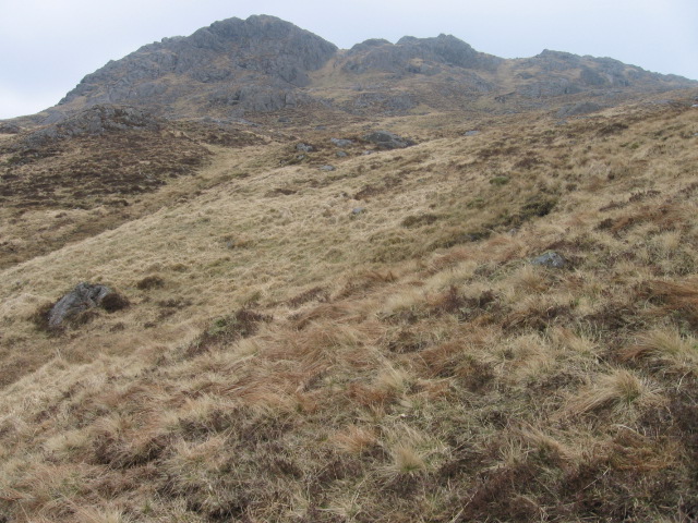
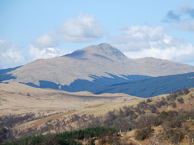
The terrain of Meall nan Tighearn is primarily rocky, with some grassy slopes and patches of heather. Its distinct shape and steep sides make it an attractive feature in the landscape. From the summit, hikers are rewarded with breathtaking views of Loch Awe, the surrounding hills, and on clear days, even the Isle of Mull and the Inner Hebrides.

Due to its location within Loch Lomond and The Trossachs National Park, Meall nan Tighearn is home to a variety of wildlife, including red deer, mountain hares, and various bird species. It also boasts a diverse range of plant life, with heather, mosses, and grasses covering its slopes.

Overall, Meall nan Tighearn is a challenging yet rewarding hill/mountain to climb, offering stunning views and an opportunity to immerse oneself in the natural beauty of the Scottish Highlands.

If you have any feedback on the listing, please let us know in the comments section below.

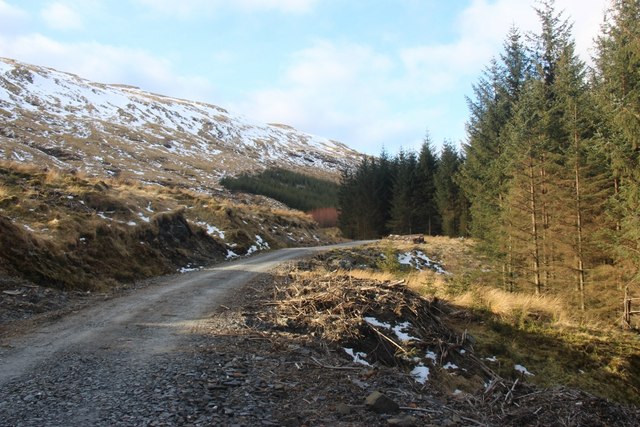
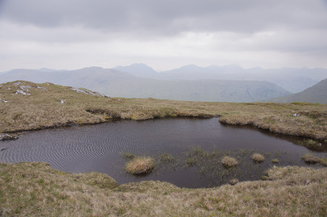
Meall nan Tighearn Images

Images are sourced within 2km of 56.370665/-4.854489 or Grid Reference NN2323. Thanks to Geograph Open Source API. All images are credited.

SW flank of Beinn a Chleibh Dropping down to access the new road being built along the line of pylons from Cruachan power station. Tip for those wanting to use this route ..... don't.
SW flank of Beinn a Chleibh
Dropping down to access the new road being built along the line of pylons from Cruachan power station. Tip for those wanting to use this route ..... don't.
New road The foundations of the pylons on the transmission line from Cruachan are to be upgraded. This new road is being driven over the moors almost to Glen Falloch to allow access for heavy trucks.
New road
The foundations of the pylons on the transmission line from Cruachan are to be upgraded. This new road is being driven over the moors almost to Glen Falloch to allow access for heavy trucks.
Track Removal New track only built in 2021 in order to upgrade the transmission line is now being taken out.
As seen here in Hugh Dale's picture in September 2021:-
<a title="https://www.geograph.org.uk/photo/6967769" href="https://www.geograph.org.uk/photo/6967769">Link</a>. Notwithstanding the mess in the glen there is a fine view of Ben Cruachan and Beinn a' Chochuill from the lower slopes of Beinn a' Chleibh.
Track Removal
New track only built in 2021 in order to upgrade the transmission line is now being taken out. As seen here in Hugh Dale's picture in September 2021:- Link. Notwithstanding the mess in the glen there is a fine view of Ben Cruachan and Beinn a' Chochuill from the lower slopes of Beinn a' Chleibh.
Big Hills From Small Hill Looking East from the slopes of the Graham Meall nan Gabhar to 5 Munros - Beinn a' Chleibh, Ben Lui, Ben Oss, Ben More and Stob Binnein.
Big Hills From Small Hill
Looking East from the slopes of the Graham Meall nan Gabhar to 5 Munros - Beinn a' Chleibh, Ben Lui, Ben Oss, Ben More and Stob Binnein.
Meall nan Gabhar Autumn View In this view it looks much more like the season of Autumn as compared to this picture taken 15 years ago - also in October:-
<a title="https://www.geograph.org.uk/photo/2294635" href="https://www.geograph.org.uk/photo/2294635">Link</a>
Fine view of Mull, Ben Cruachan, Beinn Eunaich and Ben Starav.
Meall nan Gabhar Autumn View
In this view it looks much more like the season of Autumn as compared to this picture taken 15 years ago - also in October:- Link Fine view of Mull, Ben Cruachan, Beinn Eunaich and Ben Starav.
Old and New Plantations From the lower slopes of Meall nan Gabhar you can clearly see several ages of plantation from newly planted to mature trees waiting to be felled. Looking to the Graham of Beinn Bhalgairean and Ben Cruachan.
Old and New Plantations
From the lower slopes of Meall nan Gabhar you can clearly see several ages of plantation from newly planted to mature trees waiting to be felled. Looking to the Graham of Beinn Bhalgairean and Ben Cruachan.
Burns, upper Glen Fyne A series of parallel burns on the north side of upper Glen Fyne.
Burns, upper Glen Fyne
A series of parallel burns on the north side of upper Glen Fyne.
Meall nan Tighearn The south top of   Meall nan Gabhar as seen across Glen Fyne from Ceann Garbh.
Meall nan Tighearn
The south top of Meall nan Gabhar as seen across Glen Fyne from Ceann Garbh.
Power lines, Allt nan Caorainn The power lines which are seen at the head of Loch Lomond and run down Glen Gyle cross some featureless moorland south of Beinn Laoigh.
Power lines, Allt nan Caorainn
The power lines which are seen at the head of Loch Lomond and run down Glen Gyle cross some featureless moorland south of Beinn Laoigh.
Forest road on the lower slopes of Meall nan Gabhar
Forest road in Coire Lair Recently graded for forest extraction lorry traffic
Forest road in Coire Lair
Recently graded for forest extraction lorry traffic
Cairn at NN245230 Built by whom for what purpose?
Cairn at NN245230
Built by whom for what purpose?
Small lochan on the summit of Meall nan Tighearn Looking east on a hazy day.
Small lochan on the summit of Meall nan Tighearn
Looking east on a hazy day.
Meall nan Gabhar (743m) from Meall nan Tighearn (739m)
Plantation beside the Allt a Chaorainn This looks north west over the plantation towards Ben Cruachan - the obtrusive pylons at least bring electricity from a hydro electric scheme
Plantation beside the Allt a Chaorainn
This looks north west over the plantation towards Ben Cruachan - the obtrusive pylons at least bring electricity from a hydro electric scheme
Bealach between Beinn a Chleibh + Meall nan Tighearn This saddle helps create a wonderful walk between Glen Orchy and Glen Falloch.  Ben Cruachan pokes upon the horizon
Bealach between Beinn a Chleibh + Meall nan Tighearn
This saddle helps create a wonderful walk between Glen Orchy and Glen Falloch. Ben Cruachan pokes upon the horizon
Pylon line and forest National Grid pylon line cutting through plantation near Ben Lui Nature Reserve
Pylon line and forest
National Grid pylon line cutting through plantation near Ben Lui Nature Reserve
Grassy hills A grassy ridge stretches from the summit of the 'Graham', Meall nan Gabhar to its subsidiary top Meall Nan Tighearn, which is about 6m lower. The Arrochar Alps can be seen in the distance
Grassy hills
A grassy ridge stretches from the summit of the 'Graham', Meall nan Gabhar to its subsidiary top Meall Nan Tighearn, which is about 6m lower. The Arrochar Alps can be seen in the distance
Show me another place!

Meall nan Tighearn is located at Grid Ref: NN2323 (Lat: 56.370665, Lng: -4.854489)

Unitary Authority: Argyll and Bute

Police Authority: Argyll and West Dunbartonshire

What 3 Words

///screeches.herring.starring. Near Tyndrum, Stirling

Related Wikis

Beinn a' Chleibh

Beinn a' Chleibh (Gaelic: Beinn a' Chlèibh) is a Scottish mountain. It is linked to Ben Lui by a short ridge. == References == The Munros, Scottish Mountaineering...

Ben Lui

Ben Lui (Scottish Gaelic: Beinn Laoigh) is a mountain in the southern Highlands of Scotland. It is a Munro with a height of 1,130 metres (3,710 ft). Ben...

Meall an Fhudair

Meall an Fhudair (764 m) is a mountain in the Grampian Mountains, Scotland. It lies immediately north of the Arrochar Alps, near to the small village of...

Ben Oss

Ben Oss (Scottish Gaelic: Beinn Os) is a mountain in the southern Highlands of Scotland. It is a Munro with a height of 1,029 metres (3,376 ft). Ben Oss...

Beinn Bhuidhe (Glen Fyne)

Beinn Bhuidhe is a mountain near the head of Loch Fyne in Argyll in the Scottish Highlands. It is a Munro with a height of 948 metres (3,110 ft). ��2...

Tyndrum Hills

The Tyndrum Hills are a mountain range located to the south-west of Tyndrum in the Scottish Highlands, within the Strath Fillan and Breadalbane area. They...

Allt na Lairige Dam

Allt na Lairige Dam (Burn of the Pass), is a pre-stressed concrete dam in Argyll and Bute, Scotland at grid reference NN25251745. It creates an impounding...

River Lochy (Glen Lochy)

The River Lochy flows west through Glen Lochy from Loch Bhe to the River Orchy and hence Lochawe in the West Highlands of Scotland. The A85 road parallels...

Nearby Amenities

Located within 500m of 56.370665,-4.854489
Meall nan Tighearn
Ele: 739
Natural: peak
Lat/Long: 56.3706331/-4.8551788
The data included in this document is from www.openstreetmap.org. The data is made available under ODbL.

Have you been to Meall nan Tighearn?

Leave your review of Meall nan Tighearn below (or comments, questions and feedback).