Stob Coire Creagach
Hill, Mountain in Argyllshire
Scotland
Stob Coire Creagach
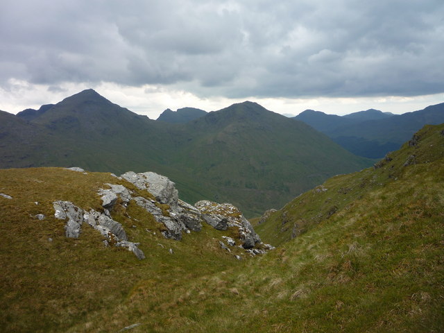
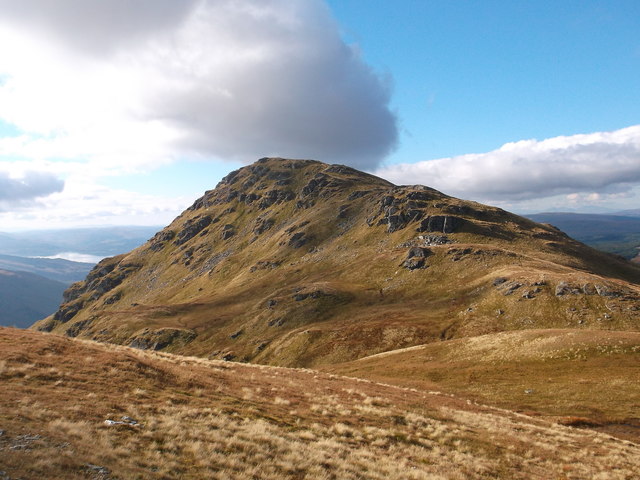
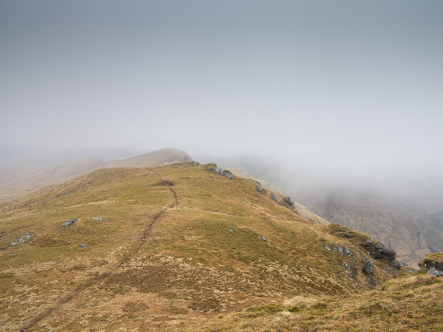
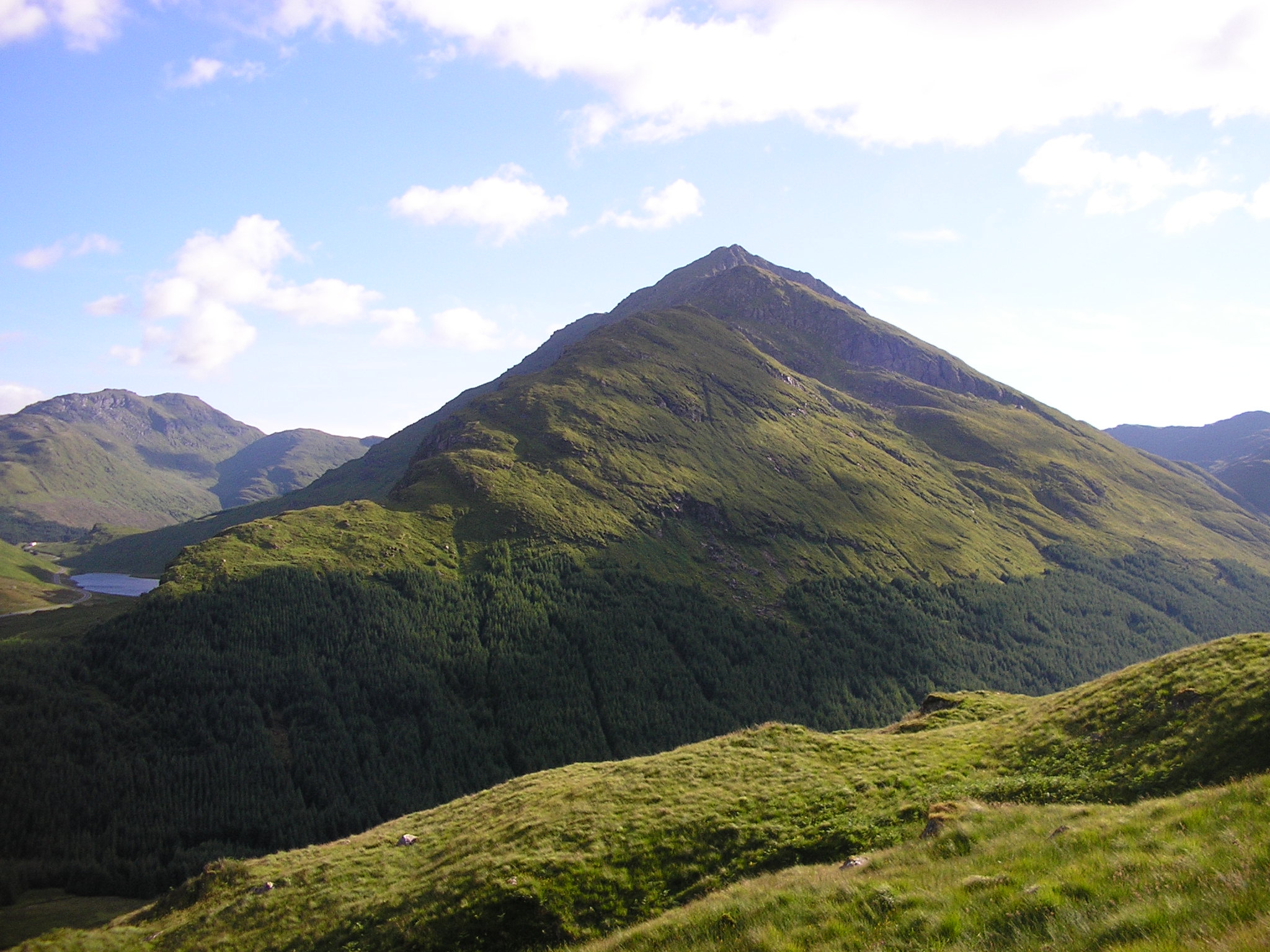
Stob Coire Creagach is a prominent hill situated in Argyllshire, Scotland. It is part of the Arrochar Alps mountain range, which lies within the Loch Lomond and The Trossachs National Park. With a height of 817 meters (2,680 feet), it offers breathtaking views of the surrounding landscape and is a popular destination for hikers and nature enthusiasts.
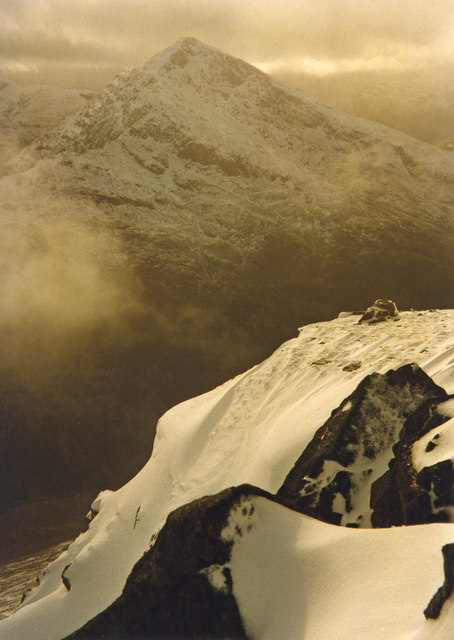
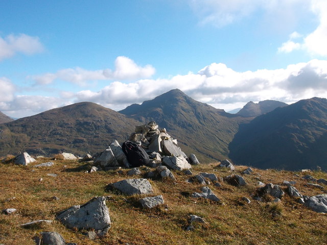
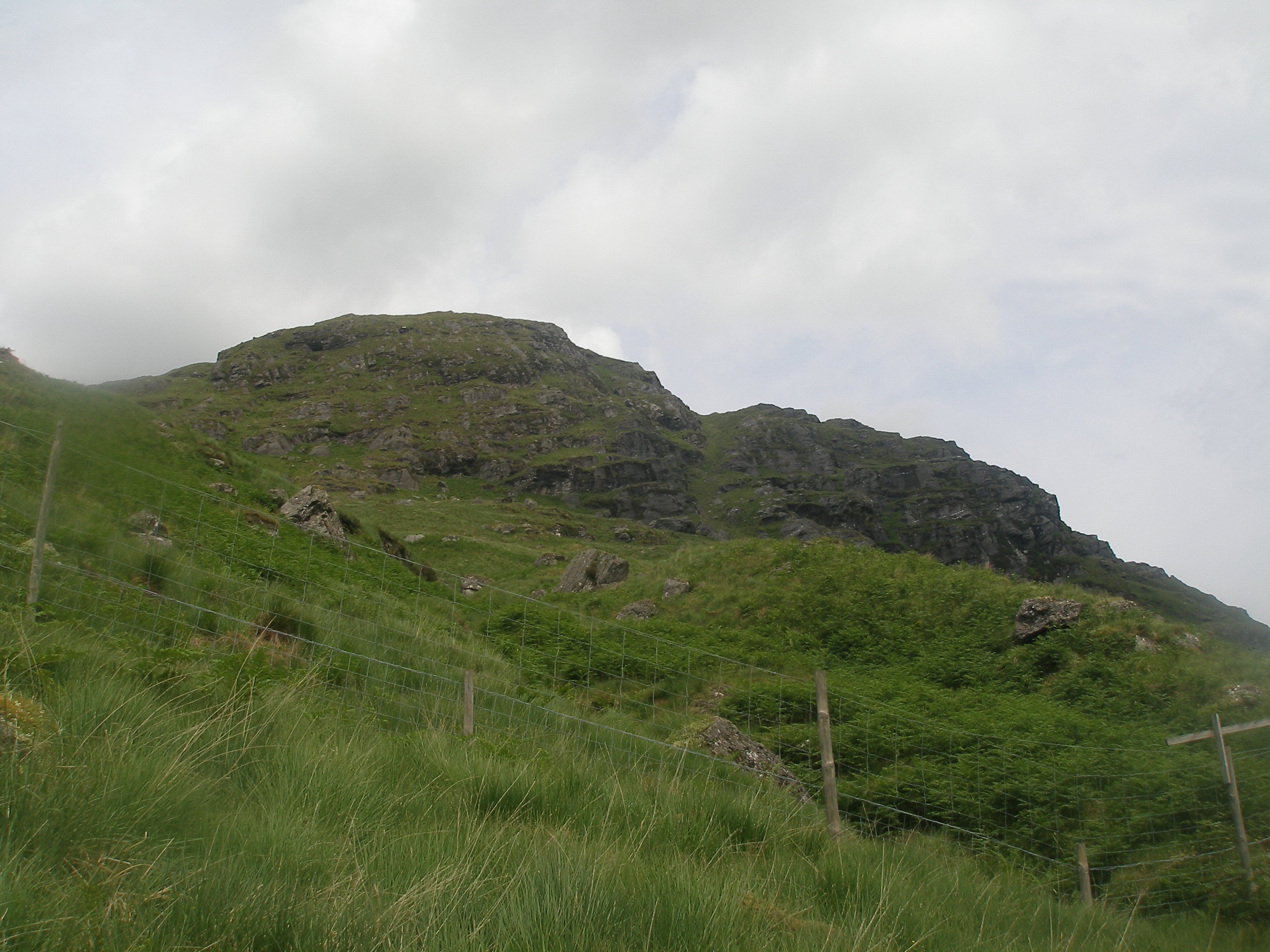
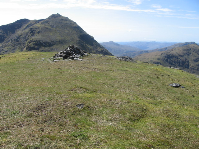
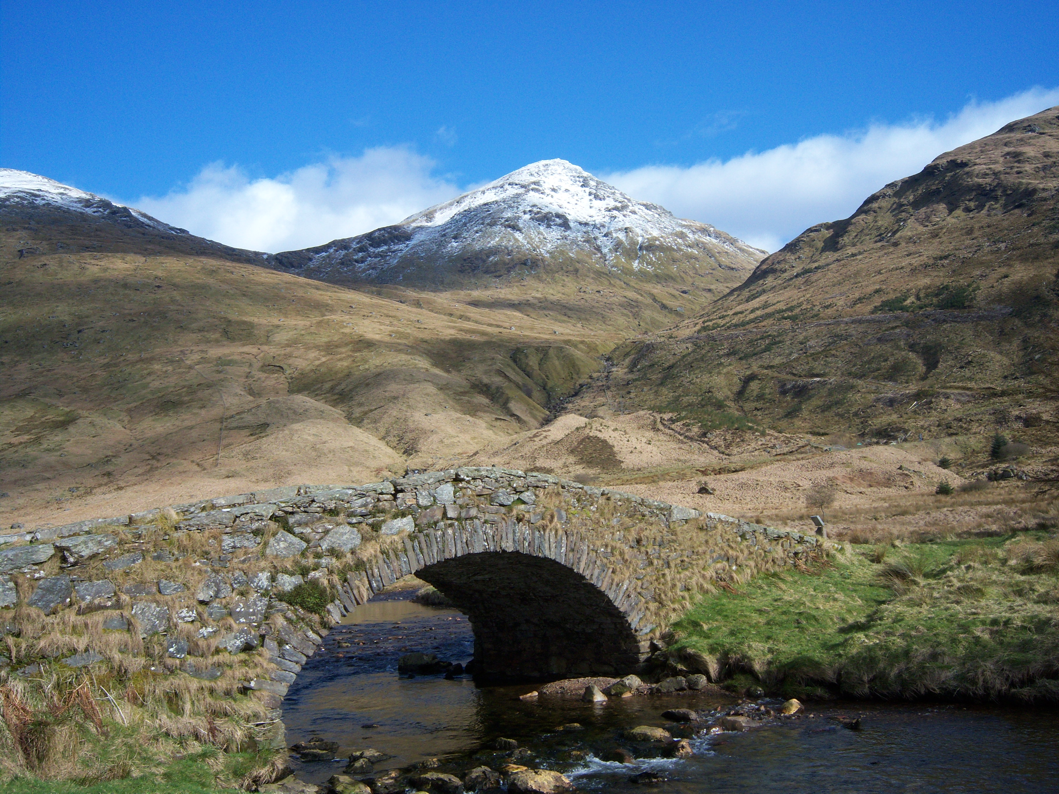
The hill is characterized by its distinctive rocky terrain, with steep slopes and craggy ridges. It is primarily composed of granite and schist, which give it a rugged and imposing appearance. The summit of Stob Coire Creagach is marked by a cairn, providing a rewarding goal for those who reach the top.
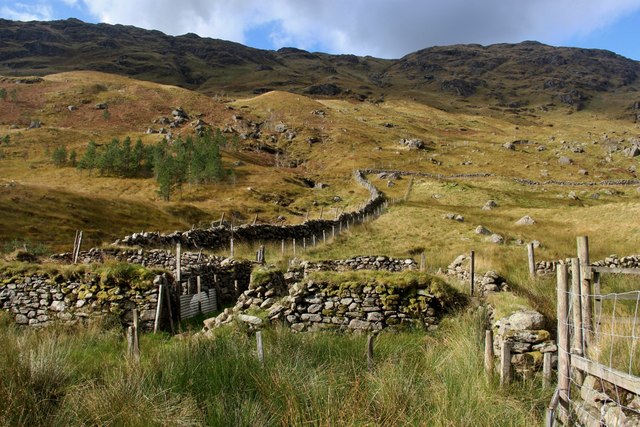
The ascent of Stob Coire Creagach can be approached from various directions, with the most common being from the village of Arrochar. The route typically follows a well-defined path, although it can become more challenging and steep as one nears the summit. On a clear day, the panoramic views from the top are simply breathtaking, offering glimpses of Loch Long, Loch Lomond, and the nearby mountains of the Arrochar Alps.
The hill is also home to a variety of wildlife, including red deer, mountain hares, and various bird species. The surrounding area is known for its diverse flora, with heather, mosses, and wildflowers adding color to the landscape.
Overall, Stob Coire Creagach is a stunning natural feature that offers both a challenging hike and a rewarding experience for outdoor enthusiasts, allowing them to immerse themselves in the beauty of the Scottish Highlands.
If you have any feedback on the listing, please let us know in the comments section below.
Stob Coire Creagach Images
Images are sourced within 2km of 56.257731/-4.8580848 or Grid Reference NN2310. Thanks to Geograph Open Source API. All images are credited.


Stob Coire Creagach is located at Grid Ref: NN2310 (Lat: 56.257731, Lng: -4.8580848)
Unitary Authority: Argyll and Bute
Police Authority: Argyll and West Dunbartonshire
What 3 Words
///bloom.zapped.eagle. Near Inveraray, Argyll & Bute
Nearby Locations
Related Wikis
Binnein an Fhidhleir
Binnein an Fhidhleir, one of the Arrochar Alps, is a mountain in southern Scotland. It is located above Butterbridge on the north side the A83 road facing...
Beinn Chorranach
Beinn Chorranach is one of the Arrochar Alps, a mountain range that marks the start of the Argyll Highlands and provides a wilderness of long coastlines...
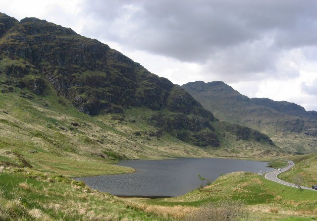
Loch Restil
Loch Restil is a freshwater loch that lies in the pass between Glen Croe and Glen Kinglas on the Cowal peninsula, Argyll and Bute, West of Scotland. One...
Beinn an Lochain
Beinn an Lochain is a mountain in the Arrochar Alps, southern Scotland, on the western edge of Loch Lomond and the Trossachs National Park. Although included...

Beinn Luibhean
Beinn Luibhean is one of the Arrochar Alps in the Argyll Highlands of Scotland, located to the northern side of Glen Croe between Loch Long in Dunbartonshire...
Beinn Ìme
Beinn Ìme (Scottish Gaelic for 'butter mountain') is the highest mountain in the Arrochar Alps of Argyll, in the Southern Highlands of Scotland. It reaches...

Arrochar Alps
The Arrochar Alps are a group of mountains located around the head of Loch Long, Loch Fyne, and Loch Goil, near the villages of Arrochar and Lochgoilhead...
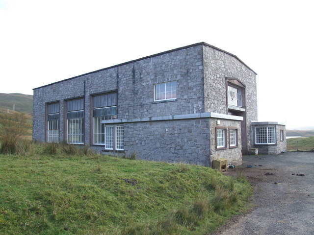
Shira Hydro-Electric Scheme
The Shira Hydro-Electric Scheme is a project initiated by the North of Scotland Hydro-Electric Board to use the waters of the River Shira, the River Fyne...
Nearby Amenities
Located within 500m of 56.257731,-4.8580848Have you been to Stob Coire Creagach?
Leave your review of Stob Coire Creagach below (or comments, questions and feedback).