Burneven Hill

Hill, Mountain in Renfrewshire

Scotland

Burneven Hill

Cloch Lighthouse and the Firth of Clyde Viewed from the rocky shore alongside the A770 Cloch Road.
Cloch Lighthouse and the Firth of Clyde Credit: Thomas Nugent

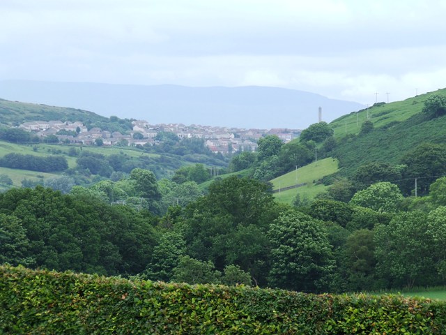
Burneven Hill is a prominent hill located in Renfrewshire, Scotland. Situated approximately 17 miles southwest of Glasgow, it is part of the larger Clyde Muirshiel Regional Park. Rising to an elevation of 427 meters (1,401 feet), it commands breathtaking panoramic views of the surrounding countryside.

Covered in lush green vegetation, Burneven Hill offers a diverse range of flora and fauna. The hillside is adorned with heather, bracken, and various species of wildflowers, providing a vibrant display of colors during the summer months. The area is home to a multitude of bird species, including buzzards, kestrels, and peregrine falcons, making it a popular spot for birdwatchers.

Burneven Hill offers a range of recreational activities for outdoor enthusiasts. Hikers and walkers can enjoy a network of well-maintained trails that wind their way up the hill, providing both challenging climbs and leisurely strolls. The hill also serves as a great location for picnics and family outings, with designated areas offering stunning vistas for visitors to relax and enjoy the surroundings.

Due to its proximity to populated areas, Burneven Hill attracts a steady stream of visitors throughout the year. Its accessibility, coupled with the captivating natural beauty it offers, makes it a popular destination for locals and tourists alike.

If you have any feedback on the listing, please let us know in the comments section below.

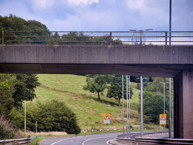
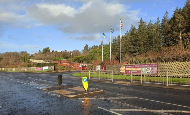
Burneven Hill Images

Images are sourced within 2km of 55.93929/-4.8528939 or Grid Reference NS2175. Thanks to Geograph Open Source API. All images are credited.

Cloch Lighthouse and the Firth of Clyde Viewed from the rocky shore alongside the A770 Cloch Road.
Cloch Lighthouse and the Firth of Clyde
Viewed from the rocky shore alongside the A770 Cloch Road.
Cloch Lighthouse Located on the South Bank of the Firth of Clyde, between Gourock and Inverkip.
Cloch Lighthouse
Located on the South Bank of the Firth of Clyde, between Gourock and Inverkip.
Buildings being renovated at Cloch Lighthouse These buildings to the north of the lighthouse tower were roofless and derelict for many years, as can be seen in this linked photo from 2008 <a href="https://www.geograph.org.uk/photo/858663">NS2075 : Cloch Lighthouse</a>.
Buildings being renovated at Cloch Lighthouse
These buildings to the north of the lighthouse tower were roofless and derelict for many years, as can be seen in this linked photo from 2008 NS2075 : Cloch Lighthouse.
Cloch Lighthouse On a damp and grey January afternoon.
Cloch Lighthouse
On a damp and grey January afternoon.
Toilets at Lunderston Bay Toilets and cycle facilities at the car park at the bay.
Toilets at Lunderston Bay
Toilets and cycle facilities at the car park at the bay.
Covid-19 advice notice at Lunderston Bay The now familiar advice about social distancing and mask wearing at the bike rack at Lunderston Bay.
Covid-19 advice notice at Lunderston Bay
The now familiar advice about social distancing and mask wearing at the bike rack at Lunderston Bay.
Play park construction site A new play park is under construction at the North end of the Lunderston Bay picnic area. This will replace the now dilapidated one at the South end of the site.
Play park construction site
A new play park is under construction at the North end of the Lunderston Bay picnic area. This will replace the now dilapidated one at the South end of the site.
3-storey Housing on Cloch Road
Bridge over Inverkip Road at Chrisswell The A78 runs for 42 miles between Greenock and Prestwick. For much of its route, it follows the northern section of the Ayrshire coast. Although it is classified as a primary road throughout its length, the standard varies. Much of the road is single carriageway, both for a short distance through Greenock and a 21-mile stretch between Inverkip and Ardrossan. The rest is dual carriageway; between the Eglinton and Warrix interchanges there are in fact 3 lanes in each direction, and the road is constructed to motorway standard (with full grade separation at junctions) except for a lack of hard shoulders.
Bridge over Inverkip Road at Chrisswell
The A78 runs for 42 miles between Greenock and Prestwick. For much of its route, it follows the northern section of the Ayrshire coast. Although it is classified as a primary road throughout its length, the standard varies. Much of the road is single carriageway, both for a short distance through Greenock and a 21-mile stretch between Inverkip and Ardrossan. The rest is dual carriageway; between the Eglinton and Warrix interchanges there are in fact 3 lanes in each direction, and the road is constructed to motorway standard (with full grade separation at junctions) except for a lack of hard shoulders.
Cloch Lighthouse The Cloch Lighthouse is a prominent feature of the Inverclyde coast, situated on the East Shore of the Firth of Clyde, adjacent to the A770 coastal road at Cloch Point. It was designed by Thomas Smith and his son-in-law Robert Stevenson and first operated in 1797.

The lighthouse is Category B Listed (LB13820 <span class="nowrap"><a title="http://portal.historicenvironment.scot/designation/LB13820" rel="nofollow ugc noopener" href="http://portal.historicenvironment.scot/designation/LB13820">Link</a><img style="margin-left:2px;" alt="External link" title="External link - shift click to open in new window" src="https://s1.geograph.org.uk/img/external.png" width="10" height="10"/></span>  Historic Environment Scotland).
Cloch Lighthouse
The Cloch Lighthouse is a prominent feature of the Inverclyde coast, situated on the East Shore of the Firth of Clyde, adjacent to the A770 coastal road at Cloch Point. It was designed by Thomas Smith and his son-in-law Robert Stevenson and first operated in 1797. The lighthouse is Category B Listed (LB13820 LinkExternal link Historic Environment Scotland).
Cardwell Nursery and Garden Centre The entrance to the garden centre, on the A770 Cloch Road, between Inverkip and Gourock at Lunderston Bay.
Cardwell Nursery and Garden Centre
The entrance to the garden centre, on the A770 Cloch Road, between Inverkip and Gourock at Lunderston Bay.
PS Waverley in the Firth of Clyde Seen from Cloch Lighthouse, heading upriver.
PS Waverley in the Firth of Clyde
Seen from Cloch Lighthouse, heading upriver.
PS Waverley passing Cloch Lighthouse Heading back upriver to Glasgow.
PS Waverley passing Cloch Lighthouse
Heading back upriver to Glasgow.
Cloch Lighthouse A prominent landmark on the firth of Clyde at the point where it starts to head south. Category B Listed <span class="nowrap"><a title="http://portal.historicenvironment.scot/designation/LB13820" rel="nofollow ugc noopener" href="http://portal.historicenvironment.scot/designation/LB13820">Link</a><img style="margin-left:2px;" alt="External link" title="External link - shift click to open in new window" src="https://s1.geograph.org.uk/img/external.png" width="10" height="10"/></span> .
Cloch Lighthouse
A prominent landmark on the firth of Clyde at the point where it starts to head south. Category B Listed LinkExternal link .
Bute and Arran Bute is in the foreground of this telephoto shot taken from Cloch Point. Toward Point is on the right.
Bute and Arran
Bute is in the foreground of this telephoto shot taken from Cloch Point. Toward Point is on the right.
Water tap on Dunrod Road A recent addition, near the junction with the A78 Inverkip Road.

See also <a href="https://www.geograph.org.uk/photo/7565743">NS2273 : Dunrod Road</a>.
Water tap on Dunrod Road
A recent addition, near the junction with the A78 Inverkip Road. See also NS2273 : Dunrod Road.
Cloch Lighthouse The formerly derelict buildings in the foreground were recently sympathetically restored and brought into residential use.

See the scene in January 2022 <a href="https://www.geograph.org.uk/photo/7089581">NS2075 : Buildings being renovated at Cloch Lighthouse</a>.
See the scene in 2016 <a href="https://www.geograph.org.uk/photo/5022202">NS2075 : Cloch Lighthouse</a>.
Cloch Lighthouse
The formerly derelict buildings in the foreground were recently sympathetically restored and brought into residential use. See the scene in January 2022 NS2075 : Buildings being renovated at Cloch Lighthouse. See the scene in 2016 NS2075 : Cloch Lighthouse.
Show me another place!

Burneven Hill is located at Grid Ref: NS2175 (Lat: 55.93929, Lng: -4.8528939)

Unitary Authority: Inverclyde

Police Authority: Renfrewshire and Inverclyde

What 3 Words

///outlawing.backpacks.squish. Near Gourock, Inverclyde

Nearby Locations

Burneven Hill

Related Wikis

Castle Levan

Castle Levan (also known as Levan Castle) is a fortified tower house in Levan area of Gourock, Inverclyde, Scotland. A building had been on the site from...
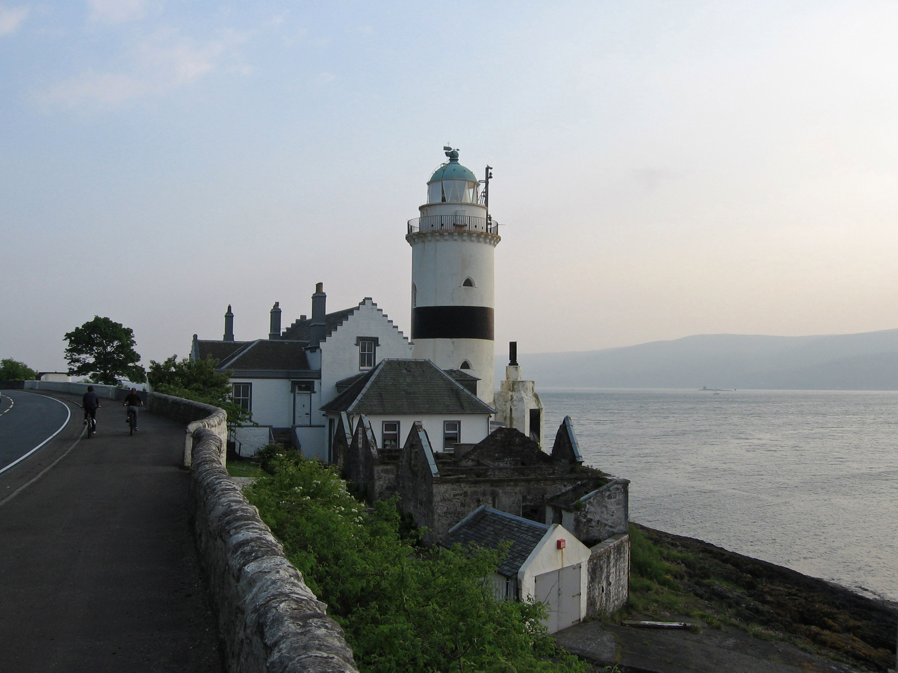
Cloch

Cloch or Cloch Point (Scottish Gaelic: stone) is a point on the coast of the Firth of Clyde, Scotland. There has been a lighthouse since 1797 to warn...

Spango Valley

Spango Valley is a steep sided valley to the south-west of Greenock, Scotland. It runs approximately south west to north east for around 2.4 km (1.5 mi...

Larkfield, Greenock

Larkfield is the largest council housing estate in Greenock, Inverclyde, Scotland. == Geography == The estate is named after Larkfield Farm, Larkfield...

IBM railway station

IBM railway station (formerly known as IBM Halt) is a currently disused railway station on the Inverclyde Line, 25+1⁄2 miles (41 km) west of Glasgow Central...

Braeside, Greenock

Braeside is a neighbourhood situated on the far west side of Greenock, in Inverclyde, Scotland. It has one primary schools in its vicinity, Aileymill,...

Cragburn Pavilion

The Cragburn Pavilion was built in Gourock in 1935-6 by J. & J.A. Carrick, in brick and stucco with prominent art deco fluting along its front North-facing...

Ravenscraig Stadium

Ravenscraig Stadium is a multi-purpose stadium, in Greenock, Inverclyde, Scotland. The stadium is primarily set up for athletics, with a running track...

Related Videos

Lunderston Bay Play Area, Inverclyde

The stunning Lunderston Bay Play Area in Inverclyde, Scotland offers children the unique experience feeling like they are sailing ...

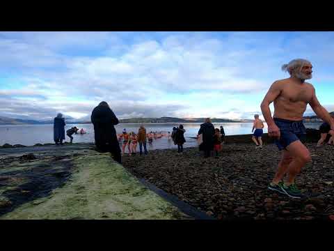
Royal Gourock Yacht Club New Year Swim

Short video as the brave souls enter the cold clyde on new years day.

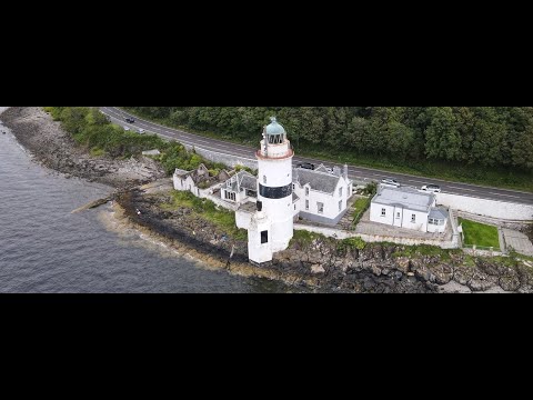
Cloch Lighthouse With Music On History Visit To The Firth Of Clyde Scotland

Tour Scotland short 4K travel video clip, with Scottish music, of Cloch Lighthouse on ancestry, genealogy, family history visit to the ...

River Clyde Dip - The Sea of Two Anvils

A wee welly splash in the river on a rainy summer's day.

Nearby Amenities

Located within 500m of 55.93929,-4.8528939
Power: pole
Lat/Long: 55.9435122/-4.8555759
Power: pole
Lat/Long: 55.9431004/-4.8564758
Power: pole
Lat/Long: 55.9426372/-4.8574549
Power: pole
Lat/Long: 55.9421111/-4.8585923
Power: pole
Lat/Long: 55.9417716/-4.8594423
Power: pole
Lat/Long: 55.9413994/-4.8589944
Power: pole
Lat/Long: 55.9412758/-4.857907
Power: pole
Lat/Long: 55.9418684/-4.8576757
Power: pole
Lat/Long: 55.9413738/-4.8578466
Power: pole
Lat/Long: 55.9418783/-4.8582955
Power: pole
Lat/Long: 55.9408814/-4.8573956
Power: pole
Lat/Long: 55.9406702/-4.856481
Power: pole
Lat/Long: 55.9407962/-4.8551915
Power: pole
Lat/Long: 55.9409327/-4.8538625
Power: pole
Lat/Long: 55.9410319/-4.8528646
Power: pole
Lat/Long: 55.9411696/-4.8516084
Power: pole
Lat/Long: 55.9413049/-4.8503189
Power: pole
Lat/Long: 55.9414064/-4.8493211
Power: pole
Lat/Long: 55.9414951/-4.8479649
Power: pole
Lat/Long: 55.9415581/-4.8469046
Power: pole
Lat/Long: 55.9414298/-4.8464088
Power: pole
Lat/Long: 55.9413516/-4.8478024
Power: pole
Lat/Long: 55.9412711/-4.8491378
Power: pole
Lat/Long: 55.9411299/-4.8505085
Power: pole
Lat/Long: 55.9409864/-4.8519605
Power: pole
Lat/Long: 55.9408779/-4.8529709
Power: pole
Lat/Long: 55.9407426/-4.8542041
Power: pole
Lat/Long: 55.9406294/-4.8551395
Power: pole
Lat/Long: 55.9404871/-4.8565331
Power: pole
Lat/Long: 55.9408067/-4.8575247
Power: pole
Lat/Long: 55.9417984/-4.8584184
The data included in this document is from www.openstreetmap.org. The data is made available under ODbL.

Have you been to Burneven Hill?

Leave your review of Burneven Hill below (or comments, questions and feedback).