Balkenna Hill

Hill, Mountain in Ayrshire

Scotland

Balkenna Hill

Old sewage outfall pipe, Turnberry Old sewage outfall pipe, Turnberry.
Old sewage outfall pipe, Turnberry Credit: Colin Kinnear

Balkenna Hill is a prominent hill located in Ayrshire, Scotland. It forms part of the Southern Uplands, a range of hills in the southern part of the country. Rising to an elevation of approximately 271 meters (889 feet), Balkenna Hill offers stunning panoramic views of the surrounding countryside.

The hill is situated near the village of Straiton, which lies approximately 16 kilometers (10 miles) southeast of Ayr. It is easily accessible by foot, with several walking routes leading to its summit. The terrain consists of grassy slopes and rocky outcrops, making it a popular destination for hikers and nature enthusiasts.

Balkenna Hill is known for its rich biodiversity, hosting a variety of plant and animal species. The hillside is adorned with heather, gorse, and wildflowers, providing a colorful display during the summer months. Birdwatchers can often spot raptors such as buzzards and kestrels soaring above, while the surrounding woodlands are home to species like red squirrels and roe deer.

Aside from its natural beauty, Balkenna Hill also holds historical significance. In close proximity to the hill, there are remnants of ancient settlements and burial mounds, indicating human presence in the area dating back thousands of years.

Overall, Balkenna Hill offers a wonderful opportunity to explore the Scottish countryside, immerse oneself in nature, and appreciate the historical and environmental heritage of Ayrshire.

If you have any feedback on the listing, please let us know in the comments section below.

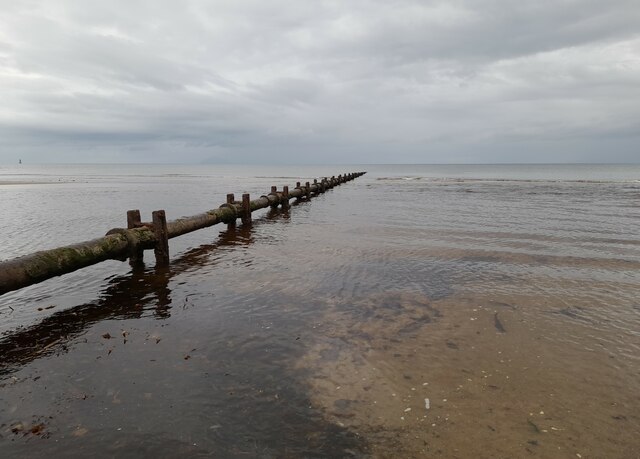
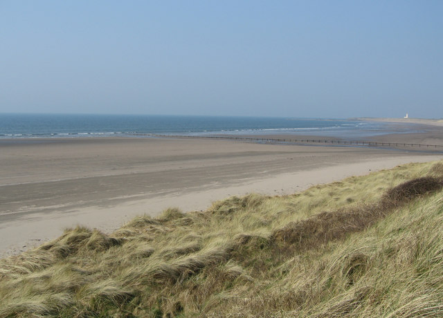
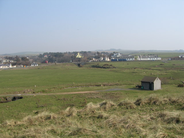
Balkenna Hill Images

Images are sourced within 2km of 55.296424/-4.8311759 or Grid Reference NS2003. Thanks to Geograph Open Source API. All images are credited.

Old sewage outfall pipe, Turnberry Old sewage outfall pipe, Turnberry.
Old sewage outfall pipe, Turnberry
Old sewage outfall pipe, Turnberry.
Foreshore at Drumbeg The Foreshore near Drumbeg.
Foreshore at Drumbeg
The Foreshore near Drumbeg.
Ailsa Craig A closer look zoomed from Dowhill - it has been pictured several times before but I thought that I might as well add to the collection.
Ailsa Craig
A closer look zoomed from Dowhill - it has been pictured several times before but I thought that I might as well add to the collection.
Turnberry Dunes Turnberry lighthouse in the distance. Milton Burn outflow in middle distance.
Turnberry Dunes
Turnberry lighthouse in the distance. Milton Burn outflow in middle distance.
Granite Boulders Way in the distance is Turnberry Lighthouse.
Granite Boulders
Way in the distance is Turnberry Lighthouse.
Balkenna Isle The light on Brest Rocks can be seen on the horizon.
Balkenna Isle
The light on Brest Rocks can be seen on the horizon.
Shore Boulder Turnberry Lighthouse can be seen way in the distance (just right of centre on the horizon).
Shore Boulder
Turnberry Lighthouse can be seen way in the distance (just right of centre on the horizon).
Dipple Shore Looking north.  Turnberry Lighthouse is visible in the distance.
Dipple Shore
Looking north. Turnberry Lighthouse is visible in the distance.
Dipple Shore Looking south, towards Girvan.
Dipple Shore
Looking south, towards Girvan.
Lady Burn Mouth Lady Burn enters the Firth of Clyde here at Dipple Shore, spreading itself out across the beach.  Viewed at high tide, with the island of Arran in the background.
Lady Burn Mouth
Lady Burn enters the Firth of Clyde here at Dipple Shore, spreading itself out across the beach. Viewed at high tide, with the island of Arran in the background.
On Dipple Shore Looking south at high tide towards the shoreline cottages in the next square.
On Dipple Shore
Looking south at high tide towards the shoreline cottages in the next square.
Beach View High tide at Dipple Shore, on a fine August afternoon.  The Paddle Steamer "Waverley" is passing in front of the island of Arran in the background.
Beach View
High tide at Dipple Shore, on a fine August afternoon. The Paddle Steamer "Waverley" is passing in front of the island of Arran in the background.
On The Ayrshire Coastal Path One of the waymarker posts to the south of the Lady Burn, with the island of Arran in the background.
On The Ayrshire Coastal Path
One of the waymarker posts to the south of the Lady Burn, with the island of Arran in the background.
Clyde View Looking out across the Firth of Clyde towards Arran from the raised beach at Dipple Shore.  The yellow flowers are Ragwort (Senecio jacobaea).
Clyde View
Looking out across the Firth of Clyde towards Arran from the raised beach at Dipple Shore. The yellow flowers are Ragwort (Senecio jacobaea).
Looking North Looking north along Dipple Shore, towards the ISP Alginates Ltd's Ladyburn Works in <a href="https://www.geograph.org.uk/gridref/NS2002">NS2002</a>.
Looking North
Looking north along Dipple Shore, towards the ISP Alginates Ltd's Ladyburn Works in NS2002.
Back To The Beach The Ayrshire Coastal Path uses a track immediately in front of the Ladyburn Works, returning to the beach at the northern end.  At low tide, walkers can stay on the beach all the way here.
Back To The Beach
The Ayrshire Coastal Path uses a track immediately in front of the Ladyburn Works, returning to the beach at the northern end. At low tide, walkers can stay on the beach all the way here.
Beach View The Explorer map shows this point of land just inside the square. Looking north at high tide, towards Balkenna.
Beach View
The Explorer map shows this point of land just inside the square. Looking north at high tide, towards Balkenna.
Dowhill Port Looking out into the Firth of Clyde at high tide.  According to the Explorer map, this point is just inside the square.  The Paddle Steamer "Waverley" is on the horizon.
Dowhill Port
Looking out into the Firth of Clyde at high tide. According to the Explorer map, this point is just inside the square. The Paddle Steamer "Waverley" is on the horizon.
Show me another place!

Balkenna Hill is located at Grid Ref: NS2003 (Lat: 55.296424, Lng: -4.8311759)

Unitary Authority: South Ayrshire

Police Authority: Ayrshire

What 3 Words

///airliners.embers.crashing. Near Girvan, South Ayrshire

Nearby Locations

Balkenna Hill

Related Wikis

Turnberry, South Ayrshire

Turnberry is a village 6 miles (9.7 km) north of Girvan, in the civil parish of Kirkoswald, in the council area of South Ayrshire, Scotland. It has a golf...

Turnberry railway station

Turnberry railway station was a railway station serving the Turnberry Golf Course and its associated hotel, South Ayrshire, Scotland. The station was part...

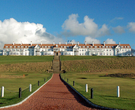
Turnberry (golf course)

Turnberry is a golf resort on the Firth of Clyde in Ayrshire, southwest Scotland. It comprises three links golf courses, a golf academy, a five-star James...

1986 Open Championship

The 1986 Open Championship was a men's major golf championship and the 115th Open Championship, held from 17 to 20 July at Turnberry Golf Resort, Scotland...

Nearby Amenities

Located within 500m of 55.296424,-4.8311759
Power: pole
Lat/Long: 55.2962451/-4.8253959
Power: pole
Lat/Long: 55.2969035/-4.8255614
Power: pole
Lat/Long: 55.2976684/-4.8257733
Power: pole
Lat/Long: 55.2998982/-4.8262136
Power: pole
Lat/Long: 55.2986254/-4.82568
Power: pole
Lat/Long: 55.2978687/-4.8254864
Power: pole
Lat/Long: 55.2971523/-4.8252716
Power: pole
Lat/Long: 55.2964198/-4.8250214
Power: pole
Lat/Long: 55.2957276/-4.8246602
Power: pole
Lat/Long: 55.2947356/-4.8244666
Power: pole
Lat/Long: 55.2988472/-4.8245728
Power: pole
Lat/Long: 55.2988658/-4.8260903
Power: pole
Lat/Long: 55.2995188/-4.8262657
The data included in this document is from www.openstreetmap.org. The data is made available under ODbL.

Have you been to Balkenna Hill?

Leave your review of Balkenna Hill below (or comments, questions and feedback).