Balmerino
Settlement in Fife
Scotland
Balmerino

Balmerino is a small village situated in the eastern coastal region of Fife, Scotland. Located approximately 7 miles west of Dundee, it is nestled on the southern bank of the River Tay. This picturesque village is known for its scenic beauty and historical significance.
With a population of around 200 residents, Balmerino offers a tranquil and peaceful environment away from the hustle and bustle of city life. The village is renowned for its charming 13th-century Cistercian monastery, Balmerino Abbey. This well-preserved ruin attracts tourists and history enthusiasts alike, who are fascinated by its architectural grandeur and rich heritage.
Balmerino is surrounded by stunning landscapes, providing ample opportunities for outdoor activities. The nearby Balmerino Woods offer beautiful woodland walks, with a range of flora and fauna to discover. The village also boasts stunning views across the River Tay, with the Tay Rail Bridge visible in the distance.
Although small in size, Balmerino offers some amenities for its residents and visitors. There is a local pub where locals can gather for a drink and a chat, and a tearoom for those looking to enjoy a cup of tea or coffee in a quaint setting. For more extensive amenities, the nearby town of Newport-on-Tay provides a wider range of shops, restaurants, and services.
Balmerino is well-connected to neighboring towns and cities by road, making it easily accessible. Its idyllic location, rich history, and natural beauty make Balmerino an appealing destination for those seeking tranquility and a glimpse into Scotland's past.
If you have any feedback on the listing, please let us know in the comments section below.
Balmerino Images
Images are sourced within 2km of 56.409292/-3.042743 or Grid Reference NO3524. Thanks to Geograph Open Source API. All images are credited.


Balmerino is located at Grid Ref: NO3524 (Lat: 56.409292, Lng: -3.042743)
Unitary Authority: Fife
Police Authority: Fife
What 3 Words
///dockers.drums.actual. Near Invergowrie, Perth & Kinross
Nearby Locations
Related Wikis

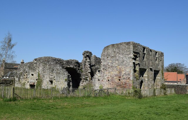
Balmerino Abbey
Balmerino Abbey, or St Edward's Abbey, in Balmerino, Fife, Scotland, was a Cistercian monastic community which has been ruinous since the 16th century...

Balmerino
Balmerino is a small village and former monastic centre in Fife, Scotland. It is the home of Balmerino Abbey and the former abbots of Balmerino who were...
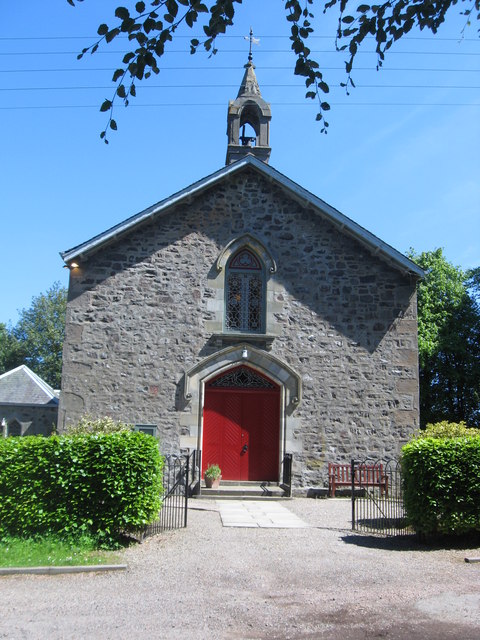
Balmerino Parish Church
Balmerino Parish Church is a Church of Scotland parish church in Bottomcraig, Fife, Scotland. The church sits in the centre of the small village where...
Bottomcraig
Bottomcraig is a village in Fife, Scotland located near Balmerino and The Gauldry. The village is home to Balmerino Parish Church, built in 1811, and the...
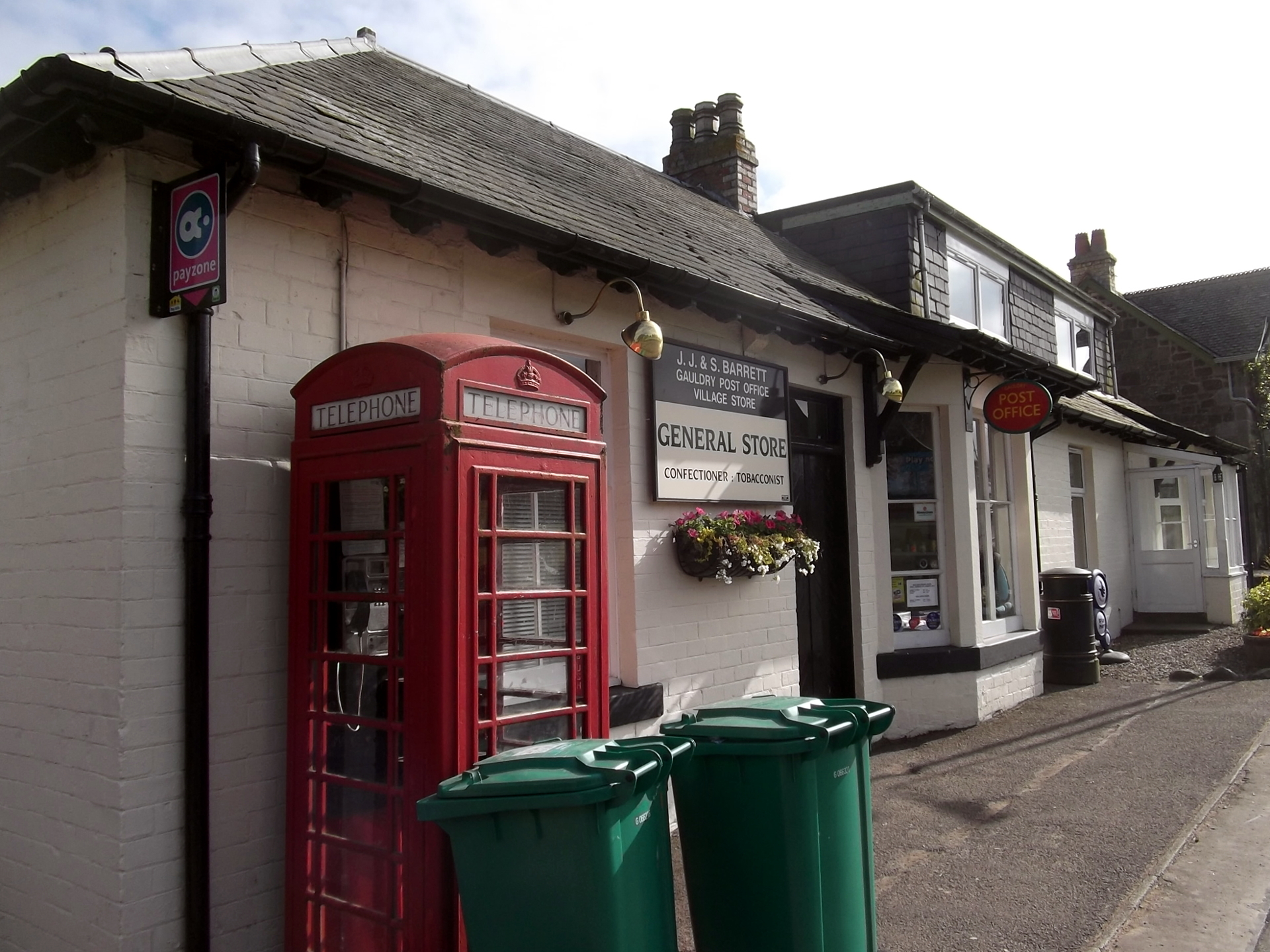
Gauldry
Gauldry, locally sometimes The Gauldry, is a village in Fife, Scotland. It is located 3 kilometres (1.9 mi) southwest of Newport on Tay, 2 kilometres...

Birkhill Castle
Birkhill Castle is a stately home, the residence of the Earl of Dundee, located on the banks of the River Tay, a short drive from St. Andrews. The castle...
Kilmany railway station
Kilmany railway station served the village of Kilmany, Fife, Scotland from 1909 to 1951 on the Newburgh and North Fife Railway. == History == The station...

Flisk
Flisk (Scottish Gaelic: Fleasg meaning "Stalk" or "Rod") was a parish in Fife, Scotland. According to the 1853 Gazetteer, in part: "Flisk parish is bounded...
Nearby Amenities
Located within 500m of 56.409292,-3.042743Have you been to Balmerino?
Leave your review of Balmerino below (or comments, questions and feedback).