An Garbhanach

Hill, Mountain in Inverness-shire

Scotland

An Garbhanach

Tops of Na Gruagaichean Looking to Na Gruagaichean (on the left) and its north-west top, from the Binnein Mór ridge to the north-east.
Tops of Na Gruagaichean Credit: Scott Cormie

An Garbhanach is a prominent hill located in the Inverness-shire region of Scotland. It is part of the wider Monadhliath mountain range, which stretches across the central Highlands. Standing at an elevation of approximately 799 meters (2,621 feet), An Garbhanach is a popular destination for hikers, mountaineers, and nature enthusiasts.

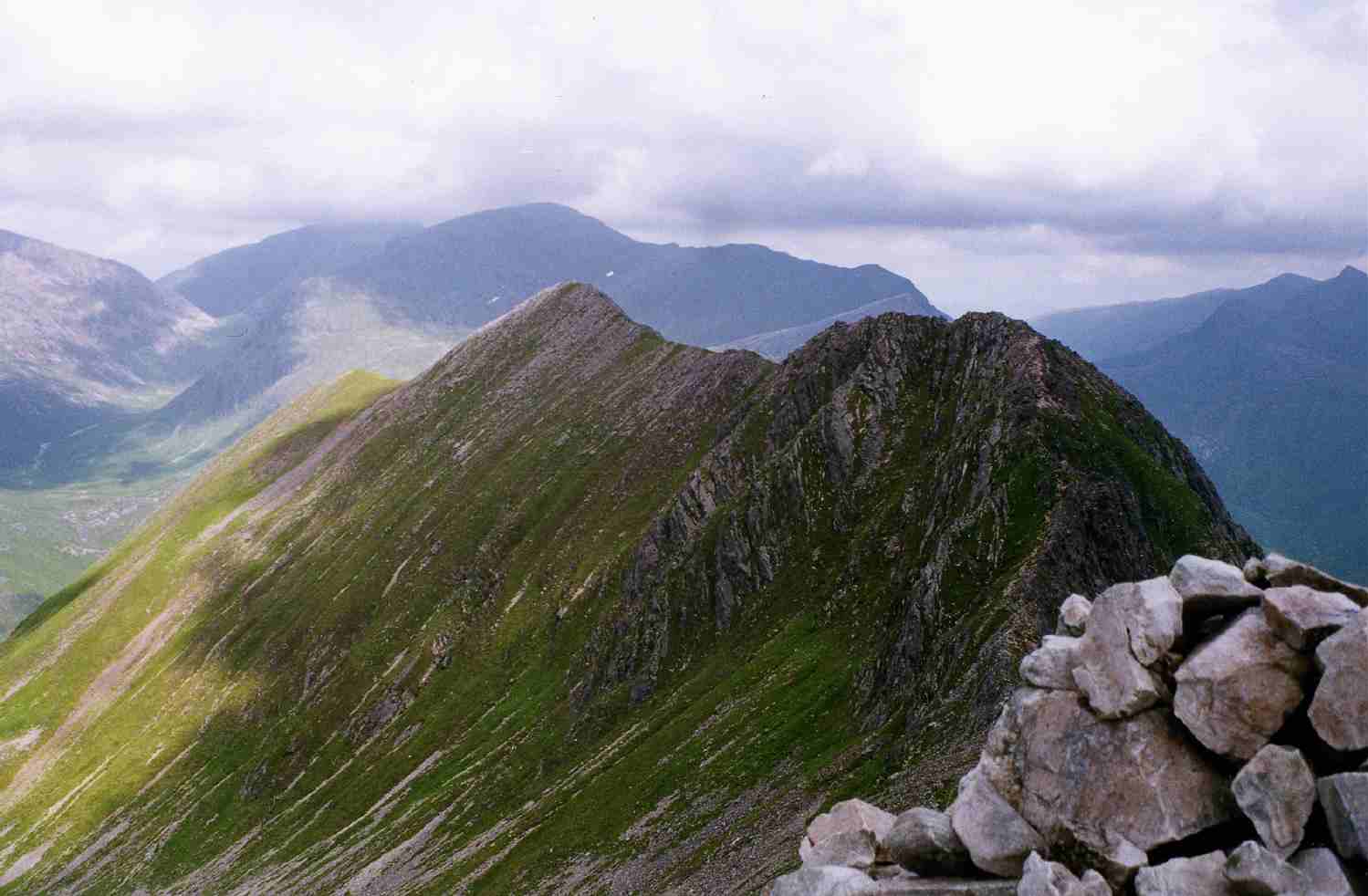
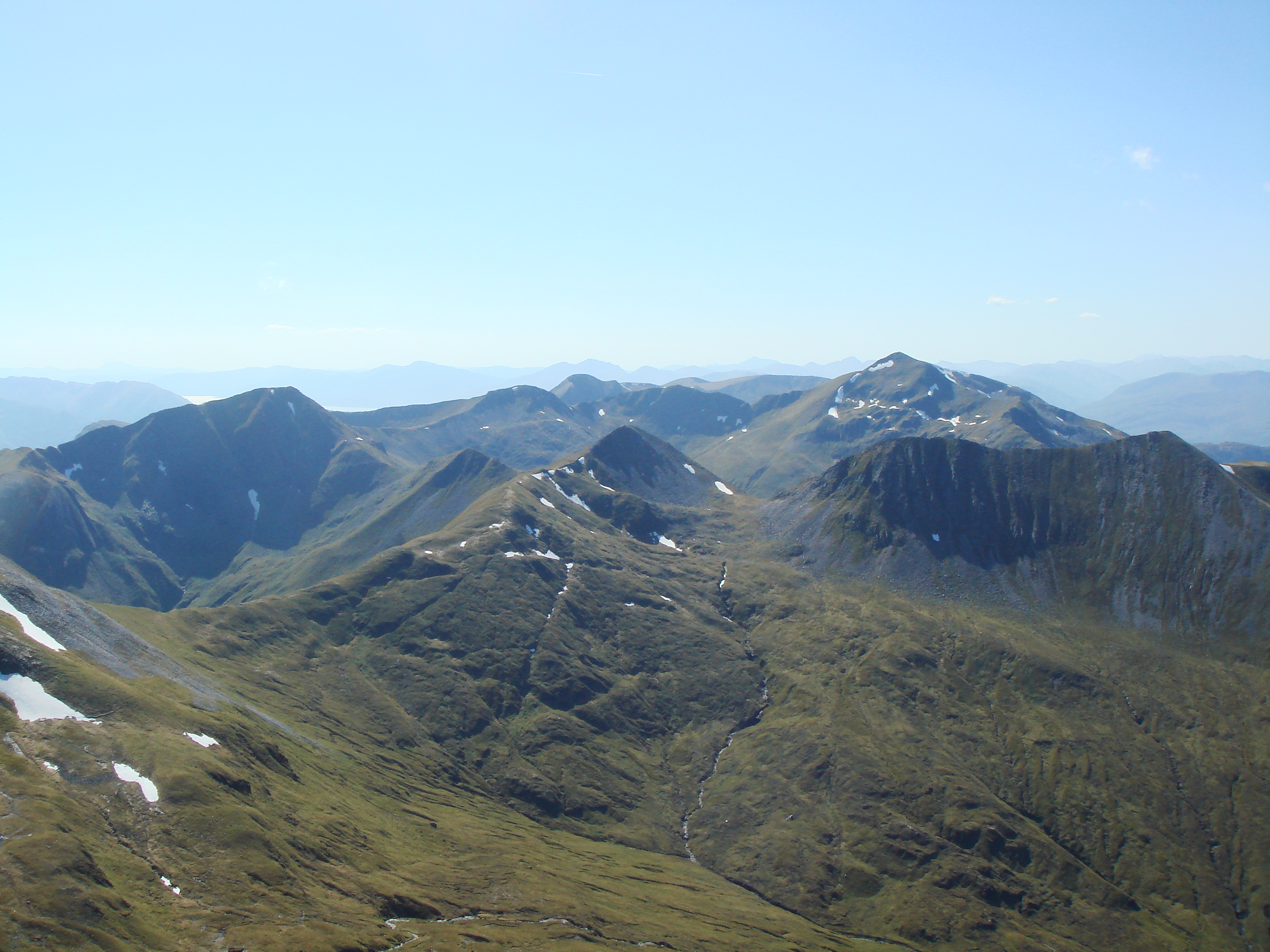
The hill is characterized by its rugged and steep terrain, adorned with rocky outcrops and scree slopes. Its summit offers breathtaking panoramic views of the surrounding landscape, including the nearby Loch Ness and the Great Glen. On a clear day, visitors can also catch a glimpse of the distant Cairngorms National Park.

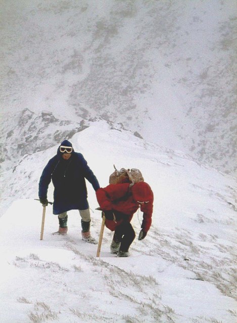
The ascent up An Garbhanach is challenging but rewarding. Various routes are available, with the most common starting point being the small village of Foyers, situated on the eastern shores of Loch Ness. The hike involves navigating through heather-covered slopes, crossing streams, and scrambling over boulders. It is recommended to be adequately prepared with appropriate hiking gear and to be mindful of changing weather conditions.

The hill is home to a variety of flora and fauna, including heather, mosses, and alpine flowers. Wildlife such as red deer, mountain hares, and golden eagles can also be spotted in the area. An Garbhanach provides a tranquil and scenic escape for those seeking to immerse themselves in nature and experience the raw beauty of the Scottish Highlands.

If you have any feedback on the listing, please let us know in the comments section below.

An Garbhanach Images

Images are sourced within 2km of 56.755394/-4.9651009 or Grid Reference NN1866. Thanks to Geograph Open Source API. All images are credited.

Tops of Na Gruagaichean Looking to Na Gruagaichean (on the left) and its north-west top, from the Binnein Mór ridge to the north-east.
Tops of Na Gruagaichean
Looking to Na Gruagaichean (on the left) and its north-west top, from the Binnein Mór ridge to the north-east.
Na Gruagaichean from Am Bodach, the Mamores Frosty January weather provided some good views. The Blackwater Reservoir is on the extreme right with the cone of Schiehallion on the skyline to its left. The hills were quiet for a Saturday - changed days!
Na Gruagaichean from Am Bodach, the Mamores
Frosty January weather provided some good views. The Blackwater Reservoir is on the extreme right with the cone of Schiehallion on the skyline to its left. The hills were quiet for a Saturday - changed days!
Summit of Na Gruagaichean Looking towards the NW top.
Summit of Na Gruagaichean
Looking towards the NW top.
Climbing Na Gruagaichean's north top
Na Gruagaichean
Na Gruagaichean
Glen Nevis at Steall, Scotland An idyllic spot at the foot of Britain's highest mountain, on a warm summer's day.
Glen Nevis at Steall, Scotland
An idyllic spot at the foot of Britain's highest mountain, on a warm summer's day.
Ben Nevis from An Gearanach, Scottish Highlands View facing north from the side of An Gearanach looking to Ben Nevis.
Ben Nevis from An Gearanach, Scottish Highlands
View facing north from the side of An Gearanach looking to Ben Nevis.
Valley of Allt Coire a’ Mhail The valley seen from the ridge connecting Am Bodach with Sgùrr an Iubhair, on the ascent to the former.
The distant mountains are beyond Glen Nevis. Aonach Mor is the farther of the two, Aonach Beag is central and snow-capped.
Valley of Allt Coire a’ Mhail
The valley seen from the ridge connecting Am Bodach with Sgùrr an Iubhair, on the ascent to the former. The distant mountains are beyond Glen Nevis. Aonach Mor is the farther of the two, Aonach Beag is central and snow-capped.
An Steall (waterfall) Allt Coire a' Mhàil  meeting the Water of Nevis in Glen Nevis.
An Steall (waterfall)
Allt Coire a' Mhàil meeting the Water of Nevis in Glen Nevis.
An Steall - The Steall Waterfall Allt Coire a' Mhàil meeting the Water of Nevis in Glen Nevis.
An Steall - The Steall Waterfall
Allt Coire a' Mhàil meeting the Water of Nevis in Glen Nevis.
Northern ridge of Am Bodach towards Stob Coire a’ Chairn
Am Bodach
Am Bodach
Path towards Stob Coire a’ Chairn
An Garbhanach from Stob Coire a’ Chairn
Path down into Coire na Ba
Steep path towards An Gearanach
Path towards An Gearanach
Path on the northern slopes of An Gearanach
Show me another place!

An Garbhanach is located at Grid Ref: NN1866 (Lat: 56.755394, Lng: -4.9651009)

Unitary Authority: Highland

Police Authority: Highlands and Islands

What 3 Words

///bets.defrost.bids. Near Fort William, Highland

Related Wikis

An Gearanach

An Gearanach is a Scottish mountain situated in the Mamore Forest, five and a half kilometres north of Kinlochleven in the Lochaber region of the Highland...

Mamores

The Mamores are a group of mountains in the Lochaber area of the Grampian Mountains in the Scottish Highlands. They form an east–west ridge approximately...

Stob Coire a' Chàirn

Stob Coire a’ Chàirn is a Scottish mountain situated in the Mamores range, 3.5 kilometres north of Kinlochleven. The mountain reaches a height of 981 metres...

Steall Waterfall

Steall Waterfall, also known as An Steall Bàn or Steall Falls, is situated in Glen Nevis near Fort William, Highland, Scotland. It is Scotland's second...

Nearby Amenities

Located within 500m of 56.755394,-4.9651009
An Gearanach
Description: The complainer
Ele: 982
Marilyn: yes
Munro: yes
Munro Number: M166
Natural: peak
Prominence: 151
Source: NPE
Wikidata: Q3355685
Wikipedia: en:An Gearanach
Lat/Long: 56.7592172/-4.9662721
Bealach a' Chadha Riabhaich
Place: locality
Lat/Long: 56.7524654/-4.9678271
The data included in this document is from www.openstreetmap.org. The data is made available under ODbL.

Have you been to An Garbhanach?

Leave your review of An Garbhanach below (or comments, questions and feedback).