An Gearanach

Hill, Mountain in Inverness-shire

Scotland

An Gearanach

Glen Nevis at Steall, Scotland An idyllic spot at the foot of Britain's highest mountain, on a warm summer's day.
Glen Nevis at Steall, Scotland Credit: Andrew Tryon

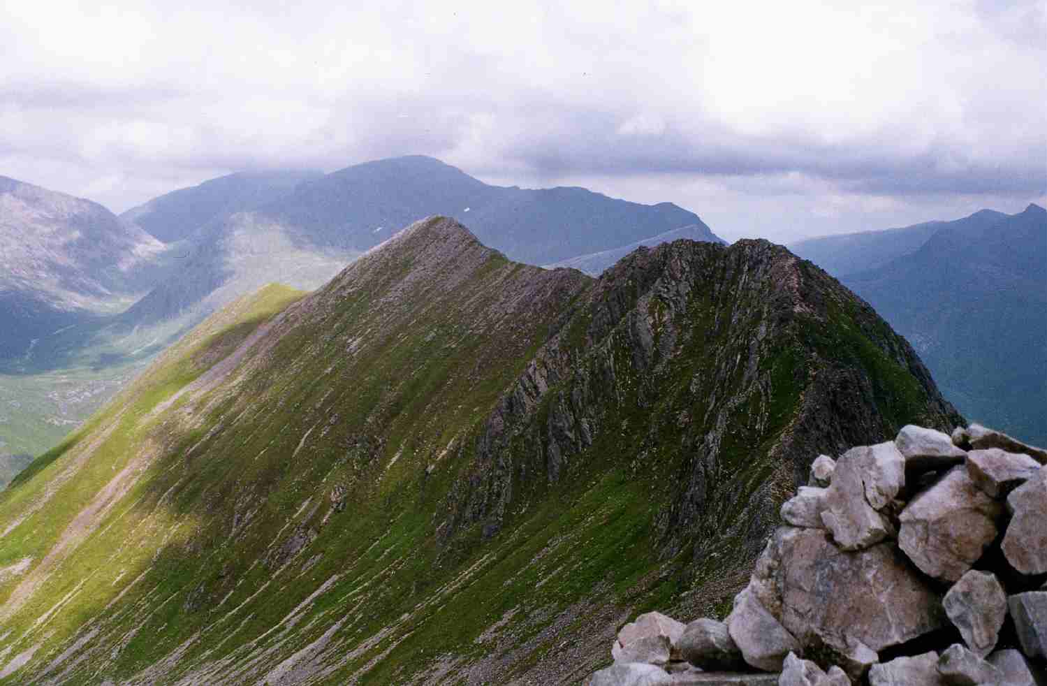
An Gearanach is a mountain located in the Mamores range in Inverness-shire, Scotland. It stands at a height of 982 meters (3,222 feet) and is classified as a Munro, which is a Scottish term for a mountain over 3,000 feet in height.

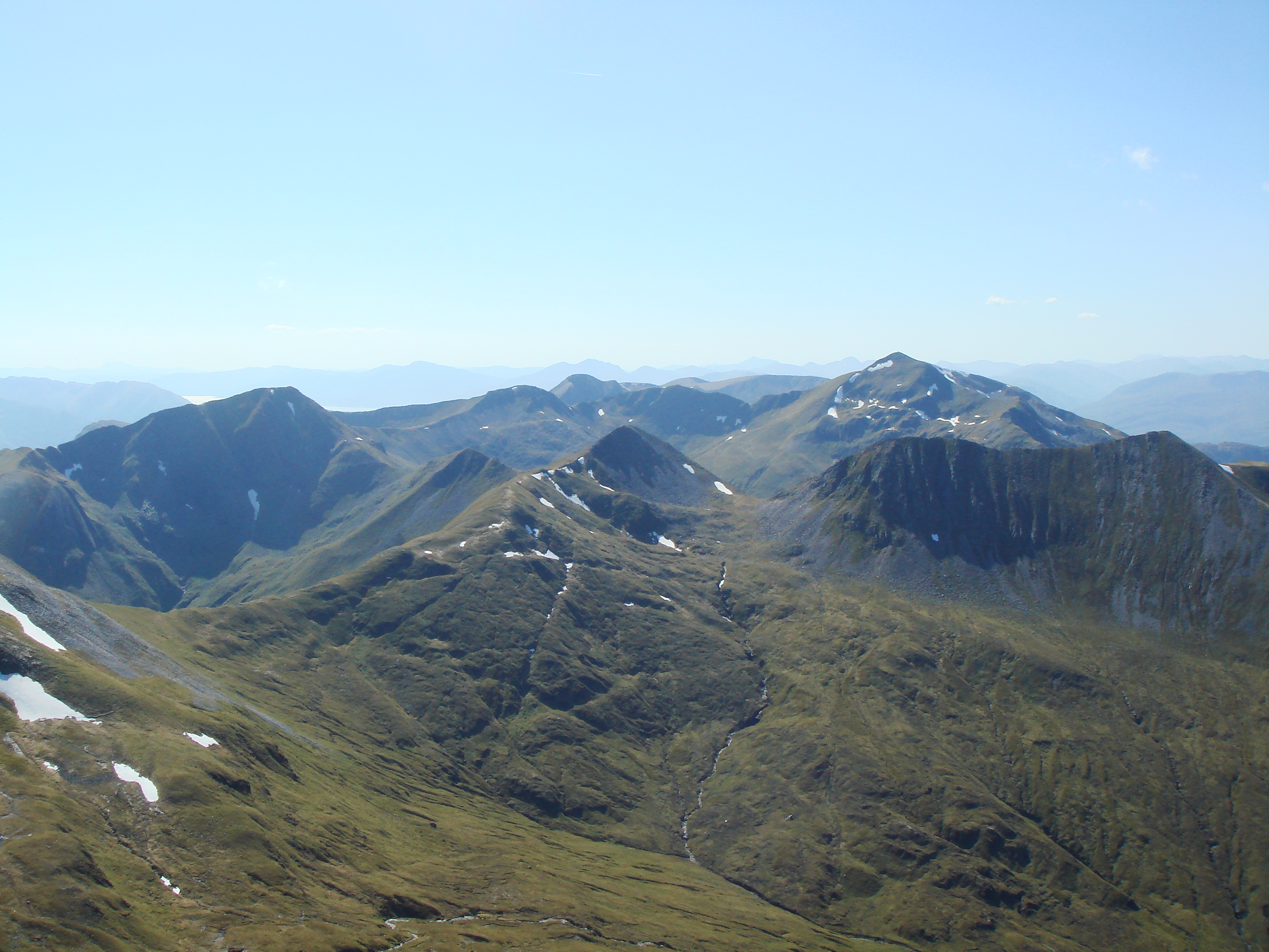
The mountain is popular among hikers and climbers due to its challenging terrain and stunning views of the surrounding landscape. It is often climbed as part of the Ring of Steall, a popular hiking route that includes several other Munros in the area.

An Gearanach is known for its steep and rocky slopes, which provide a thrilling challenge for experienced climbers. The summit offers panoramic views of the surrounding mountains, including Ben Nevis, the highest peak in the British Isles.

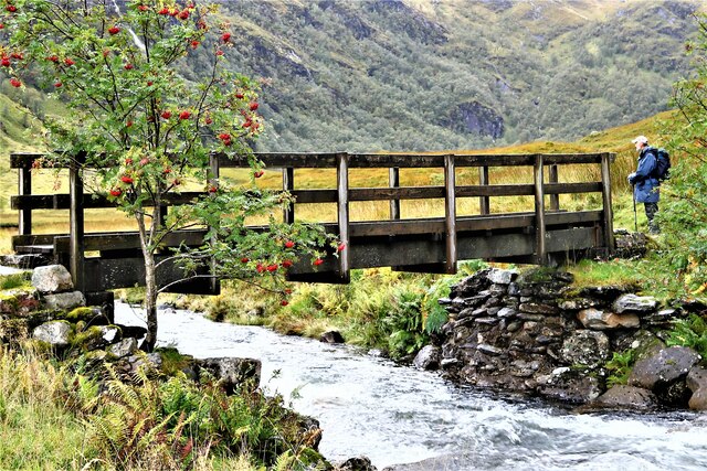
The mountain is accessible from the town of Fort William, which is located approximately 7 miles to the southwest. Hikers can reach the summit of An Gearanach via various routes, with the most popular starting from the Glen Nevis Youth Hostel.

Overall, An Gearanach is a must-visit destination for outdoor enthusiasts looking to experience the beauty and adventure of the Scottish Highlands.

If you have any feedback on the listing, please let us know in the comments section below.

An Gearanach Images

Images are sourced within 2km of 56.75918/-4.9661522 or Grid Reference NN1866. Thanks to Geograph Open Source API. All images are credited.

Glen Nevis at Steall, Scotland An idyllic spot at the foot of Britain's highest mountain, on a warm summer's day.
Glen Nevis at Steall, Scotland
An idyllic spot at the foot of Britain's highest mountain, on a warm summer's day.
Ben Nevis from An Gearanach, Scottish Highlands View facing north from the side of An Gearanach looking to Ben Nevis.
Ben Nevis from An Gearanach, Scottish Highlands
View facing north from the side of An Gearanach looking to Ben Nevis.
Steall ruins and Allt Coire Giubhsachan
Path to Steall waterfall
Valley of Allt Coire a’ Mhail The valley seen from the ridge connecting Am Bodach with Sgùrr an Iubhair, on the ascent to the former.
The distant mountains are beyond Glen Nevis. Aonach Mor is the farther of the two, Aonach Beag is central and snow-capped.
Valley of Allt Coire a’ Mhail
The valley seen from the ridge connecting Am Bodach with Sgùrr an Iubhair, on the ascent to the former. The distant mountains are beyond Glen Nevis. Aonach Mor is the farther of the two, Aonach Beag is central and snow-capped.
Sgùrr a' Mhàim A very foreshortened view from the upper carpark in Glen Nevis. Cloud is lifting after a period of wet weather.
Sgùrr a' Mhàim
A very foreshortened view from the upper carpark in Glen Nevis. Cloud is lifting after a period of wet weather.
An Steall (waterfall) Allt Coire a' Mhàil  meeting the Water of Nevis in Glen Nevis.
An Steall (waterfall)
Allt Coire a' Mhàil meeting the Water of Nevis in Glen Nevis.
Footbridge over Allt Coire Giubhsachan
An Steall - The Steall Waterfall Allt Coire a' Mhàil meeting the Water of Nevis in Glen Nevis.
An Steall - The Steall Waterfall
Allt Coire a' Mhàil meeting the Water of Nevis in Glen Nevis.
Northern ridge of Am Bodach towards Stob Coire a’ Chairn
Path towards Stob Coire a’ Chairn
An Garbhanach from Stob Coire a’ Chairn
Path down into Coire na Ba
Steep path towards An Gearanach
Path towards An Gearanach
Path on the northern slopes of An Gearanach
Steall ruins
Steall ruins
Water of Nevis We look along the river from just beside the famous rope bridge. At this time of year much of the glen never sees direct sunlight although surrounding summits are illuminated.
Water of Nevis
We look along the river from just beside the famous rope bridge. At this time of year much of the glen never sees direct sunlight although surrounding summits are illuminated.
Show me another place!

An Gearanach is located at Grid Ref: NN1866 (Lat: 56.75918, Lng: -4.9661522)

Unitary Authority: Highland

Police Authority: Highlands and Islands

What 3 Words

///handbook.unopposed.flip. Near Fort William, Highland

Related Wikis

An Gearanach

An Gearanach is a Scottish mountain situated in the Mamore Forest, five and a half kilometres north of Kinlochleven in the Lochaber region of the Highland...

Stob Coire a' Chàirn

Stob Coire a’ Chàirn is a Scottish mountain situated in the Mamores range, 3.5 kilometres north of Kinlochleven. The mountain reaches a height of 981 metres...

Mamores

The Mamores are a group of mountains in the Lochaber area of the Grampian Mountains in the Scottish Highlands. They form an east–west ridge approximately...
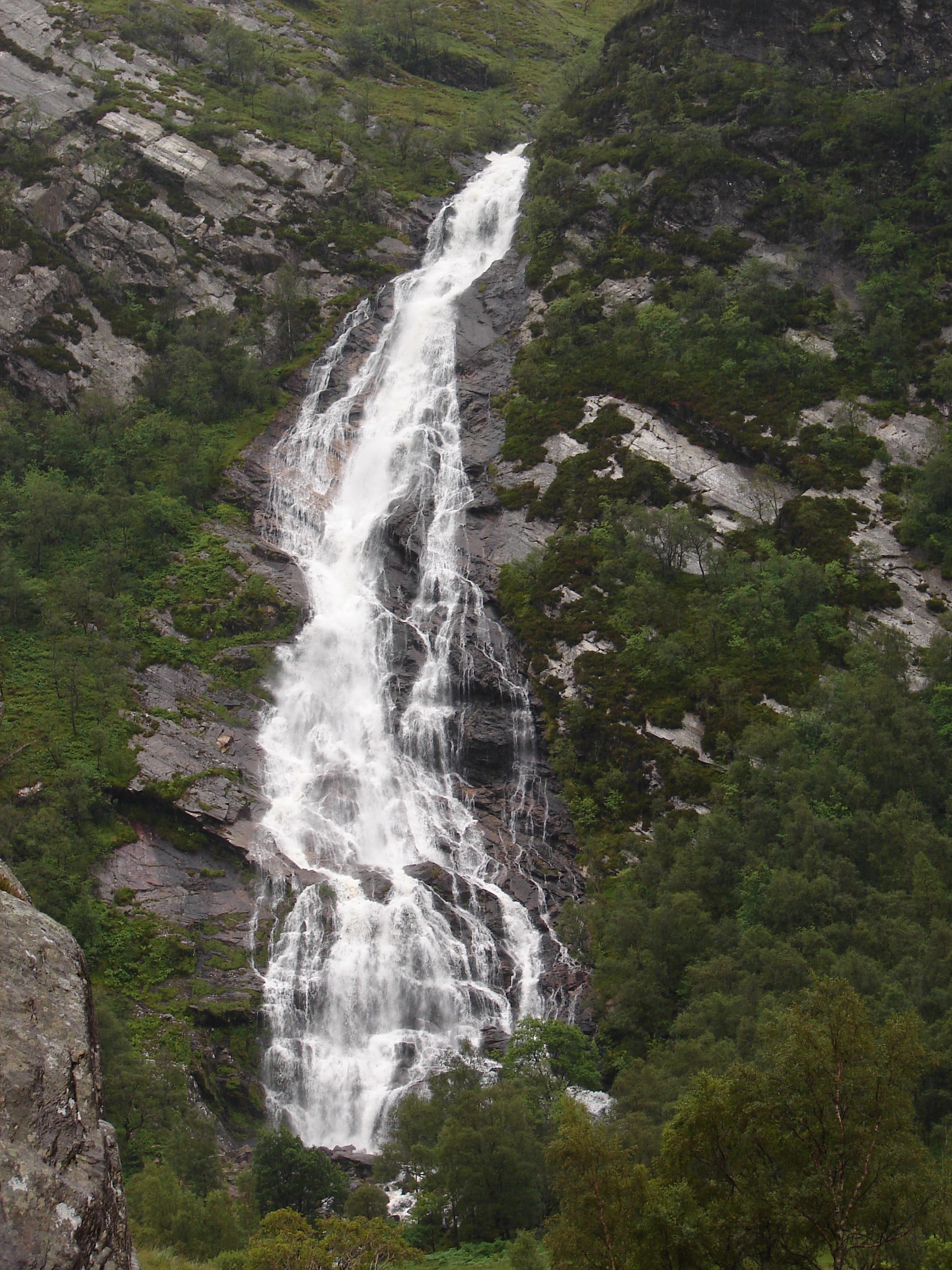
Steall Waterfall

Steall Waterfall, also known as An Steall Bàn or Steall Falls, is situated in Glen Nevis near Fort William, Highland, Scotland. It is Scotland's second...

Nearby Amenities

Located within 500m of 56.75918,-4.9661522
An Gearanach
Description: The complainer
Ele: 982
Marilyn: yes
Munro: yes
Munro Number: M166
Natural: peak
Prominence: 151
Source: NPE
Wikidata: Q3355685
Wikipedia: en:An Gearanach
Lat/Long: 56.7592172/-4.9662721
An Gearnananch
Place: locality
Lat/Long: 56.7610275/-4.9666919
The data included in this document is from www.openstreetmap.org. The data is made available under ODbL.

Have you been to An Gearanach?

Leave your review of An Gearanach below (or comments, questions and feedback).