Balmedie

Settlement in Aberdeenshire

Scotland

Balmedie

Waste management facility, Easter Hatton
Waste management facility, Easter Hatton Credit: Bill Harrison

Balmedie is a serene village located in the Aberdeenshire region of Scotland. Situated just 8 miles north of Aberdeen, it is a popular destination for both residents and tourists seeking a peaceful retreat from the bustling city life. With a population of around 2,000, Balmedie offers a close-knit community atmosphere with a range of amenities.

One of the main attractions in Balmedie is its stunning beach, which stretches for nearly 14 miles along the coast. The golden sand dunes and crystal-clear waters make it an ideal spot for picnics, walks, or simply enjoying the breathtaking views. The beach is also home to the Balmedie Country Park, providing opportunities for outdoor activities such as cycling, horse riding, and bird watching.

The village itself boasts a variety of local businesses including shops, restaurants, and pubs, catering to the needs of both residents and visitors. Additionally, Balmedie is known for its thriving golf culture, with the world-renowned Trump International Golf Links located nearby.

Transportation in Balmedie is convenient, with regular bus services connecting the village to Aberdeen and other neighboring towns. The village also benefits from easy access to major roadways, making it easily reachable by car.

Overall, Balmedie offers a tranquil escape with its beautiful beach, natural surroundings, and friendly community. Whether exploring the dunes, enjoying outdoor activities, or simply unwinding in the picturesque setting, Balmedie is a hidden gem in Aberdeenshire.

If you have any feedback on the listing, please let us know in the comments section below.
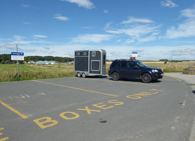
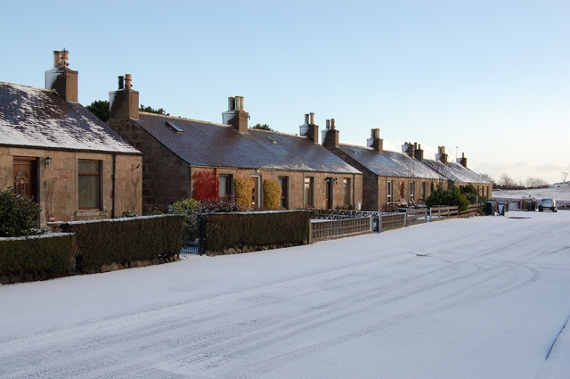
Balmedie Images

Images are sourced within 2km of 57.25083/-2.056428 or Grid Reference NJ9617. Thanks to Geograph Open Source API. All images are credited.

Waste management facility, Easter Hatton
Sand bothy The sand bothy and play park of Balmedie country park, as seen from the sand dunes.
Sand bothy
The sand bothy and play park of Balmedie country park, as seen from the sand dunes.
War defence The sand dunes of the country park with some abandoned WW2 defences
War defence
The sand dunes of the country park with some abandoned WW2 defences
A tree grove A small grove of trees some of which are apple trees
A tree grove
A small grove of trees some of which are apple trees
Bunker in Balmedie Country Park This bunker in the sand dunes is used as the base for Balmedie Beach Wheelchairs, a volunteer charitable organization which loans out wheelchairs with all-terrain capability to those in need.
Bunker in Balmedie Country Park
This bunker in the sand dunes is used as the base for Balmedie Beach Wheelchairs, a volunteer charitable organization which loans out wheelchairs with all-terrain capability to those in need.
Balmedie Beach Wheelchairs Balmedie Beach Wheelchairs are a volunteer charitable organization based in a bunker in Balmedie Country Park which loans out wheelchairs with all-terrain capability to those in need.
Balmedie Beach Wheelchairs
Balmedie Beach Wheelchairs are a volunteer charitable organization based in a bunker in Balmedie Country Park which loans out wheelchairs with all-terrain capability to those in need.
Boardwalk in Balmedie Country Park It may not be immediately obvious but this boardwalk which runs along the western bank of a pond is the only easy way on to Balmedie Beach which does involved scrambling over the dunes.
Boardwalk in Balmedie Country Park
It may not be immediately obvious but this boardwalk which runs along the western bank of a pond is the only easy way on to Balmedie Beach which does involved scrambling over the dunes.
You can lead a horse to the water... ...but this one was extremely nervous about getting its hooves wet.
You can lead a horse to the water...
...but this one was extremely nervous about getting its hooves wet.
Support services As part of the operation to allow this girl to ride her horse on the beach, it was necessary to arrange for support services in the form of a giant pooper-scooper.
Support services
As part of the operation to allow this girl to ride her horse on the beach, it was necessary to arrange for support services in the form of a giant pooper-scooper.
Driftwood on Balmedie Beach Bleached white by exposure to sea water and the sun.
Driftwood on Balmedie Beach
Bleached white by exposure to sea water and the sun.
A reluctant horse Not easy to coax a nervous horse over the steep sandy slopes of the sand dunes down on to the beach.
A reluctant horse
Not easy to coax a nervous horse over the steep sandy slopes of the sand dunes down on to the beach.
You can lead a horse to the water... ...but this one was extremely nervous about getting its hooves wet.
You can lead a horse to the water...
...but this one was extremely nervous about getting its hooves wet.
Left by the receding tide A ring of sandcastles on Balmedie Beach.
Left by the receding tide
A ring of sandcastles on Balmedie Beach.
Beach games on Balmedie Beach
Balmedie  Grange Former farm steading converted into stylish apartments.
Balmedie Grange
Former farm steading converted into stylish apartments.
Former farm buildings on North Beach Road The sign proclaims Balmedie Mushroom Farm but this is now closed. Other small businesses occupy the various former farm buildings.
Former farm buildings on North Beach Road
The sign proclaims Balmedie Mushroom Farm but this is now closed. Other small businesses occupy the various former farm buildings.
Parking for horse boxes only Horse-riding is a popular pastime on Balmedie Beach.
Parking for horse boxes only
Horse-riding is a popular pastime on Balmedie Beach.
Show me another place!

Balmedie is located at Grid Ref: NJ9617 (Lat: 57.25083, Lng: -2.056428)

Unitary Authority: Aberdeenshire

Police Authority: North East

What 3 Words

///mason.motive.curly. Near Balmedie, Aberdeenshire

Nearby Locations

Balmedie

Related Wikis

Balmedie

Balmedie (Scottish Gaelic: Baile Mheadhain) is a large village in Aberdeenshire in Scotland. It lies north of the city of Aberdeen, in the civil parish...

Belhelvie

Belhelvie (Scottish Gaelic: Baile Shealbhaigh) is a small village and civil parish in Aberdeenshire in Scotland. The parish has a population of 3,802...

Potterton

Potterton is a village north of Aberdeen, Scotland, in Aberdeenshire, west of Balmedie. Population in 1991 was 1159, falling by 2001 to 886. == References ==

Trump International Golf Links, Scotland

Trump International Golf Links, Scotland is a golf course in Balmedie, Aberdeenshire, Scotland, owned by Donald Trump. It opened in 2012. == History... ==

Nearby Amenities

Located within 500m of 57.25083,-2.056428
Balmedie
Name Gd: Baile Mheadhain
Place: village
Population: 2510
Wikidata: Q805468
Wikipedia: en:Balmedie
Lat/Long: 57.246473/-2.0571418
Direction: both
Surface: asphalt
Traffic Calming: hump
Lat/Long: 57.2465329/-2.0564704
Turning Circle
Lat/Long: 57.248473/-2.0562758
Traffic Calming: hump
Lat/Long: 57.2531192/-2.0598927
Traffic Calming: hump
Lat/Long: 57.251983/-2.0557394
Traffic Calming: hump
Lat/Long: 57.2524022/-2.0530881
Barrier: bollard
Motor Vehicle: no
Lat/Long: 57.2489898/-2.0531811
Barrier: bollard
Motor Vehicle: no
Lat/Long: 57.2487749/-2.0526603
Post Office
Balmedie Post Office
Addr Postcode: AB23 8YF
Branch: Balmedie
Brand: Post Office
Brand Wikidata: Q1783168
Check Date: 2023-05-27
Contact Website: https://www.postoffice.co.uk/branch-finder/1058010/balmedie
Ref Pol Id: 1416
Lat/Long: 57.2510254/-2.0561287
Fast Food
Balmedie Fish & Chip Shop
Addr City: Balmedie
Addr Housenumber: 2
Addr Postcode: AB23 8AD
Addr Street: Whitehorse Pend
Cuisine: fish
Fhrs Authority: Aberdeenshire
Fhrs Id: 129465
Fhrs Local Authority Id: 6026
Lat/Long: 57.2510723/-2.0611307
Shop: hairdresser
Lat/Long: 57.2511477/-2.0611093
Co-op Food
Addr City: Aberdeenshire
Addr Housenumber: 1
Addr Postcode: AB23 8SJ
Addr Street: Balmedie
Brand: Co-op Food
Brand Wikidata: Q3277439
Brand Wikipedia: en:Co-op Food
Fhrs Authority: Aberdeenshire
Fhrs Id: 113072
Fhrs Local Authority Id: 42169
Operator: The Co-operative Group
Operator Wikidata: Q117202
Shop: supermarket
Website: https://www.coop.co.uk/store-finder/AB23-8SW/rowan-drive
Lat/Long: 57.246603/-2.0575151
Pharmacy
Dickies Pharmacy
Dispensing: yes
Healthcare: pharmacy
Lat/Long: 57.2464986/-2.0578906
Kindergarten
Lat/Long: 57.2466263/-2.058191
Post Box
Collection Times: Mo-Fr 16:45; Sa 11:45
Operator: Royal Mail
Operator Wikidata: Q638098
Post Box Design: type_k
Post Box Type: pillar
Ref: AB23 268
Royal Cypher: scottish_crown
Lat/Long: 57.250936/-2.0563427
Post Box
Collection Times: Mo-Fr 09:00; Sa 07:00
Operator: Royal Mail
Operator Wikidata: Q638098
Post Box Type: pillar
Ref: AB23 347
Lat/Long: 57.2507861/-2.0617148
Recycling
Check Date: 2023-05-27
Recycling Batteries: no
Recycling Books: no
Recycling Cans: yes
Recycling Cardboard: yes
Recycling Cartons: yes
Recycling Clothes: yes
Recycling Electrical Appliances: no
Recycling Glass: yes
Recycling Glass Bottles: yes
Recycling Green Waste: no
Recycling Magazines: yes
Recycling Newspaper: yes
Recycling Paper: yes
Recycling Paper Packaging: yes
Recycling Plastic: no
Recycling Plastic Bottles: yes
Recycling Plastic Packaging: no
Recycling Scrap Metal: no
Recycling Small Appliances: no
Recycling Waste: no
Recycling Wood: no
Recycling Type: container
Lat/Long: 57.2511884/-2.0560989
Recycling
Recycling Cans: yes
Recycling Cardboard: yes
Recycling Glass: yes
Recycling Glass Bottles: yes
Recycling Magazines: yes
Recycling Newspaper: yes
Recycling Paper: yes
Recycling Paper Packaging: yes
Recycling Plastic Bottles: yes
Recycling Type: container
Lat/Long: 57.2464108/-2.0573373
Bus Stop
Whitehorse Terrace
Bench: yes
Bin: no
Bus: yes
Lit: yes
Naptan AtcoCode: 630046082
Naptan Bearing: E
Naptan CommonName: Whitehorse Terrace
Naptan Indicator: opp
Naptan Landmark: Whitehorse Terrace
Naptan NaptanCode: 23629645
Naptan Street: North Beach Road
Naptan Verified: no
Public Transport: platform
Ref: 23629645
Shelter: yes
Tactile Paving: no
Lat/Long: 57.2520602/-2.0605072
Bus Stop
Whiethorse Terrace, northbound
Bus: yes
Public Transport: platform
Lat/Long: 57.2520079/-2.0601957
Bus Stop
Burnside Way
Bus: yes
Naptan AtcoCode: 630032431
Naptan Bearing: N
Naptan CommonName: Burnside Way
Naptan Indicator: at
Naptan Landmark: Burnside Way
Naptan NaptanCode: 23626862
Naptan Street: Eigie Road
Naptan Verified: no
Public Transport: platform
Ref: 23626862
Lat/Long: 57.2518164/-2.0568161
Bus Stop
Bench: yes
Bin: yes
Bus: yes
Public Transport: platform
Shelter: yes
Tactile Paving: no
Lat/Long: 57.2519847/-2.0566445
Bus Stop
Bus: yes
Public Transport: platform
Lat/Long: 57.2479915/-2.0563977
Bus Stop
Bench: yes
Bin: yes
Bus: yes
Public Transport: platform
Shelter: yes
Tactile Paving: no
Lat/Long: 57.2470744/-2.0560651
Bus Stop
Blairton House
Bench: yes
Bin: no
Bus: yes
Lit: yes
Naptan AtcoCode: 630045772
Naptan Bearing: S
Naptan CommonName: Blairton House
Naptan Indicator: opp
Naptan Landmark: Blairton House
Naptan NaptanCode: 23629385
Naptan Street: Old Aberdeen Road
Naptan Verified: no
Public Transport: platform
Ref: 23629385
Shelter: yes
Tactile Paving: no
Lat/Long: 57.254526/-2.06081
Bus Stop
Bench: yes
Bin: yes
Bus: yes
Public Transport: platform
Shelter: yes
Tactile Paving: no
Lat/Long: 57.2543981/-2.0610776
Traffic Calming: hump
Lat/Long: 57.2533791/-2.0588368
Barrier: bollard
Lat/Long: 57.2487128/-2.0548873
Barrier: bollard
Lat/Long: 57.2486079/-2.0534644
Crossing
Crossing: unmarked
Surface: asphalt
Tactile Paving: no
Lat/Long: 57.2473535/-2.0534433
Crossing
Crossing: unmarked
Surface: asphalt
Tactile Paving: no
Lat/Long: 57.2472979/-2.0534372
Traffic Calming: hump
Lat/Long: 57.252397/-2.0558208
Entrance: yes
Lat/Long: 57.2476532/-2.0570608
Turning Loop
Lat/Long: 57.2490447/-2.0564816
Access: no
Barrier: bollard
Bicycle: designated
Bollard: fixed
Foot: designated
Height: 1
Horse: yes
Material: metal
Width: 0.25
Lat/Long: 57.2507759/-2.0632358
Cafe
Beachside Cafe
Cuisine: coffee_shop
Outdoor Seating: yes
Lat/Long: 57.2474827/-2.056794
Fast Food
Bengal Tiger
Addr City: Balmedie
Addr Postcode: AB23 8SJ
Addr Street: Birch Way
Addr Unit: Unit 2
Cuisine: indian
Fhrs Authority: Aberdeenshire
Fhrs Id: 778965
Fhrs Local Authority Id: 49916
Lat/Long: 57.246523/-2.0577726
Bus Stop
Whitehorse Inn
Bench: yes
Bin: yes
Bus: yes
Lit: yes
Naptan AtcoCode: 630030052
Naptan Bearing: S
Naptan CommonName: Whitehorse Inn
Naptan Indicator: at
Naptan Landmark: Whitehorse Inn
Naptan NaptanCode: 23626846
Naptan Street: Old Aberdeen Road
Naptan Verified: no
Public Transport: platform
Ref: 23626846
Shelter: yes
Tactile Paving: no
Lat/Long: 57.2513251/-2.0614328
Bus Stop
Whitehorse Inn
Bench: yes
Bin: no
Bus: yes
Lit: yes
Naptan AtcoCode: 630030051
Naptan Bearing: N
Naptan CommonName: Whitehorse Inn
Naptan Indicator: opp
Naptan Landmark: Whitehorse Inn
Naptan NaptanCode: 23626842
Naptan Street: Old Aberdeen Road
Naptan Verified: no
Public Transport: platform
Ref: 23626842
Shelter: yes
Tactile Paving: no
Lat/Long: 57.2513752/-2.0617762
Grit Bin
Access: yes
Colour: yellow
Lat/Long: 57.2480886/-2.0532408
Waste Basket
Waste: trash
Lat/Long: 57.2490426/-2.0531426
Waste Basket
Waste: dog_excrement
Lat/Long: 57.2489871/-2.0529027
Bench
Backrest: yes
Material: wood
Seats: 3
Lat/Long: 57.248783/-2.054013
Waste Basket
Lat/Long: 57.2487749/-2.05406
Bus Stop
Eigie Crescent
Bench: yes
Bin: no
Bus: yes
Departures Board: timetable
Lit: yes
Naptan AtcoCode: 630032411
Naptan Bearing: S
Naptan CommonName: Eigie Crescent
Naptan Indicator: at
Naptan Landmark: Eigie Crescent
Naptan NaptanCode: 23626867
Naptan Street: Eigie Road
Naptan Verified: no
Public Transport: platform
Ref: 23626867
Shelter: yes
Tactile Paving: no
Lat/Long: 57.2491239/-2.0557923
Grit Bin
Access: yes
Colour: yellow
Material: plastic
Lat/Long: 57.2495538/-2.0544335
Bus Stop
Eigie Crescent
Bus: yes
Naptan AtcoCode: 630032412
Naptan Bearing: N
Naptan CommonName: Eigie Crescent
Naptan Indicator: opp
Naptan Landmark: Eigie Crescent
Naptan NaptanCode: 23626865
Naptan Street: Eigie Road
Naptan Verified: no
Public Transport: platform
Ref: 23626865
Lat/Long: 57.252189/-2.0577178
Generator Method: photovoltaic
Generator Output Electricity: yes
Generator Source: solar
Generator Type: solar_photovoltaic_panel
Location: roof
Power: generator
Lat/Long: 57.2510991/-2.0570974
Generator Method: photovoltaic
Generator Output Electricity: yes
Generator Source: solar
Generator Type: solar_photovoltaic_panel
Location: roof
Power: generator
Lat/Long: 57.2516403/-2.0578994
Crossing
Crossing: uncontrolled
Crossing Island: yes
Crossing Markings: no
Tactile Paving: no
Lat/Long: 57.2532044/-2.0612521
Traffic Calming: hump
Lat/Long: 57.2527075/-2.0608283
Generator Method: photovoltaic
Generator Output Electricity: yes
Generator Source: solar
Generator Type: solar_photovoltaic_panel
Location: roof
Power: generator
Lat/Long: 57.2519272/-2.057316
Grit Bin
Lat/Long: 57.2471921/-2.0525879
Generator Method: photovoltaic
Generator Output Electricity: yes
Generator Source: solar
Generator Type: solar_photovoltaic_panel
Location: roof
Power: generator
Lat/Long: 57.2548148/-2.0553553
Generator Method: photovoltaic
Generator Output Electricity: yes
Generator Source: solar
Generator Type: solar_photovoltaic_panel
Location: roof
Power: generator
Lat/Long: 57.2478082/-2.0618878
Generator Method: photovoltaic
Generator Output Electricity: yes
Generator Source: solar
Generator Type: solar_photovoltaic_panel
Location: roof
Power: generator
Lat/Long: 57.2486672/-2.0619898
Generator Method: photovoltaic
Generator Output Electricity: yes
Generator Source: solar
Generator Type: solar_photovoltaic_panel
Location: roof
Power: generator
Lat/Long: 57.2483632/-2.062207
Generator Method: photovoltaic
Generator Output Electricity: yes
Generator Source: solar
Generator Type: solar_photovoltaic_panel
Location: roof
Power: generator
Lat/Long: 57.2484242/-2.0614225
Generator Method: photovoltaic
Generator Output Electricity: yes
Generator Source: solar
Generator Type: solar_photovoltaic_panel
Location: roof
Power: generator
Lat/Long: 57.2517752/-2.0511898
Generator Method: photovoltaic
Generator Output Electricity: yes
Generator Source: solar
Generator Type: solar_photovoltaic_panel
Location: roof
Power: generator
Lat/Long: 57.2482649/-2.0570713
Generator Method: photovoltaic
Generator Output Electricity: yes
Generator Source: solar
Generator Type: solar_photovoltaic_panel
Location: roof
Power: generator
Lat/Long: 57.2498273/-2.0596724
Generator Method: photovoltaic
Generator Output Electricity: yes
Generator Source: solar
Generator Type: solar_photovoltaic_panel
Location: roof
Power: generator
Lat/Long: 57.2510701/-2.0578766
Generator Method: photovoltaic
Generator Output Electricity: yes
Generator Source: solar
Generator Type: solar_photovoltaic_panel
Location: roof
Power: generator
Lat/Long: 57.2523201/-2.0580858
Generator Method: photovoltaic
Generator Output Electricity: yes
Generator Source: solar
Generator Type: solar_photovoltaic_panel
Location: roof
Power: generator
Lat/Long: 57.249458/-2.060194
Generator Method: photovoltaic
Generator Output Electricity: yes
Generator Source: solar
Generator Type: solar_photovoltaic_panel
Location: roof
Power: generator
Lat/Long: 57.2481187/-2.0534979
Generator Method: photovoltaic
Generator Output Electricity: yes
Generator Source: solar
Generator Type: solar_photovoltaic_panel
Location: roof
Power: generator
Lat/Long: 57.2483081/-2.0533852
Grit Bin
Lat/Long: 57.2512859/-2.0585103
Power: pole
Lat/Long: 57.2485386/-2.0634809
Material: wood
Power: pole
Lat/Long: 57.2486104/-2.063211
Power: pole
Lat/Long: 57.2527703/-2.0512274
Power: pole
Lat/Long: 57.2523424/-2.0505752
Power: pole
Lat/Long: 57.2517915/-2.0496906
Power: pole
Lat/Long: 57.2512696/-2.0488963
Power: pole
Lat/Long: 57.2526409/-2.0516438
Power: pole
Lat/Long: 57.2528517/-2.0509632
Power: pole
Lat/Long: 57.2532234/-2.050898
Power: pole
Lat/Long: 57.2536911/-2.051
Traffic Calming: hump
Lat/Long: 57.2519668/-2.053408
Bus Stop
Whitehorse Terrace
Bench: yes
Bin: no
Bus: yes
Lit: yes
Naptan AtcoCode: 630046081
Naptan Bearing: W
Naptan CommonName: Whitehorse Terrace
Naptan Indicator: at
Naptan Landmark: Whitehorse Terrace
Naptan NaptanCode: 23629624
Naptan Street: North Beach Road
Naptan Verified: no
Public Transport: platform
Ref: 23629624
Shelter: yes
Tactile Paving: no
Lat/Long: 57.251938/-2.0608099
Bus Stop
Mill Of Eigie Road
Bench: no
Bin: no
Bus: yes
Lit: yes
Naptan AtcoCode: 630032562
Naptan Bearing: N
Naptan CommonName: Mill Of Eigie Road
Naptan Indicator: opp
Naptan Landmark: Mill Of Eigie Road
Naptan NaptanCode: 23626847
Naptan Street: Old Aberdeen Road
Naptan Verified: no
Passenger Information Display: no
Public Transport: platform
Ref: 23626847
Shelter: no
Tactile Paving: no
Lat/Long: 57.2495448/-2.0609991
Bus Stop
Mill of Eigie Road
Bus: yes
Naptan AtcoCode: 630032561
Naptan Bearing: S
Naptan CommonName: Mill of Eigie Road
Naptan Indicator: at
Naptan Landmark: Mill Of Eigie Road
Naptan NaptanCode: 23628254
Naptan Street: Old Aberdeen Road
Naptan Verified: no
Public Transport: platform
Ref: 23628254
Lat/Long: 57.249384/-2.060704
Bus Stop
Burnside Way
Bench: yes
Bus: yes
Naptan AtcoCode: 630032432
Naptan Bearing: S
Naptan CommonName: Burnside Way
Naptan Indicator: opp
Naptan Landmark: Burnside Way
Naptan NaptanCode: 23626864
Naptan Street: Eigie Road
Naptan Verified: no
Public Transport: platform
Ref: 23626864
Shelter: yes
Lat/Long: 57.2518519/-2.056671
Bus Stop
Rowan Drive
Bench: yes
Bin: yes
Bus: yes
Lit: yes
Naptan AtcoCode: 630032422
Naptan Bearing: S
Naptan CommonName: Rowan Drive
Naptan Indicator: opp
Naptan Landmark: Rowan Drive
Naptan NaptanCode: 23626859
Naptan Street: Eigie Road
Naptan Verified: no
Public Transport: platform
Ref: 23626859
Shelter: yes
Tactile Paving: no
Lat/Long: 57.2469171/-2.0561147
Bus Stop
Rowan Drive
Bus: yes
Naptan AtcoCode: 630032421
Naptan Bearing: N
Naptan CommonName: Rowan Drive
Naptan Indicator: at
Naptan Landmark: Rowan Drive
Naptan NaptanCode: 23626863
Naptan Street: Eigie Road
Naptan Verified: no
Public Transport: platform
Ref: 23626863
Lat/Long: 57.2478729/-2.0564352
Barratt Homes
Brand: Barratt Homes
Brand Wikidata: Q43851666
Contact Website: https://www.barrattcareers.co.uk/locations/scotland
Office: company
Lat/Long: 57.2541765/-2.061519
Give Way
Direction: backward
Lat/Long: 57.2519679/-2.06146
Direction: both
Surface: asphalt
Traffic Calming: hump
Lat/Long: 57.2532188/-2.0515676
Give Way
Direction: forward
Lat/Long: 57.2526062/-2.0571438
Crossing
Crossing: uncontrolled
Crossing Island: no
Crossing Markings: zebra
Crossing Ref: zebra
Surface: asphalt
Lat/Long: 57.2507552/-2.0539594
Crossing
Crossing: unmarked
Crossing Island: no
Surface: asphalt
Tactile Paving: yes
Lat/Long: 57.2501873/-2.0562755
Assembly Point
Assembly Point Fire: yes
Emergency: assembly_point
Lat/Long: 57.2494421/-2.0542113
Give Way
Direction: forward
Lat/Long: 57.2465859/-2.0561575
Give Way
Direction: backward
Lat/Long: 57.2488908/-2.0604064
The data included in this document is from www.openstreetmap.org. The data is made available under ODbL.

Have you been to Balmedie?

Leave your review of Balmedie below (or comments, questions and feedback).