Mynydd Anelog

Hill, Mountain in Caernarfonshire

Wales

Mynydd Anelog

Milestone
Milestone Credit: Adrian Dust

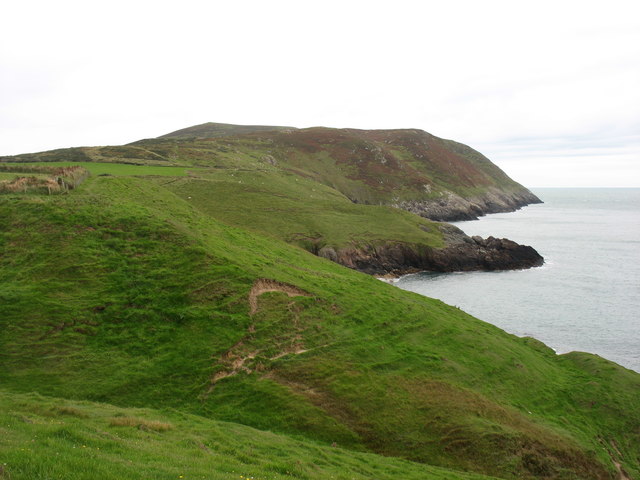
Mynydd Anelog is a prominent hill located in Caernarfonshire, Wales. It is situated on the Llŷn Peninsula, a narrow strip of land that extends into the Irish Sea. With an elevation of approximately 189 meters (620 feet), Mynydd Anelog is not classified as a mountain but rather a hill. However, it still offers breathtaking views of the surrounding landscape.

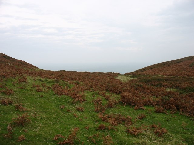
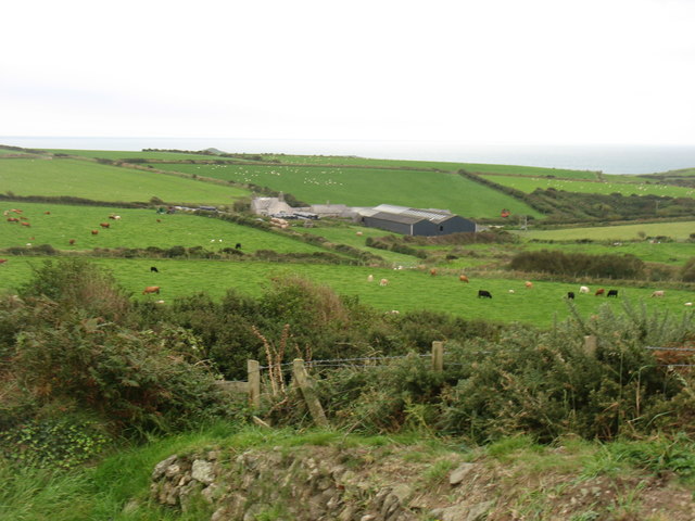
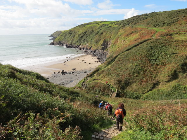
The hill is known for its rugged and rocky terrain, covered with heather, grasses, and other typical upland vegetation. Its slopes are relatively gentle, making it accessible to hikers and nature enthusiasts of various skill levels. At the summit, there is a trig point, which serves as a navigational marker and offers panoramic vistas of the surrounding area. On clear days, visitors can enjoy stunning views of the Llŷn Peninsula, Cardigan Bay, and even the distant peaks of Snowdonia National Park.

Mynydd Anelog is also home to a diverse range of wildlife. The hill provides a habitat for various bird species, including buzzards, kestrels, and peregrine falcons. Additionally, during the spring and summer months, the slopes come alive with colorful wildflowers, creating a picturesque sight.

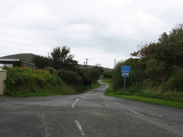
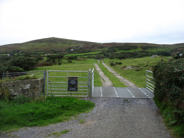
The hill is easily accessible by foot, with several footpaths and trails leading to its summit. It is a popular destination for outdoor activities such as hillwalking, hiking, and birdwatching. Mynydd Anelog offers a tranquil and serene setting, allowing visitors to immerse themselves in the natural beauty of the Welsh countryside.

If you have any feedback on the listing, please let us know in the comments section below.

Mynydd Anelog Images

Images are sourced within 2km of 52.810788/-4.7434777 or Grid Reference SH1527. Thanks to Geograph Open Source API. All images are credited.

Milestone
Milestone
The southern slopes of Mynydd Mawr Bardsey Island in the hazy background.
The southern slopes of Mynydd Mawr
Bardsey Island in the hazy background.
North-eastern slopes of Mynydd Mawr
Steps to the summit of Mynydd Mawr I presume that the steps, and the concrete platform at their foot, are the remains of constructions during World War II.
Steps to the summit of Mynydd Mawr
I presume that the steps, and the concrete platform at their foot, are the remains of constructions during World War II.
The lane to Anelog
The lane to Anelog
Cwrt Farm Aberdaron Bay beyond.
Cwrt Farm
Aberdaron Bay beyond.
The drive to Anelog Farm With Mynydd Anelog behind (and still in square!).
The drive to Anelog Farm
With Mynydd Anelog behind (and still in square!).
Coastline at Carreg Seen from the Wales Coast Path.
Coastline at Carreg
Seen from the Wales Coast Path.
Porth Simdde Cerddwyr yn dilyn Llwybr Arfordir Cymru ym Mhorth Simdde.

Walkers following the Wales Coast Path at Porth Simdde.
Porth Simdde
Cerddwyr yn dilyn Llwybr Arfordir Cymru ym Mhorth Simdde. Walkers following the Wales Coast Path at Porth Simdde.
Tuag at Abardaron / Towards Aberdaron Cerddwyr yn dilyn Llwybr Arfordir Cymru tuag at Aberdaron, yr anheddiad yn y pellter.

Walkers following the Wales Coast Path towards Aberdaron (trans. mouth of the river daron), the settlement in the distance.
Tuag at Abardaron / Towards Aberdaron
Cerddwyr yn dilyn Llwybr Arfordir Cymru tuag at Aberdaron, yr anheddiad yn y pellter. Walkers following the Wales Coast Path towards Aberdaron (trans. mouth of the river daron), the settlement in the distance.
Llwybr yn Uwchfynydd / Path at Uwchfynydd Llwybr yn mynd drwy gaeau yn Uwchfynydd. Nid yw'r llwybr ar y ddaear yn dilyn yr un a ddynodir ar y Map OS. 

A path going through fields in Uwchfynydd (trans. above mountain). The path on the ground does not correspond with that as shown by the OS Map.
Llwybr yn Uwchfynydd / Path at Uwchfynydd
Llwybr yn mynd drwy gaeau yn Uwchfynydd. Nid yw'r llwybr ar y ddaear yn dilyn yr un a ddynodir ar y Map OS. A path going through fields in Uwchfynydd (trans. above mountain). The path on the ground does not correspond with that as shown by the OS Map.
Tuag at Fynydd Mawr / Towards Mynydd Mawr Cerddwyr yn cyrraedd hen ddisgwylfa wylwyr y glannau ar Fynydd Mawr.

Walkers approaching the former coastguard lookout on Mynydd Mawr (trans. big mountain).
Tuag at Fynydd Mawr / Towards Mynydd Mawr
Cerddwyr yn cyrraedd hen ddisgwylfa wylwyr y glannau ar Fynydd Mawr. Walkers approaching the former coastguard lookout on Mynydd Mawr (trans. big mountain).
Ger Bryn Goronwy / Near Bryn Goronwy Gat fochyn ger anhedd-dy o'r enw Bryn Goronwy.

A kissing gate near a property known as Bryn Goronwy (trans. Goronwy's hill).
Ger Bryn Goronwy / Near Bryn Goronwy
Gat fochyn ger anhedd-dy o'r enw Bryn Goronwy. A kissing gate near a property known as Bryn Goronwy (trans. Goronwy's hill).
Hen gat fochyn / Old kissing gate Hen gar fochyn ger Bryn Goronwy.

An old kissing gate near Bryn Goronwy. (trans. Goronwy's hill).
Hen gat fochyn / Old kissing gate
Hen gar fochyn ger Bryn Goronwy. An old kissing gate near Bryn Goronwy. (trans. Goronwy's hill).
A soggy start to a walk This innocent looking green lane proved to be as much water as grass. A good test for the boots in the first few hundred metres of a walk.
A soggy start to a walk
This innocent looking green lane proved to be as much water as grass. A good test for the boots in the first few hundred metres of a walk.
Sheep pasture, Uwchmynydd Following a footpath across sheep pasture towards the white farmhouse. The hill in the distance is Mynydd Anelog.
Sheep pasture, Uwchmynydd
Following a footpath across sheep pasture towards the white farmhouse. The hill in the distance is Mynydd Anelog.
Coastal sheep, Pennant Sheep on clifftop pasture close to Pennant cottage. The first traces of a sea mist can be seen creeping around the headland.
Coastal sheep, Pennant
Sheep on clifftop pasture close to Pennant cottage. The first traces of a sea mist can be seen creeping around the headland.
The start of a testing little hill The coast path near Pennant makes a shortish but very steep ascent of the northern spur of Mynydd Mawr. Meanwhile a sea mist creeps in from behind, soon enveloping the headland and obliterating the view along the path.
The start of a testing little hill
The coast path near Pennant makes a shortish but very steep ascent of the northern spur of Mynydd Mawr. Meanwhile a sea mist creeps in from behind, soon enveloping the headland and obliterating the view along the path.
Show me another place!

Mynydd Anelog is located at Grid Ref: SH1527 (Lat: 52.810788, Lng: -4.7434777)

Unitary Authority: Gwynedd

Police Authority: North Wales

What 3 Words

///gadget.structure.strain. Near Nefyn, Gwynedd

Nearby Locations

Mynydd Anelog Anelog

Related Wikis

Aberdaron

Aberdaron is a community, electoral ward and former fishing village at the western tip of the Llŷn Peninsula in the Welsh county of Gwynedd. It lies 14...

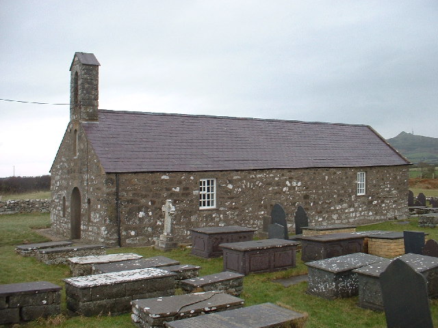
St Hywyn's Church, Aberdaron

The Church of St Hywyn, Aberdaron, Gwynedd, Wales, is a parish church dating from the 12th century. Its origins are earlier, as a clas church from the...

Bodferin

Bodferin is a former civil parish in the Welsh county of Gwynedd. It was abolished in 1934, and incorporated into Aberdaron. == References ==

Llanfaelrhys

Llanfaelrhys is a village and former civil parish in the Welsh county of Gwynedd, located on the Llŷn Peninsula. The parish was abolished in 1934 and...

Bardsey Island

Bardsey Island (Welsh: Ynys Enlli), known as the legendary "Island of 20,000 Saints", is located 1.9 miles (3.1 km) off the Llŷn Peninsula in the Welsh...

Bardsey Bird and Field Observatory

Bardsey Bird and Field Observatory is a bird observatory on Bardsey Island, off the Welsh coast. It was founded in 1953 by a group of ornithologists from...
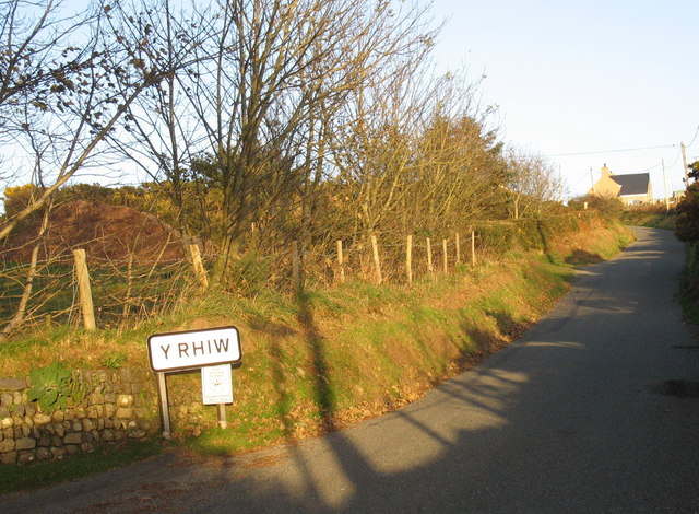
Y Rhiw

Y Rhiw () is a small village on the south west tip of the Llŷn Peninsula in Gwynedd, Wales. The village forms part of the community of Aberdaron. From...

Bardsey Lighthouse

Bardsey Lighthouse stands on the southerly tip of Bardsey Island, off the Llŷn Peninsula in Gwynedd, Wales, and guides vessels passing through St George...

Nearby Amenities

Located within 500m of 52.810788,-4.7434777
Mynydd Anelog
Ele: 192
Natural: peak
Source: NPE
Lat/Long: 52.8107845/-4.74349
Barrier: kissing_gate
Source: survey;gps
Lat/Long: 52.8099126/-4.7382831
Barrier: kissing_gate
Lat/Long: 52.806707/-4.7412819
Power: portal
Lat/Long: 52.8128966/-4.7444348
Power: pole
Lat/Long: 52.8129586/-4.7439768
Power: pole
Lat/Long: 52.8131548/-4.742507
Power: pole
Lat/Long: 52.8132492/-4.7417224
Power: pole
Lat/Long: 52.8132075/-4.7420624
Power: pole
Lat/Long: 52.8131106/-4.7429039
Power: pole
Lat/Long: 52.8130437/-4.7434799
Power: pole
Lat/Long: 52.8135394/-4.7396578
Power: pole
Lat/Long: 52.8136594/-4.7389685
Power: pole
Lat/Long: 52.8134413/-4.7401714
Power: pole
Lat/Long: 52.8133311/-4.7407776
Power: pole
Lat/Long: 52.8139828/-4.740606
The data included in this document is from www.openstreetmap.org. The data is made available under ODbL.

Have you been to Mynydd Anelog?

Leave your review of Mynydd Anelog below (or comments, questions and feedback).