Sound Hill

Hill, Mountain in Wigtownshire

Scotland

Sound Hill

Farm Ruins The ruins of Inchbread farm lie at the foot of the Moors.
Farm Ruins Credit: David Baird

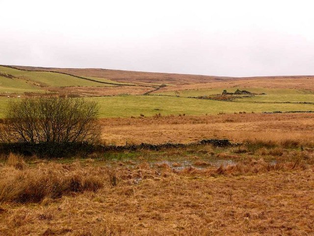
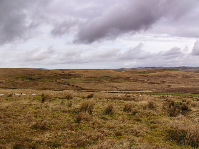
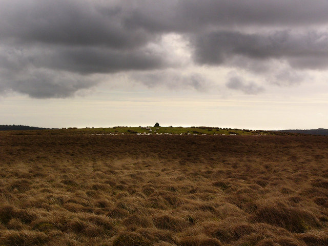
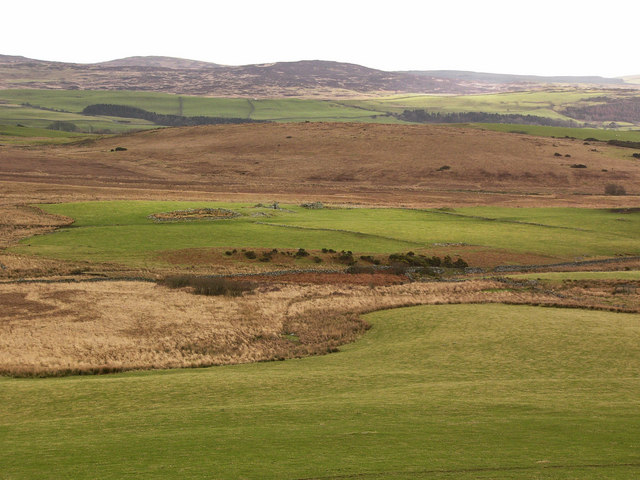
Sound Hill is a prominent hill located in Wigtownshire, a historic county in the southwestern part of Scotland. Rising to an elevation of approximately 198 meters (650 feet), it is a notable landmark in the region. The hill is situated near the village of Port William and offers breathtaking panoramic views of the surrounding countryside and the Irish Sea.

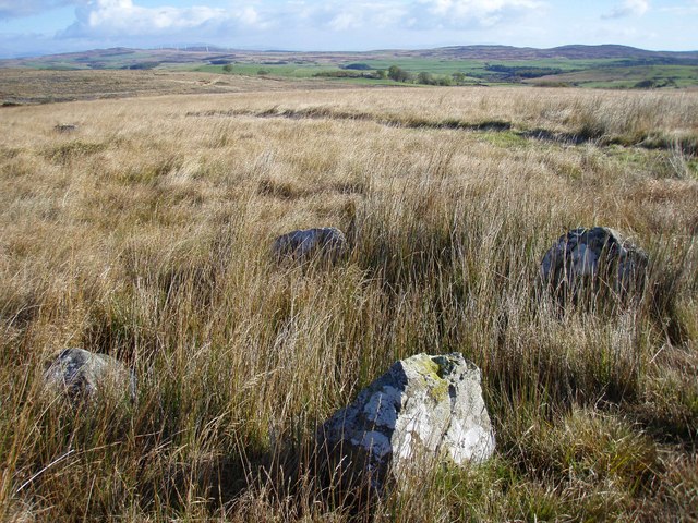
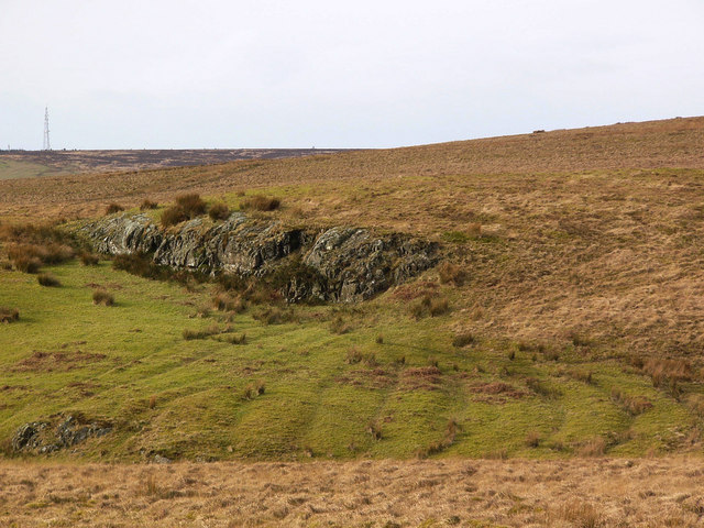
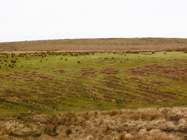
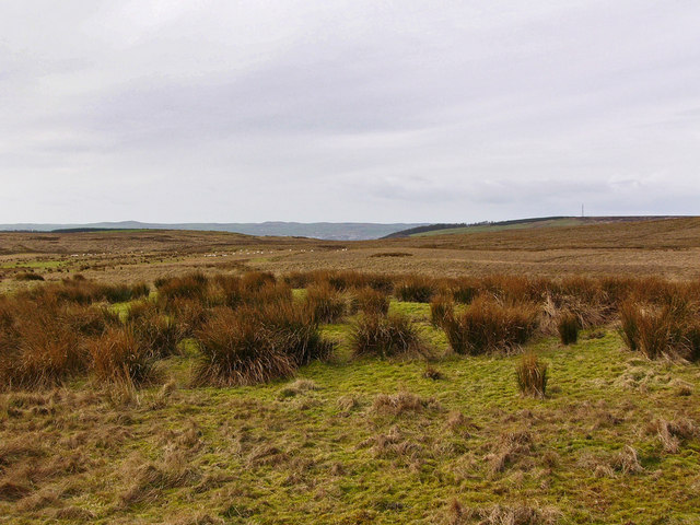
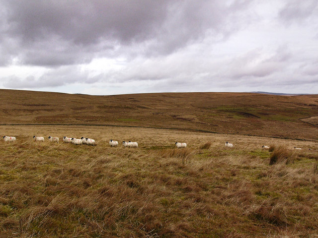
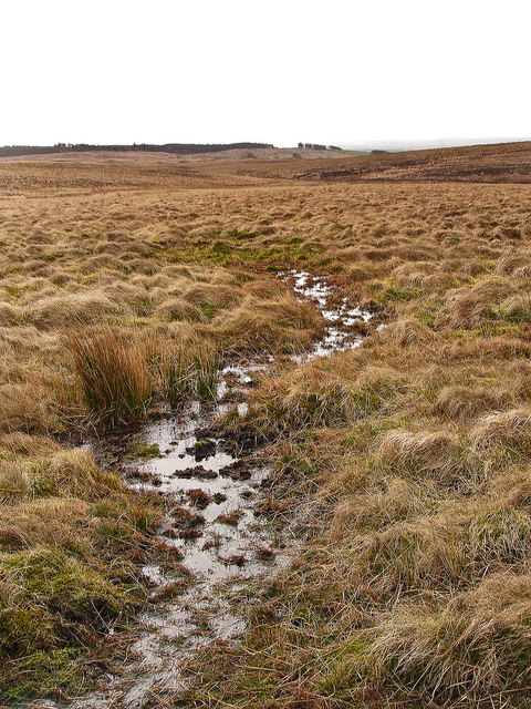
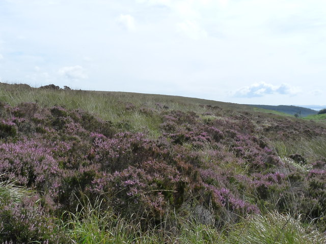
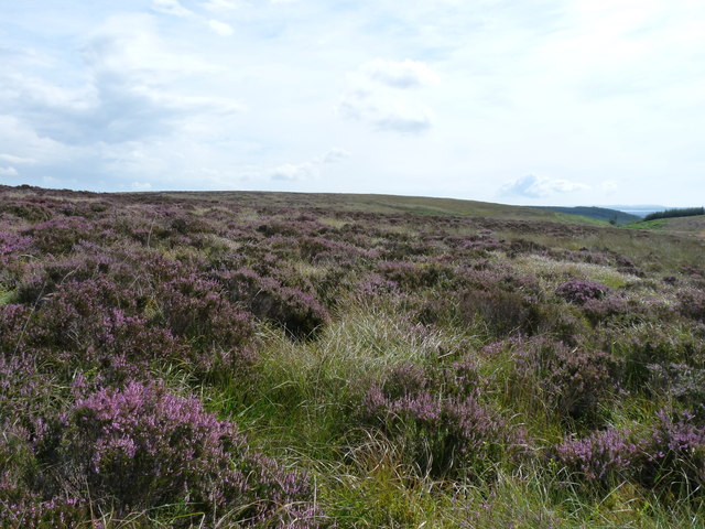
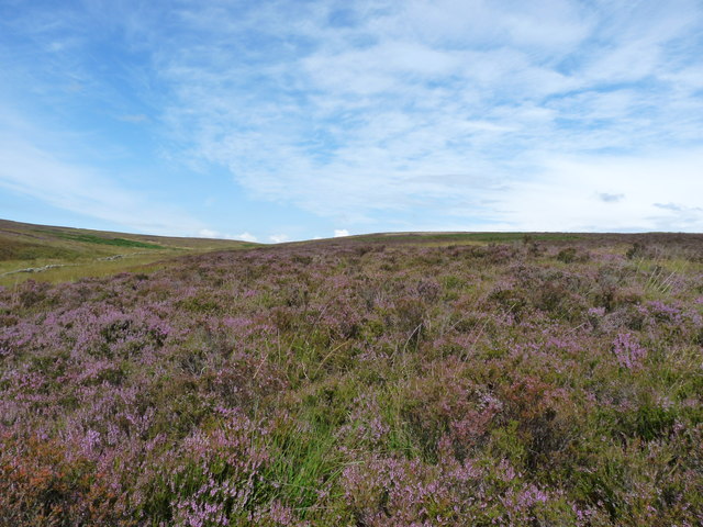
Sound Hill is predominantly composed of granite, which gives it a distinctive rugged appearance. Its slopes are covered with heather and grass, creating a beautiful contrast against the grayish rock. The hill is known for its diverse flora and fauna, with several species of birds, butterflies, and wildflowers thriving in its vicinity.

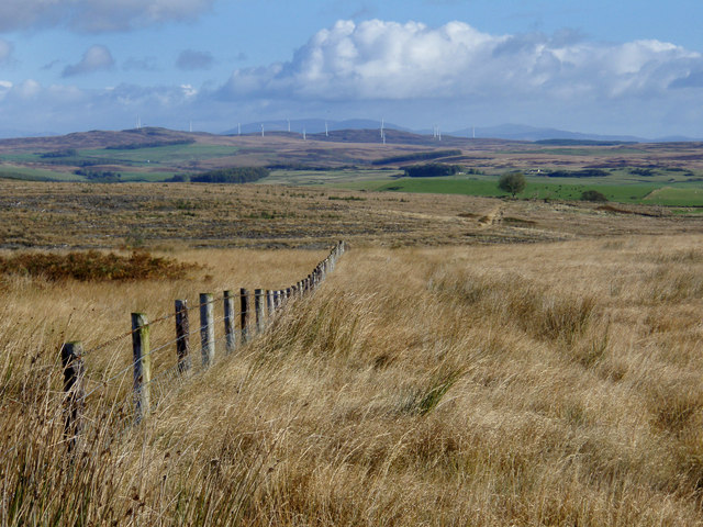
The summit of Sound Hill provides an ideal vantage point, offering visitors a panoramic view of the picturesque coastline and the vast expanse of the Irish Sea. On clear days, one can even catch a glimpse of the Isle of Man in the distance. Many hiking enthusiasts are drawn to Sound Hill, as it offers a variety of trails catering to different skill levels.

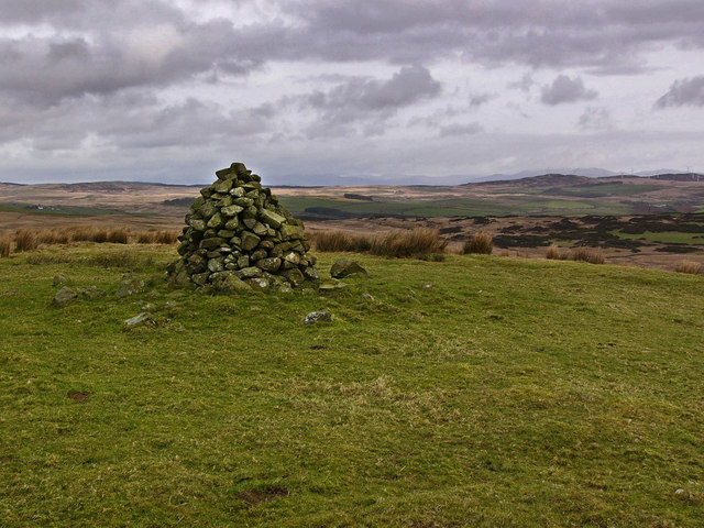
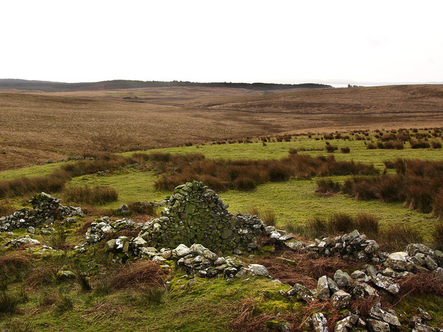
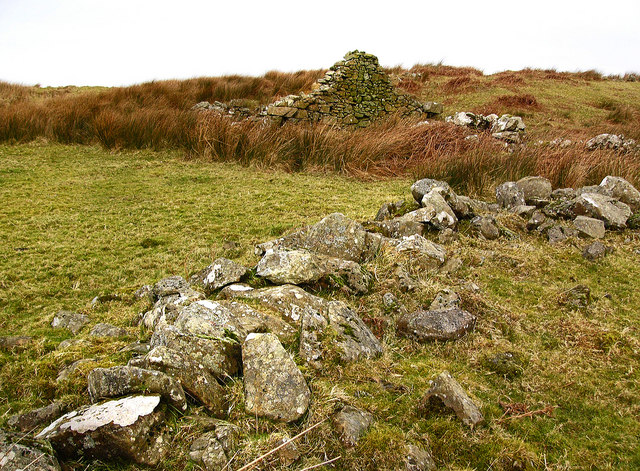
The hill is also steeped in history, with archaeological evidence suggesting human activity in the area dating back thousands of years. It is believed that the hill was once settled by ancient communities, and remnants of ancient burial sites have been discovered nearby.

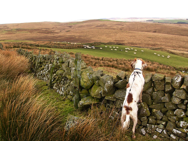
Sound Hill is not only a natural wonder but also a cherished part of the local community. It serves as a recreational area for locals and visitors alike, providing an opportunity to connect with nature and experience the tranquility of the Scottish countryside.

If you have any feedback on the listing, please let us know in the comments section below.

Sound Hill Images

Images are sourced within 2km of 54.935829/-4.9131591 or Grid Reference NX1364. Thanks to Geograph Open Source API. All images are credited.

Farm Ruins The ruins of Inchbread farm lie at the foot of the Moors.
Farm Ruins
The ruins of Inchbread farm lie at the foot of the Moors.
The Standing Stones of Glenterrow This is a small group of four standing stones with a fifth just visible at a distance to the upper left of the picture. A row of standing stones called the Stepping Stones of Glenterrow apparently ran in a roughly southerly direction for about a quarter of a mile, but by the beginning of the 20th century these had gradually sunk into the peat and were no longer visible. Glenterrow may be from 'gleann t-searrach' - the foal's glen.
The Standing Stones of Glenterrow
This is a small group of four standing stones with a fifth just visible at a distance to the upper left of the picture. A row of standing stones called the Stepping Stones of Glenterrow apparently ran in a roughly southerly direction for about a quarter of a mile, but by the beginning of the 20th century these had gradually sunk into the peat and were no longer visible. Glenterrow may be from 'gleann t-searrach' - the foal's glen.
Glenterrow Looking towards Artfield wind farm and beyond to Cairnsmore of Fleet.
Glenterrow
Looking towards Artfield wind farm and beyond to Cairnsmore of Fleet.
Cairn on Auchmantle Fell Originally there were two cairns on this hill. Muckle (big) cairn and Wee Cairn. Muckle Cairn used to contain a burial cist, but apparently the slabs were removed by a farmer for building material at the beginning of the last century and the cairn had been "almost entirely eradicated" when the inventory for the Royal Commission on Historical Monuments was compiled for Wigtownshire in 1911. This may actually be the remains of Wee Cairn, which was noted at the time to be "surmounted by a modern beacon."
Cairn on Auchmantle Fell
Originally there were two cairns on this hill. Muckle (big) cairn and Wee Cairn. Muckle Cairn used to contain a burial cist, but apparently the slabs were removed by a farmer for building material at the beginning of the last century and the cairn had been "almost entirely eradicated" when the inventory for the Royal Commission on Historical Monuments was compiled for Wigtownshire in 1911. This may actually be the remains of Wee Cairn, which was noted at the time to be "surmounted by a modern beacon."
Looking towards Drumminnoch From the northern slopes of Auchmantle Fell. A green patch in the distance, more or less in the middle of the picture, marks the site of an old abandoned farm called Auchie (gaelic achadh - a cultivated field).
Looking towards Drumminnoch
From the northern slopes of Auchmantle Fell. A green patch in the distance, more or less in the middle of the picture, marks the site of an old abandoned farm called Auchie (gaelic achadh - a cultivated field).
Craigbower These are the ruins of a small cottage, unnamed on the present day 1:25000 OS map but marked as Craigbower on an 1848 map. The surrounding land has evidence of extensive cultivation ridges. Luce Bay can just be seen in the distance.
Craigbower
These are the ruins of a small cottage, unnamed on the present day 1:25000 OS map but marked as Craigbower on an 1848 map. The surrounding land has evidence of extensive cultivation ridges. Luce Bay can just be seen in the distance.
Ruins of Craigbower
Ruins of Craigbower
Cultivation ridges near Craigbower These cultivation ridges were probably formed in the 18th or 19th century, and were known as lazy beds. By the 19th century they were used mainly for growing potatoes.
Cultivation ridges near Craigbower
These cultivation ridges were probably formed in the 18th or 19th century, and were known as lazy beds. By the 19th century they were used mainly for growing potatoes.
Cultivation ridges, Craigbower See also <a href="https://www.geograph.org.uk/photo/702488">NX1463 : Cultivation ridges near Craigbower</a>
Cultivation ridges, Craigbower
Moorland northeast of Little Tongue
Moorland to the north of Auchmantle Fell To the left are the slopes of Cairnscarrow (Carn sceirach - rocky cairn) and straight ahead is Drumminnoch (Druim meadhonach - middle ridge).
Moorland to the north of Auchmantle Fell
To the left are the slopes of Cairnscarrow (Carn sceirach - rocky cairn) and straight ahead is Drumminnoch (Druim meadhonach - middle ridge).
Sheep on the northern slopes of Auchmantle Fell Looking towards Inchbread Hill.
Sheep on the northern slopes of Auchmantle Fell
Looking towards Inchbread Hill.
Cairn on Auchmantle Fell See <a href="https://www.geograph.org.uk/photo/702437">NX1463 : Cairn on Auchmantle Fell</a>
Cairn on Auchmantle Fell
The southern slopes of Auchmantle Fell
Inchbread from Auchmantle Fell The ruins of Inchbread farm sit on a green island surrounded by moorland and the bogs of the Auchmantle Burn.
Inchbread from Auchmantle Fell
The ruins of Inchbread farm sit on a green island surrounded by moorland and the bogs of the Auchmantle Burn.
Loan Hill Moorland heather on Loan hill.
Loan Hill
Moorland heather on Loan hill.
Loan Hill Heather on Loan hill.
Loan Hill
Heather on Loan hill.
Phillstabban Moorland heather on Philstabban.
Phillstabban
Moorland heather on Philstabban.
Show me another place!

Sound Hill is located at Grid Ref: NX1364 (Lat: 54.935829, Lng: -4.9131591)

Unitary Authority: Dumfries and Galloway

Police Authority: Dumfries and Galloway

What 3 Words

///disprove.cleans.equality. Near Cairnryan, Dumfries & Galloway

Related Wikis

Inch, Dumfries and Galloway

Inch is a civil parish in Dumfries and Galloway, southwest Scotland. It lies on the shore of Loch Ryan, in the traditional county of Wigtownshire.The...

New Luce railway station

New Luce railway station served the village of New Luce, Dumfries and Galloway, Scotland from 1887 to 1965 on the Girvan and Portpatrick Junction Railway...

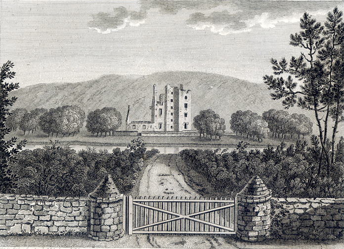
Castle Kennedy (castle)

Castle Kennedy is a ruined 17th-century tower house, about 3 miles (4.8 km) east of Stranraer, Dumfries and Galloway, Scotland, around 0.5 miles (0.80...

New Luce

New Luce (Scottish Gaelic: Baile Ùr Ghlinn Lus) is a civil parish in Dumfries and Galloway, south-west Scotland. It lies in the traditional county of Wigtownshire...

RAF Castle Kennedy

Royal Air Force Castle Kennedy, or more simply RAF Castle Kennedy, is a former Royal Air Force satellite station located in Castle Kennedy, Dumfries and...

Castle Kennedy

Castle Kennedy is a small village 3 miles (4.8 km) east of Stranraer in Dumfries and Galloway, south-west Scotland. It is on the A75 road, and is within...

Castle Kennedy railway station

Castle Kennedy railway station served the village of Castle Kennedy, Dumfries and Galloway, Scotland from 1861 to 1965 on the Portpatrick and Wigtownshire...

Aird, Dumfries and Galloway

Aird (Gaelic:An Àird) is a village in Dumfries and Galloway, in the southwest of Scotland. It is 2.5 miles (4.0 km) east of Stranraer and 1 mile (1.6 km...

Nearby Amenities

Located within 500m of 54.935829,-4.9131591
Sound Hill
Place: locality
Lat/Long: 54.9362593/-4.9208451
Cairnscarrow
Place: locality
Lat/Long: 54.939908/-4.9124337
The data included in this document is from www.openstreetmap.org. The data is made available under ODbL.

Have you been to Sound Hill?

Leave your review of Sound Hill below (or comments, questions and feedback).