Glas Bheinn

Hill, Mountain in Inverness-shire

Scotland

Glas Bheinn

North face of Sgurr Chòinich Sgurr Chòinich is just high enough for a corrie glacier to have formed in the late ice age. The small north facing corrie has a steep headwall. Looking down a mix of steep grass and crag after a traverse into the square below the summit. 
The burns run north to Loch Garry.
North face of Sgurr Chòinich Credit: Richard Webb

Glas Bheinn is a prominent hill located in Inverness-shire, Scotland. With an elevation of 1,042 meters (3,419 feet), it is considered one of the notable peaks in the region. Situated in the northern part of the Scottish Highlands, Glas Bheinn offers breathtaking panoramic views of the surrounding landscape.

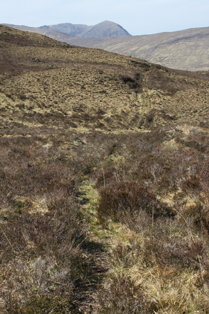
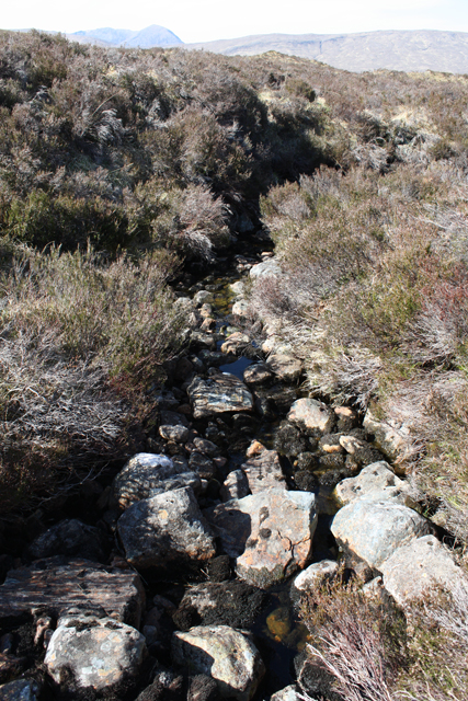
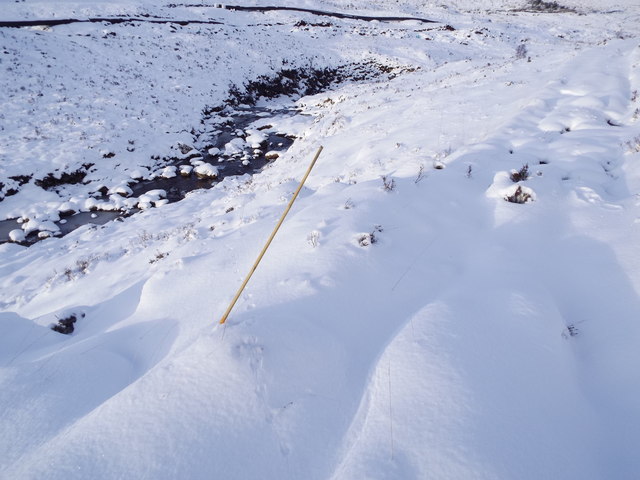
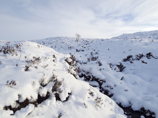
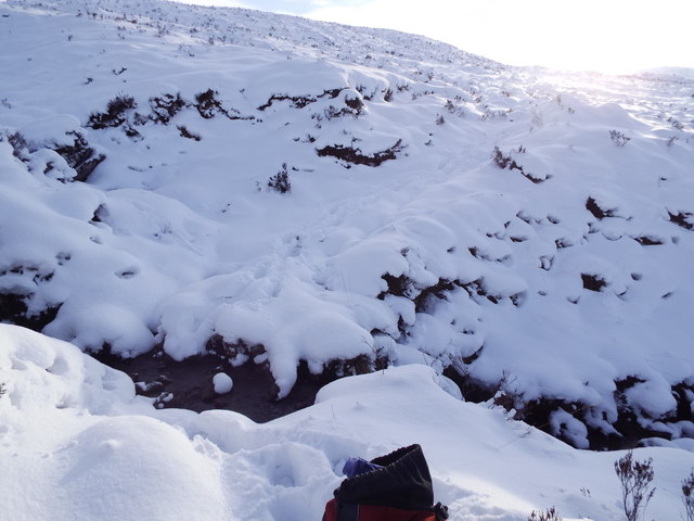
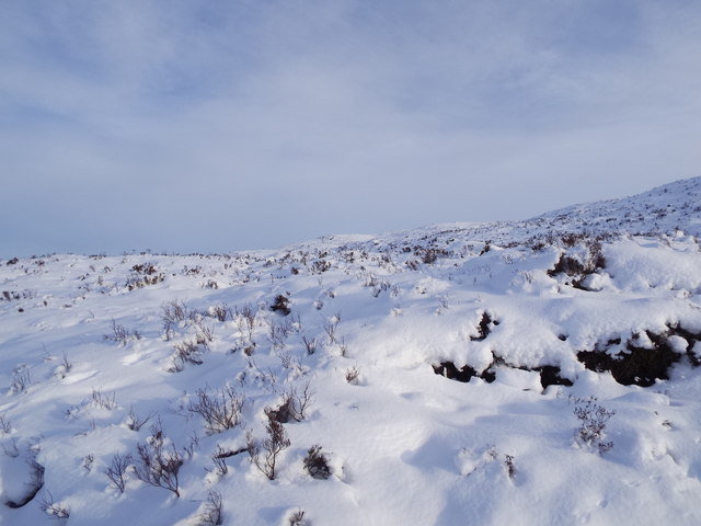
The hill is characterized by its rugged terrain, featuring steep slopes and rocky outcrops, which make it a challenging but rewarding climb for outdoor enthusiasts and hikers. The ascent can be demanding, but the effort is well worth it for those seeking stunning vistas and a sense of accomplishment.

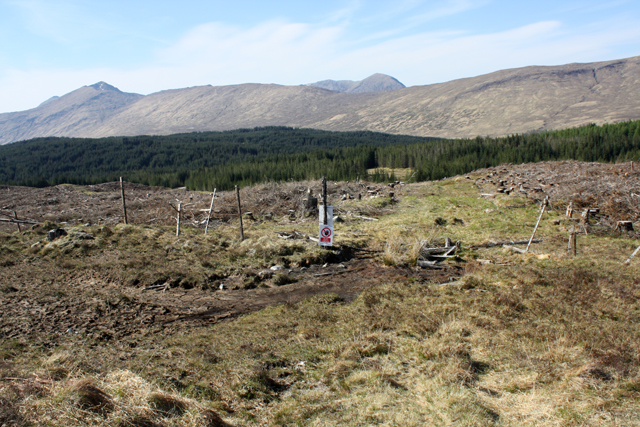
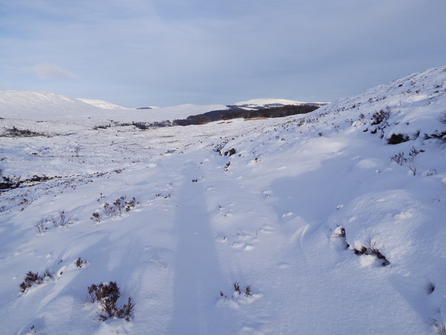
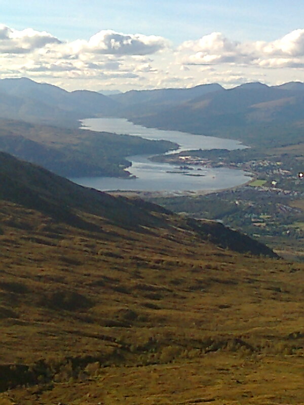
The summit of Glas Bheinn provides a commanding view of the surrounding mountains, including the iconic Ben Nevis, the highest peak in the British Isles. On clear days, it is also possible to see the Great Glen and the shimmering waters of Loch Lochy and Loch Linnhe in the distance.

The hill is part of a larger area known for its natural beauty, with diverse flora and fauna. It is not uncommon to spot various bird species, including golden eagles and peregrine falcons, as well as red deer roaming the slopes.

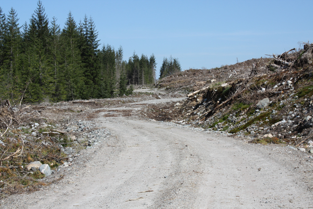
Access to Glas Bheinn is primarily via established hiking routes, which may involve navigating through moorland and grassy slopes. It is advisable to come prepared with suitable outdoor gear, including sturdy footwear and appropriate clothing, as the weather conditions in the Scottish Highlands can change rapidly.

Overall, Glas Bheinn offers a rewarding and invigorating outdoor experience for those seeking stunning vistas and a chance to explore the rugged beauty of the Scottish Highlands.

If you have any feedback on the listing, please let us know in the comments section below.
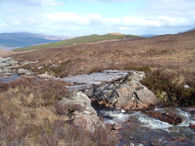
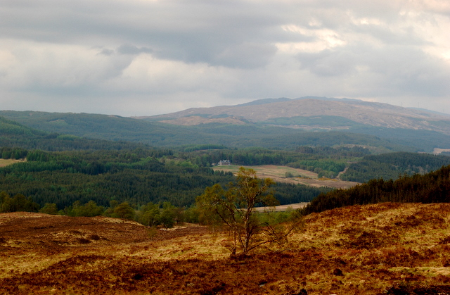
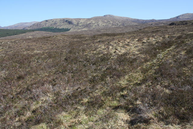
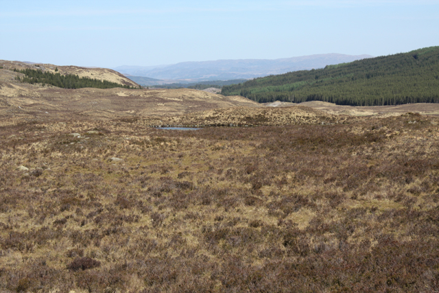
Glas Bheinn Images

Images are sourced within 2km of 57.030506/-5.076748 or Grid Reference NN1397. Thanks to Geograph Open Source API. All images are credited.

North face of Sgurr Chòinich Sgurr Chòinich is just high enough for a corrie glacier to have formed in the late ice age. The small north facing corrie has a steep headwall. Looking down a mix of steep grass and crag after a traverse into the square below the summit. 
The burns run north to Loch Garry.
North face of Sgurr Chòinich
Sgurr Chòinich is just high enough for a corrie glacier to have formed in the late ice age. The small north facing corrie has a steep headwall. Looking down a mix of steep grass and crag after a traverse into the square below the summit. The burns run north to Loch Garry.
Rotten Bridge over the Allt Lon Glas Bheinn
Forest clearing You can see the Tomdoun Hotel from this clearing.
Forest clearing
You can see the Tomdoun Hotel from this clearing.
Stalkers' path NE of Glas Bheinn An overgrown path, but still quite easy to follow.  Meall Doir' an Daimh in the distance.
Stalkers' path NE of Glas Bheinn
An overgrown path, but still quite easy to follow. Meall Doir' an Daimh in the distance.
A glimpse of Lochan na Glas Bheinn Seen from a stalkers' path NE of Glas Bheinn.
A glimpse of Lochan na Glas Bheinn
Seen from a stalkers' path NE of Glas Bheinn.
Stalkers' path below Glas Bheinn An overgrown path south of Glen Garry.
Stalkers' path below Glas Bheinn
An overgrown path south of Glen Garry.
Allt Fionn-dhail The source of this burn is in Coire an Duill on Glas Bheinn.  It is a tributary of the River Garry.
Allt Fionn-dhail
The source of this burn is in Coire an Duill on Glas Bheinn. It is a tributary of the River Garry.
Stalkers' path entering plantation The southern part of this plantation on Bad an t-Seobhag has been clear felled.
Stalkers' path entering plantation
The southern part of this plantation on Bad an t-Seobhag has been clear felled.
New forest road In a plantation on Bad an t-Seobhag.  Built for timber extraction, the area on the right has been clear felled.  Not yet showing on OS maps or Google Earth.
New forest road
In a plantation on Bad an t-Seobhag. Built for timber extraction, the area on the right has been clear felled. Not yet showing on OS maps or Google Earth.
Track east of Allt Choire a' Bhalachain under deep snow Marker flag for new track in the foreground.
Track east of Allt Choire a' Bhalachain under deep snow
Marker flag for new track in the foreground.
View upstream from ford on path above Glen Garry
Ford on path above Glen Garry
The path to Glen Garry by Allt Choire a' Bhalachain
Slopes of Glas Bheinn above Glen Garry
Slopes of Glas Bheinn east of Allt Choire a' Bhalachain
Slopes of Glas Bheinn above Glen Garry
Path to Glen Garry at last becoming distinct under its blanket of snow
Fenceline climbing slopes of Glas Bheinn above Glen Garry
Show me another place!

Glas Bheinn is located at Grid Ref: NN1397 (Lat: 57.030506, Lng: -5.076748)

Unitary Authority: Highland

Police Authority: Highlands and Islands

What 3 Words

///invented.food.blackmail. Near Gairlochy, Highland

Nearby Locations

Glas Bheinn Coire an Duill

Related Wikis

Tomdoun

Tomdoun (Scottish Gaelic: An Tom Donn) is a settlement on the north side of the River Garry, near the western end of Loch Garry, in Glen Garry in the Highlands...

Lochaber

Lochaber ( lokh-AH-bər; Scottish Gaelic: Loch Abar) is a name applied to a part of the Scottish Highlands. Historically, it was a provincial lordship consisting...

Battle of Lochaber

The Battle of Lochaber was a battle fought in 1429, in the Scottish Highlands, between the forces of Alexander of Islay, Earl of Ross, Lord of the Isles...

Meall na h-Eilde

Meall na h-Eilde is a Scottish hill situated in the high ground between the Great Glen and Glen Garry, 23 km north of Fort William in the Highland Council...

Nearby Amenities

Located within 500m of 57.030506,-5.076748
Glas Bheinn
Corbett: no
Ele: 556
Munro: no
Natural: peak
Lat/Long: 57.0302593/-5.0782523
The data included in this document is from www.openstreetmap.org. The data is made available under ODbL.

Have you been to Glas Bheinn?

Leave your review of Glas Bheinn below (or comments, questions and feedback).