An Tudair

Hill, Mountain in Inverness-shire

Scotland

An Tudair

Loch Uaine at the head of Gleann nam Fiadh Loch Uaine and the valley into which it drains seen from the col between two Munros, Màm Sodhail and Carn Eighe.
Sgùrr na Lapaich is the mountain at the end of the right hand ridge.
Loch Uaine at the head of Gleann nam Fiadh Credit: Trevor Littlewood

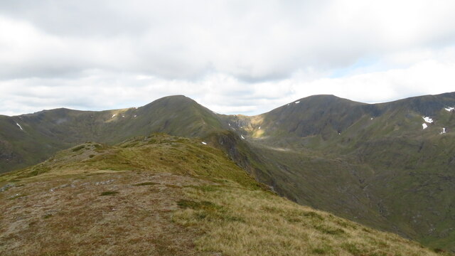
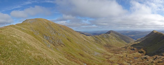
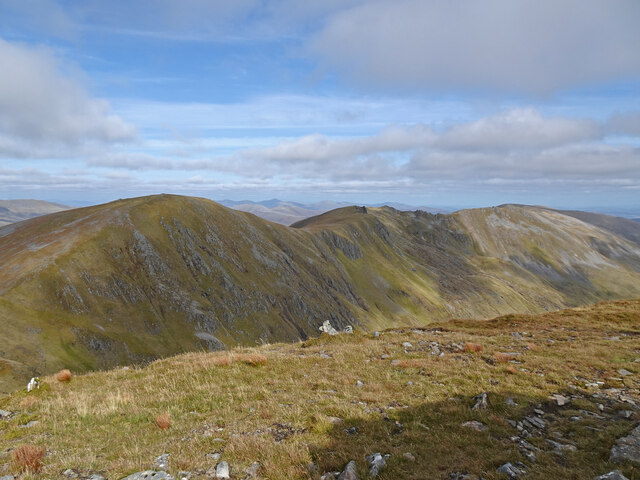
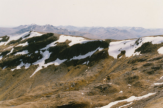
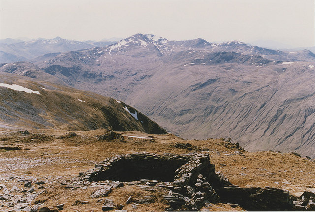
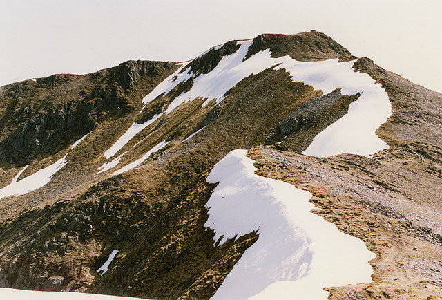
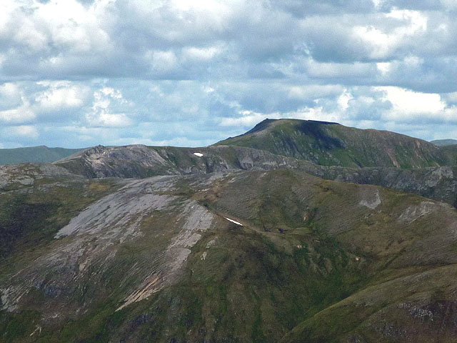
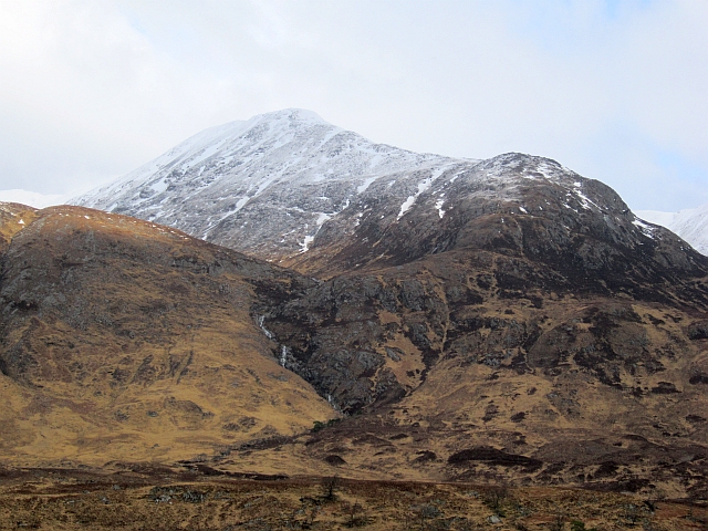
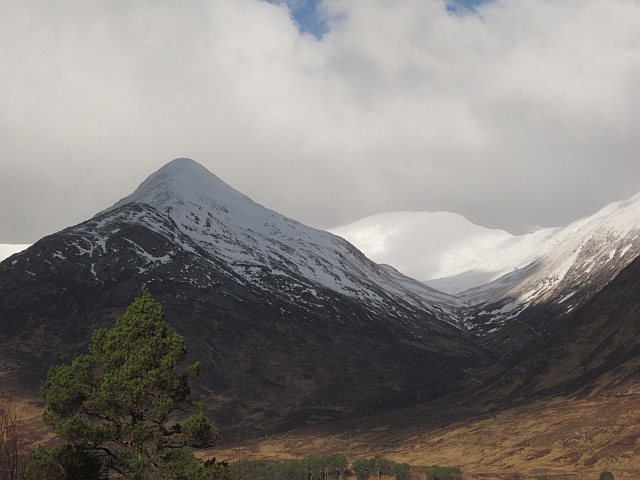
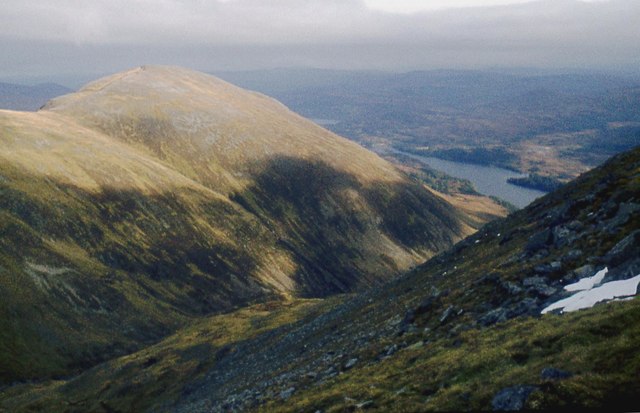
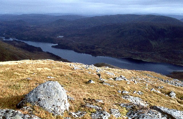
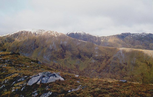
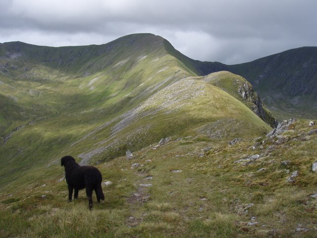
An Tudair, located in Inverness-shire, Scotland, is a prominent hill that stands at an elevation of 827 meters (2,713 feet). It is part of the wider mountain range referred to as the Northwest Highlands, characterized by its rugged and picturesque landscape. An Tudair is situated in a remote and relatively inaccessible area, contributing to its untouched and pristine natural beauty.

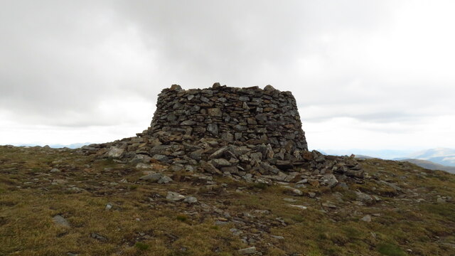
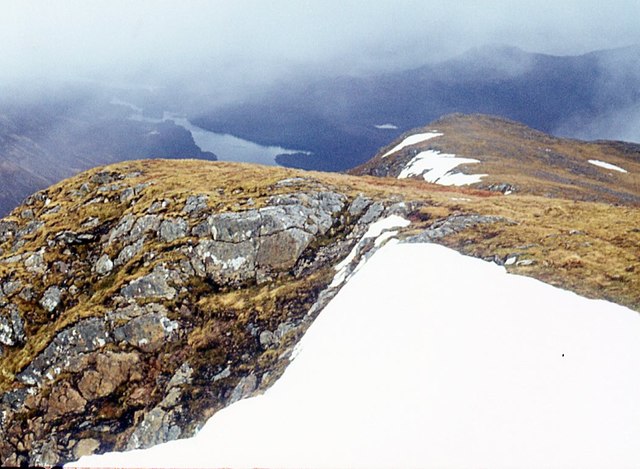
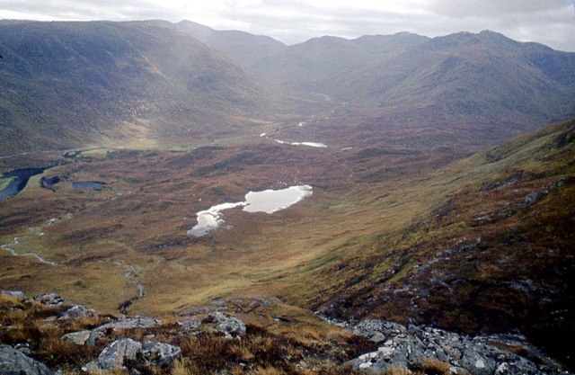
The hill is composed mainly of ancient Lewisian Gneiss, a type of metamorphic rock known for its distinctive light grey color and banding patterns. As a result, An Tudair boasts impressive cliffs and crags, providing a challenging terrain for rock climbers and mountaineers. The summit of An Tudair offers breathtaking panoramic views of the surrounding glens, lochs, and distant mountains, making it a popular destination for hikers and outdoor enthusiasts seeking to immerse themselves in the region's striking scenery.

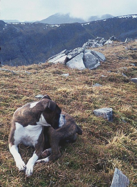
The area surrounding An Tudair is rich in biodiversity, with a diverse range of flora and fauna. The hill supports a variety of vegetation, including heather, grasses, and mosses, which add vibrant colors to the landscape. It is also home to various bird species, such as golden eagles and ptarmigans, and mammals like red deer and mountain hares.

Due to its remote location, accessing An Tudair requires careful planning and appropriate equipment. Visitors are advised to be well-prepared and familiar with the challenging terrain and changeable weather conditions that are typical of the Scottish Highlands. Nonetheless, those who undertake the journey are rewarded with a truly memorable and awe-inspiring experience in the heart of Scotland's untamed wilderness.

If you have any feedback on the listing, please let us know in the comments section below.

An Tudair Images

Images are sourced within 2km of 57.267688/-5.1067872 or Grid Reference NH1223. Thanks to Geograph Open Source API. All images are credited.

Loch Uaine at the head of Gleann nam Fiadh Loch Uaine and the valley into which it drains seen from the col between two Munros, Màm Sodhail and Carn Eighe.
Sgùrr na Lapaich is the mountain at the end of the right hand ridge.
Loch Uaine at the head of Gleann nam Fiadh
Loch Uaine and the valley into which it drains seen from the col between two Munros, Màm Sodhail and Carn Eighe. Sgùrr na Lapaich is the mountain at the end of the right hand ridge.
Heading W along the ridge from Sgurr na Lapaich towards Mam Sodhail
Summit cairn on Mam Sodhail
Coire Leachavie Just above the point where a good stalkers path drops into Coire Leachavie is this fine view of the coire and the peaks surrounding it. Mam Sodhail is on the left and it's subsidiary tops of Sgurr na Lapaich and An Tudair can also be seen.
Coire Leachavie
Just above the point where a good stalkers path drops into Coire Leachavie is this fine view of the coire and the peaks surrounding it. Mam Sodhail is on the left and it's subsidiary tops of Sgurr na Lapaich and An Tudair can also be seen.
Carn Eige from Mam Sodhail Carn Eige and its rolling east ridge as seen from Mam Sodhail. The 2 highest mountains north of the Great Glen.
Carn Eige from Mam Sodhail
Carn Eige and its rolling east ridge as seen from Mam Sodhail. The 2 highest mountains north of the Great Glen.
Coire Coulavie Looking across the coire from Ciste Dhubh, with Creag Coire nan Each rising beyond.
Coire Coulavie
Looking across the coire from Ciste Dhubh, with Creag Coire nan Each rising beyond.
Ruined shelter on Màm Sodhail Built by the Ordnance Survey for their surveyors, at the same time as the massive cairn on the summit of the mountain. Another big mountain, Sgùrr nan Ceathreamhnan, can be seen in the distance.
Ruined shelter on Màm Sodhail
Built by the Ordnance Survey for their surveyors, at the same time as the massive cairn on the summit of the mountain. Another big mountain, Sgùrr nan Ceathreamhnan, can be seen in the distance.
Màm Sodhail from the north Taken from the col with Carn Eige. The huge cairn on its summit can be clearly seen.
Màm Sodhail from the north
Taken from the col with Carn Eige. The huge cairn on its summit can be clearly seen.
August snow patches above Glen Affric A few small patches have survived into August on the mountains north of Glen Affric. Mam Sodhail seen in a zoom shot from Mullach Fraoch-choire.
August snow patches above Glen Affric
A few small patches have survived into August on the mountains north of Glen Affric. Mam Sodhail seen in a zoom shot from Mullach Fraoch-choire.
Sputan Bàn and An Tudair Waterfall beneath a hanging valley on Màm Sodhail.
Sputan Bàn and An Tudair
Waterfall beneath a hanging valley on Màm Sodhail.
Allt Coire Leachavie A big burn draining Màm Sodhail, the scar is a construction road for a small hydro electric power station.
Allt Coire Leachavie
A big burn draining Màm Sodhail, the scar is a construction road for a small hydro electric power station.
Màm Sodhail Looking up Coire Leachavie towards Màm Sodhail with sharp An Tudair on the left.
Màm Sodhail
Looking up Coire Leachavie towards Màm Sodhail with sharp An Tudair on the left.
An Tudair ridge Loch Affric down below.
An Tudair ridge
Loch Affric down below.
Slopes above Loch Coulavie
Coire Leachavie opening out to Loch Affric
Brow of An Tudair Beag
Summit ridge of An Tudair
Looking across Coire Leachavie
Show me another place!

An Tudair is located at Grid Ref: NH1223 (Lat: 57.267688, Lng: -5.1067872)

Unitary Authority: Highland

Police Authority: Highlands and Islands

What 3 Words

///corkscrew.trouser.apparatus. Near Cannich, Highland

Nearby Locations

Coire Coulavie An Tudair

Related Wikis

Mam Sodhail

Mam Sodhail, or Màm Sabhail in Gaelic (meaning "rounded mountain of barns"), sometimes anglicised "Mam Soul", is a mountain with a height of 1,181 metres...

Càrn Eighe

Carn Eighe (Scottish Gaelic: Càrn Èite) is a mountain in the Northwest Highlands of Scotland. Rising to 1,183 metres (3,881 ft) above sea level, it is...

Beinn Fhionnlaidh (Mullardoch)

Beinn Fhionnlaidh is a mountain in the Highlands of Scotland. It is situated on the south side of Loch Mullardoch, at the end of Glen Cannich, about 60...

Glen Affric

Glen Affric (Scottish Gaelic: Gleann Afraig) is a glen south-west of the village of Cannich in the Highland region of Scotland, some 15 miles (25 kilometres...

Nearby Amenities

Located within 500m of 57.267688,-5.1067872
An Tudair
Ele: 1074
Natural: peak
Wikidata: Q13129896
Lat/Long: 57.2676969/-5.1067349
The data included in this document is from www.openstreetmap.org. The data is made available under ODbL.

Have you been to An Tudair?

Leave your review of An Tudair below (or comments, questions and feedback).