Stac Pollaidh
Hill, Mountain in Cromartyshire
Scotland
Stac Pollaidh
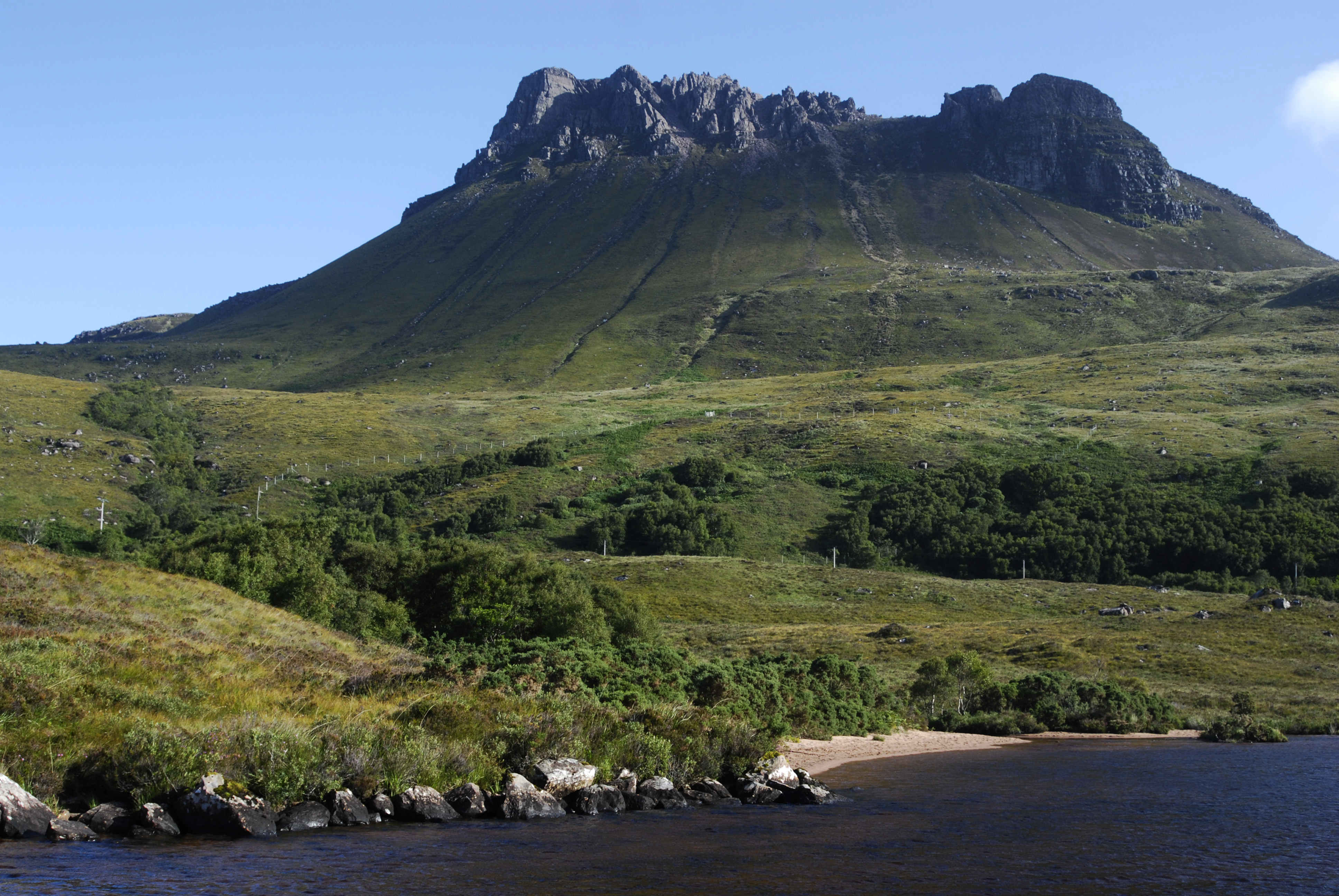
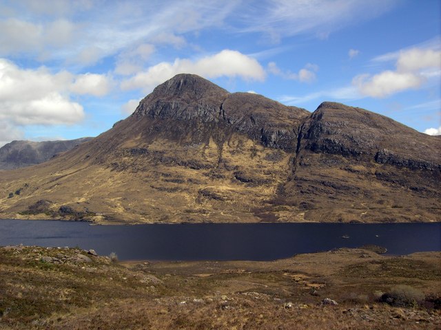
Stac Pollaidh is a prominent hill located in Cromartyshire, a county in the Scottish Highlands. It is part of the North West Highlands Geopark and is a popular destination for hikers and nature enthusiasts. Standing at a height of 612 meters (2,008 feet), Stac Pollaidh offers breathtaking panoramic views of the surrounding landscape.
The hill is composed mainly of Torridonian sandstone, a red-brown rock that gives it a distinctive appearance. Its rugged and steep slopes, coupled with its unique shape, make it one of the most recognizable landmarks in the region. The hill's name, Stac Pollaidh, is derived from the Gaelic language and translates to "Peak of the Pool."
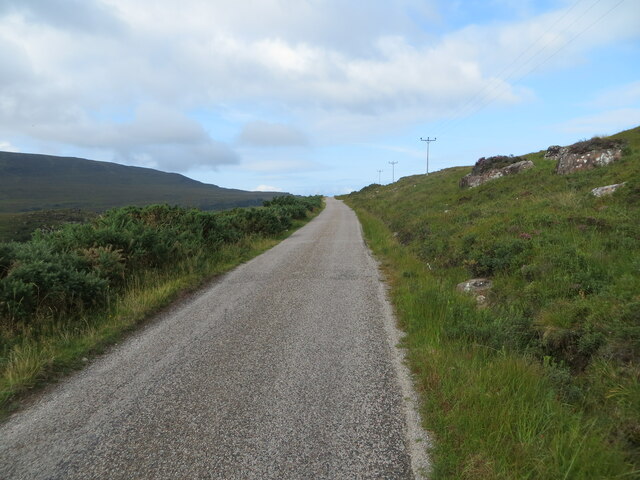
The ascent to the summit of Stac Pollaidh is challenging but rewarding. There are several well-marked trails that lead hikers through the rocky terrain, offering opportunities to observe the diverse flora and fauna of the area. The hill is home to a variety of plant species, including heather, mosses, and lichens, which add to its natural beauty.
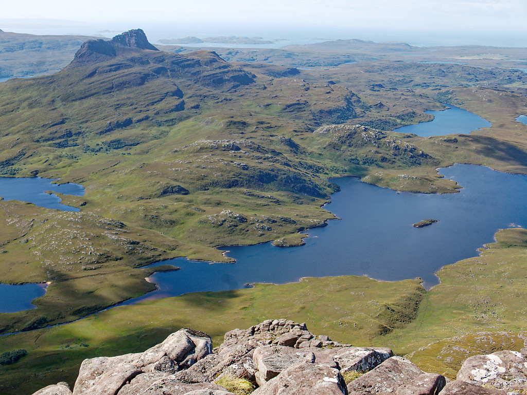
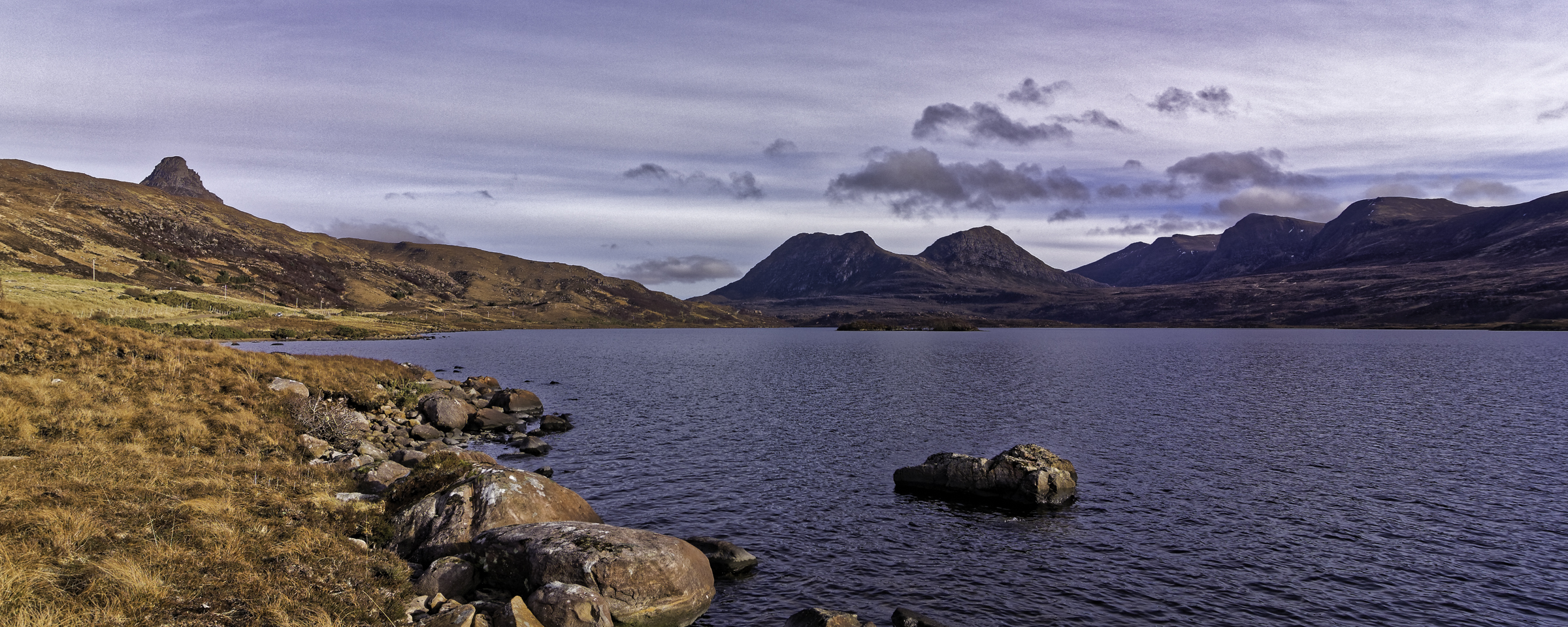
From the top, visitors can enjoy breathtaking views of Loch Lurgainn, a nearby freshwater loch, as well as the surrounding mountains and glens. On a clear day, it is even possible to see the Isle of Lewis in the Outer Hebrides. The hill's strategic location and commanding views have made it a popular spot for photographers and artists, who seek to capture its beauty in various forms.
Overall, Stac Pollaidh is a remarkable hill in Cromartyshire, offering both a physical challenge and a visual feast for those who venture to its summit.
If you have any feedback on the listing, please let us know in the comments section below.
Stac Pollaidh Images
Images are sourced within 2km of 58.044128/-5.2085463 or Grid Reference NC1010. Thanks to Geograph Open Source API. All images are credited.


Stac Pollaidh is located at Grid Ref: NC1010 (Lat: 58.044128, Lng: -5.2085463)
Unitary Authority: Highland
Police Authority: Highlands and Islands
What 3 Words
///pioneered.question.pranced. Near Ullapool, Highland
Nearby Locations
Related Wikis
Stac Pollaidh
Stac Pollaidh (Scottish Gaelic pronunciation: [ˈs̪t̪ʰaʰkˈpʰɔɫ̪ai]) is a mountain in the Northwest Highlands of Scotland. The peak displays a rocky crest...

Inverpolly
Inverpolly is the name given to a large area of northern Wester Ross in the Northwest Highlands of Scotland, north of Ullapool. The area contains several...

Loch an Doire Dhuibh
Loch an Doire Dhuibh is a small irregular shaped freshwater loch, situated on a north-east to south-west orientation in northern Wester Ross and located...
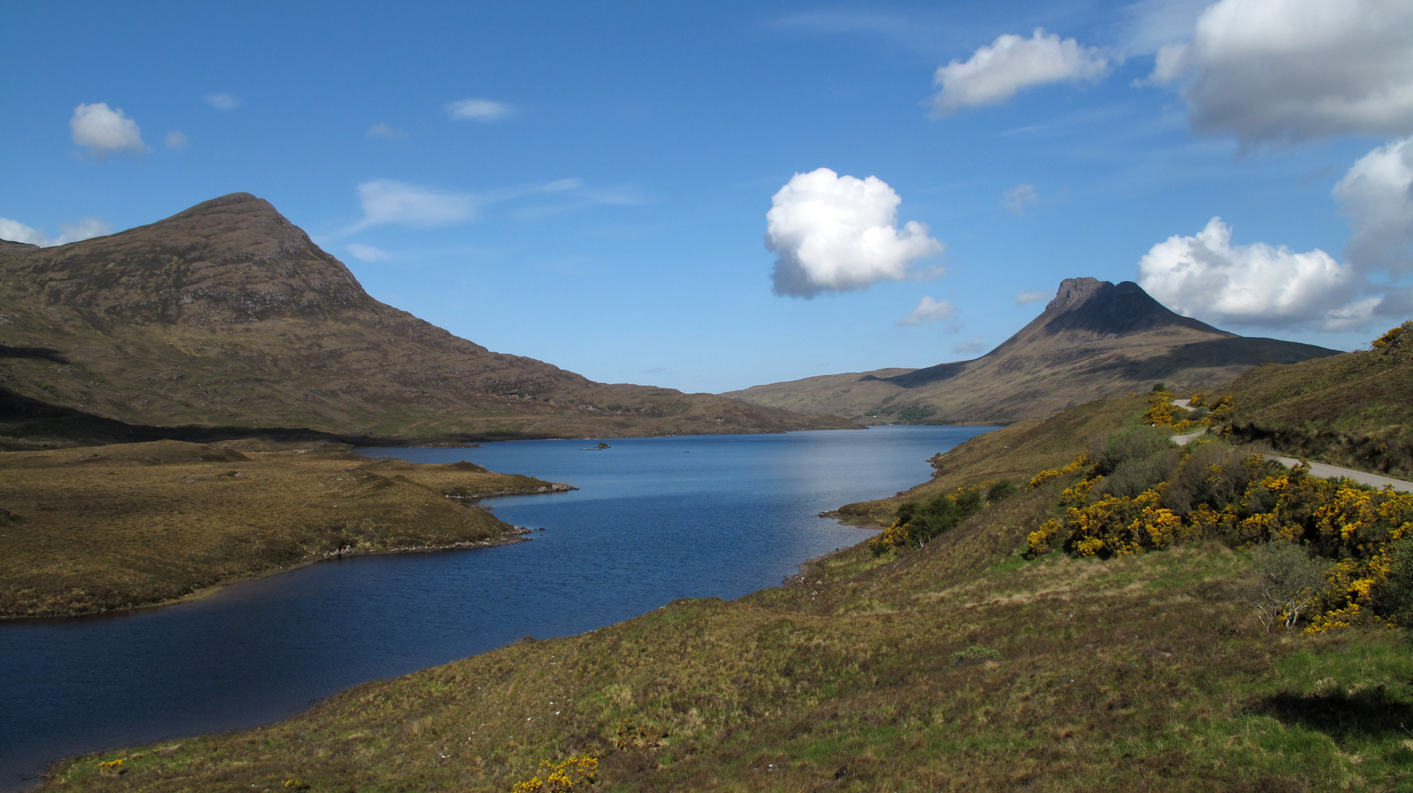
Loch Lurgainn
Loch Lurgainn is a large remote and deep freshwater loch with a crescent shape with its concave side turned to the south. It is located in the Coigach...
Loch Sionascaig
Loch Sionascaig is a large irregular shaped, freshwater loch in the remote Coigach area of northern Wester Ross. It is located 5.5 miles southeast of the...
Cùl Beag
Cùl Beag is a mountain in Coigach, in the Northwest Highlands of Scotland. It is 15 km north of Ullapool and lies to the south of Cùl Mòr, and to the east...
Loch Bad a' Ghaill
Loch Bad a' Ghaill is a small remote and deep freshwater loch that is located 10 miles north of Ullapool and immediately north west of Loch Lurgainn. It...

Beinn an Eoin (Coigach)
Beinn an Eoin (619 m) is a mountain in the Northwest Highlands of Scotland. It lies in the remote Coigach area in the far northwest of Scotland, north...
Nearby Amenities
Located within 500m of 58.044128,-5.2085463Have you been to Stac Pollaidh?
Leave your review of Stac Pollaidh below (or comments, questions and feedback).