Torr Mòr

Hill, Mountain in Buteshire

Scotland

Torr Mòr

Overlooking Garroch Head A view of Garroch Head, the most southerly point of the Isle of Bute.

This photograph was taken during the Coronavirus (COVID-19) pandemic of 2020/21.
Overlooking Garroch Head Credit: James T M Towill

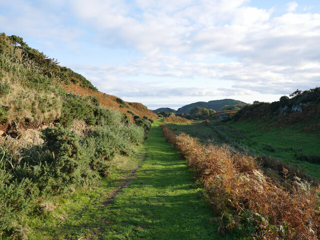
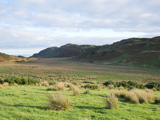
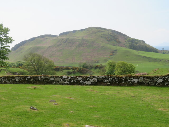
Torr Mòr is a prominent hill located in the county of Buteshire, Scotland. It is situated on the Isle of Bute, surrounded by the picturesque landscapes of the Firth of Clyde. With an elevation of approximately 280 meters (919 feet), Torr Mòr stands as one of the highest points on the island.

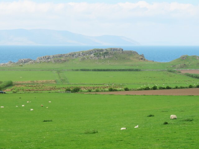
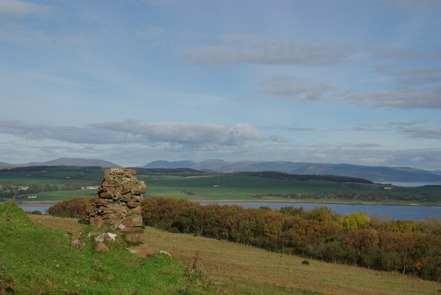
The hill is known for its distinctive cone-shaped peak, which offers breathtaking panoramic views of the surrounding area. From the summit, visitors can enjoy vistas of the rolling green hills, the sparkling blue waters of the Firth of Clyde, and the neighboring islands of Arran and Inchmarnock.

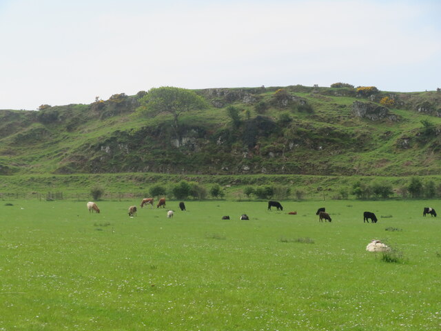
Torr Mòr is a popular destination for outdoor enthusiasts and nature lovers, attracting hikers, climbers, and photographers alike. There are several well-marked trails that lead to the summit, catering to varying levels of difficulty and fitness levels. While ascending the hill, visitors may encounter an array of wildlife, including birds of prey, deer, and various species of flora and fauna.

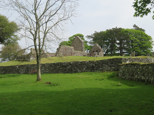
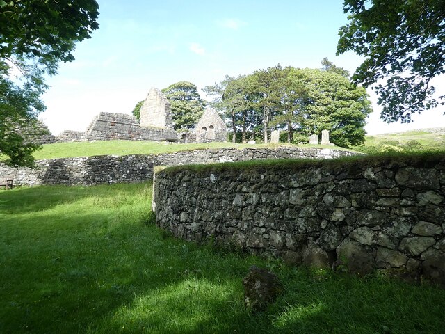
The hill holds historical significance as well, with traces of ancient settlements and burial mounds found in its vicinity. These remnants serve as a testament to the rich cultural heritage of the area.

Overall, Torr Mòr is a captivating natural landmark that offers a rewarding and immersive experience for those who venture to its summit. Whether seeking adventure, stunning vistas, or a glimpse into the past, this hill in Buteshire is sure to leave a lasting impression on all who visit.

If you have any feedback on the listing, please let us know in the comments section below.

Torr Mòr Images

Images are sourced within 2km of 55.733242/-5.0168735 or Grid Reference NS1052. Thanks to Geograph Open Source API. All images are credited.
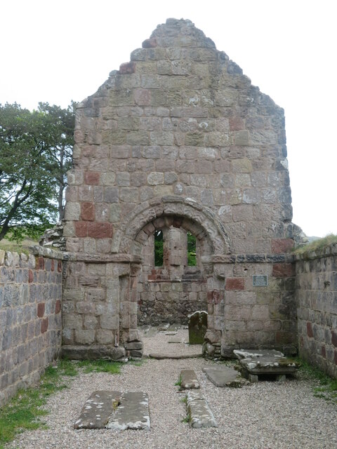
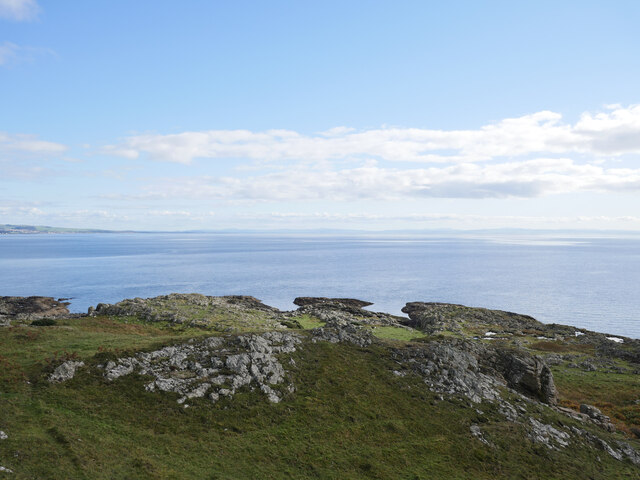
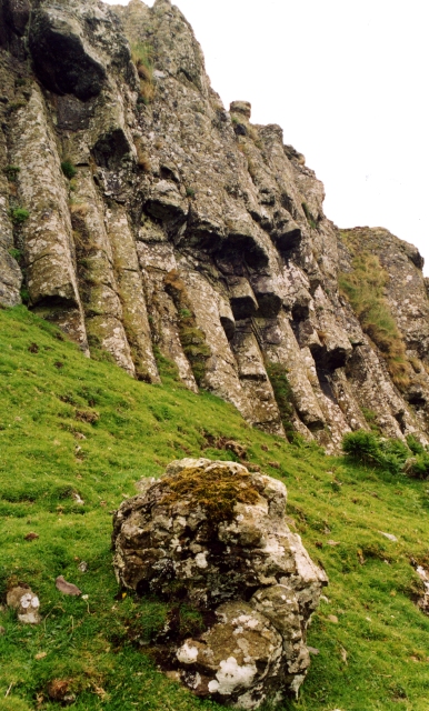
Overlooking Garroch Head A view of Garroch Head, the most southerly point of the Isle of Bute.

This photograph was taken during the Coronavirus (COVID-19) pandemic of 2020/21.
Overlooking Garroch Head
A view of Garroch Head, the most southerly point of the Isle of Bute. This photograph was taken during the Coronavirus (COVID-19) pandemic of 2020/21.
Plain by The Plan Well, perhaps more just a little bit of level ground rather than a 'plain'!  On the West Island Way heading back inland after a brief detour to Garroch Head.

This photograph was taken during the Coronavirus (COVID-19) pandemic of 2020/21.
Plain by The Plan
Well, perhaps more just a little bit of level ground rather than a 'plain'! On the West Island Way heading back inland after a brief detour to Garroch Head. This photograph was taken during the Coronavirus (COVID-19) pandemic of 2020/21.
View to St Blane's Hill from St Blane's Churchyard A view from a shaded corner of St Blane's Churchyard in an October mid-afternoon.  The distinctive outline of Holy Island off the Isle of Arran can be seen to the right of shot.

This photograph was taken during the Coronavirus (COVID-19) pandemic of 2020/21.
View to St Blane's Hill from St Blane's Churchyard
A view from a shaded corner of St Blane's Churchyard in an October mid-afternoon. The distinctive outline of Holy Island off the Isle of Arran can be seen to the right of shot. This photograph was taken during the Coronavirus (COVID-19) pandemic of 2020/21.
St Blane's Church A view across the churchyard to the medieval Church of St Blane in the south of the Isle of Bute.

This photograph was taken during the Coronavirus (COVID-19) pandemic of 2020/21.
St Blane's Church
A view across the churchyard to the medieval Church of St Blane in the south of the Isle of Bute. This photograph was taken during the Coronavirus (COVID-19) pandemic of 2020/21.
West Island Way above St Blane's Church This section of the West Island Way utilises an old farm track.  

This photograph was taken during the Coronavirus (COVID-19) pandemic of 2020/21.
West Island Way above St Blane's Church
This section of the West Island Way utilises an old farm track. This photograph was taken during the Coronavirus (COVID-19) pandemic of 2020/21.
View to Branzet Moss A view to Branzet Moss, and beyond Glen Callum, from the West Island Way.

This photograph was taken during the Coronavirus (COVID-19) pandemic of 2020/21.
View to Branzet Moss
A view to Branzet Moss, and beyond Glen Callum, from the West Island Way. This photograph was taken during the Coronavirus (COVID-19) pandemic of 2020/21.
St Blane's monastic site and church What a fascinating site this is. Remains of a very early 6th century monastic site with a medieval church within its boundary. Here one can see very ancient walls with the 12thC church on the higher ground.
St Blane's monastic site and church
What a fascinating site this is. Remains of a very early 6th century monastic site with a medieval church within its boundary. Here one can see very ancient walls with the 12thC church on the higher ground.
Ancient well at monastic site Fresh water would have been a priority for the monks at the 6thC monastery here.
Ancient well at monastic site
Fresh water would have been a priority for the monks at the 6thC monastery here.
St Blane's church The ruins of the 12thC church set within the walls of the 6thC monastic site. The original monastery was destroyed by Viking raiders in the 8thC, but by 1200 that had accepted Christianity and had this church constructed. One might describe the chancel arch as 'Norman' in style, although the Normans never reached this far north.
St Blane's church
The ruins of the 12thC church set within the walls of the 6thC monastic site. The original monastery was destroyed by Viking raiders in the 8thC, but by 1200 that had accepted Christianity and had this church constructed. One might describe the chancel arch as 'Norman' in style, although the Normans never reached this far north.
Fields below St Blane's church A scattering of sheep across the field that borders the road. Ahead is the rocky headland of Dunagoil, site of a prehistoric vitrified fort.
Fields below St Blane's church
A scattering of sheep across the field that borders the road. Ahead is the rocky headland of Dunagoil, site of a prehistoric vitrified fort.
St Blane's monastic site towards St Blane's Hill Looking south from within the old monastic site towards the 123m high St Blane's Hill, most of which is composed of volcanic rocks from the carboniferous period.
St Blane's monastic site towards St Blane's Hill
Looking south from within the old monastic site towards the 123m high St Blane's Hill, most of which is composed of volcanic rocks from the carboniferous period.
Contented cattle - and a few sheep Cattle and sheep on pasture land at Garrochty Farm.
Contented cattle - and a few sheep
Cattle and sheep on pasture land at Garrochty Farm.
Track to Dunagoil Headland composed of volcanic rocks overlooking a fine sandy bay [off photo to the right]. There's traces of a vitrified fort on the highest part of the hill, a burial cist below, a couple of interesting caves, plus some items that this contributor couldn't find, such as cup marked stones and St Blane's Stone.
Track to Dunagoil
Headland composed of volcanic rocks overlooking a fine sandy bay [off photo to the right]. There's traces of a vitrified fort on the highest part of the hill, a burial cist below, a couple of interesting caves, plus some items that this contributor couldn't find, such as cup marked stones and St Blane's Stone.
Bute - St Blane's - Former monastery and church  A view of the ruins of St Blane's monastery and church as seen when approaching from the south.
See shared description below:
Bute - St Blane's - Former monastery and church
A view of the ruins of St Blane's monastery and church as seen when approaching from the south. See shared description below:
Bute - Suidhe Bhlain or St Blane's Hill St Blane's Hill (Suidhe Bhlain in Gaelic) is named after the saint associated with the nearby monastery, the shared description gives information about him.
According to current OS maps the hill rises to 123m which equates to c.403' but earlier maps show its height as 399' though these were probably based on an old bench-mark of 389.9' recorded on the earliest maps, this benchmark being not quite at the top of the hill.
Bute - Suidhe Bhlain or St Blane's Hill
St Blane's Hill (Suidhe Bhlain in Gaelic) is named after the saint associated with the nearby monastery, the shared description gives information about him. According to current OS maps the hill rises to 123m which equates to c.403' but earlier maps show its height as 399' though these were probably based on an old bench-mark of 389.9' recorded on the earliest maps, this benchmark being not quite at the top of the hill.
Bute - St Blane's - Vallum (south) The Vallum (Latin for "rampart") marks the outer perimeter of the ancient monastery with a wall along its top. This would have encircled the site and was the demarcation between the religious community within and the secular world outside. Much of this Vallum with its associated wall can still be seen, such as in this image, though it is no longer complete.
See shared description:
Bute - St Blane's - Vallum (south)
The Vallum (Latin for "rampart") marks the outer perimeter of the ancient monastery with a wall along its top. This would have encircled the site and was the demarcation between the religious community within and the secular world outside. Much of this Vallum with its associated wall can still be seen, such as in this image, though it is no longer complete. See shared description:
Bute - St Blane's - Approaching the Lower Churchyard Wall Approaching from the south (as most visitors will) having passed <a href="https://www.geograph.org.uk/photo/7234591">NS0953 : Bute - St Blane's - Vallum (south)</a> the land rises gently and the <a href="https://www.geograph.org.uk/photo/7234596">NS0953 : Bute - St Blane's - Wall encircling Lower Churchyard</a> 
comes into view.
Bute - St Blane's - Approaching the Lower Churchyard Wall
Approaching from the south (as most visitors will) having passed NS0953 : Bute - St Blane's - Vallum (south) the land rises gently and the NS0953 : Bute - St Blane's - Wall encircling Lower Churchyard comes into view.
Bute - St Blane's - View back to Blane's Hill Approaching the ancient monastery site at St Blane's, this is the view back along the route you've just walked with <a href="https://www.geograph.org.uk/photo/7234589">NS0952 : Bute - Suidhe Bhlain or St Blane's Hill</a> rising in the background.
Bute - St Blane's - View back to Blane's Hill
Approaching the ancient monastery site at St Blane's, this is the view back along the route you've just walked with NS0952 : Bute - Suidhe Bhlain or St Blane's Hill rising in the background.
Show me another place!

Torr Mòr is located at Grid Ref: NS1052 (Lat: 55.733242, Lng: -5.0168735)

Unitary Authority: Argyll and Bute

Police Authority: Argyll and West Dunbartonshire

What 3 Words

///snowstorm.sandals.spend. Near Millport, North Ayrshire

Related Wikis

Strathclyde

Strathclyde (Ystrad Clud in Northern Brittonic; Srath Chluaidh [s̪t̪ɾa ˈxl̪ˠɯi] in Gaelic, meaning "strath (valley) of the River Clyde") was one of nine...

Kelspoke Castle

Kelspoke Castle is a ruined castle overlooking Kilchattan Bay, Isle of Bute, Scotland. Only a small amount of the ruins are above ground. == Notes ==

Kilchattan Bay

Kilchattan Bay is a village on the Isle of Bute, Scotland. It lies on the island's southern end, along the coast road at the foot of a steep hill called...

Dunagoil

Dunagoil is a vitrified fort or dun on the Isle of Bute – an Iron Age hill fort whose ramparts have been melted by intense heat. It stands on a volcanic...

Related Videos

Kelspoke Walk part 1

A walk from Kilchattan Bay to Glencallum Bay.

A little adventure to the south of the island - Isle of Bute

A fun little adventure to the south of the Isle of Bute, and a good training day getting ready for our big hike starting on May 28th ...

Kilchattan Bay to Kerrycroy, part 2

This video gives you a sense of the journey round the coast from Kilchattan Bay to Kerrycroy, walking along the shore line.

Kilchattan Bay to Kerrycroy, part 1

This video gives you a sense of the journey round the coast from Kilchattan Bay to Kerrycroy, walking along the shore line.

Nearby Amenities

Located within 500m of 55.733242,-5.0168735
Ele: 149
Natural: peak
Lat/Long: 55.7352295/-5.0228156
Torr Mor
Ele: 146
Natural: peak
Lat/Long: 55.7330065/-5.0164642
The data included in this document is from www.openstreetmap.org. The data is made available under ODbL.

Have you been to Torr Mòr?

Leave your review of Torr Mòr below (or comments, questions and feedback).