Cnoc Bad na Goibhre

Hill, Mountain in Sutherland

Scotland

Cnoc Bad na Goibhre

Loch Druim Suardalain
Loch Druim Suardalain Credit: Alan Reid

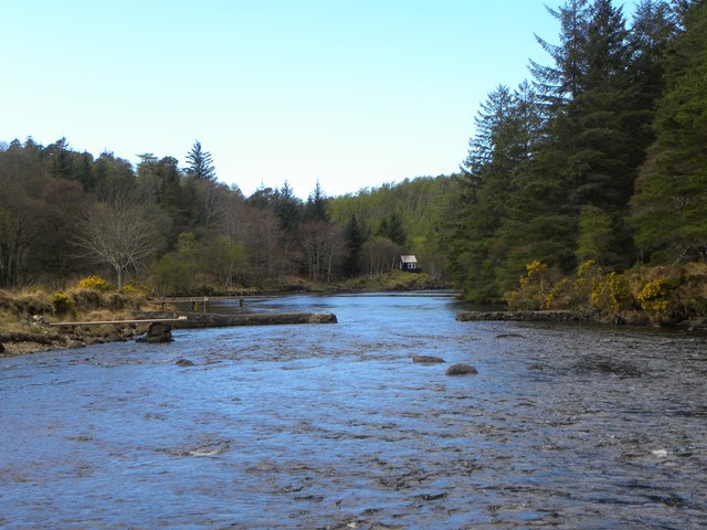
Cnoc Bad na Goibhre is a prominent hill located in the county of Sutherland, in the Scottish Highlands. It is situated near the village of Lairg and stands at an elevation of approximately 586 meters (1,923 feet). The hill is part of the wider range known as the Grudie Hills, which are characterized by their rugged and scenic landscapes.

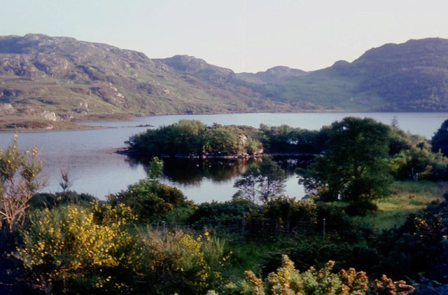
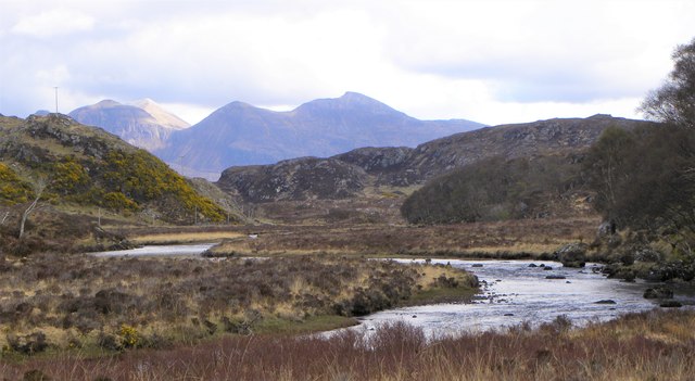
Cnoc Bad na Goibhre is renowned for its stunning panoramic views of the surrounding area. From its summit, visitors can enjoy breathtaking vistas of the nearby Loch Shin, the expansive Strathmore Valley, and the picturesque hills and mountains that dot the horizon. On clear days, it is even possible to catch a glimpse of the distant peaks of the Assynt and Torridon mountain ranges.

The hill is a popular destination for hikers and outdoor enthusiasts, with several walking routes and trails leading to its summit. These paths vary in difficulty, catering to both experienced climbers and casual walkers. The ascent typically takes around two to three hours, depending on the chosen route and individual pace.

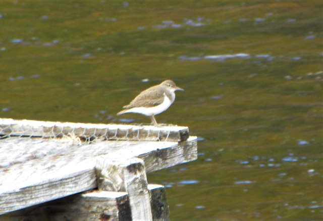
The surrounding area of Cnoc Bad na Goibhre is rich in wildlife, with opportunities for birdwatching and spotting native Scottish fauna. The hill is also home to a variety of plant species, including heather and mosses, which add to its natural beauty.

Overall, Cnoc Bad na Goibhre offers a rewarding and scenic experience for those seeking to explore the enchanting landscapes of the Scottish Highlands.

If you have any feedback on the listing, please let us know in the comments section below.

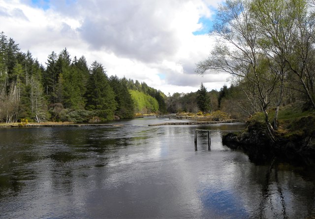
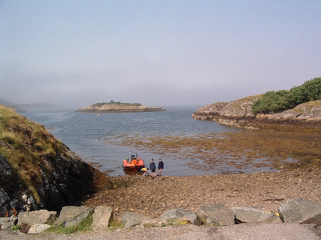
Cnoc Bad na Goibhre Images

Images are sourced within 2km of 58.150078/-5.2188663 or Grid Reference NC1022. Thanks to Geograph Open Source API. All images are credited.

Loch Druim Suardalain
Loch Druim Suardalain and Suilven
Loch Druim Suardalain A view eastwards across the loch with Canisp to the left and Suilven to the right.
Loch Druim Suardalain
A view eastwards across the loch with Canisp to the left and Suilven to the right.
Customers exiting the 'self service' shop Glencanisp Lodge has a series of outbuildings, in one of which is a self service shop where one can purchase various snacks, drinks and ice creams, paying via an honesty box.
Customers exiting the 'self service' shop
Glencanisp Lodge has a series of outbuildings, in one of which is a self service shop where one can purchase various snacks, drinks and ice creams, paying via an honesty box.
Path above Glencanisp Lodge The start of the short but fairly steep climb on the path heading north from Glencanisp Lodge.
Path above Glencanisp Lodge
The start of the short but fairly steep climb on the path heading north from Glencanisp Lodge.
Path above Glencansip Lodge The path descends through gorse towards the lodge and Loch Druim Suardalain, which is seen in the middle distance.
Path above Glencansip Lodge
The path descends through gorse towards the lodge and Loch Druim Suardalain, which is seen in the middle distance.
Over the crest of the ridge The well marked path from Glencanisp Lodge crosses the low ridge of Druim Saurdalain before descending on the north side.
Over the crest of the ridge
The well marked path from Glencanisp Lodge crosses the low ridge of Druim Saurdalain before descending on the north side.
View towards Quinag As the path from Glencanisp Lodge crosses the low ridge to the north, a fine view towards Quinag is revealed. On this occasion there was also a fine view of an eagle and a large skein of high flying geese.
View towards Quinag
As the path from Glencanisp Lodge crosses the low ridge to the north, a fine view towards Quinag is revealed. On this occasion there was also a fine view of an eagle and a large skein of high flying geese.
Remains of an old dwelling on the moor The size and shape of this structure would suggest a blackhouse rather than anything more mundane such as a sheepfold. Set on a dry hillock with a little potential pastureland around.
Remains of an old dwelling on the moor
The size and shape of this structure would suggest a blackhouse rather than anything more mundane such as a sheepfold. Set on a dry hillock with a little potential pastureland around.
River Inver Looking upstream towards the noble profile of Quinag.
River Inver
Looking upstream towards the noble profile of Quinag.
Wooden fishing pier on River Inver The Inver is a major sporting river where salmon run in season. The river is adapted for fishermen with various piers of timber and stone.
Wooden fishing pier on River Inver
The Inver is a major sporting river where salmon run in season. The river is adapted for fishermen with various piers of timber and stone.
Common Sandpiper by the river This little wader obligingly posed on one of the fishing piers on the River Inver.
Common Sandpiper by the river
This little wader obligingly posed on one of the fishing piers on the River Inver.
Fishing piers on the Inver There are a number of timber and stone piers built out into the River Inver for the convenience of salmon fishermen.
Fishing piers on the Inver
There are a number of timber and stone piers built out into the River Inver for the convenience of salmon fishermen.
Upstream along the Inver This section of the river is relatively wide, shallow and slow running. There are both timber and stone piers to be seen either side of the river.
Upstream along the Inver
This section of the river is relatively wide, shallow and slow running. There are both timber and stone piers to be seen either side of the river.
A section of the old road The fine main road from Inchnadamph to Lochinver replaced one of those typical single track highland roads that wound its way around the landscape rather than bulldozing a route through it.
A section of the old road
The fine main road from Inchnadamph to Lochinver replaced one of those typical single track highland roads that wound its way around the landscape rather than bulldozing a route through it.
Loch Druim a' Suardalain Loch Druim a' Suardalain taken from near the bridge, Suilven to the right of the picture.
Loch Druim a' Suardalain
Loch Druim a' Suardalain taken from near the bridge, Suilven to the right of the picture.
The Glencanisp Road Loch Suardelain in the middle distance. On the skyline - Suilven <a href="https://www.geograph.org.uk/gridref/NC1518">NC1518</a> and Canisp <a href="https://www.geograph.org.uk/gridref/NC2018">NC2018</a>.
The Glencanisp Road
Loch Suardelain in the middle distance. On the skyline - Suilven NC1518 and Canisp NC2018.
Footbridge across the Culag River At the lower end of Loch Druim Suardalain.
Footbridge across the Culag River
At the lower end of Loch Druim Suardalain.
Show me another place!

Cnoc Bad na Goibhre is located at Grid Ref: NC1022 (Lat: 58.150078, Lng: -5.2188663)

Unitary Authority: Highland

Police Authority: Highlands and Islands

What 3 Words

///segregate.snapping.rooftop. Near Clachtoll, Highland

Related Wikis

Loch Culag

Loch Culag also known as Loch na Doire Daraich is a small freshwater shallow loch, located south of Lochinver in the Assynt district of Sutherland, Highland...

Strathan, Sutherland

Strathan is a remote scattered coastal village, located in Bàgh an t-strathain Bay, which lies on the south shore of the sea loch, Loch Inver, in the Assynt...

Badnaban

Badnaban is a remote scattered coastal village, which lies on the south shore of the sea loch, Loch Inver, in the Assynt district of the west coast of...

Loch an Tuirc

Loch an Tuirc is a large irregular shaped, shallow loch, located about two miles north-by-north-east of Lochinver in the Assynt district of Sutherland...

Nearby Amenities

Located within 500m of 58.150078,-5.2188663
Footway
Designation: public_footpath
Foot: designated
Surface: dirt
Lat/Long: 58.1459827/-5.2171129
Power: pole
Lat/Long: 58.1469326/-5.2182819
Power: pole
Lat/Long: 58.1474011/-5.2251819
Power: pole
Lat/Long: 58.1469807/-5.219788
Power: pole
Lat/Long: 58.1469213/-5.2209896
Power: pole
Lat/Long: 58.1468604/-5.2218989
Power: pole
Lat/Long: 58.1468377/-5.2231434
Power: pole
Lat/Long: 58.1468813/-5.2160849
Power: pole
Lat/Long: 58.1469142/-5.2149286
The data included in this document is from www.openstreetmap.org. The data is made available under ODbL.

Have you been to Cnoc Bad na Goibhre?

Leave your review of Cnoc Bad na Goibhre below (or comments, questions and feedback).