Cnoc na h-Iolaire

Hill, Mountain in Sutherland

Scotland

Cnoc na h-Iolaire

Loch Druim Suardalain
Loch Druim Suardalain Credit: Alan Reid

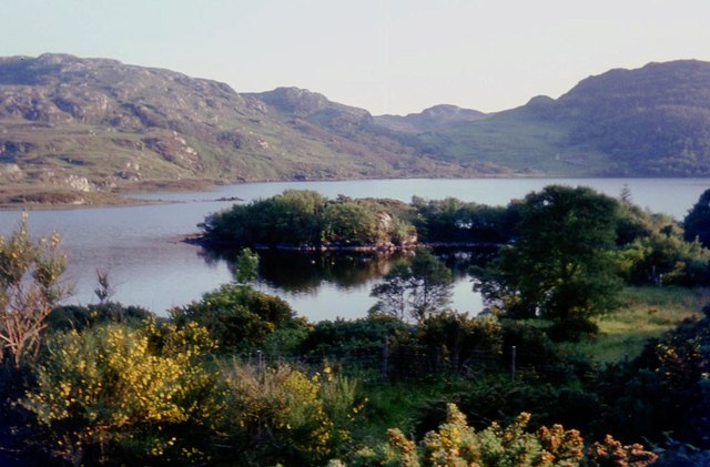
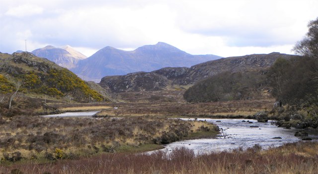
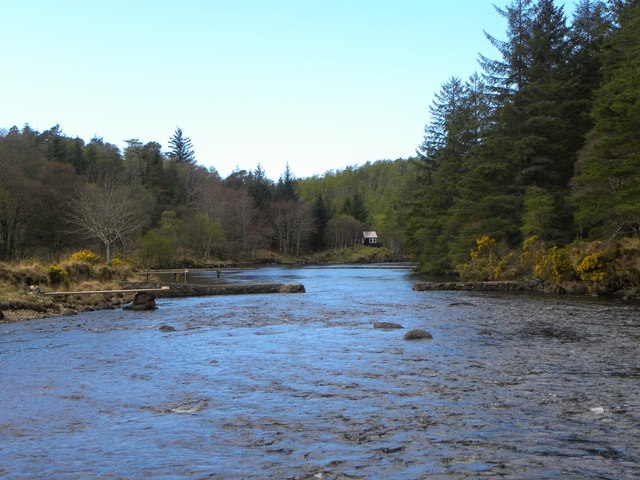
Cnoc na h-Iolaire, located in Sutherland, Scotland, is a prominent hill that stands at an elevation of 528 meters (1,732 feet). It is part of the stunning mountain range known as the Northwest Highlands. The name Cnoc na h-Iolaire translates to "Hill of the Eagles" in English, a fitting name considering the area's rich biodiversity.

This hill is a popular destination for hikers and nature enthusiasts, offering breathtaking panoramic views of the surrounding landscape. Its location in the expansive wilderness of Sutherland provides visitors with an opportunity to immerse themselves in unspoiled natural beauty. The rugged terrain and rocky slopes present a moderate challenge for climbers, making it a great spot for outdoor adventurers seeking a thrill.

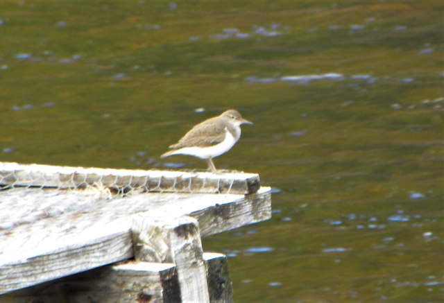
Cnoc na h-Iolaire is home to various species of flora and fauna, including a wide range of birdlife. The hill’s name reflects the presence of eagles, which can sometimes be observed soaring gracefully above. Additionally, the area is known for its diverse plant life, with heather, mosses, and grasses adorning the landscape.

Visitors to Cnoc na h-Iolaire can explore the hill's trails and take in the breathtaking scenery, with views stretching out over the surrounding lochs and glens. The hill offers a sense of tranquility and solitude, with only the sounds of nature interrupting the peace. It serves as a testament to the raw beauty of the Scottish highlands and the allure of the great outdoors.

If you have any feedback on the listing, please let us know in the comments section below.

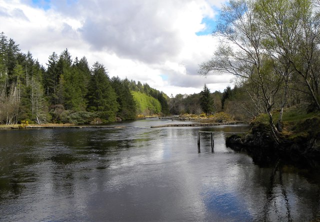
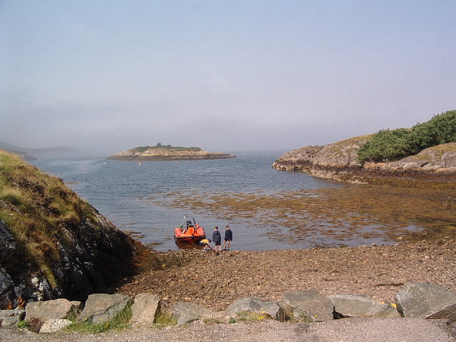
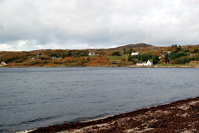
Cnoc na h-Iolaire Images

Images are sourced within 2km of 58.153083/-5.2279788 or Grid Reference NC1022. Thanks to Geograph Open Source API. All images are credited.

Loch Druim Suardalain
Loch Druim Suardalain and Suilven
Loch Druim Suardalain A view eastwards across the loch with Canisp to the left and Suilven to the right.
Loch Druim Suardalain
A view eastwards across the loch with Canisp to the left and Suilven to the right.
Customers exiting the 'self service' shop Glencanisp Lodge has a series of outbuildings, in one of which is a self service shop where one can purchase various snacks, drinks and ice creams, paying via an honesty box.
Customers exiting the 'self service' shop
Glencanisp Lodge has a series of outbuildings, in one of which is a self service shop where one can purchase various snacks, drinks and ice creams, paying via an honesty box.
Path above Glencanisp Lodge The start of the short but fairly steep climb on the path heading north from Glencanisp Lodge.
Path above Glencanisp Lodge
The start of the short but fairly steep climb on the path heading north from Glencanisp Lodge.
Path above Glencansip Lodge The path descends through gorse towards the lodge and Loch Druim Suardalain, which is seen in the middle distance.
Path above Glencansip Lodge
The path descends through gorse towards the lodge and Loch Druim Suardalain, which is seen in the middle distance.
Over the crest of the ridge The well marked path from Glencanisp Lodge crosses the low ridge of Druim Saurdalain before descending on the north side.
Over the crest of the ridge
The well marked path from Glencanisp Lodge crosses the low ridge of Druim Saurdalain before descending on the north side.
View towards Quinag As the path from Glencanisp Lodge crosses the low ridge to the north, a fine view towards Quinag is revealed. On this occasion there was also a fine view of an eagle and a large skein of high flying geese.
View towards Quinag
As the path from Glencanisp Lodge crosses the low ridge to the north, a fine view towards Quinag is revealed. On this occasion there was also a fine view of an eagle and a large skein of high flying geese.
Remains of an old dwelling on the moor The size and shape of this structure would suggest a blackhouse rather than anything more mundane such as a sheepfold. Set on a dry hillock with a little potential pastureland around.
Remains of an old dwelling on the moor
The size and shape of this structure would suggest a blackhouse rather than anything more mundane such as a sheepfold. Set on a dry hillock with a little potential pastureland around.
River Inver Looking upstream towards the noble profile of Quinag.
River Inver
Looking upstream towards the noble profile of Quinag.
Wooden fishing pier on River Inver The Inver is a major sporting river where salmon run in season. The river is adapted for fishermen with various piers of timber and stone.
Wooden fishing pier on River Inver
The Inver is a major sporting river where salmon run in season. The river is adapted for fishermen with various piers of timber and stone.
Common Sandpiper by the river This little wader obligingly posed on one of the fishing piers on the River Inver.
Common Sandpiper by the river
This little wader obligingly posed on one of the fishing piers on the River Inver.
Fishing piers on the Inver There are a number of timber and stone piers built out into the River Inver for the convenience of salmon fishermen.
Fishing piers on the Inver
There are a number of timber and stone piers built out into the River Inver for the convenience of salmon fishermen.
Upstream along the Inver This section of the river is relatively wide, shallow and slow running. There are both timber and stone piers to be seen either side of the river.
Upstream along the Inver
This section of the river is relatively wide, shallow and slow running. There are both timber and stone piers to be seen either side of the river.
Loch Druim a' Suardalain Loch Druim a' Suardalain taken from near the bridge, Suilven to the right of the picture.
Loch Druim a' Suardalain
Loch Druim a' Suardalain taken from near the bridge, Suilven to the right of the picture.
The Glencanisp Road Loch Suardelain in the middle distance. On the skyline - Suilven <a href="https://www.geograph.org.uk/gridref/NC1518">NC1518</a> and Canisp <a href="https://www.geograph.org.uk/gridref/NC2018">NC2018</a>.
The Glencanisp Road
Loch Suardelain in the middle distance. On the skyline - Suilven NC1518 and Canisp NC2018.
Footbridge across the Culag River At the lower end of Loch Druim Suardalain.
Footbridge across the Culag River
At the lower end of Loch Druim Suardalain.
Footbridge over the Abhainn Bad na h'Achlaise A very primitive footbridge at the top end of Loch Druim Suardalain
Footbridge over the Abhainn Bad na h'Achlaise
A very primitive footbridge at the top end of Loch Druim Suardalain
Show me another place!

Cnoc na h-Iolaire is located at Grid Ref: NC1022 (Lat: 58.153083, Lng: -5.2279788)

Unitary Authority: Highland

Police Authority: Highlands and Islands

What 3 Words

///microfilm.pinch.soothing. Near Clachtoll, Highland

Related Wikis

Loch Culag

Loch Culag also known as Loch na Doire Daraich is a small freshwater shallow loch, located south of Lochinver in the Assynt district of Sutherland, Highland...

Strathan, Sutherland

Strathan is a remote scattered coastal village, located in Bàgh an t-strathain Bay, which lies on the south shore of the sea loch, Loch Inver, in the Assynt...

Badnaban

Badnaban is a remote scattered coastal village, which lies on the south shore of the sea loch, Loch Inver, in the Assynt district of the west coast of...

Loch Inver

Loch Inver is a 3.62-kilometre-long (1+61⁄64-nautical-mile) sea loch in Assynt, Sutherland and is on the northwest coast of Scotland. The loch meets the...

Lochinver

Lochinver (Loch an Inbhir in Gaelic) is a village that is located at the head of the sea loch Loch Inver, on the coast in the Assynt district of Sutherland...

Loch an Tuirc

Loch an Tuirc is a large irregular shaped, shallow loch, located about two miles north-by-north-east of Lochinver in the Assynt district of Sutherland...

Inverkirkaig

Inverkirkaig (Scottish Gaelic: Inbhir Chirceig) is extremely remote scattered crofting township, situated on the north eastern bay, of the sea loch Loch...

Achmelvich

Achmelvich (Gaelic: Achadh Mhealbhaich) is a settlement situated in the Highland region of Scotland. The name comes from the Gaelic "Achadh" - a plain...

Nearby Amenities

Located within 500m of 58.153083,-5.2279788
Barrier: kissing_gate
Lat/Long: 58.1566984/-5.2327145
Man Made: tower
Lat/Long: 58.1511421/-5.232026
Man Made: mast
Tower Type: communication
Lat/Long: 58.1533199/-5.2293963
The data included in this document is from www.openstreetmap.org. The data is made available under ODbL.

Have you been to Cnoc na h-Iolaire?

Leave your review of Cnoc na h-Iolaire below (or comments, questions and feedback).