Cnoc Leathan

Hill, Mountain in Sutherland

Scotland

Cnoc Leathan

Sìdhean nan Ealachan,  Oldany Island Boat trip from Lower Badcall to Oldany Island for Ken Whyte's 2977th HuMP celebration, so he has now hit the wall and only 7 from the finish.
Name: Sidhean nan Ealachan
Hill number: 4773
Height: 104m / 341ft
Parent (Ma/M): none
Area: 16E: Scourie to Lairg
Class: Hu,1
Grid ref: NC085348 (est)
Drop: 104m
Col: Sea
Sìdhean nan Ealachan, Oldany Island Credit: Rude Health

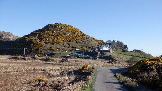
Cnoc Leathan is a prominent hill located in Sutherland, a county in the northernmost part of mainland Scotland. It is part of the Scottish Highlands, known for its rugged and stunning landscapes. Cnoc Leathan, with an elevation of approximately 556 meters (1,824 feet), is a notable feature in this region.

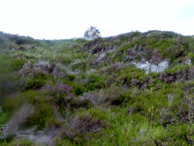
The hill is situated in a remote and wild area, surrounded by vast expanses of moorland and heather. Its location offers breathtaking panoramic views of the surrounding countryside, including nearby lochs, rolling hills, and distant mountains. On clear days, it is possible to see as far as the North Sea to the east and the mountains of Torridon to the south.

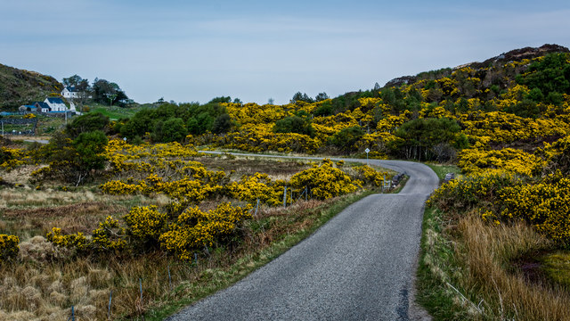
Cnoc Leathan is a popular destination for outdoor enthusiasts, particularly hikers and hillwalkers. Several well-defined paths and trails lead to the summit, making it accessible to both experienced walkers and those looking for a more leisurely stroll. The ascent to the top is relatively straightforward, although the final section can be steep and rocky.

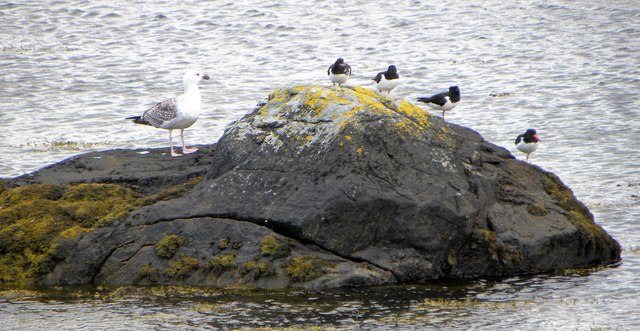
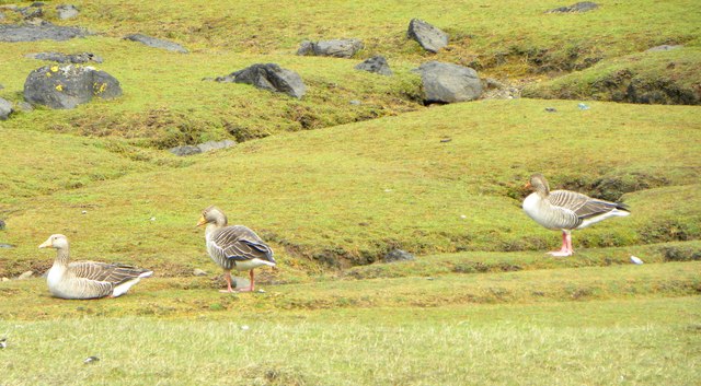
At the summit, visitors are rewarded with stunning vistas in all directions. The hill's location also provides an opportunity for wildlife spotting, with the possibility of encountering red deer, mountain hares, and a variety of bird species.

Cnoc Leathan offers a peaceful and serene setting, far away from the hustle and bustle of urban life. It is a place where visitors can immerse themselves in the natural beauty of the Scottish Highlands and experience a true sense of tranquility.

If you have any feedback on the listing, please let us know in the comments section below.
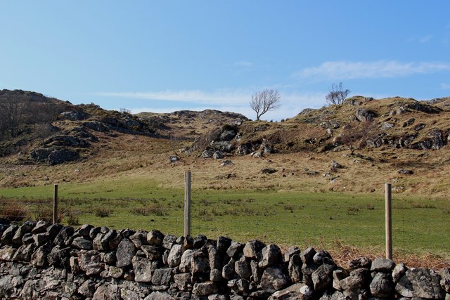
Cnoc Leathan Images

Images are sourced within 2km of 58.25639/-5.2477759 or Grid Reference NC0934. Thanks to Geograph Open Source API. All images are credited.
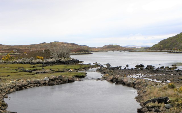
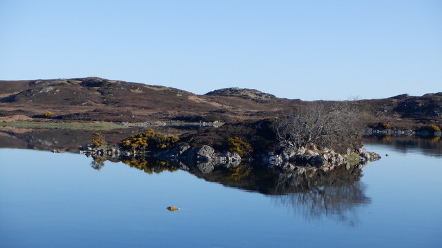
Sìdhean nan Ealachan,  Oldany Island Boat trip from Lower Badcall to Oldany Island for Ken Whyte's 2977th HuMP celebration, so he has now hit the wall and only 7 from the finish.
Name: Sidhean nan Ealachan
Hill number: 4773
Height: 104m / 341ft
Parent (Ma/M): none
Area: 16E: Scourie to Lairg
Class: Hu,1
Grid ref: NC085348 (est)
Drop: 104m
Col: Sea
Sìdhean nan Ealachan, Oldany Island
Boat trip from Lower Badcall to Oldany Island for Ken Whyte's 2977th HuMP celebration, so he has now hit the wall and only 7 from the finish. Name: Sidhean nan Ealachan Hill number: 4773 Height: 104m / 341ft Parent (Ma/M): none Area: 16E: Scourie to Lairg Class: Hu,1 Grid ref: NC085348 (est) Drop: 104m Col: Sea
Moorland On Oldany Island
Gate to Lòn Ruadh, boggy flats at Oldany
Fish farm by Oldany Island
Lòn Ruadh Wetland by Oldany, North Assynt. Looks like a former loch which has undergone succession.
Lòn Ruadh
Wetland by Oldany, North Assynt. Looks like a former loch which has undergone succession.
B869, Oldany
B869, Oldany
B869 near Oldany
B869 near Oldany
Mouth of the Oldany River The little Oldany River enters a sea loch at this point.
Mouth of the Oldany River
The little Oldany River enters a sea loch at this point.
Birds on a rock Four oystercatchers and one gull taking it easy on a rock in this tidal inlet. The only question is, what type of gull is it?  My guess is an immature lesser black backed, but no doubt some 'geograph' contributor who is also a keen ornithologist will put me right.
Birds on a rock
Four oystercatchers and one gull taking it easy on a rock in this tidal inlet. The only question is, what type of gull is it? My guess is an immature lesser black backed, but no doubt some 'geograph' contributor who is also a keen ornithologist will put me right.
Track near the shore This track leads from the road round to what is marked as a jetty on the OS map, although no jetty was evident when I visited.
Track near the shore
This track leads from the road round to what is marked as a jetty on the OS map, although no jetty was evident when I visited.
Greylags on the saltings Greylag geese close by the shore.
Greylags on the saltings
Greylag geese close by the shore.
Towards Oldany Island In the centre of the photo is the narrow channel that separates Oldany Island [right] from the mainland. I am informed that when there are low spring tides it is possible to cross at the narrowest point, but that time on Oldany is very limited before one is cut off.
Towards Oldany Island
In the centre of the photo is the narrow channel that separates Oldany Island [right] from the mainland. I am informed that when there are low spring tides it is possible to cross at the narrowest point, but that time on Oldany is very limited before one is cut off.
Coastline north of Culkein Drumbeg jetty
Oldany River rushes into the sea
Farmland wrested from rugged moor at Oldany
Farmland, Oldany Near the shoreline, a contrast to the rough moorland of North Assynt.
Farmland, Oldany
Near the shoreline, a contrast to the rough moorland of North Assynt.
B869, Oldany The North Assynt road, west of Drumbeg.
B869, Oldany
The North Assynt road, west of Drumbeg.
Island, Lochan na Leobhaig Lochan na Leobhaig is a drying sea loch on the north coast of Assynt
Island, Lochan na Leobhaig
Lochan na Leobhaig is a drying sea loch on the north coast of Assynt
Show me another place!

Cnoc Leathan is located at Grid Ref: NC0934 (Lat: 58.25639, Lng: -5.2477759)

Unitary Authority: Highland

Police Authority: Highlands and Islands

What 3 Words

///fractions.snooping.remit. Near Clachtoll, Highland

Related Wikis

Oldany Island

Oldany Island (formerly Oldney Island) is an uninhabited island in Assynt, Sutherland, north-west Scotland. The name is Norse in origin and possibly means...

Culkein Drumbeg

Culkein Drumbeg (Scottish Gaelic: Cùl-cinn an Droma Bhig) is a remote village on the north west coast of Scotland. It is located 0.93 miles (1.50 km) north...

MV Bermuda

MV Bermuda was a passenger motor ship that Furness, Withy's Furness Bermuda Line operated between New York and Bermuda from 1928 until 1931. She was damaged...

Drumbeg, Sutherland

Drumbeg (Scottish Gaelic: An Druim Beag) is a remote crofting village on the north west coast of Scotland in Assynt, Sutherland, Scottish Highlands and...

Clashnessie

Clashnessie (Scottish Gaelic: Clais an Easaidh) is a small crofting community on the North-West coast of Scotland; specifically in the Assynt area of Sutherland...

Nedd

Nedd (Scottish Gaelic: An Nead) is a small village, which lies on the western head of Loch Nedd in Lairg, western Sutherland, Scottish Highlands and is...

Eddrachillis Bay

Eddrachillis Bay (Scottish Gaelic: Eadar Dà Chaolas- "between two kyles", Kylesku and Laxford) is a bay on the north-west coast of Sutherland, Scotland...

Achnacarnin

Achnacarnin (Scottish Gaelic: Achadh nan Càrnan) is a village on the headland of Point of Stoer in Lairg, Sutherland, within the Scottish local authority...

Nearby Amenities

Located within 500m of 58.25639,-5.2477759
Source: PGS
Lat/Long: 58.2574115/-5.2415454
Source: PGS
Lat/Long: 58.2575464/-5.2416227
Source: PGS
Lat/Long: 58.2577809/-5.2421328
Source: PGS
Lat/Long: 58.2578839/-5.2421156
Source: PGS
Lat/Long: 58.2579742/-5.2422884
Source: PGS
Lat/Long: 58.2580202/-5.2419467
Source: PGS
Lat/Long: 58.2580527/-5.2415948
Source: PGS
Lat/Long: 58.2579759/-5.2416565
Source: PGS
Lat/Long: 58.2579169/-5.2417031
Source: PGS
Lat/Long: 58.2578207/-5.2416683
Source: PGS
Lat/Long: 58.2577984/-5.2414317
Source: PGS
Lat/Long: 58.2577067/-5.2412568
Source: PGS
Lat/Long: 58.2577868/-5.2409205
Source: PGS
Lat/Long: 58.2579466/-5.2408099
Source: PGS
Lat/Long: 58.2579356/-5.2406335
Source: PGS
Lat/Long: 58.2581103/-5.240347
Source: PGS
Lat/Long: 58.2580849/-5.2400123
Source: PGS
Lat/Long: 58.2580194/-5.2398776
Source: PGS
Lat/Long: 58.2578845/-5.2398304
Source: PGS
Lat/Long: 58.2573113/-5.2408116
Source: PGS
Lat/Long: 58.2572749/-5.2411753
Source: PGS
Lat/Long: 58.2561271/-5.241289
Source: PGS
Lat/Long: 58.2561556/-5.2425652
Source: PGS
Lat/Long: 58.2565098/-5.24162
Source: PGS
Lat/Long: 58.2565194/-5.2413281
Source: PGS
Lat/Long: 58.2562656/-5.2414263
Source: PGS
Lat/Long: 58.2561437/-5.2413973
Source: PGS
Lat/Long: 58.2560133/-5.2395922
Created By: almien_coastlines
Source: PGS
Lat/Long: 58.255983/-5.240635
Source: PGS
Lat/Long: 58.2561406/-5.2404693
Source: PGS
Lat/Long: 58.2563238/-5.2401394
Source: PGS
Lat/Long: 58.2563125/-5.2393943
Source: PGS
Lat/Long: 58.2536766/-5.2410937
Source: PGS
Lat/Long: 58.2538897/-5.2415915
Source: PGS
Lat/Long: 58.2539535/-5.2413405
Source: PGS
Lat/Long: 58.2540252/-5.2414896
Source: PGS
Lat/Long: 58.2541457/-5.2415009
Source: PGS
Lat/Long: 58.2542832/-5.2415513
Source: PGS
Lat/Long: 58.2529828/-5.243313
Source: PGS
Lat/Long: 58.2532896/-5.2431488
Source: PGS
Lat/Long: 58.2541268/-5.243402
Source: PGS
Lat/Long: 58.2541214/-5.2436155
Source: PGS
Lat/Long: 58.2543529/-5.2435415
Source: PGS
Lat/Long: 58.2544951/-5.2440163
Source: PGS
Lat/Long: 58.2547494/-5.2439047
Source: PGS
Lat/Long: 58.2548573/-5.243909
Source: PGS
Lat/Long: 58.255608/-5.2441788
Source: PGS
Lat/Long: 58.255888/-5.2436381
Source: PGS
Lat/Long: 58.2561897/-5.2436515
Source: PGS
Lat/Long: 58.2564671/-5.2437775
Source: PGS
Lat/Long: 58.2566229/-5.243254
Source: PGS
Lat/Long: 58.2565422/-5.2430421
Source: PGS
Lat/Long: 58.2565137/-5.2427497
Source: PGS
Lat/Long: 58.2565419/-5.2424364
Source: PGS
Lat/Long: 58.2566495/-5.2423887
Source: PGS
Lat/Long: 58.2567903/-5.2426558
Source: PGS
Lat/Long: 58.2570361/-5.2426682
Source: PGS
Lat/Long: 58.2570756/-5.2430399
Source: PGS
Lat/Long: 58.2569119/-5.2434707
Source: PGS
Lat/Long: 58.2567014/-5.2438028
Source: PGS
Lat/Long: 58.258204/-5.2441262
Source: PGS
Lat/Long: 58.2585029/-5.242672
Source: PGS
Lat/Long: 58.2598233/-5.2427733
Source: PGS
Lat/Long: 58.2597169/-5.2428881
Source: PGS
Lat/Long: 58.2594934/-5.2429257
Source: PGS
Lat/Long: 58.2592091/-5.2430365
Source: PGS
Lat/Long: 58.2589662/-5.2435416
Source: PGS
Lat/Long: 58.2588596/-5.2443767
Source: PGS
Lat/Long: 58.2588264/-5.2447708
Source: PGS
Lat/Long: 58.2588497/-5.2451744
Source: PGS
Lat/Long: 58.2589405/-5.2455167
Source: PGS
Lat/Long: 58.2590588/-5.2465976
Created By: almien_coastlines
Source: PGS
Lat/Long: 58.258813/-5.247129
Source: PGS
Lat/Long: 58.258239/-5.2479242
Created By: almien_coastlines
Source: PGS
Lat/Long: 58.258404/-5.248561
Source: PGS
Lat/Long: 58.258769/-5.2487536
Source: PGS
Lat/Long: 58.2593503/-5.2494086
Source: PGS
Lat/Long: 58.2596977/-5.2497079
Source: PGS
Lat/Long: 58.259843/-5.2501923
Source: PGS
Lat/Long: 58.2602954/-5.2507685
The data included in this document is from www.openstreetmap.org. The data is made available under ODbL.

Have you been to Cnoc Leathan?

Leave your review of Cnoc Leathan below (or comments, questions and feedback).