Cnoc an Aodainn
Hill, Mountain in Sutherland
Scotland
Cnoc an Aodainn

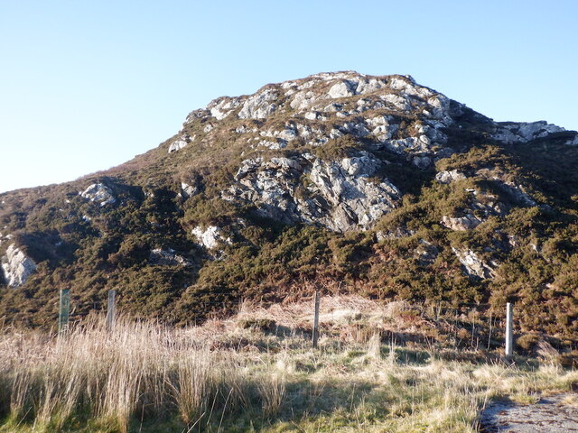
Cnoc an Aodainn, also known as Cnoc na h-Odharain, is a prominent hill located in the county of Sutherland, in the northern part of the Scottish Highlands. Standing at an elevation of 691 meters (2,267 feet), it is classified as a Corbett, a term used to describe a Scottish hill between 2,500 and 3,000 feet in height.
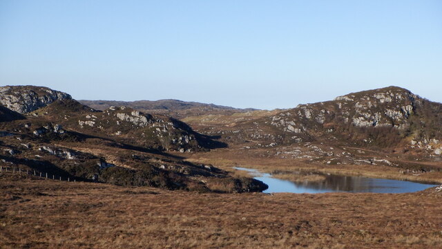
Situated in a remote and rugged area, Cnoc an Aodainn offers breathtaking panoramic views of the surrounding landscape. From its summit, one can admire the vast expanse of the Scottish Highlands, with its rolling hills, deep valleys, and pristine lochs. On a clear day, it is even possible to see as far as the distant coast.
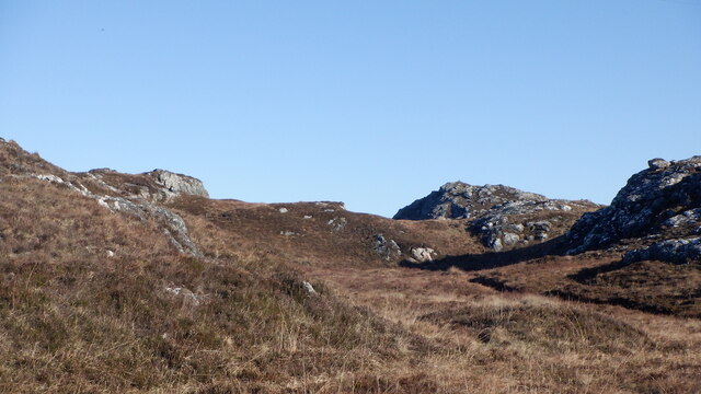
The hill itself is characterized by its steep slopes and rocky terrain, making it a challenging but rewarding climb for experienced hikers and mountaineers. The ascent can be approached from various directions, with the most common route starting from the small village of Invershin, to the northeast.
Cnoc an Aodainn is blessed with an abundance of natural beauty and wildlife. The hill is home to a diverse range of flora and fauna, including heather, mosses, and a variety of bird species, such as ptarmigans and golden eagles.
Overall, Cnoc an Aodainn offers adventurers and nature enthusiasts an opportunity to immerse themselves in the stunning scenery and tranquility of the Scottish Highlands.
If you have any feedback on the listing, please let us know in the comments section below.
Cnoc an Aodainn Images
Images are sourced within 2km of 58.238409/-5.2480053 or Grid Reference NC0932. Thanks to Geograph Open Source API. All images are credited.


Cnoc an Aodainn is located at Grid Ref: NC0932 (Lat: 58.238409, Lng: -5.2480053)
Unitary Authority: Highland
Police Authority: Highlands and Islands
What 3 Words
///defaults.launched.luxury. Near Clachtoll, Highland
Nearby Locations
Related Wikis

Culkein Drumbeg
Culkein Drumbeg (Scottish Gaelic: Cùl-cinn an Droma Bhig) is a remote village on the north west coast of Scotland. It is located 0.93 miles (1.50 km) north...
Oldany Island
Oldany Island (formerly Oldney Island) is an uninhabited island in Assynt, Sutherland, north-west Scotland. The name is Norse in origin and possibly means...

Drumbeg, Sutherland
Drumbeg (Scottish Gaelic: An Druim Beag) is a remote crofting village on the north west coast of Scotland in Assynt, Sutherland, Scottish Highlands and...

Clashnessie
Clashnessie (Scottish Gaelic: Clais an Easaidh) is a small crofting community on the North-West coast of Scotland; specifically in the Assynt area of Sutherland...

MV Bermuda
MV Bermuda was a passenger motor ship that Furness, Withy's Furness Bermuda Line operated between New York and Bermuda from 1928 until 1931. She was damaged...

Nedd
Nedd (Scottish Gaelic: An Nead) is a small village, which lies on the western head of Loch Nedd in Lairg, western Sutherland, Scottish Highlands and is...

Loch Cròcach, Lochinver
Loch Cròcach is a large irregular shaped, shallow loch, located about three miles north of Lochinver in the Assynt district of Sutherland, Highland, Scotland...
Achnacarnin
Achnacarnin (Scottish Gaelic: Achadh nan Càrnan) is a village on the headland of Point of Stoer in Lairg, Sutherland, within the Scottish local authority...
Nearby Amenities
Located within 500m of 58.238409,-5.2480053Have you been to Cnoc an Aodainn?
Leave your review of Cnoc an Aodainn below (or comments, questions and feedback).