Barscarrow Hill

Hill, Mountain in Wigtownshire

Scotland

Barscarrow Hill

The Dyemill, Near Sandhead Now a private dwelling, the Dye Mill was once powered by the Alwhibbie Burn to mill seaweed and obtain a brown dye.  Seaweed was one of Scotland's most valuable natural resources.
The Dyemill, Near Sandhead Credit: Jeff Wells

Barscarrow Hill is a prominent hill located in Wigtownshire, a region in southwestern Scotland. Standing at an elevation of approximately 300 meters (984 feet), it is classified as a hill rather than a mountain. The hill is situated near the village of Kirkinner, about 7 kilometers (4.3 miles) southeast of the town of Newton Stewart.

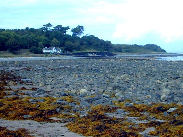
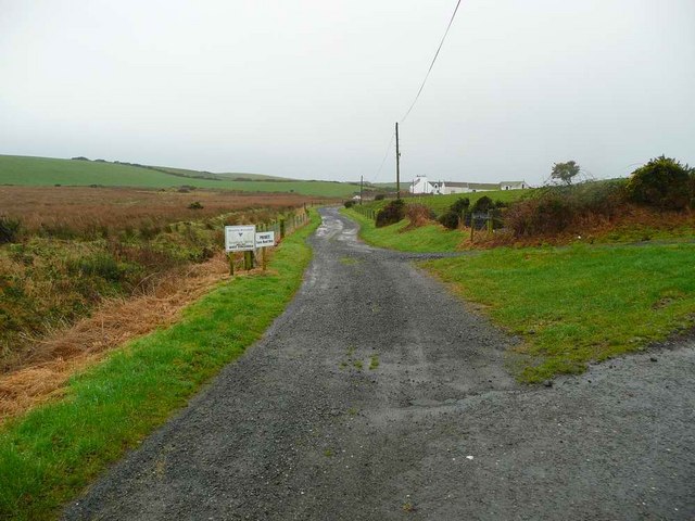
Barscarrow Hill is known for its distinct shape and prominent position, offering panoramic views of the surrounding countryside. Its slopes are covered in lush green vegetation, typical of the Scottish landscape, and are often frequented by hikers and nature enthusiasts.

The hill is composed mainly of sedimentary rock, formed over millions of years through natural processes such as erosion and deposition. It is part of the larger Southern Uplands, a range of hills and low mountains that stretch across southern Scotland.

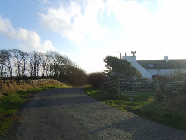
Due to its relatively low elevation, Barscarrow Hill does not experience extreme weather conditions, although it can be subject to strong winds and occasional fog. The area surrounding the hill is characterized by rolling hills, farmland, and scattered forests, creating a picturesque setting.

Overall, Barscarrow Hill offers visitors a chance to explore the natural beauty of Wigtownshire and enjoy breathtaking views of the Scottish countryside.

If you have any feedback on the listing, please let us know in the comments section below.

Barscarrow Hill Images

Images are sourced within 2km of 54.787773/-4.9755527 or Grid Reference NX0847. Thanks to Geograph Open Source API. All images are credited.
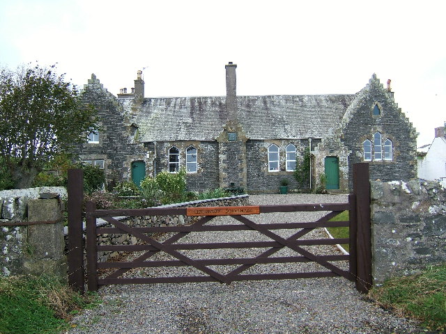
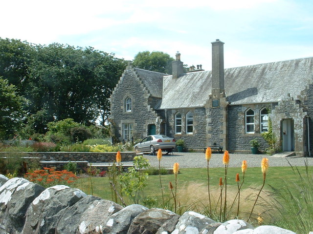
The Dyemill, Near Sandhead Now a private dwelling, the Dye Mill was once powered by the Alwhibbie Burn to mill seaweed and obtain a brown dye.  Seaweed was one of Scotland's most valuable natural resources.
The Dyemill, Near Sandhead
Now a private dwelling, the Dye Mill was once powered by the Alwhibbie Burn to mill seaweed and obtain a brown dye. Seaweed was one of Scotland's most valuable natural resources.
Shoreline, Sandhead bay This shore is at the south end of Sandhead Bay - part of Luce Bay
Shoreline, Sandhead bay
This shore is at the south end of Sandhead Bay - part of Luce Bay
Summer on the Mull Of Galloway
Farmland near Ardwell Mill
Kirkmadrine Church (disused) This disused church is only just in this square located at NX080484. Housed in the old entrance to the church are some of the earliest Christian sculptured stones some of which date back to the 5th century.
Kirkmadrine Church (disused)
This disused church is only just in this square located at NX080484. Housed in the old entrance to the church are some of the earliest Christian sculptured stones some of which date back to the 5th century.
The old schoolhouse at Clachanmore, Ardwell. The old schoolhouse situated at Clachanmore crossroads near Ardwell is the former schoolhouse for Ardwell. It was recently used as an Art gallery, but has since closed and is now a private house.
The old schoolhouse at Clachanmore, Ardwell.
The old schoolhouse situated at Clachanmore crossroads near Ardwell is the former schoolhouse for Ardwell. It was recently used as an Art gallery, but has since closed and is now a private house.
Kirkmadrine Church Probably the site of a monastery in the early Christian period and later of a medieval parish church, built as a burial chapel in the late 19th Century by Lady McTaggart Stewart of Ardwell.
Kirkmadrine Church
Probably the site of a monastery in the early Christian period and later of a medieval parish church, built as a burial chapel in the late 19th Century by Lady McTaggart Stewart of Ardwell.
Cross in Kirkmadrine Churchyard
Cottages near the old school
Another view of the old school at Ardwell
Sandhead beach Looking south.
Sandhead beach
Looking south.
Kirkmadrine Church This is no longer used as a church but it is the site of an early Christian community. The Kirkmadrine Stones are fine sculptured stones from the 5th century. They are displayed in a glass-fronted porch at the west of the church.
Kirkmadrine Church
This is no longer used as a church but it is the site of an early Christian community. The Kirkmadrine Stones are fine sculptured stones from the 5th century. They are displayed in a glass-fronted porch at the west of the church.
Church Porch, Kirkmadrine This is a glassed porch which contains early Christian stones [5th century]
Church Porch, Kirkmadrine
This is a glassed porch which contains early Christian stones [5th century]
West Ringuinea roadend The farm itself in the distance.
West Ringuinea roadend
The farm itself in the distance.
Farmhouse and Bones Plantation Rhins farmhouse on quiet country road
Farmhouse and Bones Plantation
Rhins farmhouse on quiet country road
Stoneykirk Old Manse, Sandhead Old manse for the now disused Stoneykirk Free Church (in trees behind manse); both date from 1844. The buildings actually stand to the south of Sandhead at Lake Cottage junction.
Stoneykirk Old Manse, Sandhead
Old manse for the now disused Stoneykirk Free Church (in trees behind manse); both date from 1844. The buildings actually stand to the south of Sandhead at Lake Cottage junction.
Kirkmadrine Stones The 5th century Kirkmadrine Christian sculptured stones are displayed in the glass-fronted west porch of Kirkmadrine Church; they are under the care of Historic Scotland.
Kirkmadrine Stones
The 5th century Kirkmadrine Christian sculptured stones are displayed in the glass-fronted west porch of Kirkmadrine Church; they are under the care of Historic Scotland.
Toskerton Kirk Road Upper part of track (former Kirk Road) that originally led to the medieval Toskerton Parish Church, it was rebuilt on by Kirkmadrine Church <a href="https://www.geograph.org.uk/gridref/NX0848">NX0848</a>.
Toskerton Kirk Road
Upper part of track (former Kirk Road) that originally led to the medieval Toskerton Parish Church, it was rebuilt on by Kirkmadrine Church NX0848.
Show me another place!

Barscarrow Hill is located at Grid Ref: NX0847 (Lat: 54.787773, Lng: -4.9755527)

Unitary Authority: Dumfries and Galloway

Police Authority: Dumfries and Galloway

What 3 Words

///logo.wacky.cropping. Near Drummore, Dumfries & Galloway

Related Wikis

Clachanmore

Clachanmore is a village in the South Rhins of Galloway near Ardwell in the south west of Scotland. It has also been known as Low Ardwell.The name of the...

Sandhead

Sandhead is a small village in Dumfries and Galloway, south west Scotland. It overlooks Luce Bay, 7 miles south of Stranraer. The old main road, named...

Ardwell

Ardwell (from Gaelic Àrd Bhaile meaning "high town", pronounced as "Ardwell") is a village in the Scottish unitary council area of Dumfries and Galloway...

Doon Castle Broch

Doon Castle Broch is an iron-age broch located in Dumfries and Galloway, Scotland (grid reference NX 06702 44683). == Location == The Broch is located...

Logan Botanic Garden

Logan Botanic Garden is a botanical garden near Port Logan on the Rhins of Galloway, at the south-western tip of Scotland. The Botanic Garden was established...

Stoneykirk

Stoneykirk (Scottish Gaelic: Eaglais Steafain) is an area and a village in the heart of the Rhins of Galloway, Wigtownshire, in the administrative council...

RAF West Freugh

RAF West Freugh is a former Royal Air Force station located in Wigtownshire, 5 miles (8 km) south east of Stranraer, Dumfries and Galloway, Scotland. It...

Port Logan

Port Logan, formerly Port Nessock, is a small village in the parish of Kirkmaiden in the Rhins of Galloway in Wigtownshire. The Gaelic name is Port Neasaig...

Related Videos

Review of Sands of Luce Holiday Park, Sandhead Dumfries and Galloway

A brilliant weekend away to this park, thoroughly recommend it.

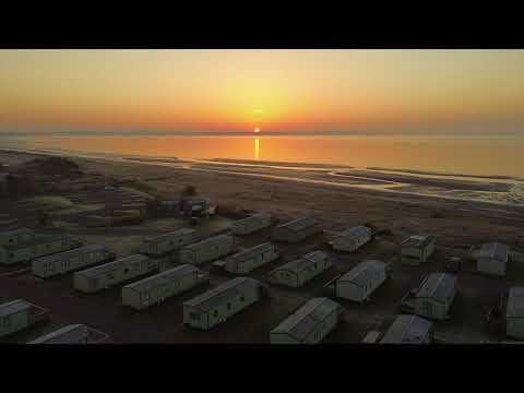
Sands Of Luce Holiday Park Sunrise

Sunrise early on a frosty April morning at Sands Of Luce Holiday Park, Dumfries & Galloway, South-West Scotland.

One Of The Scariest Places In Dumfries And Galloway Scotland: The Kirkmadrine Chapel

The Kirkmadrine Chapei is rated as one of the scariest places in Dumfries and Galloway Scotland. At the Kirkmadrine Chapel ...

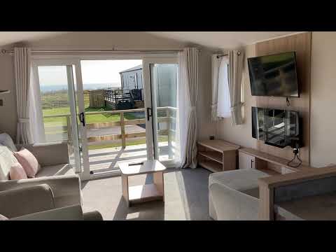
Walk around of a 2020 Willerby Manor 38x12 2 bedroom holiday home

Take a look inside one of our 2020 Willerby Manor 38x12 2 bedrooms. This one is located on our stunning new Beach Meadow ...

Nearby Amenities

Located within 500m of 54.787773,-4.9755527
Power: pole
Lat/Long: 54.7846797/-4.9777991
Power: pole
Lat/Long: 54.7854654/-4.9778634
Power: pole
Lat/Long: 54.7860315/-4.9779439
Power: pole
Lat/Long: 54.7866347/-4.9780029
Power: pole
Lat/Long: 54.7870647/-4.9780351
Power: pole
Lat/Long: 54.7875534/-4.9780673
Power: pole
Lat/Long: 54.7881473/-4.9781585
Power: pole
Lat/Long: 54.7888339/-4.978196
Power: pole
Lat/Long: 54.7897062/-4.9782497
Power: pole
Lat/Long: 54.7905846/-4.978314
Power: pole
Lat/Long: 54.7913331/-4.9783891
Power: pole
Lat/Long: 54.7918341/-4.9784482
Place: farm
Lat/Long: 54.7907408/-4.9758267
Power: pole
Lat/Long: 54.7898861/-4.9697158
Power: pole
Lat/Long: 54.789914/-4.9707771
Power: pole
Lat/Long: 54.7899465/-4.9719839
Power: pole
Lat/Long: 54.7899823/-4.9731888
Power: pole
Lat/Long: 54.7903156/-4.9745469
The data included in this document is from www.openstreetmap.org. The data is made available under ODbL.

Have you been to Barscarrow Hill?

Leave your review of Barscarrow Hill below (or comments, questions and feedback).