Cnoc na h-Uidhe Doimhne

Hill, Mountain in Sutherland

Scotland

Cnoc na h-Uidhe Doimhne

Small Lochan near Loch nan Lub The shallow cliff on the right was the highest point in the area.
Small Lochan near Loch nan Lub Credit: Peter Bond

Cnoc na h-Uidhe Doimhne is a prominent hill located in the county of Sutherland, in the northern Highlands of Scotland. With an elevation of approximately 642 meters (2,106 feet), it stands as one of the notable peaks in the region. The hill is situated within the vast expanse of the Scottish wilderness, surrounded by rugged terrain and breathtaking landscapes.

Cnoc na h-Uidhe Doimhne offers stunning views of the surrounding area, including the nearby Ben Klibreck and Ben Hope mountains. Its location makes it a popular destination for hikers and outdoor enthusiasts seeking to explore the beauty of the Scottish Highlands. The hill's challenging ascent provides a thrilling experience and rewards climbers with panoramic vistas of the surrounding glens and lochs.

The hill is a part of the vast Sutherland estate, which spans over thousands of hectares and includes diverse habitats such as moorland, forests, and lochs. This area is home to a variety of wildlife, including red deer, golden eagles, and mountain hares. Visitors to Cnoc na h-Uidhe Doimhne may have the opportunity to spot these magnificent creatures in their natural habitat.

The hill is accessible via a network of well-marked trails, which offer different routes to the summit. It is advisable for visitors to come prepared with appropriate hiking gear and navigation tools, as the terrain can be challenging and weather conditions unpredictable. However, the effort is rewarded by the awe-inspiring beauty of the Scottish Highlands and the sense of accomplishment upon reaching the summit of Cnoc na h-Uidhe Doimhne.

If you have any feedback on the listing, please let us know in the comments section below.

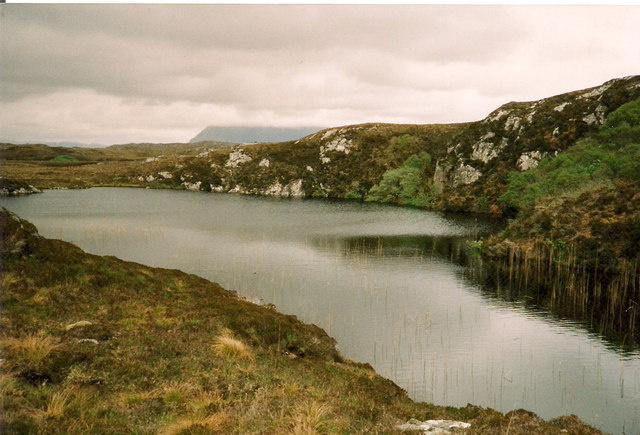
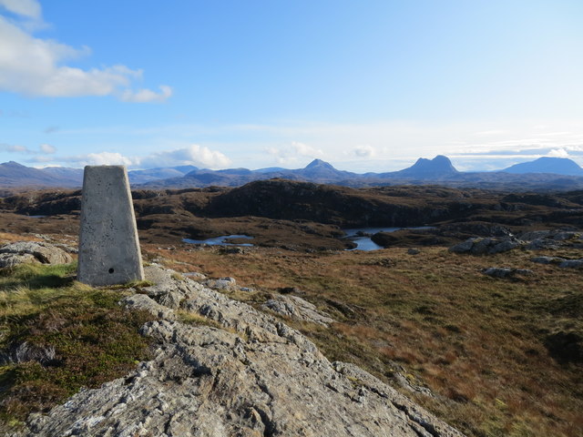
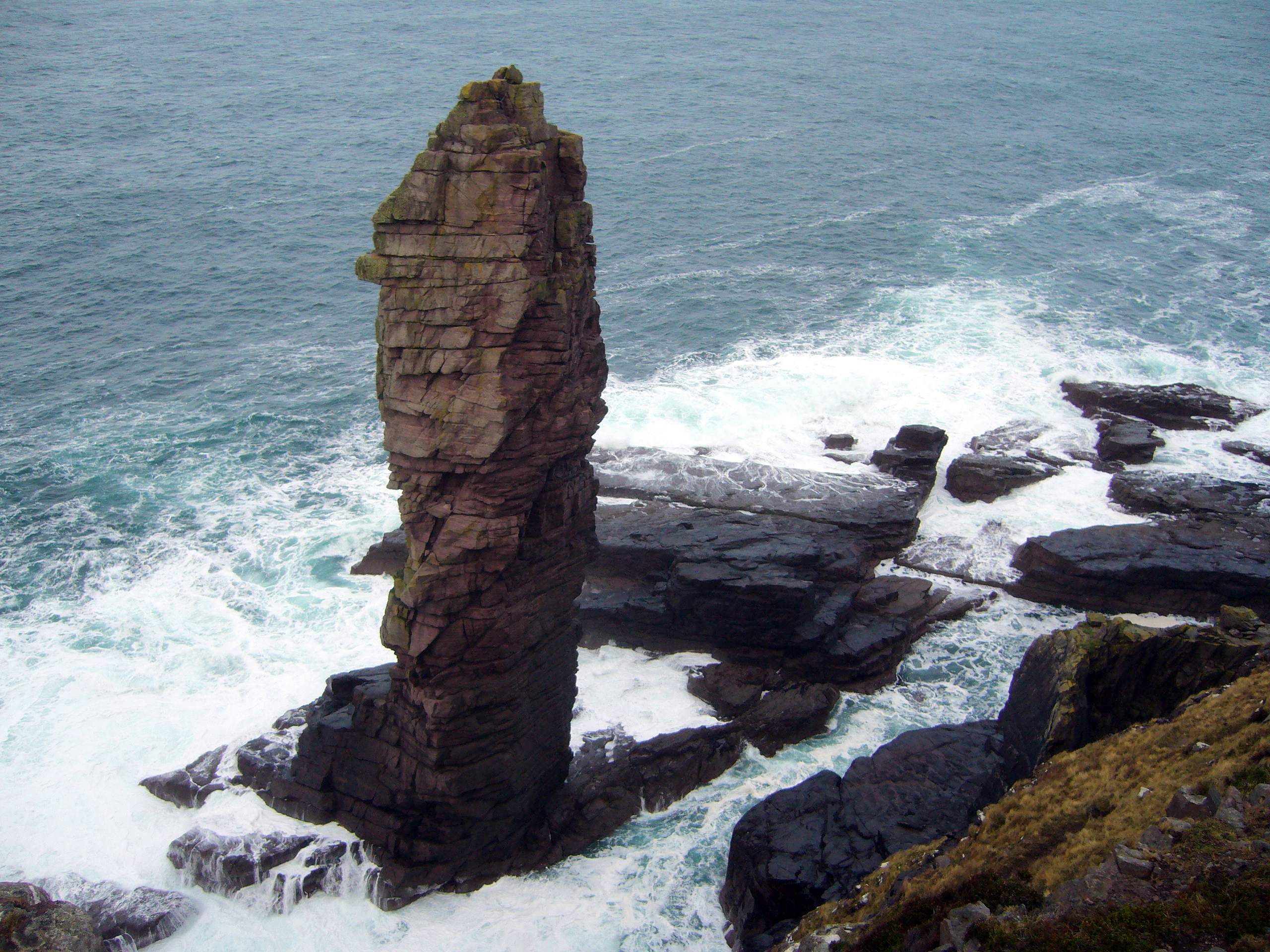
Cnoc na h-Uidhe Doimhne Images

Images are sourced within 2km of 58.204358/-5.2860977 or Grid Reference NC0728. Thanks to Geograph Open Source API. All images are credited.

Small Lochan near Loch nan Lub The shallow cliff on the right was the highest point in the area.
Small Lochan near Loch nan Lub
The shallow cliff on the right was the highest point in the area.
Unnamed lochan on the moor Close by the track that runs eastwards from the top end of Stoer. The outlines of Foinaven, Arkle and Ben Stack on the horizon.
Unnamed lochan on the moor
Close by the track that runs eastwards from the top end of Stoer. The outlines of Foinaven, Arkle and Ben Stack on the horizon.
View towards Clashnessie I took this view to show the contrast between the rough, knobbly and boggy country of the Lewisian gneiss with the relatively gentle green slopes seen in the distance, where gneiss gives way to Torridonian Sandstones. One or two of the houses at Clashnessie are visible in the distance.
View towards Clashnessie
I took this view to show the contrast between the rough, knobbly and boggy country of the Lewisian gneiss with the relatively gentle green slopes seen in the distance, where gneiss gives way to Torridonian Sandstones. One or two of the houses at Clashnessie are visible in the distance.
Sheepfold by the track Unsure of which grid square this feature should be in, it was wisest to photograph it from NC0629 as the fold/fank appears to be mostly in this square. If there is a relatively large sheepfold here, then the question is, where are the sheep?  None were seen on the walk in from the road and one suspects that there are none in this area as the grazing is very poor.
Sheepfold by the track
Unsure of which grid square this feature should be in, it was wisest to photograph it from NC0629 as the fold/fank appears to be mostly in this square. If there is a relatively large sheepfold here, then the question is, where are the sheep? None were seen on the walk in from the road and one suspects that there are none in this area as the grazing is very poor.
Old peat track east of Stoer This track is signposted as a 'peat track' [or peat path/road] from the roadside in Stoer, and it appears that other communities in the area such as Clachtoll and Culkein also had peat tracks leading into the back of beyond and made for the transportation of peat or turf for fuel.  No sign of any old peat cuttings anywhere on this walk.
Old peat track east of Stoer
This track is signposted as a 'peat track' [or peat path/road] from the roadside in Stoer, and it appears that other communities in the area such as Clachtoll and Culkein also had peat tracks leading into the back of beyond and made for the transportation of peat or turf for fuel. No sign of any old peat cuttings anywhere on this walk.
Creag Clais nan Cruineachd
Ruined sheepfold
Ruined sheepfold
Lochan na Creige
Lochan na Creige
Causeway, Loch na h-Uidhe Doimhne
Un-named lochan
Un-named lochan
Standing stone
Standing stone
Unnamed hill loch below Beinn Poll an Tobair
Trig pillar on Beinn Poll an Tobair Suilven and Canisp in the distance
Trig pillar on Beinn Poll an Tobair
Suilven and Canisp in the distance
Rough ground and small lochans near Loch an Aon Aite Quinag can be seen in the distance.  A good trek to get to these tiny lochans, very easy to lose yourself.  Scanned from a print.
Rough ground and small lochans near Loch an Aon Aite
Quinag can be seen in the distance. A good trek to get to these tiny lochans, very easy to lose yourself. Scanned from a print.
Loch an Easain Fish on! Easain forms part of the Nan Lub system - beautiful country.
The western outlet creates the splendid Eas Clais an Easaidh waterfall seen from the B869 at Clashnessie.
Loch an Easain
Fish on! Easain forms part of the Nan Lub system - beautiful country. The western outlet creates the splendid Eas Clais an Easaidh waterfall seen from the B869 at Clashnessie.
Deer fence gate Access to the western end of Loch an Easain.  There is another gate higher up the hillside at 055 295 where you gain access to the track back to the B869 north of Stoer.
Deer fence gate
Access to the western end of Loch an Easain. There is another gate higher up the hillside at 055 295 where you gain access to the track back to the B869 north of Stoer.
Unnamed lochan
Unnamed lochan
Loch an Eich Uidhir
Loch an Eich Uidhir
Show me another place!

Cnoc na h-Uidhe Doimhne is located at Grid Ref: NC0728 (Lat: 58.204358, Lng: -5.2860977)

Unitary Authority: Highland

Police Authority: Highlands and Islands

What 3 Words

///tree.newsprint.leotard. Near Clachtoll, Highland

Related Wikis

Clashnessie

Clashnessie (Scottish Gaelic: Clais an Easaidh) is a small crofting community on the North-West coast of Scotland; specifically in the Assynt area of Sutherland...

Stoer

Stoer (Scottish Gaelic: An Stòr) is a crofting township in the parish of Assynt, Sutherland, in the Highlands of Scotland and in the council area of Highland...

Clachtoll

Clachtoll (Scottish Gaelic: Clach Toll) is a coastal fishing and crofting village situated on the Bay of Clachtoll, in the ancient parish of Assynt, Sutherland...

Loch Cròcach, Lochinver

Loch Cròcach is a large irregular shaped, shallow loch, located about three miles north of Lochinver in the Assynt district of Sutherland, Highland, Scotland...

Have you been to Cnoc na h-Uidhe Doimhne?

Leave your review of Cnoc na h-Uidhe Doimhne below (or comments, questions and feedback).