Blackpark Hill
Hill, Mountain in Buteshire
Scotland
Blackpark Hill
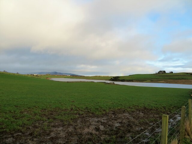
Blackpark Hill is a prominent hill located in the county of Buteshire, Scotland. Situated in the southern part of the county, it forms part of the larger Blackpark Hill range. The hill stands at an elevation of approximately 320 meters (1,050 feet) above sea level, making it a noticeable landmark in the region.
Blackpark Hill boasts a distinctive cone-shaped summit, which is covered in heather and grasses, providing a picturesque view of the surrounding countryside. The hill is composed mainly of sedimentary rocks, such as sandstone and shale, which have weathered over time to create its unique geological features.
The hill is accessible via several footpaths and trails, making it a popular destination for hikers and nature enthusiasts. From the summit, visitors can enjoy panoramic views of the surrounding area, including the nearby town of Rothesay and the picturesque coastline of the Isle of Bute.
Blackpark Hill is also home to a diverse range of flora and fauna. The heather-covered slopes provide a habitat for various bird species, including buzzards and kestrels. In addition, the hill is known for its rich plant life, with wildflowers such as harebells and foxgloves adding color to the landscape during the summer months.
Overall, Blackpark Hill offers visitors a chance to explore the natural beauty of Buteshire, with its stunning views, diverse wildlife, and accessible trails making it a must-visit destination for outdoor enthusiasts.
If you have any feedback on the listing, please let us know in the comments section below.
Blackpark Hill Images
Images are sourced within 2km of 55.812748/-5.0820003 or Grid Reference NS0662. Thanks to Geograph Open Source API. All images are credited.


Blackpark Hill is located at Grid Ref: NS0662 (Lat: 55.812748, Lng: -5.0820003)
Unitary Authority: Argyll and Bute
Police Authority: Argyll and West Dunbartonshire
What 3 Words
///fade.gathers.strikers. Near Rothesay, Argyll & Bute
Nearby Locations
Related Wikis

Dhu Loch
Dhu Loch (also known as "Loch Dhu") is an impounding reservoir, located 1 kilometre directly west of the much larger Loch Fad and 5 kilometres south west...

Loch Fad
Loch Fad is a freshwater loch on the Isle of Bute in Scotland. Its name means "long loch" in Scottish Gaelic. It lies on the Highland Boundary Fault. Its...

Kirk Dam
Kirk Dam is an impounding dam, located 1.5 kilometres south of Rothesay, and is separated by a causeway from the much larger Loch Fad to the south-west...

Kilmory Castle, Bute
Kilmory Castle (Kilmorie Castle, Crowner's Castle) is the remains of a 15th-century castle at Meikle Kilmory, Isle of Bute, Scotland. The castle was the...

Rothesay Academy
Rothesay Academy is a secondary school in the town of Rothesay on the Isle of Bute. == Feeder schools == Rothesay Academy has 3 associated primary schools...
Isle of Bute
The Isle of Bute (Scots: Buit; Scottish Gaelic: Eilean Bhòid or An t-Eilean Bòdach), known as Bute (), is an island in the Firth of Clyde in Scotland,...

West Island Way
The West Island Way is a waymarked long distance footpath on the Isle of Bute. The route opened in September 2000 as part of Bute's millennium celebrations...
Loch Ascog
Loch Ascog is a small reservoir on the east coast of the island of Bute, in the council area of Argyll and Bute, Scotland. The loch supplies water to the...
Have you been to Blackpark Hill?
Leave your review of Blackpark Hill below (or comments, questions and feedback).