Ardbeg Hill

Hill, Mountain in Argyllshire

Scotland

Ardbeg Hill

Rocks At Loch Striven
Rocks At Loch Striven Credit: Lynn M Reid

Ardbeg Hill is a prominent landmark located in Argyllshire, Scotland. Situated in the western part of the country, it forms part of the stunning scenery that characterizes this region. This hill is known for its breathtaking beauty and exceptional panoramic views.

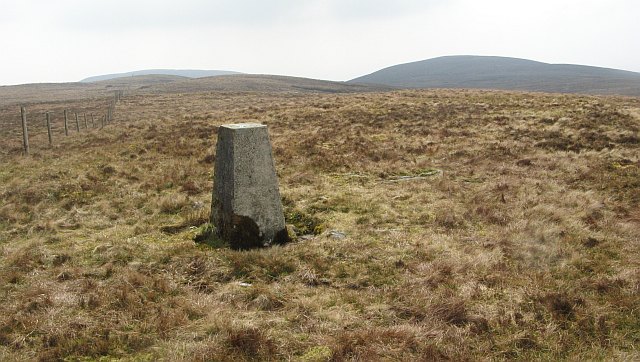
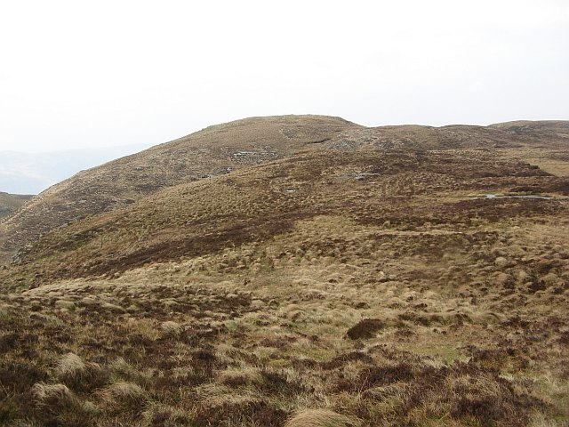
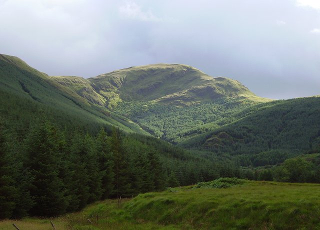
Rising to an elevation of approximately 376 meters (1,234 feet), Ardbeg Hill offers a moderate hiking challenge to outdoor enthusiasts. Its gentle slopes make it accessible to both experienced hikers and beginners looking for a scenic adventure. The hill is covered in a lush carpet of heather and grass, providing a picturesque backdrop throughout the year.

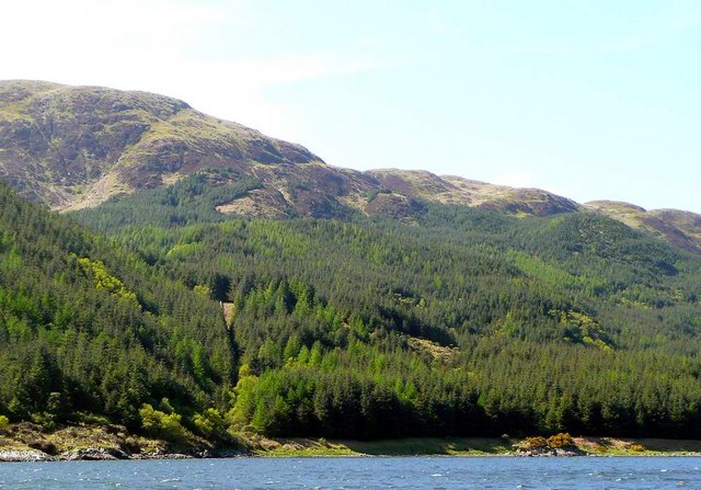
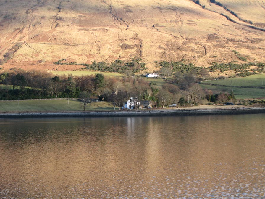
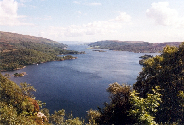
One of the standout features of Ardbeg Hill is its uninterrupted views of the surrounding landscape. From its summit, visitors can enjoy breathtaking vistas of the nearby Loch Fyne, one of Scotland's longest sea lochs. The hill also offers panoramic views of the rolling hills and moorlands that characterize the region, creating a sense of tranquility and awe.

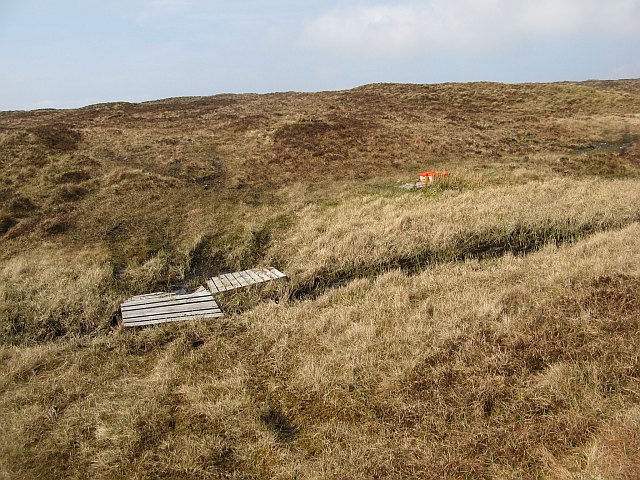
Ardbeg Hill is a popular destination for nature lovers, hikers, and photographers alike. Its diverse flora and fauna attract a wide range of wildlife, including deer, birds, and smaller mammals. Exploring the hill's trails, visitors may also come across historic ruins or stone cairns, adding a sense of mystery and intrigue to the experience.

Whether it's for an invigorating hike, a peaceful picnic, or simply to immerse oneself in the beauty of Scotland's natural landscapes, Ardbeg Hill in Argyllshire is a must-visit destination.

If you have any feedback on the listing, please let us know in the comments section below.

Ardbeg Hill Images

Images are sourced within 2km of 55.949478/-5.1124734 or Grid Reference NS0577. Thanks to Geograph Open Source API. All images are credited.

Rocks At Loch Striven
Shepherding stuff, Beinn Bhreac Tubs of energy blocks and some bog beating pallets on Beinn Bhreac.
Shepherding stuff, Beinn Bhreac
Tubs of energy blocks and some bog beating pallets on Beinn Bhreac.
Beinn Bhreac, South top The lower of the two 500m summits on Beinn Bhreac, with triangulation pillar.
Beinn Bhreac, South top
The lower of the two 500m summits on Beinn Bhreac, with triangulation pillar.
Beinn Bhreac The ground gets rougher to the north. View across heather and bog to the higher north top.
Beinn Bhreac
The ground gets rougher to the north. View across heather and bog to the higher north top.
Burn descending Beinn Bhreac A tributary of the Milton Burn leaves the summit ridge of Beinn Bhreac by a small ravine.
Burn descending Beinn Bhreac
A tributary of the Milton Burn leaves the summit ridge of Beinn Bhreac by a small ravine.
West side of Beinn Bhreac Grassy slopes above the Milton Burn. A tributary of the Milton Burn has formed a small ravine.
West side of Beinn Bhreac
Grassy slopes above the Milton Burn. A tributary of the Milton Burn has formed a small ravine.
Summit area, Beinn Bhreac The highest point of the hill is a confusing area of bumps, I am unsure as to which is the highest, but the money is on the dark pointed one in the middle. There is a place name, Coraddie, I am unsure if this refers to the summit area, another top, a bog or a notch in the ridge.
Summit area, Beinn Bhreac
The highest point of the hill is a confusing area of bumps, I am unsure as to which is the highest, but the money is on the dark pointed one in the middle. There is a place name, Coraddie, I am unsure if this refers to the summit area, another top, a bog or a notch in the ridge.
West side of Beinn Bhreac Rough grazing above the head of the Milton Burn, and close to the highest part of the hill.
West side of Beinn Bhreac
Rough grazing above the head of the Milton Burn, and close to the highest part of the hill.
Deep bogs, Beinn Bhreac A boggy col with the steep eastern side of the hill beyond.
Deep bogs, Beinn Bhreac
A boggy col with the steep eastern side of the hill beyond.
Peatland, Beinn Bhreac Boggy land in the Coraddie  area, below the higher top of Beinn Bhreac.
Peatland, Beinn Bhreac
Boggy land in the Coraddie area, below the higher top of Beinn Bhreac.
Eastern side of Beinn Bhreac The east contrasts greatly with the gentle west of the hill. Steep gullied slopes and forestry plantations above Loch Striven. It was a windy day as can be seen by the water on the loch.
Eastern side of Beinn Bhreac
The east contrasts greatly with the gentle west of the hill. Steep gullied slopes and forestry plantations above Loch Striven. It was a windy day as can be seen by the water on the loch.
Lochan na Leirg A loch near the north summit of Beinn Bhreac. The ground is more rugged than the south of the hill and the peak beyond the loch, Stùchdan Capuill, has a lot of exposed rock.
The island is a nesting site for common gulls.
Lochan na Leirg
A loch near the north summit of Beinn Bhreac. The ground is more rugged than the south of the hill and the peak beyond the loch, Stùchdan Capuill, has a lot of exposed rock. The island is a nesting site for common gulls.
Cruach an Lochain Bump on the north side of Beinn Bhreac, much more impressive from the  north west.
Cruach an Lochain
Bump on the north side of Beinn Bhreac, much more impressive from the north west.
Pheasant on the beach at Port na Curaich The Estate at Glenstriven is run as a sporting estate, pheasants being the main game.
Pheasant on the beach at Port na Curaich
The Estate at Glenstriven is run as a sporting estate, pheasants being the main game.
Small pebbly beach south of  Ardbeg Point We sailed up Loch Striven for this and other photographs.  The pilot is unenthusiastic "A fairly dull glen subject to fierce squalls."  It was, it was!  We nearly got knocked flat.
Small pebbly beach south of Ardbeg Point
We sailed up Loch Striven for this and other photographs. The pilot is unenthusiastic "A fairly dull glen subject to fierce squalls." It was, it was! We nearly got knocked flat.
Loch Striven hillside
Rocky edge to Loch Striven We sailed up Loch Striven for this and other photographs.  The pilot is unenthusiastic "A fairly dull glen subject to fierce squalls."  It was, it was!  We nearly got knocked flat.
Rocky edge to Loch Striven
We sailed up Loch Striven for this and other photographs. The pilot is unenthusiastic "A fairly dull glen subject to fierce squalls." It was, it was! We nearly got knocked flat.
Loch Striven shoreline The Loch Striven mussel farm buoys can be seen in the water to the left of the photo.
Loch Striven shoreline
The Loch Striven mussel farm buoys can be seen in the water to the left of the photo.
Show me another place!

Ardbeg Hill is located at Grid Ref: NS0577 (Lat: 55.949478, Lng: -5.1124734)

Unitary Authority: Argyll and Bute

Police Authority: Argyll and West Dunbartonshire

What 3 Words

///pelting.walled.promoting. Near Sandbank, Argyll & Bute

Nearby Locations

Ardbeg Hill

Related Wikis

Loch Striven

Loch Striven (Scottish Gaelic: Loch Sroigheann) is a sea loch extending off the Firth of Clyde, and forms part of the Cowal peninsula coast, in Argyll...
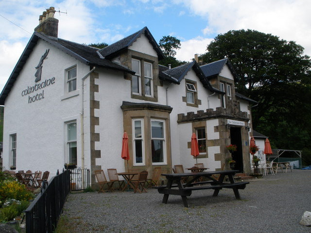
Colintraive Hotel

The Colintraive Hotel (also known as The Colintraive) is a hotel and pub in Colintraive, Argyll and Bute, Scotland. It was formerly a hunting lodge for...

Inverchaolain

Inverchaolain is a hamlet on the Cowal peninsula, Argyll and Bute, Scotland. It lies on the east shore of Loch Striven, to the south of Glenstriven and...

Colintraive

Colintraive (Scottish Gaelic: Caol an t-Snàimh) is a village in Argyll and Bute, Scotland. Once the site where cattle were swum across the narrows to the...

Inverchaolain Church

Inverchaolain Church is a former Church of Scotland church building in Inverchaolain, Argyll and Bute, Scotland. Located on the eastern shores of Loch...

Cruach nan Capull

Cruach nan Capull is a mountain within the Arrochar Alps, near Loch Fyne, in Argyll and Bute, Scotland. It stands on the southern side of Hell's Glen and...

Burnt Islands

The Burnt Islands (Scottish Gaelic: Na h-Eileanan Loisgte) are three small islands that lie in the Kyles of Bute, on the Cowal Peninsula, Argyll and Bute...

Eilean Dearg, Loch Ruel

Eilean Dearg is a small island in Loch Ruel (or Loch Riddon) in Argyll, Scotland. The island was once home to a castle, which was destroyed by naval action...

Nearby Amenities

Located within 500m of 55.949478,-5.1124734
Ardbeg Hill
Ele: 444
Natural: peak
Lat/Long: 55.948573/-5.1120185
The data included in this document is from www.openstreetmap.org. The data is made available under ODbL.

Have you been to Ardbeg Hill?

Leave your review of Ardbeg Hill below (or comments, questions and feedback).