Meall Ruadh

Hill, Mountain in Argyllshire

Scotland

Meall Ruadh

Bridge, Abhainn Sròn a' Chreagain The road has, unusually, smooth tar for some distance.
Bridge, Abhainn Sròn a' Chreagain Credit: Richard Webb

Meall Ruadh, located in Argyllshire, Scotland, is a prominent hill that offers breathtaking views and a challenging hiking experience. Standing at an elevation of 663 meters (2,175 feet), it is a popular destination for outdoor enthusiasts and nature lovers.

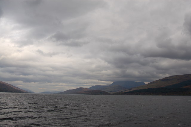
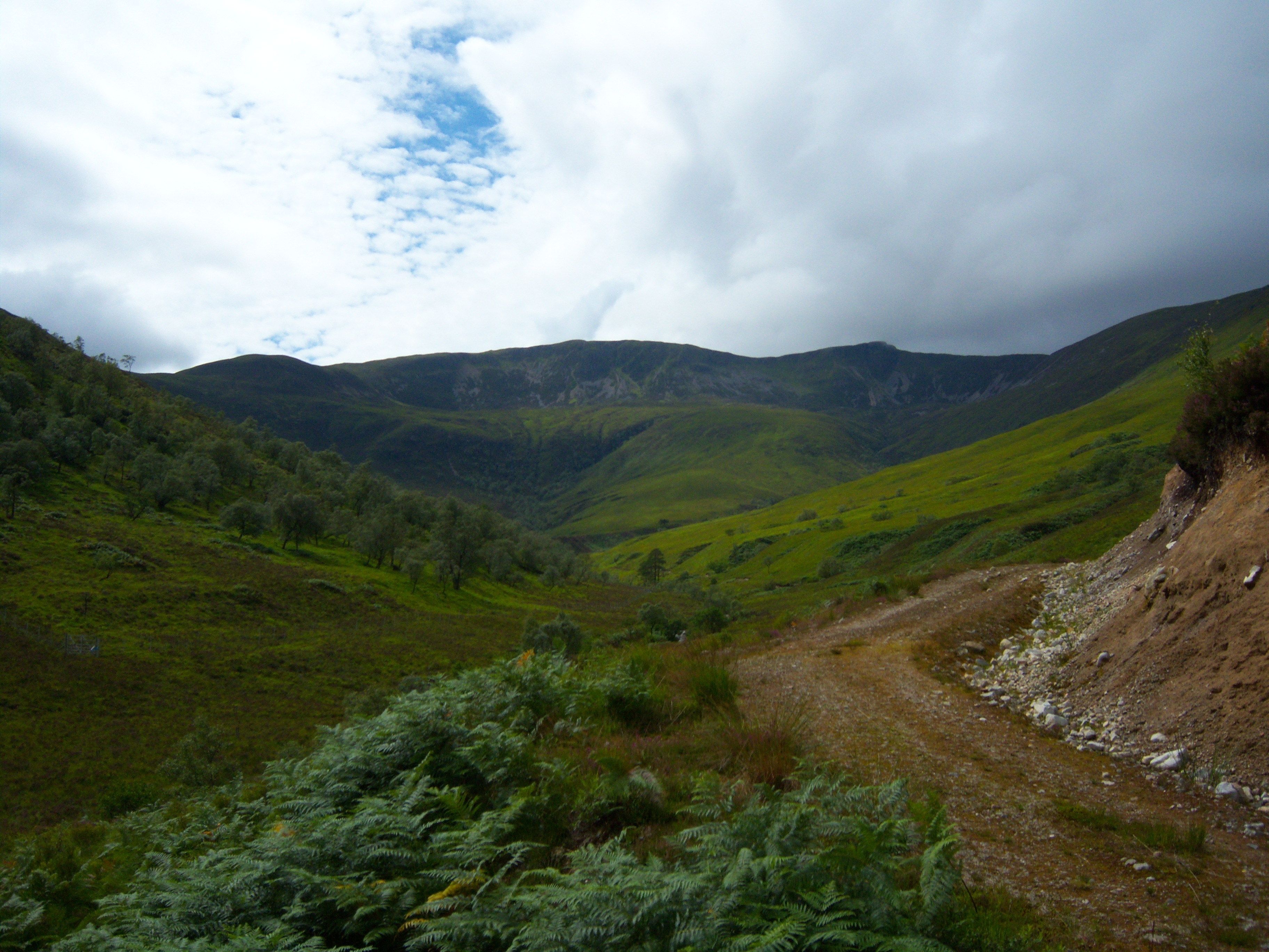
Situated in the southern part of the Argyll Forest Park, Meall Ruadh is surrounded by stunning landscapes and diverse wildlife. The hill is characterized by its rugged terrain, with rocky slopes covered in heather and grasses, making it an ideal habitat for a variety of plant and animal species.

The ascent to the summit of Meall Ruadh is considered a moderate to difficult hike, requiring a good level of fitness and experience in hillwalking. The route starts from the nearby village of Kilfinan, taking hikers through ancient woodlands and across open moorland. As they climb higher, the views become more spectacular, offering panoramic vistas of Loch Fyne, the Kintyre Peninsula, and the surrounding hills.

The summit of Meall Ruadh rewards hikers with a breathtaking 360-degree view of the surrounding landscape, including the nearby peaks of Beinn Bhuidhe and Beinn Mhor. On a clear day, it is even possible to see as far as the Isle of Arran and the Cowal Peninsula.

Visitors to Meall Ruadh should come prepared with appropriate clothing, sturdy footwear, and navigation tools, as the weather conditions can change rapidly. The hill is accessible year-round, but it is advisable to check weather forecasts and daylight hours before embarking on the hike.

If you have any feedback on the listing, please let us know in the comments section below.

Meall Ruadh Images

Images are sourced within 2km of 56.795695/-5.1852805 or Grid Reference NN0571. Thanks to Geograph Open Source API. All images are credited.

Bridge, Abhainn Sròn a' Chreagain The road has, unusually, smooth tar for some distance.
Bridge, Abhainn Sròn a' Chreagain
The road has, unusually, smooth tar for some distance.
Gate, Sròn a' Chreagain The track up the glen is on the other side of the river.
Gate, Sròn a' Chreagain
The track up the glen is on the other side of the river.
Cruise liner leaves for Iceland Loch Linnhe at Fort William
Cruise liner leaves for Iceland
Loch Linnhe at Fort William
A861 towards Stronchreggan
A861 near Stronchreggan
Superyacht "Scenic Eclipse II", Loch Linnhe Year of build 2023
Flag state: Croatia
Builder: 3 Maj Shipyard (Rijeka, Croatia)
Class: ice-strengthened expedition mega-yacht
Building cost: EUR 190 million (USD 230 million)
Speed: 17 kn / 31 km/h / 20 mph
Length (LOA): 168 m / 551 ft
Beam (width): 22 m / 72 ft
Gross Tonnage: 22498 gt
Passengers: 228
Crew: 176
Decks: 10
Cabins: 114
Decks with cabins: 5
Sister-ships: Scenic Eclipse 1
Former names: NOVOGRADNJA 101, BRIONI
Christened by: Kathryn Dwyer Sullivan
Owner: Scenic Group (Australia)
Operator: Scenic Yacht Cruises
Superyacht "Scenic Eclipse II", Loch Linnhe
Year of build 2023 Flag state: Croatia Builder: 3 Maj Shipyard (Rijeka, Croatia) Class: ice-strengthened expedition mega-yacht Building cost: EUR 190 million (USD 230 million) Speed: 17 kn / 31 km/h / 20 mph Length (LOA): 168 m / 551 ft Beam (width): 22 m / 72 ft Gross Tonnage: 22498 gt Passengers: 228 Crew: 176 Decks: 10 Cabins: 114 Decks with cabins: 5 Sister-ships: Scenic Eclipse 1 Former names: NOVOGRADNJA 101, BRIONI Christened by: Kathryn Dwyer Sullivan Owner: Scenic Group (Australia) Operator: Scenic Yacht Cruises
From the coast road below Meall Ruadh, Ardgour Fort William in the distance
From the coast road below Meall Ruadh, Ardgour
Fort William in the distance
Gorsten Cottage  by Goirtean a' Chladaich An old "black house" that would have had a thatched roof
Gorsten Cottage by Goirtean a' Chladaich
An old "black house" that would have had a thatched roof
Adder
Adder
Wall, Fence and Trees South of Stronchreggan. Loch Linnhe in the background.
Wall, Fence and Trees
South of Stronchreggan. Loch Linnhe in the background.
View Through the Trees Overlooking Loch Linnhe.
View Through the Trees
Overlooking Loch Linnhe.
Tree Lined Road The A861 looking northeast.
Tree Lined Road
The A861 looking northeast.
Shoreline through the Trees The shore of Loch Linnhe viewed through the trees from the A861.
Shoreline through the Trees
The shore of Loch Linnhe viewed through the trees from the A861.
Small Burn Unnamed burn running from the slopes of Meall an Doire Dhuinn.
Small Burn
Unnamed burn running from the slopes of Meall an Doire Dhuinn.
View of Fort William Picture taken from hills over Loch Linnhe from Fort William. Ben Nevis seen in the background with clouds around the summit
View of Fort William
Picture taken from hills over Loch Linnhe from Fort William. Ben Nevis seen in the background with clouds around the summit
Loch Linnhe Salmon Farming on the Loch. Look closely and see them jumping.
Loch Linnhe
Salmon Farming on the Loch. Look closely and see them jumping.
The Great Glen Loch Linnhe featuring Ben Nevis with its head in the clouds
The Great Glen
Loch Linnhe featuring Ben Nevis with its head in the clouds
Scots Pine and Ancient Woodland A couple of Scots Pine beside the Abhainn Sron a Chreagain, with semi-natural ancient woodland of mainly birch and oak behind. A wild, wet and windy day in Ardgour.
Scots Pine and Ancient Woodland
A couple of Scots Pine beside the Abhainn Sron a Chreagain, with semi-natural ancient woodland of mainly birch and oak behind. A wild, wet and windy day in Ardgour.
Show me another place!

Meall Ruadh is located at Grid Ref: NN0571 (Lat: 56.795695, Lng: -5.1852805)

Unitary Authority: Highland

Police Authority: Highlands and Islands

What 3 Words

///takeovers.builds.pencils. Near Fort William, Highland

Nearby Locations

Meall Ruadh

Related Wikis

Stronchreggan

Stronchreggan (Scottish Gaelic: Sròn a' Chritheagain) is a scattered coastal hamlet, on the north eastern shores of Loch Linnhe, and is situated directly...

Druimarben

Druimarben (Scottish Gaelic: Druim Earbainn) is a hamlet on the east shore of Loch Linnhe in Inverness-shire, Scottish Highlands and is in the Scottish...

Ach' An Todhair

Ach' An Todhair is a small hamlet on the shore of Loch Linnhe in the Highland council area, Scotland. It is located along the A82 road directly south of...

Stob Coire a' Chearcaill

Stob Coire a' Chearcaill (771 m) is a mountain in the Northwest Highlands, Scotland. It lies west of Loch Linnhe in Lochaber. The peak is a familiar sight...

Blarmachfoldach

Blarmachfoldach (or Blàr Mac Faoilteach; Blàrmacfaoltach) is a small crofting settlement in Lochaber, in the Highland council area of Scotland. It is located...

Trislaig

Trislaig (Scottish Gaelic: Trìoslaig) is a small coastal hamlet on the north eastern shores of Loch Linnhe, and is situated directly across from Fort...

HMS St Christopher (shore establishment)

HMS St Christopher was a Coastal Forces training base of the Royal Navy operational during the Second World War and located in and around Fort William...

West Highland Museum

The West Highland Museum (Scottish Gaelic: Taigh-tasgaidh na Gàidhealtachd an Iar) tells the story of the Scottish Highlands and the Islands. It aims to...

Nearby Amenities

Located within 500m of 56.795695,-5.1852805
Meall Ruadh
Ele: 310
Natural: peak
Place: locality
Lat/Long: 56.7955996/-5.1840265
The data included in this document is from www.openstreetmap.org. The data is made available under ODbL.

Have you been to Meall Ruadh?

Leave your review of Meall Ruadh below (or comments, questions and feedback).