Àird an Eilein

Hill, Mountain in Argyllshire

Scotland

Àird an Eilein

Cadderlie The former croft of Cadderlie is now maintained as a bothy by the MBA. (Mountain Bothies Association).A welcome refuge. Across Loch Etive in the background can be seen the serrated ridge of Ben Cruachan.
Cadderlie Credit: ronnie leask

Àird an Eilein, also known as the Point of the Island, is a remarkable hill located in Argyllshire, Scotland. Standing at an impressive height of 368 meters (1,207 feet), it offers breathtaking panoramic views of the surrounding landscape.

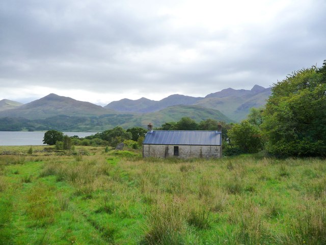
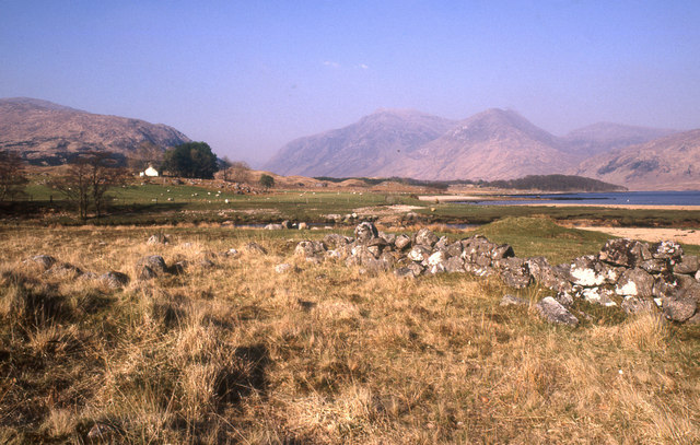
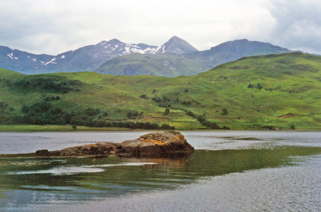
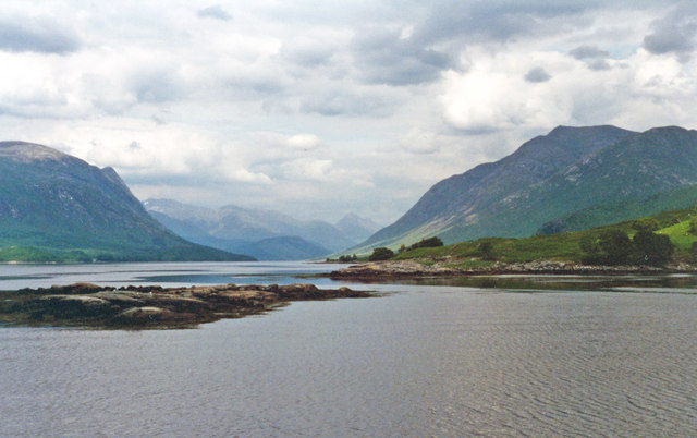
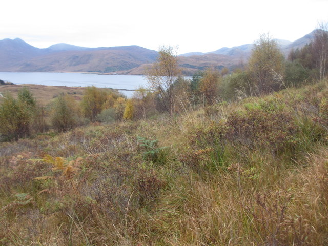
Situated on the western shore of Loch Awe, Àird an Eilein is renowned for its natural beauty and rich history. The hill is covered in lush greenery, with heather and grasses adorning its slopes. The diverse flora and fauna found here create a vibrant ecosystem, making it a haven for nature enthusiasts and hikers.

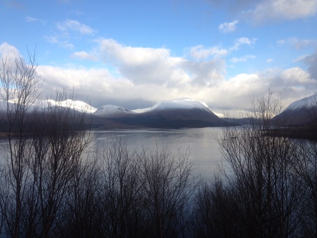
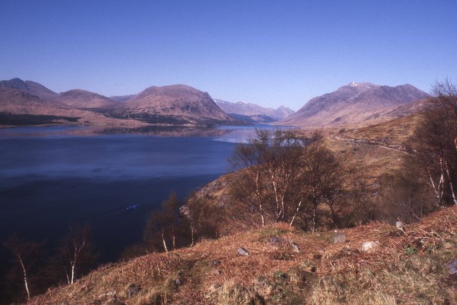
The summit of Àird an Eilein provides a commanding view of the picturesque Loch Awe, the longest freshwater loch in Scotland. On a clear day, visitors can see the distant mountains and islands that dot the horizon, adding to the enchanting atmosphere of this place.

The historical significance of Àird an Eilein adds another layer of intrigue to the hill. It is believed that the site was once home to an ancient fort, providing a strategic vantage point for its inhabitants. The remnants of the fort can still be seen, adding an element of mystery and nostalgia to the landscape.

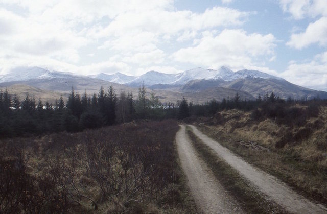
For those seeking adventure, Àird an Eilein offers various hiking trails that cater to all levels of fitness. These trails wind through the beautiful Argyllshire countryside, allowing visitors to immerse themselves in the natural wonders of the region.

In conclusion, Àird an Eilein is a captivating hill in Argyllshire, Scotland, which boasts stunning views, a rich history, and an abundance of natural beauty. It is a must-visit destination for nature lovers and history enthusiasts alike.

If you have any feedback on the listing, please let us know in the comments section below.

Àird an Eilein Images

Images are sourced within 2km of 56.489048/-5.1669066 or Grid Reference NN0537. Thanks to Geograph Open Source API. All images are credited.

Cadderlie The former croft of Cadderlie is now maintained as a bothy by the MBA. (Mountain Bothies Association).A welcome refuge. Across Loch Etive in the background can be seen the serrated ridge of Ben Cruachan.
Cadderlie
The former croft of Cadderlie is now maintained as a bothy by the MBA. (Mountain Bothies Association).A welcome refuge. Across Loch Etive in the background can be seen the serrated ridge of Ben Cruachan.
Loch Etive From the track up the eastern shore.
Loch Etive
From the track up the eastern shore.
Loch Etive Between Glennoe and Inverliver.
Loch Etive
Between Glennoe and Inverliver.
Camas na Cùirte Shores of Loch Etive with descendants, or even the trees themselves (after coppicing) that fed the iron furnaces.
Camas na Cùirte
Shores of Loch Etive with descendants, or even the trees themselves (after coppicing) that fed the iron furnaces.
Allt Seilich The eastern slopes of Beinn Mheadhonach fall steeply to Cadderlie on the shores of Loch Etive. The big glen on the other side is Glen Kinglass.
Allt Seilich
The eastern slopes of Beinn Mheadhonach fall steeply to Cadderlie on the shores of Loch Etive. The big glen on the other side is Glen Kinglass.
Abhainn Dalach, Loch Etive and Ben Cruachan Outlet of a big burn into Loch Etive.
Abhainn Dalach, Loch Etive and Ben Cruachan
Outlet of a big burn into Loch Etive.
Forest road above Dail A soon to be obscured view of Ben Cruachan.
Forest road above Dail
A soon to be obscured view of Ben Cruachan.
Abhainn Dalach View up the Abhainn Dalach towards Creach Bheinn.
Abhainn Dalach
View up the Abhainn Dalach towards Creach Bheinn.
Abhainn Dalach
Abhainn Dalach
Looking over Abhainn Dalach towards Dail
Inverliver Bay and Ben Cruachan, from Loch Etive View eastward from a pleasure-launch from Taynuilt and back. Note the considerable amount of snow on the mountain - in July. (Cf. <a href="https://www.geograph.org.uk/photo/2040707">NN0636 : Sgeirean Inverliver, Loch Etive</a>).
Inverliver Bay and Ben Cruachan, from Loch Etive
View eastward from a pleasure-launch from Taynuilt and back. Note the considerable amount of snow on the mountain - in July. (Cf. NN0636 : Sgeirean Inverliver, Loch Etive).
NE up Loch Etive off Inverliver Bay View up the Loch taken at same time as <a href="https://www.geograph.org.uk/photo/4767634">NN0636 : Inverliver Bay and Ben Cruachan, from Loch Etive</a>. On the left are the slopes of Beinn Mheadhonach, on the right those of Monadh Liath; in the distance are the mountains of the Royal Forest (Glen Coe).
NE up Loch Etive off Inverliver Bay
View up the Loch taken at same time as NN0636 : Inverliver Bay and Ben Cruachan, from Loch Etive. On the left are the slopes of Beinn Mheadhonach, on the right those of Monadh Liath; in the distance are the mountains of the Royal Forest (Glen Coe).
Alluvial fan Where the Cadderlie Burn enters Loch Etive.
Alluvial fan
Where the Cadderlie Burn enters Loch Etive.
Ruins at Cadderlie
Ruins at Cadderlie
Cadderlie by Loch Etive A cottage and some ruins.
Cadderlie by Loch Etive
A cottage and some ruins.
Trees in the ruins Showing what a reduction in grazing/browsing pressure can do to the vegetation.
Trees in the ruins
Showing what a reduction in grazing/browsing pressure can do to the vegetation.
Moorland above Cadderlie Very rough moorland with scattered trees above the Cadderlie MBA bothy.
Moorland above Cadderlie
Very rough moorland with scattered trees above the Cadderlie MBA bothy.
Big boulder Big boulder with a lush heather garden on top.
Big boulder
Big boulder with a lush heather garden on top.
Show me another place!

Àird an Eilein is located at Grid Ref: NN0537 (Lat: 56.489048, Lng: -5.1669066)

Unitary Authority: Argyll and Bute

Police Authority: Argyll and West Dunbartonshire

What 3 Words

///downfield.clotting.goat. Near Oban, Argyll & Bute

Related Wikis

Loch Etive

Loch Etive (Scottish Gaelic, Loch Eite) is a 30 km sea loch in Argyll and Bute, Scotland. It reaches the sea at Connel, 5 km north of Oban. It measures...

Creach Bheinn (Loch Creran)

Creach Bheinn (810 m) is a mountain in the Grampian Mountains of Scotland. It rises above the head Loch Creran in Argyll. A large and sprawling peak, a...

Bonawe

Bonawe (Scots pronunciation: [boˈnɔː]; Scottish Gaelic: Bun Abha [puˈna.ə]) is a village in Ardchattan Parish Argyll and Bute, Scotland opposite Taynuilt...

River Awe

The River Awe (Scottish Gaelic: Uisge Abha) is a short river in the Southwest Highlands of Scotland by which the freshwater Loch Awe empties into Loch...

Have you been to Àird an Eilein?

Leave your review of Àird an Eilein below (or comments, questions and feedback).