Tom nan Aighean

Hill, Mountain in Argyllshire

Scotland

Tom nan Aighean

B845 towards Kilchrenan
B845 towards Kilchrenan Credit: Steven Brown

Tom nan Aighean is a prominent hill/mountain located in Argyllshire, Scotland. It is situated within the Loch Lomond and The Trossachs National Park, approximately 15 miles northeast of the town of Arrochar. With an elevation of 867 meters (2,844 feet), it is one of the tallest peaks in the area.

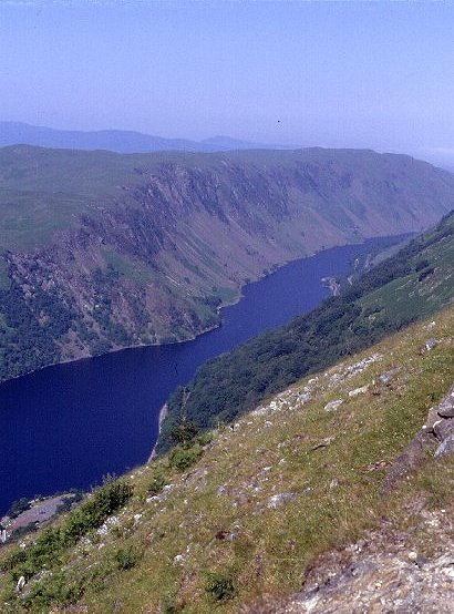
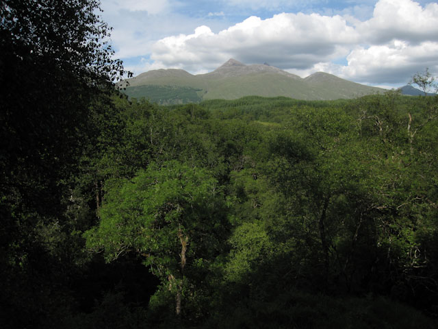
The hill/mountain is known for its rugged and rocky terrain, making it a popular destination for hikers and mountaineers. Its distinctive shape and steep slopes offer a challenging yet rewarding climb, attracting outdoor enthusiasts throughout the year. The summit provides breathtaking panoramic views of the surrounding landscape, including Loch Long and the Arrochar Alps.

Tom nan Aighean is part of the larger Arrochar Alps mountain range, which comprises several other notable peaks such as Beinn Ime and Beinn Narnain. These mountains collectively form a stunning backdrop to the picturesque Loch Lomond, making it a scenic area for outdoor activities.

The hill/mountain is rich in biodiversity, with various species of flora and fauna inhabiting its slopes. Visitors may encounter heather, mosses, and grasses, as well as birds such as ptarmigan and peregrine falcons.

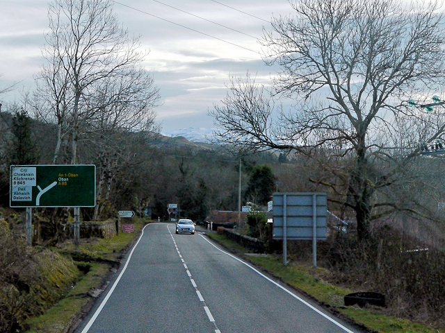
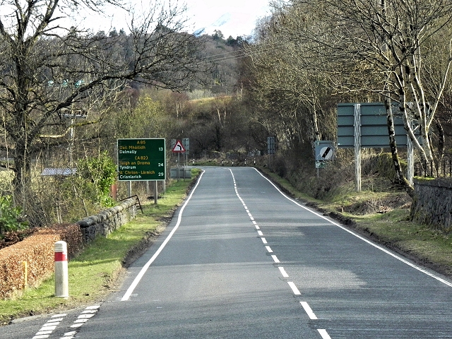
Access to Tom nan Aighean is available from several starting points, including the nearby village of Succoth. It is recommended that hikers are adequately prepared and have appropriate equipment, as the terrain can be challenging and weather conditions can change rapidly.

If you have any feedback on the listing, please let us know in the comments section below.

Tom nan Aighean Images

Images are sourced within 2km of 56.417368/-5.2091595 or Grid Reference NN0229. Thanks to Geograph Open Source API. All images are credited.

B845 towards Kilchrenan
Old Milestone by the A85, Bridge of Awe Milestone by the A85, in parish of Ardchattan & Muckairn (Argyll & Bute District), Bridge of Awe, north east side of road.

Inscription reads:-
: DLY / 11 : : INY / 26¾ : : ON / 15 :
(To Dalmally, Inveraray and Oban)

Milestone Society National ID: AB_ONDL15
Old Milestone by the A85, Bridge of Awe
Milestone by the A85, in parish of Ardchattan & Muckairn (Argyll & Bute District), Bridge of Awe, north east side of road. Inscription reads:- : DLY / 11 : : INY / 26¾ : : ON / 15 : (To Dalmally, Inveraray and Oban) Milestone Society National ID: AB_ONDL15
A85, Inverawe Road and railway emerge from the Pass of Brander after the difficult engineering of squeezing between Ben Cruachan and Loch Awe.
A85, Inverawe
Road and railway emerge from the Pass of Brander after the difficult engineering of squeezing between Ben Cruachan and Loch Awe.
Cows grazing near Taynuilt
Looking over Glen Nant Towards Ben Cruachan.
Looking over Glen Nant
Towards Ben Cruachan.
Level crossing near Taynuilt On the Crianlarich-Oban line. It does not look as if it is in regular vehicular use, and the stile for walkers is pretty shaky - the path leads down to the River Awe.
Level crossing near Taynuilt
On the Crianlarich-Oban line. It does not look as if it is in regular vehicular use, and the stile for walkers is pretty shaky - the path leads down to the River Awe.
Railway near Taynuilt Looking towards Dalmally and the Pass of Brander, from a path crossing the line and leading to the River Awe.
Railway near Taynuilt
Looking towards Dalmally and the Pass of Brander, from a path crossing the line and leading to the River Awe.
Woodland in the valley of the River Awe Looking across from the level crossing near Taynuilt.
Woodland in the valley of the River Awe
Looking across from the level crossing near Taynuilt.
Rickety stile leading over the railway The path leads from the main road to the River Awe.
Rickety stile leading over the railway
The path leads from the main road to the River Awe.
The Glasgow-Oban line near Inverawe Looking north across the wooded valley of the River Awe.
The Glasgow-Oban line near Inverawe
Looking north across the wooded valley of the River Awe.
Layby on Westbound A85 The A85 is a major road running for 115 miles from Oban to Dundee, providing a nearly continuous route linking the east and west coasts of Scotland, passing some of the country’s highest mountains.

Some statistics seem to show that the stretch of the A85 between Oban and Tyndrum is among the ten most dangerous roads in Scotland (<span class="nowrap"><a title="http://news.bbc.co.uk/1/hi/scotland/1824466.stm" rel="nofollow ugc noopener" href="http://news.bbc.co.uk/1/hi/scotland/1824466.stm">Link</a><img style="margin-left:2px;" alt="External link" title="External link - shift click to open in new window" src="https://s1.geograph.org.uk/img/external.png" width="10" height="10"/></span>  BBC Scotland)
Layby on Westbound A85
The A85 is a major road running for 115 miles from Oban to Dundee, providing a nearly continuous route linking the east and west coasts of Scotland, passing some of the country’s highest mountains. Some statistics seem to show that the stretch of the A85 between Oban and Tyndrum is among the ten most dangerous roads in Scotland (LinkExternal link BBC Scotland)
A85 Approaching Ichrachan The A85 is a major road running for 115 miles from Oban to Dundee, providing a nearly continuous route linking the east and west coasts of Scotland, passing some of the country’s highest mountains.

Some statistics seem to show that the stretch of the A85 between Oban and Tyndrum is among the ten most dangerous roads in Scotland (<span class="nowrap"><a title="http://news.bbc.co.uk/1/hi/scotland/1824466.stm" rel="nofollow ugc noopener" href="http://news.bbc.co.uk/1/hi/scotland/1824466.stm">Link</a><img style="margin-left:2px;" alt="External link" title="External link - shift click to open in new window" src="https://s1.geograph.org.uk/img/external.png" width="10" height="10"/></span>  BBC Scotland)
A85 Approaching Ichrachan
The A85 is a major road running for 115 miles from Oban to Dundee, providing a nearly continuous route linking the east and west coasts of Scotland, passing some of the country’s highest mountains. Some statistics seem to show that the stretch of the A85 between Oban and Tyndrum is among the ten most dangerous roads in Scotland (LinkExternal link BBC Scotland)
A85, Ichrachan The A85 is a major road running for 115 miles from Oban to Dundee, providing a nearly continuous route linking the east and west coasts of Scotland, passing some of the country’s highest mountains.

Some statistics seem to show that the stretch of the A85 between Oban and Tyndrum is among the ten most dangerous roads in Scotland (<span class="nowrap"><a title="http://news.bbc.co.uk/1/hi/scotland/1824466.stm" rel="nofollow ugc noopener" href="http://news.bbc.co.uk/1/hi/scotland/1824466.stm">Link</a><img style="margin-left:2px;" alt="External link" title="External link - shift click to open in new window" src="https://s1.geograph.org.uk/img/external.png" width="10" height="10"/></span>  BBC Scotland)
A85, Ichrachan
The A85 is a major road running for 115 miles from Oban to Dundee, providing a nearly continuous route linking the east and west coasts of Scotland, passing some of the country’s highest mountains. Some statistics seem to show that the stretch of the A85 between Oban and Tyndrum is among the ten most dangerous roads in Scotland (LinkExternal link BBC Scotland)
Ichrachan The A85 is a major road running for 115 miles from Oban to Dundee, providing a nearly continuous route linking the east and west coasts of Scotland, passing some of the country’s highest mountains.

Some statistics seem to show that the stretch of the A85 between Oban and Tyndrum is among the ten most dangerous roads in Scotland (<span class="nowrap"><a title="http://news.bbc.co.uk/1/hi/scotland/1824466.stm" rel="nofollow ugc noopener" href="http://news.bbc.co.uk/1/hi/scotland/1824466.stm">Link</a><img style="margin-left:2px;" alt="External link" title="External link - shift click to open in new window" src="https://s1.geograph.org.uk/img/external.png" width="10" height="10"/></span>  BBC Scotland)
Ichrachan
The A85 is a major road running for 115 miles from Oban to Dundee, providing a nearly continuous route linking the east and west coasts of Scotland, passing some of the country’s highest mountains. Some statistics seem to show that the stretch of the A85 between Oban and Tyndrum is among the ten most dangerous roads in Scotland (LinkExternal link BBC Scotland)
At the entrance to Ballet West
Colourful garden in Taynuilt
A85, Ichrachan The A85 is a major road running for 115 miles from Oban to Dundee, providing a nearly continuous route linking the east and west coasts of Scotland, passing some of the country’s highest mountains.

Some statistics seem to show that the stretch of the A85 between Oban and Tyndrum is among the ten most dangerous roads in Scotland (<span class="nowrap"><a title="http://news.bbc.co.uk/1/hi/scotland/1824466.stm" rel="nofollow ugc noopener" href="http://news.bbc.co.uk/1/hi/scotland/1824466.stm">Link</a><img style="margin-left:2px;" alt="External link" title="External link - shift click to open in new window" src="https://s1.geograph.org.uk/img/external.png" width="10" height="10"/></span>  BBC Scotland)
A85, Ichrachan
The A85 is a major road running for 115 miles from Oban to Dundee, providing a nearly continuous route linking the east and west coasts of Scotland, passing some of the country’s highest mountains. Some statistics seem to show that the stretch of the A85 between Oban and Tyndrum is among the ten most dangerous roads in Scotland (LinkExternal link BBC Scotland)
A85 near Ichrachan The A85 is a major road running for 115 miles from Oban to Dundee, providing a nearly continuous route linking the east and west coasts of Scotland, passing some of the country’s highest mountains.

Some statistics seem to show that the stretch of the A85 between Oban and Tyndrum is among the ten most dangerous roads in Scotland (<span class="nowrap"><a title="http://news.bbc.co.uk/1/hi/scotland/1824466.stm" rel="nofollow ugc noopener" href="http://news.bbc.co.uk/1/hi/scotland/1824466.stm">Link</a><img style="margin-left:2px;" alt="External link" title="External link - shift click to open in new window" src="https://s1.geograph.org.uk/img/external.png" width="10" height="10"/></span>  BBC Scotland)
A85 near Ichrachan
The A85 is a major road running for 115 miles from Oban to Dundee, providing a nearly continuous route linking the east and west coasts of Scotland, passing some of the country’s highest mountains. Some statistics seem to show that the stretch of the A85 between Oban and Tyndrum is among the ten most dangerous roads in Scotland (LinkExternal link BBC Scotland)
Show me another place!

Tom nan Aighean is located at Grid Ref: NN0229 (Lat: 56.417368, Lng: -5.2091595)

Unitary Authority: Argyll and Bute

Police Authority: Argyll and West Dunbartonshire

What 3 Words

///skims.jetliner.cabbage. Near Oban, Argyll & Bute

Nearby Locations

Tom nan Aighean

Related Wikis

Bridge of Awe

The Bridge of Awe (Scottish Gaelic: Drochaid Abha) was a triple-spanned arch bridge near Taynuilt in Argyll, Scotland. == History == In 1753 the Bonawe...

Battle of the Pass of Brander

The Battle of the Pass of Brander in Scotland forms a small part of the wider struggle known as the Wars of Scottish Independence, and a large part of...

Glen Nant

Glen Nant (Scottish Gaelic: Gleann Neannta) is a glen lying to the south of Taynuilt in the Argyll and Bute council area of Scotland. An area of woodland...

Taynuilt

Taynuilt (Scots: [ˈtɛinəlt]; Scottish Gaelic: Taigh an Uillt [t̪ʰɤj ən̪ˠ ˈɯiʎtʲ], meaning 'the house by the stream') is a large village in Argyll and Bute...

Taynuilt railway station

Taynuilt railway station is a railway station serving the village of Taynuilt in western Scotland. This station is on the Oban branch of the West Highland...
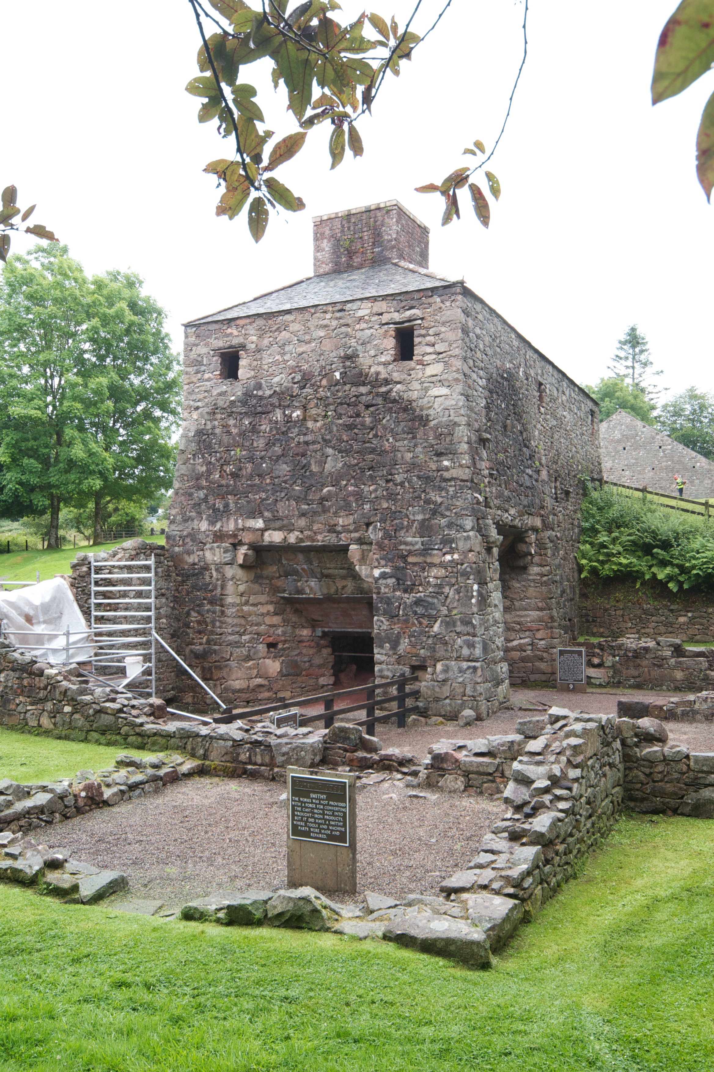
Bonawe Iron Furnace

The Bonawe Iron Furnace (also called the Lorn Furnace), was an industrial complex located in Bonawe, Lorn District, Scotland. It operated in the middle...

River Awe

The River Awe (Scottish Gaelic: Uisge Abha) is a short river in the Southwest Highlands of Scotland by which the freshwater Loch Awe empties into Loch...

Bonawe

Bonawe (Scots pronunciation: [boˈnɔː]; Scottish Gaelic: Bun Abha [puˈna.ə]) is a village in Ardchattan Parish Argyll and Bute, Scotland opposite Taynuilt...

Nearby Amenities

Located within 500m of 56.417368,-5.2091595
Design: barrel
Power: tower
Lat/Long: 56.4152665/-5.2048955
Design: barrel
Power: tower
Lat/Long: 56.4182069/-5.2059817
Design: barrel
Power: tower
Lat/Long: 56.4204614/-5.2068266
Power: pole
Lat/Long: 56.4143747/-5.2049124
Power: pole
Lat/Long: 56.4157457/-5.2054113
Power: pole
Lat/Long: 56.416983/-5.2058458
Power: pole
Lat/Long: 56.4176625/-5.2060953
Power: pole
Lat/Long: 56.4182693/-5.2063394
Power: pole
Lat/Long: 56.4185928/-5.2064386
Power: pole
Lat/Long: 56.4205169/-5.2071172
The data included in this document is from www.openstreetmap.org. The data is made available under ODbL.

Have you been to Tom nan Aighean?

Leave your review of Tom nan Aighean below (or comments, questions and feedback).