Beinn Duirinnis

Hill, Mountain in Argyllshire

Scotland

Beinn Duirinnis

Woodland at Bonawe
Woodland at Bonawe Credit: Chris Morgan

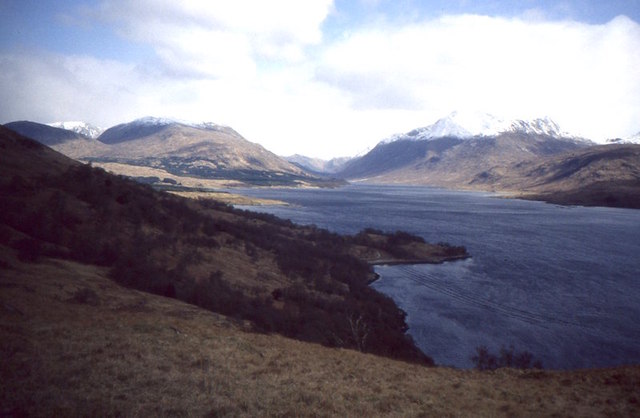
Beinn Duirinnis is a prominent hill located in Argyllshire, Scotland. Standing at an elevation of approximately 879 meters (2,884 feet), it is part of the stunning landscape of the Scottish Highlands. The hill is situated near the village of Kilchrenan and lies within the Loch Awe Forest Park.

This majestic mountain boasts a distinctive pyramid-like shape, with steep slopes covered in heather and grasses that change color with the seasons. Its rugged terrain and breathtaking views make it a popular destination for hikers and nature enthusiasts.

The ascent of Beinn Duirinnis can be challenging, with a steep and rocky path leading to the summit. However, the effort is rewarded with panoramic vistas of the surrounding countryside, including Loch Awe and the nearby mountains.

The hill is also home to a diverse range of flora and fauna, with heather moorland providing a habitat for various bird species, including golden eagles, peregrine falcons, and buzzards. Rare alpine plants can also be found in the higher reaches of the hill.

Beinn Duirinnis offers a sense of tranquility and solitude, allowing visitors to immerse themselves in the beauty of the Scottish Highlands. Whether it is the breathtaking views, the challenging hike, or the opportunity to observe the local wildlife, this hill is a true gem within the Argyllshire region.

If you have any feedback on the listing, please let us know in the comments section below.

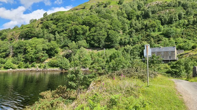
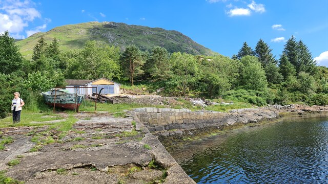
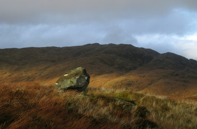
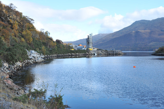
Beinn Duirinnis Images

Images are sourced within 2km of 56.463401/-5.2144414 or Grid Reference NN0234. Thanks to Geograph Open Source API. All images are credited.

Woodland at Bonawe
Woodland at Bonawe
Site of old Bonawe Ferry
Looking towards Bonawe, Loch Etive
Bonawe Quarry North side of Loch Etive.
Bonawe Quarry
North side of Loch Etive.
Loch Etive
Loch Etive
Bonawe Quarry Bonawe granite quarry taken from the south side of Loch Etive, showing the electricity transmission pylon on the north shore of the loch
Bonawe Quarry
Bonawe granite quarry taken from the south side of Loch Etive, showing the electricity transmission pylon on the north shore of the loch
Perched boulder on Ceann Creige Beinn Mheadhonach lies beyond the boulder which is north-east of the summit of Ceann Creige.
Perched boulder on Ceann Creige
Beinn Mheadhonach lies beyond the boulder which is north-east of the summit of Ceann Creige.
Hillside of Beinn Duirinnis with toppled trig point Extensive grassy slopes descend northwards from close to the summit of Beinn Duirinnis with Lairig Duirinnis far below. The trig point lies close to its original location having been stripped of its bronze metalwork.
Hillside of Beinn Duirinnis with toppled trig point
Extensive grassy slopes descend northwards from close to the summit of Beinn Duirinnis with Lairig Duirinnis far below. The trig point lies close to its original location having been stripped of its bronze metalwork.
Road sign - Bonawe Quarry
Bonawe - quarry manager's house Former quarry manager's house at Bonawe - derelict for many years, it has recently been restored as a private residence.
Bonawe - quarry manager's house
Former quarry manager's house at Bonawe - derelict for many years, it has recently been restored as a private residence.
Fishing boat Goosander A small fishing boat named Goosander sits at its moorings off Bonawe village.
Fishing boat Goosander
A small fishing boat named Goosander sits at its moorings off Bonawe village.
Bonawe Quarry
Bonawe Quarry
Bonawe Quarry This vast quarry on the shores of Loch Etive still produces granite. A fact anyone driving or cycling on the single track B 845 road from the quarry needs to be aware lest they meet lorries. From personal experience however I must acknowledge that the lorry drivers are both careful and courteous.
Bonawe Quarry
This vast quarry on the shores of Loch Etive still produces granite. A fact anyone driving or cycling on the single track B 845 road from the quarry needs to be aware lest they meet lorries. From personal experience however I must acknowledge that the lorry drivers are both careful and courteous.
B845 at Bonawe
B845 at Bonawe
Looking toward Bonawe Quarry
Ship on Loch Etive The coaster Burhou 1 passes Bonawe quarry as it makes its way up Loch Etive.
Ship on Loch Etive
The coaster Burhou 1 passes Bonawe quarry as it makes its way up Loch Etive.
Bonawe - ruin and renovation The farther building can be seen to be undergoing renovation and awaiting a new roof; the finished product can be seen in 'Turfburner's image - <a title="https://www.geograph.org.uk/photo/2349131" href="https://www.geograph.org.uk/photo/2349131">Link</a>.
Bonawe - ruin and renovation
The farther building can be seen to be undergoing renovation and awaiting a new roof; the finished product can be seen in 'Turfburner's image - Link.
Ridge on Beinn Duirinnis View up Loch Etive.
Ridge on Beinn Duirinnis
View up Loch Etive.
Show me another place!

Beinn Duirinnis is located at Grid Ref: NN0234 (Lat: 56.463401, Lng: -5.2144414)

Unitary Authority: Argyll and Bute

Police Authority: Argyll and West Dunbartonshire

What 3 Words

///undertone.promise.ridge. Near Oban, Argyll & Bute

Nearby Locations

Beinn Duirinnis

Related Wikis

Bonawe

Bonawe (Scots pronunciation: [boˈnɔː]; Scottish Gaelic: Bun Abha [puˈna.ə]) is a village in Ardchattan Parish Argyll and Bute, Scotland opposite Taynuilt...

River Awe

The River Awe (Scottish Gaelic: Uisge Abha) is a short river in the Southwest Highlands of Scotland by which the freshwater Loch Awe empties into Loch...
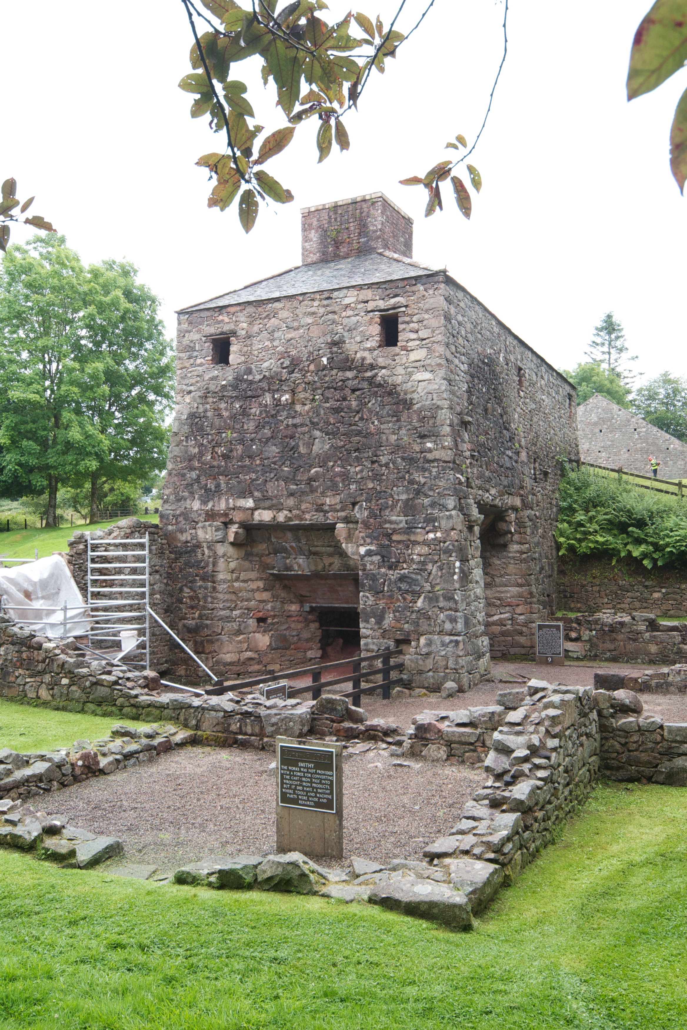
Bonawe Iron Furnace

The Bonawe Iron Furnace (also called the Lorn Furnace), was an industrial complex located in Bonawe, Lorn District, Scotland. It operated in the middle...

Taynuilt railway station

Taynuilt railway station is a railway station serving the village of Taynuilt in western Scotland. This station is on the Oban branch of the West Highland...

Taynuilt

Taynuilt (Scots: [ˈtɛinəlt]; Scottish Gaelic: Taigh an Uillt [t̪ʰɤj ən̪ˠ ˈɯiʎtʲ], meaning 'the house by the stream') is a large village in Argyll and Bute...

Loch Etive

Loch Etive (Scottish Gaelic, Loch Eite) is a 30 km sea loch in Argyll and Bute, Scotland. It reaches the sea at Connel, 5 km north of Oban. It measures...

Ardchattan and Muckairn

Ardchattan and Muckairn is a civil parish within Argyll and Bute in Scotland. It lies north of Oban, bordering Loch Etive and includes Glen Ure, Glen Creran...

Bridge of Awe

The Bridge of Awe (Scottish Gaelic: Drochaid Abha) was a triple-spanned arch bridge near Taynuilt in Argyll, Scotland. == History == In 1753 the Bonawe...

Nearby Amenities

Located within 500m of 56.463401,-5.2144414
Beinn Duirinnis
Corbett: no
Ele: 555
Graham: no
Marilyn: yes
Munro: no
Natural: peak
Prominence: 249
Lat/Long: 56.4631801/-5.2135699
The data included in this document is from www.openstreetmap.org. The data is made available under ODbL.

Have you been to Beinn Duirinnis?

Leave your review of Beinn Duirinnis below (or comments, questions and feedback).