Beinn Mòlurgainn

Hill, Mountain in Argyllshire

Scotland

Beinn Mòlurgainn

Beinn Bhreac lochan A glimpse of Loch Etive in the distance.
Beinn Bhreac lochan Credit: Alan Reid

Beinn Mòlurgainn is a prominent hill located in Argyllshire, Scotland. It is part of the wider range known as the Argyll Hills and stands at an impressive height of 863 meters (2,831 feet). The hill is situated in a remote and rugged area, offering breathtaking views of the surrounding landscape.

The ascent to Beinn Mòlurgainn is challenging but rewarding, attracting both experienced hikers and mountaineers. The terrain consists of steep slopes and rocky outcrops, providing a thrilling and adventurous climb. The hill is often covered in heather and grass, offering a vibrant and picturesque landscape during the summer months.

From the summit of Beinn Mòlurgainn, one can enjoy panoramic views of the surrounding Argyllshire countryside. To the north, the hill overlooks the vast expanse of Loch Awe, the longest freshwater loch in Scotland. To the south, the views extend towards the scenic Loch Fyne, famous for its seafood and stunning coastal scenery.

The hill is also home to a diverse range of flora and fauna. It is known for its rich birdlife, with sightings of golden eagles and peregrine falcons being relatively common. The surrounding moorland and hillsides provide habitat for various species of deer and other mammals.

Beinn Mòlurgainn offers a true Highland experience, combining challenging terrain, breathtaking views, and a chance to immerse oneself in the natural beauty of Argyllshire. Whether for hiking, photography, or simply seeking solitude in nature, this impressive hill is a must-visit destination for outdoor enthusiasts.

If you have any feedback on the listing, please let us know in the comments section below.

Beinn Mòlurgainn Images

Images are sourced within 2km of 56.51078/-5.2201776 or Grid Reference NN0140. Thanks to Geograph Open Source API. All images are credited.
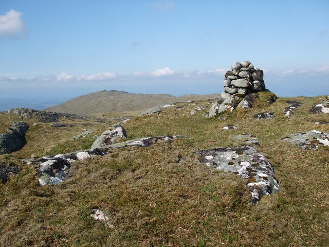
Beinn Bhreac lochan A glimpse of Loch Etive in the distance.
Beinn Bhreac lochan
A glimpse of Loch Etive in the distance.
Rocks on the Beinn Bhreac/Mam Hael summit Loch Etive and Cruachan in the background.
Rocks on the Beinn Bhreac/Mam Hael summit
Loch Etive and Cruachan in the background.
Natural Regeneration This whole area has been fenced off with an 8 foot high deer fence, and there is evidence here of natural regeneration of the flora - in this case a Scots Pine and a little Birch tree which would be a tasty snack for deer on the other side of the fence!
Natural Regeneration
This whole area has been fenced off with an 8 foot high deer fence, and there is evidence here of natural regeneration of the flora - in this case a Scots Pine and a little Birch tree which would be a tasty snack for deer on the other side of the fence!
Crossing Point This stile on a deer fence is a control in the Lowe Alpine Mountain Marathon - the Elite and 'A' courses had to cross the fence here, the only easy way over an 8ft high deer fence. You can just see the kite dangling from the stile, and it took me 20 minutes with numb hands in the drizzle to detach it, as I was collecting in the controls the day after the race went through here.
Crossing Point
This stile on a deer fence is a control in the Lowe Alpine Mountain Marathon - the Elite and 'A' courses had to cross the fence here, the only easy way over an 8ft high deer fence. You can just see the kite dangling from the stile, and it took me 20 minutes with numb hands in the drizzle to detach it, as I was collecting in the controls the day after the race went through here.
Rough Terrain Tussocky, boggy terrain on the south eastern slopes of the minor top of Meall Dearg. Although all now fenced off there was no evidence of any regeneration of trees taking place in contrast to the square 1km north of here:-
<a title="https://www.geograph.org.uk/photo/2990603" href="https://www.geograph.org.uk/photo/2990603">Link</a>
The day starts to deteriorate after a pleasant sunny start.
Rough Terrain
Tussocky, boggy terrain on the south eastern slopes of the minor top of Meall Dearg. Although all now fenced off there was no evidence of any regeneration of trees taking place in contrast to the square 1km north of here:- Link The day starts to deteriorate after a pleasant sunny start.
Eastern Slopes Beinn Molurgainn The day is getting decidedly dreich and the ground is about to rear up behind me as I am starting to climb up the Graham of Beinn Molurgainn on the lonely west side of Loch Etive.
Eastern Slopes Beinn Molurgainn
The day is getting decidedly dreich and the ground is about to rear up behind me as I am starting to climb up the Graham of Beinn Molurgainn on the lonely west side of Loch Etive.
Lochan Outlet The description on the instructions for this control in the Lowe Alpine Mountain Marathon taking place around Ben Cruachan on 9th/10th June. This is a lonely spot and a fairly committing start for the Elite and 'A' class competitors having to traverse the whole western side of Loch Etive before heading for Glen Kinglass and the overnight camp.
Collecting controls in on the Sunday.
Lochan Outlet
The description on the instructions for this control in the Lowe Alpine Mountain Marathon taking place around Ben Cruachan on 9th/10th June. This is a lonely spot and a fairly committing start for the Elite and 'A' class competitors having to traverse the whole western side of Loch Etive before heading for Glen Kinglass and the overnight camp. Collecting controls in on the Sunday.
Beinn Molurgainn Fifth top on linear walk collecting a Corbett and two Grahams then drive back to start by Cliff in Martin's van.
Name: Beinn Molurgainn
Hill number: 218
Height: 690m / 2264ft
Area: 03B: Loch Linnhe to Loch Etive
Class: Ma,G
Grid ref: NN 01957 40059
Summit feature: cairn on rock
Drop: 151m
Col: 539m  NN019405
Beinn Molurgainn
Fifth top on linear walk collecting a Corbett and two Grahams then drive back to start by Cliff in Martin's van. Name: Beinn Molurgainn Hill number: 218 Height: 690m / 2264ft Area: 03B: Loch Linnhe to Loch Etive Class: Ma,G Grid ref: NN 01957 40059 Summit feature: cairn on rock Drop: 151m Col: 539m NN019405
Beinn Bhreac [Mam Hael] Fourth top of linear walk with Jim Bloomer and Martin Richardson with Cliff collecting us in Martin's van.
Name: Beinn Bhreac [Mam Hael]
Hill number: 216
Height: 726m / 2382ft
Area: 03B: Loch Linnhe to Loch Etive
Class: Ma,G
Grid ref: NN 00862 40882
Summit feature: rock 15m E of cairn on rock
Drop: 161m
Col: 565m  NN018414
Beinn Bhreac [Mam Hael]
Fourth top of linear walk with Jim Bloomer and Martin Richardson with Cliff collecting us in Martin's van. Name: Beinn Bhreac [Mam Hael] Hill number: 216 Height: 726m / 2382ft Area: 03B: Loch Linnhe to Loch Etive Class: Ma,G Grid ref: NN 00862 40882 Summit feature: rock 15m E of cairn on rock Drop: 161m Col: 565m NN018414
Mam Hael Pass between Benderloch and Loch Etive.  Hardly used  now, but traces of a path still exist in places. The pass is 575m above sealevel between Creach Bheinn and Beinn Bhreac.
Mam Hael
Pass between Benderloch and Loch Etive. Hardly used now, but traces of a path still exist in places. The pass is 575m above sealevel between Creach Bheinn and Beinn Bhreac.
East Summit of Beinn Bhreac. Beinn Bhreac has two summits, the eastern one is the highest, confusion here as the two tops are on different sheets of the OS 1:50 000 series of paper maps.

The view is across Loch Etive towards the huge Ben Starav.
East Summit of Beinn Bhreac.
Beinn Bhreac has two summits, the eastern one is the highest, confusion here as the two tops are on different sheets of the OS 1:50 000 series of paper maps. The view is across Loch Etive towards the huge Ben Starav.
Beinn Molurgainn Beinn Molurgain (690m) on the far side of the square from the vantage point on Beinn Breac's east ridge. All this ground is given over to deer grazing. In the distance Ben Cruachan (>1000m) holds a lot of spring snow.
Beinn Molurgainn
Beinn Molurgain (690m) on the far side of the square from the vantage point on Beinn Breac's east ridge. All this ground is given over to deer grazing. In the distance Ben Cruachan (>1000m) holds a lot of spring snow.
Mam Hael A view of Creach Bheinn across the pass of Mam Hael.
Mam Hael
A view of Creach Bheinn across the pass of Mam Hael.
East side of Mam Hael Looking across the north east ridge of Beinn Morlurgain to the eastern slopes of Creach Bheinn. More rough deer forest on the western side of Loch Etive.
East side of Mam Hael
Looking across the north east ridge of Beinn Morlurgain to the eastern slopes of Creach Bheinn. More rough deer forest on the western side of Loch Etive.
Summit of Beinn Bhreac Not named on the 1:25,000 OS map this,the highest point of the hill at 726 metres,is a Graham. The name given by the OS to the lower SW top seen in the distance along the relatively level summit ridge has also been applied to the main top.
Summit of Beinn Bhreac
Not named on the 1:25,000 OS map this,the highest point of the hill at 726 metres,is a Graham. The name given by the OS to the lower SW top seen in the distance along the relatively level summit ridge has also been applied to the main top.
Summit of Beinn Molurgainn Beinn Molurgainn is a 'Graham' and with its neighbours Beinn Bhreac and Beinn Mheadhonach makes a fine days expedition of a 'horseshoe' from Gleann Salach. In clear weather views from these hills are outstanding in all directions. These few stones perched on a rock is the actual top at 690 metres
Summit of Beinn Molurgainn
Beinn Molurgainn is a 'Graham' and with its neighbours Beinn Bhreac and Beinn Mheadhonach makes a fine days expedition of a 'horseshoe' from Gleann Salach. In clear weather views from these hills are outstanding in all directions. These few stones perched on a rock is the actual top at 690 metres
Eas a' Chrinlet below Beinn Molurgainn Remains of 2 old shielings can be seen on the right hand side of the river
Eas a' Chrinlet below Beinn Molurgainn
Remains of 2 old shielings can be seen on the right hand side of the river
The Eas a' Chrinlet below Beinn Molurgainn
Show me another place!

Beinn Mòlurgainn is located at Grid Ref: NN0140 (Lat: 56.51078, Lng: -5.2201776)

Unitary Authority: Argyll and Bute

Police Authority: Argyll and West Dunbartonshire

What 3 Words

///filed.slept.sprinter. Near Oban, Argyll & Bute

Nearby Locations

Beinn Mòlurgainn

Related Wikis

Creach Bheinn (Loch Creran)

Creach Bheinn (810 m) is a mountain in the Grampian Mountains of Scotland. It rises above the head Loch Creran in Argyll. A large and sprawling peak, a...

Gleann Dubh

The reservoir (the "Black Glen") is an impounding reservoir located 9 kilometres north east of the Connel Bridge in Barcaldine Forest. The earthen dam...

Loch Etive

Loch Etive (Scottish Gaelic, Loch Eite) is a 30 km sea loch in Argyll and Bute, Scotland. It reaches the sea at Connel, 5 km north of Oban. It measures...

Glasdrum Wood

Glasdrum Wood (Scottish Gaelic: Coille a’ Ghlasdroma) is national nature reserve (NNR) at the head of Loch Creran in Argyll and Bute on the west coast...

Nearby Amenities

Located within 500m of 56.51078,-5.2201776
Beinn Mòlurgainn
Corbett: no
Ele: 690
Graham: yes
Marilyn: yes
Munro: no
Natural: peak
Prominence: 151
Wikidata: Q13125873
Lat/Long: 56.5106407/-5.2212517
The data included in this document is from www.openstreetmap.org. The data is made available under ODbL.

Have you been to Beinn Mòlurgainn?

Leave your review of Beinn Mòlurgainn below (or comments, questions and feedback).