High Spen

Settlement in Durham

England

High Spen

The Bute Arms On the main road through High Spen in County Durham
The Bute Arms Credit: Chris Tweedy

High Spen is a village situated in the county of Durham, England. It is located approximately 10 kilometers southwest of the city of Newcastle upon Tyne. With a population of around 2,000 residents, High Spen has a close-knit community feel.

The village is well-connected to nearby towns and cities, thanks to its proximity to major transportation routes. The A694 road runs through the village, providing easy access to surrounding areas. Public transportation options include regular bus services that connect High Spen to nearby towns and cities.

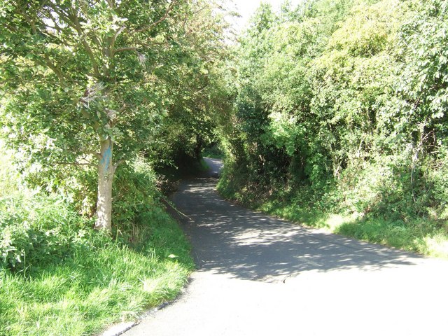
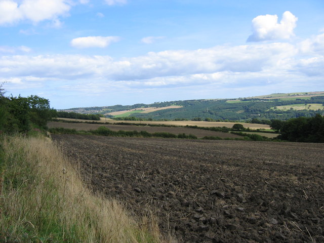
High Spen is surrounded by picturesque countryside, offering residents and visitors opportunities for outdoor activities and leisurely walks. The village is known for its scenic landscapes, with rolling hills and green fields in abundance.

Although relatively small, High Spen has a few amenities to cater to the needs of its residents. These include a primary school, a community center, and a local pub. The community center hosts various events and activities, serving as a hub for social gatherings and community engagement.

The village has a rich history, with evidence of human settlement dating back to the Roman era. Today, there are still remnants of its past, such as the nearby High Spen Colliery, which was once a thriving coal mining site.

Overall, High Spen is a charming village with a strong sense of community and a peaceful countryside setting. It offers a tranquil escape from the nearby urban centers while providing essential amenities for its residents.

If you have any feedback on the listing, please let us know in the comments section below.
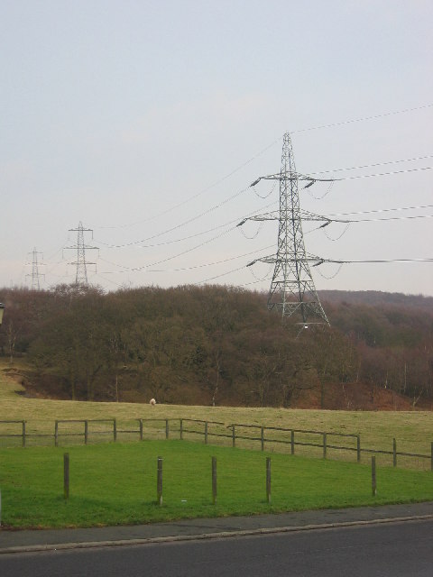
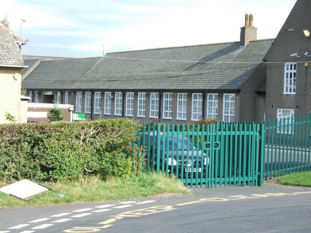
High Spen Images

Images are sourced within 2km of 54.931817/-1.789283 or Grid Reference NZ1359. Thanks to Geograph Open Source API. All images are credited.

The Bute Arms On the main road through High Spen in County Durham
The Bute Arms
On the main road through High Spen in County Durham
Spen Banks View across Spen Banks and pylons.  Road leads to Hookergate Comprehensive School and Spen Lane to the right and Hugar Road on the left.
Spen Banks
View across Spen Banks and pylons. Road leads to Hookergate Comprehensive School and Spen Lane to the right and Hugar Road on the left.
St John the Evangelist Church View of church on Clayton TCE Road just outside Chopwell.
St John the Evangelist Church
View of church on Clayton TCE Road just outside Chopwell.
Chopwell and Garesfield Railway (Disused)
'River Streets in the snow, Chopwell village' Called the River Streets because most of the streets are named after UK rivers.  Being an ex-mining village, these sturdy brick houses are mostly about 100 years old and are of different shapes and sizes.  The village sits next to Chopwell Wood, after which it was named, which is an ancient woodland.
'River Streets in the snow, Chopwell village'
Called the River Streets because most of the streets are named after UK rivers. Being an ex-mining village, these sturdy brick houses are mostly about 100 years old and are of different shapes and sizes. The village sits next to Chopwell Wood, after which it was named, which is an ancient woodland.
The Old Railway Line This is one of the first sights that I had when I visited Chopwell Woods with my dog.  The path is very black from the old coal deposits.  If you followed this path you would pass the old railway truck, go under a very old bridge then eventually come to the golf course and then on to High Spen.
The Old Railway Line
This is one of the first sights that I had when I visited Chopwell Woods with my dog. The path is very black from the old coal deposits. If you followed this path you would pass the old railway truck, go under a very old bridge then eventually come to the golf course and then on to High Spen.
Winter in Chopwell Woods A sun filled winter day in the woods
Winter in Chopwell Woods
A sun filled winter day in the woods
Building near Horse Gate Farm This concrete building looks as if it dates from WW2. Purpose unknown.
Building near Horse Gate Farm
This concrete building looks as if it dates from WW2. Purpose unknown.
Garesfield Golf Club The course dates back to 1922 and is dramatically situated high above the Derwent valley. <span class="nowrap"><a title="http://www.garesfieldgolf.com/" rel="nofollow ugc noopener" href="http://www.garesfieldgolf.com/">Link</a><img style="margin-left:2px;" alt="External link" title="External link - shift click to open in new window" src="https://s1.geograph.org.uk/img/external.png" width="10" height="10"/></span>
Garesfield Golf Club
The course dates back to 1922 and is dramatically situated high above the Derwent valley. LinkExternal link
Horse Gate Farm
Horse Gate Farm
Field up to Spen Banks
Hookergate School Ex Grammar School - now a Comprehensive
Hookergate School
Ex Grammar School - now a Comprehensive
Spen Lane  High Spen
Spen Lane High Spen
Victoria Garesfield A typical North East Pit Village
Victoria Garesfield
A typical North East Pit Village
Freshly Ploughed Field Taken from the footpath which runs along the site of a disused railway. The dark foliage on the right of the picture is the edge of Spen Banks woodland.
Freshly Ploughed Field
Taken from the footpath which runs along the site of a disused railway. The dark foliage on the right of the picture is the edge of Spen Banks woodland.
Wood ant nest.Chopwell Wood
Edge of the forest A path leads out from a bend on the forest road in Chopwell Wood to the edge of the forest.
Edge of the forest
A path leads out from a bend on the forest road in Chopwell Wood to the edge of the forest.
Show me another place!

High Spen is located at Grid Ref: NZ1359 (Lat: 54.931817, Lng: -1.789283)

Unitary Authority: Gateshead

Police Authority: Northumbria

What 3 Words

///landed.emulated.instead. Near Chopwell, Tyne & Wear

Related Wikis

High Spen

High Spen is an old mining village in the Metropolitan Borough of Gateshead, historically part of County Durham. There is an entrance to Chopwell Wood...

Hookergate School

Hookergate School was a secondary school and sixth form located in High Spen in the Metropolitan Borough of Gateshead, England. Originally founded as Hookergate...

Chopwell

Chopwell is a village in the Gateshead district, in the county of Tyne and Wear, England, 3 miles (4.8 km) west of Rowlands Gill and 1 mile (1.6 km) north...

Chopwell Colliery

Chopwell Colliery was a coal mine situated at Chopwell, in Gateshead, Tyne and Wear. The pit was first sunk in 1781, and was closed on 25 November 1966...

Nearby Amenities

Located within 500m of 54.931817,-1.789283
Turning Circle
Source: Bing 2010 GeoEye
Lat/Long: 54.9307955/-1.7821001
Pub
The Bute Arms
Addr City: Rowlands Gill
Addr Locality: High Spen
Addr Postcode: NE39 2BD
Addr Street: Hookergate Lane
Fhrs Id: 339220
Source Addr: FHRS Open Data
Lat/Long: 54.9311926/-1.7836548
Turning Circle
Source: Bing 2010 GeoEye
Lat/Long: 54.9306196/-1.7865414
High Spen
Place: village
Wikidata: Q5757082
Lat/Long: 54.9328143/-1.7829673
Historic: mine
Mineral: coal
Source: NPE
Lat/Long: 54.9325753/-1.7840081
Bus Stop
HIGH SPEN PRIMARY SCHOOL
Local Ref: S
Naptan AtcoCode: 410000000094
Naptan Bearing: S
Naptan CommonName: HIGH SPEN PRIMARY SCHOOL
Naptan Indicator: S
Naptan Landmark: HIGH SPEN PRIMARY SCHOOL
Naptan NaptanCode: twrgpwg
Naptan Street: BUTE ROAD NORTH
Naptan Verified: no
Source: naptan_import
Lat/Long: 54.9300083/-1.7847998
Bus Stop
COLLINGDON ROAD-POST OFFICE-S/B
Local Ref: S
Naptan AtcoCode: 410000019001
Naptan Bearing: S
Naptan CommonName: COLLINGDON ROAD-POST OFFICE-S/B
Naptan Indicator: S
Naptan Landmark: OPPOSITE POST OFFICE
Naptan NaptanCode: twrdpajp
Naptan Street: COLLINGDON ROAD
Naptan Verified: no
Source: naptan_import
Lat/Long: 54.9333015/-1.7820666
Bus Stop
HIGH SPEN
Local Ref: S
Naptan AtcoCode: 410000019002
Naptan Bearing: S
Naptan CommonName: HIGH SPEN
Naptan Indicator: S
Naptan Landmark: OPPOSITE WISHART TERRACE
Naptan NaptanCode: twrdpajt
Naptan Street: COLLINGDON ROAD
Naptan Verified: no
Source: naptan_import
Lat/Long: 54.9314427/-1.782857
Bus Stop
HIGH SPEN
Local Ref: N
Naptan AtcoCode: 410000019011
Naptan Bearing: N
Naptan CommonName: HIGH SPEN
Naptan Indicator: N
Naptan Landmark: OUTSIDE JOHNSON TERRACE
Naptan NaptanCode: twrdpapa
Naptan Street: HOOKERGATE LANE
Naptan Verified: no
Source: naptan_import
Lat/Long: 54.930384/-1.7838458
Bus Stop
GLOSSOP STREET-EAST STREET
Bus: yes
Local Ref: N
Naptan AtcoCode: 410000019013
Naptan Bearing: N
Naptan CommonName: GLOSSOP STREET-EAST STREET
Naptan Indicator: N
Naptan Landmark: OUTSIDE CHURCH
Naptan NaptanCode: twrdpapg
Naptan Street: GLOSSOP STREET
Naptan Verified: no
Public Transport: platform
Shelter: no
Source: naptan_import
Lat/Long: 54.9340559/-1.7868852
Bus Stop
CLAYTON TERRACE ROAD-TOWNLEY TERRACE-W/B
Local Ref: W
Naptan AtcoCode: 410000019014
Naptan Bearing: W
Naptan CommonName: CLAYTON TERRACE ROAD-TOWNLEY TERRACE-W/B
Naptan Indicator: W
Naptan Landmark: OPPOSITE NO.25 TOWNELEY TERRACE
Naptan NaptanCode: twrdpapj
Naptan Street: TOWNELEY TERRACE
Naptan Verified: no
Source: naptan_import
Lat/Long: 54.9340963/-1.7947197
Bus Stop
CLAYTON TERRACE ROAD-TOWNLEY TERRACE-E/B
Local Ref: E
Naptan AtcoCode: 410000019029
Naptan Bearing: E
Naptan CommonName: CLAYTON TERRACE ROAD-TOWNLEY TERRACE-E/B
Naptan Indicator: E
Naptan Landmark: OUTSIDE NO.18 TOWNELEY TERRACE
Naptan NaptanCode: twrdpawm
Naptan Street: CLAYTON TERRACE ROAD
Naptan Verified: no
Source: Bing 2010 GeoEye
Lat/Long: 54.9341404/-1.7941732
Bus Stop
GLOSSOP STREET-HOWARD TERRACE-S/B
Bench: no
Bin: no
Bus: yes
Local Ref: S
Naptan AtcoCode: 410000019030
Naptan Bearing: S
Naptan CommonName: GLOSSOP STREET-HOWARD TERRACE-S/B
Naptan Indicator: S
Naptan Landmark: OUTSIDE HOWARD STREET
Naptan NaptanCode: twrdpawp
Naptan Street: GLOSSOP STREET
Naptan Verified: no
Public Transport: platform
Shelter: no
Source: naptan_import
Lat/Long: 54.9337039/-1.7860286
Bus Stop
High Spen
Bench: yes
Bin: yes
Bus: yes
Departures Board: timetable
Local Ref: S
Naptan AtcoCode: 410000019031
Naptan Bearing: S
Naptan CommonName: HIGH SPEN
Naptan Indicator: S
Naptan Landmark: OPPOSITE THE GRANARIES
Naptan NaptanCode: twrdpawt
Naptan Street: GLOSSOP STREET
Naptan Verified: no
Public Transport: platform
Shelter: yes
Source: naptan_import
Lat/Long: 54.9316793/-1.7835953
Bus Stop
GLOSSOP STREET-ROSEVIEW COTTAGE
Local Ref: S
Naptan AtcoCode: 410000019900
Naptan Bearing: S
Naptan CommonName: GLOSSOP STREET-ROSEVIEW COTTAGE
Naptan Indicator: S
Naptan Landmark: OUTSIDE RECREATION GROUND
Naptan NaptanCode: twrdpdam
Naptan Street: GLOSSOP STREET
Naptan Verified: no
Source: naptan_import
Lat/Long: 54.9323716/-1.7847404
Source: Bing 2010 GeoEye
Lat/Long: 54.9341136/-1.7929234
Source: Bing 2010 GeoEye
Lat/Long: 54.93412/-1.7930639
Source: Bing 2010 GeoEye
Lat/Long: 54.9341264/-1.7932045
Source: Bing 2010 GeoEye
Lat/Long: 54.9341329/-1.7933451
Source: Bing 2010 GeoEye
Lat/Long: 54.9341393/-1.7934857
Source: Bing 2010 GeoEye
Lat/Long: 54.9341457/-1.7936263
Source: Bing 2010 GeoEye
Lat/Long: 54.9341521/-1.7937668
Source: Bing 2010 GeoEye
Lat/Long: 54.9341585/-1.7939074
Source: Bing 2010 GeoEye
Lat/Long: 54.934165/-1.794048
Source: Bing 2010 GeoEye
Lat/Long: 54.9341714/-1.7941886
Source: Bing 2010 GeoEye
Lat/Long: 54.9341778/-1.7943291
Source: Bing 2010 GeoEye
Lat/Long: 54.9341914/-1.7929126
Source: Bing 2010 GeoEye
Lat/Long: 54.9341978/-1.7930532
Source: Bing 2010 GeoEye
Lat/Long: 54.9342042/-1.7931938
Source: Bing 2010 GeoEye
Lat/Long: 54.9342106/-1.7933343
Source: Bing 2010 GeoEye
Lat/Long: 54.934217/-1.7934749
Source: Bing 2010 GeoEye
Lat/Long: 54.9342235/-1.7936155
Source: Bing 2010 GeoEye
Lat/Long: 54.9342299/-1.7937561
Source: Bing 2010 GeoEye
Lat/Long: 54.9342363/-1.7938966
Source: Bing 2010 GeoEye
Lat/Long: 54.9342427/-1.7940372
Source: Bing 2010 GeoEye
Lat/Long: 54.9342492/-1.7941778
Source: Bing 2010 GeoEye
Lat/Long: 54.9342556/-1.7943184
Source: Bing 2010 GeoEye
Lat/Long: 54.9343447/-1.7928456
Source: Bing 2010 GeoEye
Lat/Long: 54.9343515/-1.7929982
Source: Bing 2010 GeoEye
Lat/Long: 54.9343584/-1.7931508
Source: Bing 2010 GeoEye
Lat/Long: 54.9343652/-1.7933034
Source: Bing 2010 GeoEye
Lat/Long: 54.934372/-1.793456
Source: Bing 2010 GeoEye
Lat/Long: 54.9343788/-1.7936086
Source: Bing 2010 GeoEye
Lat/Long: 54.9343857/-1.7937612
Source: Bing 2010 GeoEye
Lat/Long: 54.9343925/-1.7939138
Source: Bing 2010 GeoEye
Lat/Long: 54.9343993/-1.7940664
Source: Bing 2010 GeoEye
Lat/Long: 54.9344072/-1.7942196
Source: Bing 2010 GeoEye
Lat/Long: 54.9344119/-1.7928365
Source: Bing 2010 GeoEye
Lat/Long: 54.9344123/-1.7943167
Source: Bing 2010 GeoEye
Lat/Long: 54.9344187/-1.7929891
Source: Bing 2010 GeoEye
Lat/Long: 54.9344255/-1.7931417
Source: Bing 2010 GeoEye
Lat/Long: 54.9344306/-1.7943732
Source: Bing 2010 GeoEye
Lat/Long: 54.9344324/-1.7932943
Source: Bing 2010 GeoEye
Lat/Long: 54.9344365/-1.794515
Source: Bing 2010 GeoEye
Lat/Long: 54.9344392/-1.7934469
Source: Bing 2010 GeoEye
Lat/Long: 54.9344425/-1.7946569
Source: Bing 2010 GeoEye
Lat/Long: 54.934446/-1.7935995
Source: Bing 2010 GeoEye
Lat/Long: 54.9344484/-1.7947987
Source: Bing 2010 GeoEye
Lat/Long: 54.9344528/-1.7937521
Source: Bing 2010 GeoEye
Lat/Long: 54.9344543/-1.7949406
Source: Bing 2010 GeoEye
Lat/Long: 54.9344596/-1.7939047
Source: Bing 2010 GeoEye
Lat/Long: 54.9344602/-1.7950824
Source: Bing 2010 GeoEye
Lat/Long: 54.9344662/-1.7952243
Source: Bing 2010 GeoEye
Lat/Long: 54.9344665/-1.7940573
Source: Bing 2010 GeoEye
Lat/Long: 54.9344721/-1.7953661
Source: Bing 2010 GeoEye
Lat/Long: 54.9344741/-1.7942089
Source: Bing 2010 GeoEye
Lat/Long: 54.9344774/-1.7955083
Source: Bing 2010 GeoEye
Lat/Long: 54.9344793/-1.794306
Source: Bing 2010 GeoEye
Lat/Long: 54.9344797/-1.794367
Source: Bing 2010 GeoEye
Lat/Long: 54.9344856/-1.7945088
Source: Bing 2010 GeoEye
Lat/Long: 54.9344915/-1.7946507
Source: Bing 2010 GeoEye
Lat/Long: 54.9344975/-1.7947925
Source: Bing 2010 GeoEye
Lat/Long: 54.9345034/-1.7949344
Source: Bing 2010 GeoEye
Lat/Long: 54.9345093/-1.7950762
Source: Bing 2010 GeoEye
Lat/Long: 54.9345152/-1.7952181
Source: Bing 2010 GeoEye
Lat/Long: 54.9345212/-1.7953599
Source: Bing 2010 GeoEye
Lat/Long: 54.9345271/-1.7955015
Post Box
Ref: NE39 384
Lat/Long: 54.9341479/-1.7942537
Addr City: High Spen
Addr Housenumber: 12
Addr Street: Hookergate Lane
Lat/Long: 54.9293441/-1.7836993
Sunlea Store
Brand: Premier
Brand Wikidata: Q7240340
Shop: convenience
Lat/Long: 54.9306923/-1.7833336
Bus Stop
Clayton Terrace Road
Bus: yes
Departures Board: timetable
Public Transport: platform
Lat/Long: 54.9341038/-1.7925755
Stop
Direction: forward
Stop: minor
Lat/Long: 54.9313322/-1.7831055
The data included in this document is from www.openstreetmap.org. The data is made available under ODbL.

Have you been to High Spen?

Leave your review of High Spen below (or comments, questions and feedback).