Tòrr Beag

Hill, Mountain in Buteshire

Scotland

Tòrr Beag

Glenree Mill Buildings alongside Sliddery Water.
Glenree Mill Credit: James Allan

Tòrr Beag, located in Buteshire, is a stunning hill/mountain renowned for its natural beauty and captivating landscapes. Standing at an elevation of approximately 451 meters (1,480 feet), it offers breathtaking views of the surrounding area, making it a popular destination for hikers, nature enthusiasts, and photographers.

The hill/mountain is characterized by its rugged terrain, with steep slopes covered in lush greenery, rocky outcrops, and occasional patches of heather. As visitors ascend, they are greeted with panoramic vistas that encompass rolling hills, shimmering lochs, and the vast expanse of the surrounding countryside.

Tòrr Beag is home to a rich and diverse ecosystem, supporting a variety of flora and fauna. Its slopes are adorned with a tapestry of wildflowers, including bluebells, primroses, and orchids, adding vibrant colors to the landscape. The hill/mountain also provides a habitat for various bird species, such as golden eagles, peregrine falcons, and red grouse, making it a haven for birdwatchers.

During the summer months, Tòrr Beag attracts many outdoor enthusiasts who come to explore its numerous walking trails and hiking routes. These trails cater to different levels of difficulty, ensuring that both seasoned hikers and casual walkers can enjoy the natural wonders it has to offer.

Whether one seeks solitude, adventure, or simply a chance to immerse oneself in the serenity of nature, Tòrr Beag in Buteshire provides an idyllic setting that never fails to captivate visitors with its majestic beauty and awe-inspiring vistas.

If you have any feedback on the listing, please let us know in the comments section below.

Tòrr Beag Images

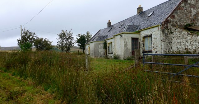
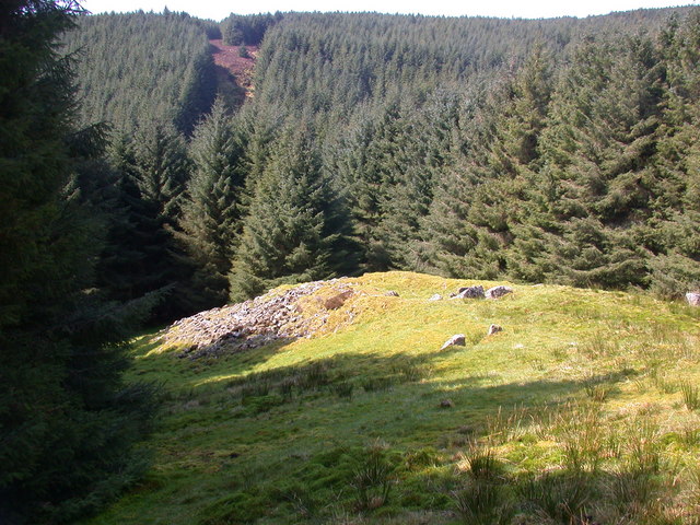
Images are sourced within 2km of 55.479401/-5.2328069 or Grid Reference NR9525. Thanks to Geograph Open Source API. All images are credited.

Glenree Mill Buildings alongside Sliddery Water.
Glenree Mill
Buildings alongside Sliddery Water.
Burrican Hill Moorland hills.
Burrican Hill
Moorland hills.
Old Milestone in Kilmory Parish, below Burican Hill, Isle of Arran Arran by the UC road, in parish of Kilmory (Arran District), on roadside bank behind ditch, 1½m from road nearly always overgrown by sedge and rushes.

Inscription reads:-
12
(To Brodick Old Quay) 

Surveyed

Milestone Society National ID: AYN_ARRR12
Old Milestone in Kilmory Parish, below Burican Hill, Isle of Arran
Arran by the UC road, in parish of Kilmory (Arran District), on roadside bank behind ditch, 1½m from road nearly always overgrown by sedge and rushes. Inscription reads:- 12 (To Brodick Old Quay) Surveyed Milestone Society National ID: AYN_ARRR12
Old Milestone near Glenree, Kilmory parish, Arran Arran by the UC road, in parish of Kilmory (Arran District), about half way down the hill, in bank behind shallow ditch.

Inscription once read:-
13
(To Brodick Old Quay)

Surveyed

Milestone Society National ID: AYN_ARRR13
Old Milestone near Glenree, Kilmory parish, Arran
Arran by the UC road, in parish of Kilmory (Arran District), about half way down the hill, in bank behind shallow ditch. Inscription once read:- 13 (To Brodick Old Quay) Surveyed Milestone Society National ID: AYN_ARRR13
Development opportunity at Glenree This derelict cottage stands beside the Ross Road.
Development opportunity at Glenree
This derelict cottage stands beside the Ross Road.
Cottage at Glenree Mill
Old milestone The 12 miles from Brodick stone on The Ross with the number regularly painted black.  It is on a banking behind a ditch.
Old milestone
The 12 miles from Brodick stone on The Ross with the number regularly painted black. It is on a banking behind a ditch.
The Ross. One of Arrans cross country roads, this one leading to Lamlash.
The Ross.
One of Arrans cross country roads, this one leading to Lamlash.
Quarry near Bennecarrigan
The track to Glenree
Looking down on the Sliddery Water I always think 'Sliddery' sounds a bit like a location for Harry Potter!
Looking down on the Sliddery Water
I always think 'Sliddery' sounds a bit like a location for Harry Potter!
Overgrown forest track near Teanga Fhraoich North of the Allt Mor Cloined this forest track has not been in use in recent years.
Overgrown forest track near Teanga Fhraoich
North of the Allt Mor Cloined this forest track has not been in use in recent years.
Firebreak beyond the end of the forest track at Teanga Fhraoich
View from The Ross, near Glenree To the centre-left, the comparative lushness of the trees marks the course of Sliddery Water.
View from The Ross, near Glenree
To the centre-left, the comparative lushness of the trees marks the course of Sliddery Water.
Buildings at Glenree Glenree Cottage and ruined Glenree Mill, sitting either side of the Sliddery Water.
Buildings at Glenree
Glenree Cottage and ruined Glenree Mill, sitting either side of the Sliddery Water.
Leacamor
Leacamor
High Clauchog
High Clauchog
High Clauchog
High Clauchog
Show me another place!

Tòrr Beag is located at Grid Ref: NR9525 (Lat: 55.479401, Lng: -5.2328069)

Unitary Authority: North Ayrshire

Police Authority: Ayrshire

What 3 Words

///disbelief.speech.curvy. Near Blackwaterfoot, North Ayrshire

Nearby Locations

Tòrr Beag

Related Wikis

Carn Ban, Arran

Carn Ban is a Neolithic chambered tomb located on the Isle of Arran in Scotland (grid reference NR99102618). == Description == Carn Ban is situated in...

Kilmory, Arran

Kilmory (Scottish Gaelic: Cill Mhoire) is a small village on the south coast of the Isle of Arran, located on the coastal road between Lagg and Kildonan...

Sliddery

Sliddery (Gaelic: Slaodraidh) is a tiny hamlet located on the Southwest coast of the Isle of Arran in Scotland. The village is situated near the Ross road...

Bennecarrigan Free Church

The Bennecarrigan Free Church is a place of worship of the Free Church of Scotland in Kilmory, on the island of Arran, Scotland. The church was built...

Nearby Amenities

Located within 500m of 55.479401,-5.2328069
Torr Beag
Ele: 240
Natural: peak
Lat/Long: 55.4787818/-5.2328853
The data included in this document is from www.openstreetmap.org. The data is made available under ODbL.

Have you been to Tòrr Beag?

Leave your review of Tòrr Beag below (or comments, questions and feedback).