Sgùrr na Sgine

Hill, Mountain in Inverness-shire

Scotland

Sgùrr na Sgine

Coire Reidh: a quiet valley
Coire Reidh: a quiet valley Credit: Ibn Musa

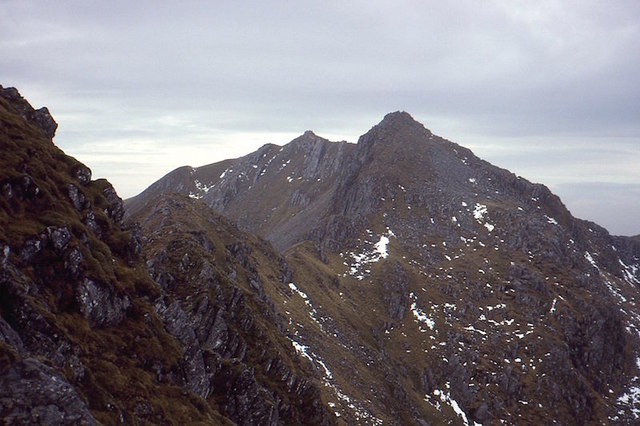
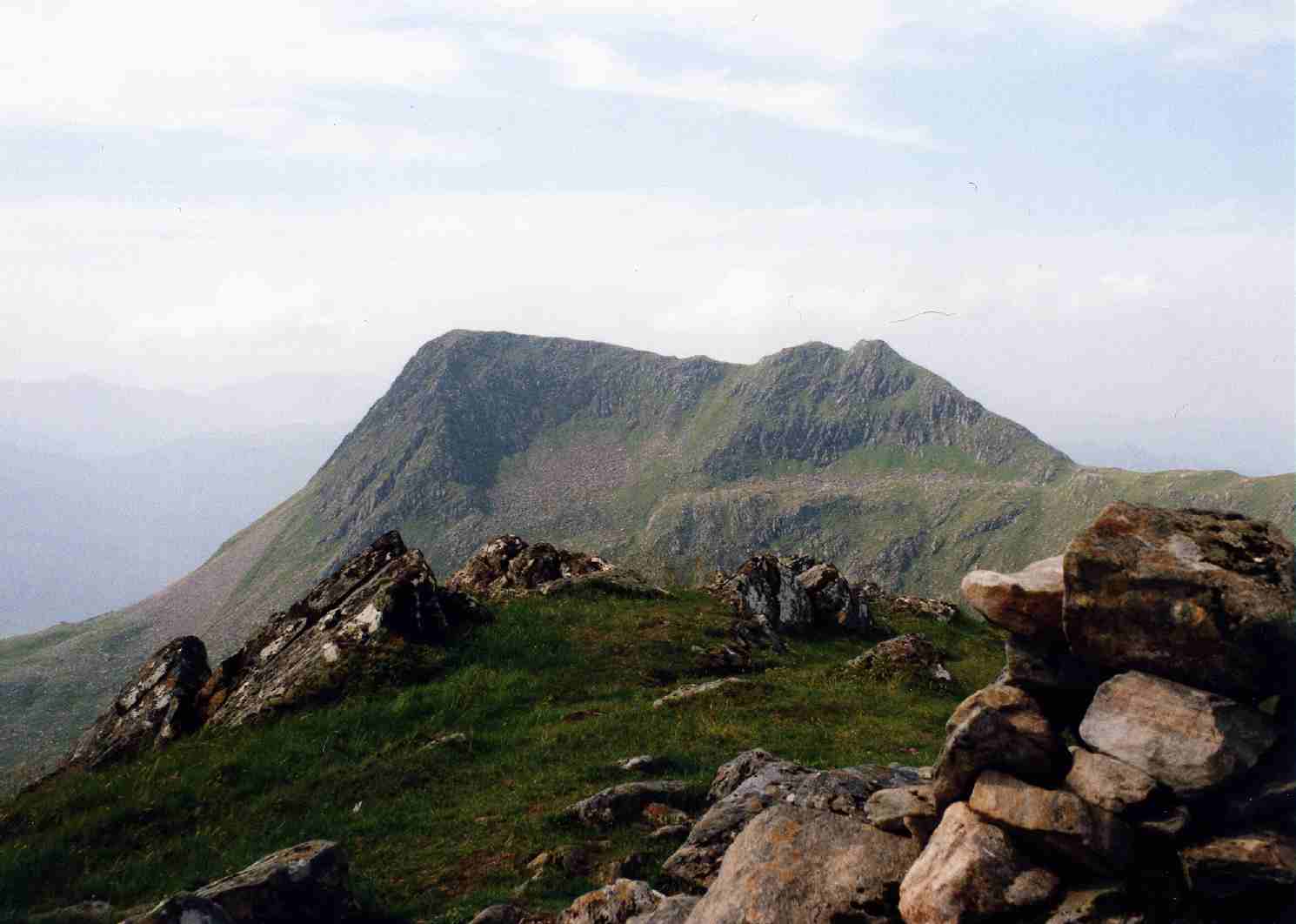
Sgùrr na Sgine is a prominent mountain located in Inverness-shire, Scotland. With a height of 946 meters (3,104 feet), it is part of the Kintail range in the Scottish Highlands. The mountain is situated near the popular Glen Shiel and offers breathtaking views of the surrounding landscape.

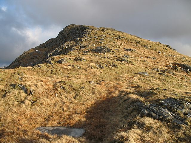
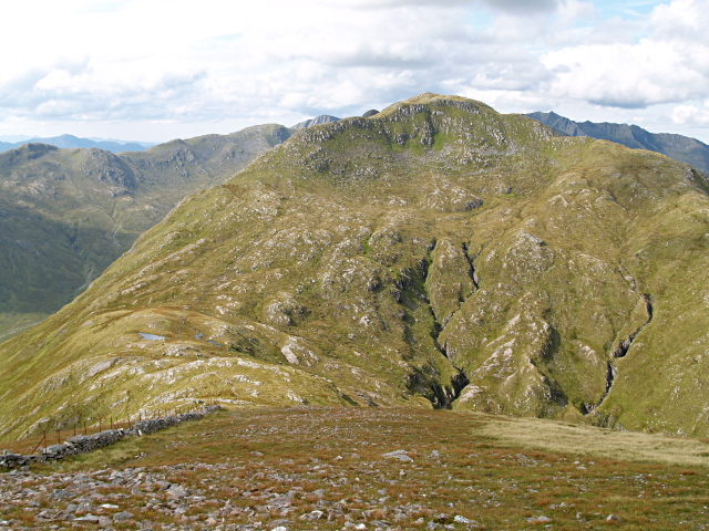
Sgùrr na Sgine is a rugged and rocky peak, characteristic of the Scottish mountains. It features a distinctive pointed summit and steep slopes, making it a challenging climb for experienced hikers and mountaineers. The mountain is known for its breathtaking views, particularly from the summit, where one can enjoy panoramic vistas of the surrounding peaks, lochs, and glens.

The ascent of Sgùrr na Sgine typically starts from the north side of the mountain, near Alltbeithe Youth Hostel. From there, hikers follow a well-defined path that gradually gains elevation. The route involves some scrambling and requires a good level of fitness and navigational skills.

Aside from its natural beauty, Sgùrr na Sgine also holds historical significance. It played a role in the Jacobite uprising of 1719, serving as a hiding place for Jacobite soldiers during the Battle of Glenshiel. Today, remnants of this historical event can still be found in the form of ruined structures and military remains scattered across the mountain.

Overall, Sgùrr na Sgine is a captivating mountain that offers a challenging and rewarding experience for outdoor enthusiasts, while also providing a glimpse into Scotland's rich history and stunning natural landscape.

If you have any feedback on the listing, please let us know in the comments section below.

Sgùrr na Sgine Images

Images are sourced within 2km of 57.147121/-5.3966505 or Grid Reference NG9411. Thanks to Geograph Open Source API. All images are credited.

Coire Reidh: a quiet valley
Tributary of the Allt Coire Mhàlagain Taken while walking the Cape Wrath Trail.
Tributary of the Allt Coire Mhàlagain
Taken while walking the Cape Wrath Trail.
Forcan Ridge The narrow ridge, with one tricky down climb section is a popular route up The Saddle. It is one of the best ridges in mainland Scotland.
Forcan Ridge
The narrow ridge, with one tricky down climb section is a popular route up The Saddle. It is one of the best ridges in mainland Scotland.
The Saddle The very famous ridge from Sgùrr na Forcan over the two summits of The Saddle above Glen Shiel.
The Saddle
The very famous ridge from Sgùrr na Forcan over the two summits of The Saddle above Glen Shiel.
Sgùrr na Forcan The narrow Forcan Ridge on The Saddle.
Sgùrr na Forcan
The narrow Forcan Ridge on The Saddle.
Below the Forcan Ridge Descending steep but easy slopes to Bealach Coire Mhàlagain, the Sgùrr na Sgine/Saddle col.  The narrow Forcan Ridge shows up well from here.
Below the Forcan Ridge
Descending steep but easy slopes to Bealach Coire Mhàlagain, the Sgùrr na Sgine/Saddle col. The narrow Forcan Ridge shows up well from here.
Bealach Coire Mhàlagain The col between The Saddle and Sgùrr na Sgine.
Bealach Coire Mhàlagain
The col between The Saddle and Sgùrr na Sgine.
Approaching the Forcan Ridge On the way to this fine ridge route to The Saddle (1010m) in Glen Shiel.
Approaching the Forcan Ridge
On the way to this fine ridge route to The Saddle (1010m) in Glen Shiel.
Scrambling on the Forcan Ridge, Glen Shiel A good summer's day for this exhilarating route to The Saddle.
Scrambling on the Forcan Ridge, Glen Shiel
A good summer's day for this exhilarating route to The Saddle.
Old wall below The Saddle Running down the boulder field and around into Coire Mhàlagain.
Old wall below The Saddle
Running down the boulder field and around into Coire Mhàlagain.
Lochan on Bealach Coire Mhàlagain The Forcan Ridge on the left hand background.
Lochan on Bealach Coire Mhàlagain
The Forcan Ridge on the left hand background.
Summit of Sgurr na Sgine A 946m Munro summit south of Glen Shiel.
Summit of Sgurr na Sgine
A 946m Munro summit south of Glen Shiel.
The Faochag Ridge Easy high level walking out to the 909m summit of Faochag. The descent from it down to Glen Shiel is another matter...
The Faochag Ridge
Easy high level walking out to the 909m summit of Faochag. The descent from it down to Glen Shiel is another matter...
Sgurr na Forcan The eastern end of the Forcan Ridge route to The Saddle.
Sgurr na Forcan
The eastern end of the Forcan Ridge route to The Saddle.
Summit of Faochag A small cairn marks the 909m high point.
Summit of Faochag
A small cairn marks the 909m high point.
Descending from Bealach Coire Mhàlagain
Crossing point on the Allt Coire Toiteil Faochag rising on the right, and the top of Sgùrr na Sgine visible straight ahead.
Crossing point on the Allt Coire Toiteil
Faochag rising on the right, and the top of Sgùrr na Sgine visible straight ahead.
Pinnacles on the Forcan Ridge The Forcan Ridge is an entertaining scramble on excellent rock. Looking down to Meallan Odhar and Glen Shiel (both on left).
Pinnacles on the Forcan Ridge
The Forcan Ridge is an entertaining scramble on excellent rock. Looking down to Meallan Odhar and Glen Shiel (both on left).
Show me another place!

Sgùrr na Sgine is located at Grid Ref: NG9411 (Lat: 57.147121, Lng: -5.3966505)

Unitary Authority: Highland

Police Authority: Highlands and Islands

What 3 Words

///flanks.clouding.wins. Near Glenelg, Highland

Nearby Locations

Coire Dubh Sgùrr na Sgine

Related Wikis

Sgùrr na Sgine

Sgùrr na Sgine (Scottish Gaelic for 'knife peak') is a mountain in the Northwest Highlands of Scotland. Its height is 946 metres (3,104 ft), making it...

The Saddle

The Saddle (Scottish Gaelic: An Dìollaid) is one of the great Scottish mountains; seen from the site of the Battle of Glen Shiel it forms (with Faochag...

Buidhe Bheinn

Buidhe Bheinn (886 m) is a mountain in the Northwest Highlands of Scotland. It lies between Glen Shiel and Loch Hourn. A rugged mountain, it can either...

Creag nan Damh

Creag nan Damh (Scottish Gaelic for 'rocky hill of the stag') is a mountain with a height of 918 metres (3,012 ft) in the Northwest Highlands of Scotland...

Nearby Amenities

Located within 500m of 57.147121,-5.3966505
Sgùrr na Sgine
Description: Peak of the knife
Ele: 946
Marilyn: yes
Munro: yes
Munro Number: M223
Natural: peak
Prominence: 247
Source: survey
Wikidata: Q7459821
Wikipedia: en:Sgùrr na Sgine
Lat/Long: 57.1471139/-5.3966556
The data included in this document is from www.openstreetmap.org. The data is made available under ODbL.

Have you been to Sgùrr na Sgine?

Leave your review of Sgùrr na Sgine below (or comments, questions and feedback).