Dùn Alva

Hill, Mountain in Argyllshire

Scotland

Dùn Alva

Old footbridge over River Add Old estate bridge thought to predate local forestry roads.
Old footbridge over River Add Credit: Richard Caulfield

Dùn Alva is a hill located in Argyllshire, Scotland. It stands at a height of 198 meters (650 feet) above sea level and offers panoramic views of the surrounding countryside and Loch Fyne. The hill is a popular destination for hikers and outdoor enthusiasts due to its relatively easy ascent and stunning vistas.

Dùn Alva is characterized by its rugged terrain, with rocky outcrops and heather-covered slopes. The summit is marked by a cairn, which serves as a focal point for those reaching the top. The hill is part of a network of walking trails in the area, making it easily accessible to visitors of all skill levels.

In addition to its natural beauty, Dùn Alva also has historical significance. It is believed to have been used as a defensive site by ancient peoples, with remnants of an Iron Age hill fort still visible on its slopes. This adds an extra layer of interest for those exploring the hill and its surroundings.

Overall, Dùn Alva is a must-visit destination for anyone looking to experience the beauty and history of the Argyllshire region.

If you have any feedback on the listing, please let us know in the comments section below.

Dùn Alva Images

Images are sourced within 2km of 56.113281/-5.3598411 or Grid Reference NR9196. Thanks to Geograph Open Source API. All images are credited.

Old footbridge over River Add Old estate bridge thought to predate local forestry roads.
Old footbridge over River Add
Old estate bridge thought to predate local forestry roads.
In Kilmichael Forest
Entrance to A' Cruach wind farm This is a 21-turbine installation north of Loch Glashan in Kilmichael Forest.
Entrance to A' Cruach wind farm
This is a 21-turbine installation north of Loch Glashan in Kilmichael Forest.
Electricity transmission tower under construction This tower is part of the upgraded Inverarary-Crossaig transmission line.
Electricity transmission tower under construction
This tower is part of the upgraded Inverarary-Crossaig transmission line.
Electricity transmission towers under construction Part of the upgraded Inveraray-Crossaig transmission line.
Electricity transmission towers under construction
Part of the upgraded Inveraray-Crossaig transmission line.
Boggy area in Kilmichael Forest Close by the River Add.
Boggy area in Kilmichael Forest
Close by the River Add.
Forestry road in Kilmichael Forest The new pylons are for the upgraded Inveraray-Crossaig transmission line.
Forestry road in Kilmichael Forest
The new pylons are for the upgraded Inveraray-Crossaig transmission line.
Abhainn Bheag an Tunns This burn is a tributary of the River Add.
A partly-built pylon on the right is part of the upgraded Inveraray - Crossaig transmission line which is currently under construction.
Abhainn Bheag an Tunns
This burn is a tributary of the River Add. A partly-built pylon on the right is part of the upgraded Inveraray - Crossaig transmission line which is currently under construction.
Forestry road in Kilmichael Forest The gorse bushes in full bloom.
Forestry road in Kilmichael Forest
The gorse bushes in full bloom.
Forestry track in Kilmichael Forest
Boggy pool in Kilmichael Forest
Ruins at Tunns Ruins of a pre-improvement settlement, now in Kilmichael Forest.
Ruins at Tunns
Ruins of a pre-improvement settlement, now in Kilmichael Forest.
Ruins at Tunns Ruins of a pre-improvement settlement, now in Kilmichael Forest.
The new transmission line from Inveraray to Crossaig passes very close by.
Ruins at Tunns
Ruins of a pre-improvement settlement, now in Kilmichael Forest. The new transmission line from Inveraray to Crossaig passes very close by.
Ruins at Auchlech The ruins of a pre-improvement settlement in Kilmichael Forest. The turbines of the A'Cruach wind farm can be seen through the mist.
I was last here - just about on the same spot - 14 years ago. <a href="https://www.geograph.org.uk/photo/341373">NR9296 : Auchlech</a>
Ruins at Auchlech
The ruins of a pre-improvement settlement in Kilmichael Forest. The turbines of the A'Cruach wind farm can be seen through the mist. I was last here - just about on the same spot - 14 years ago. NR9296 : Auchlech
Forest road in Kilmichael Forest Some of the turbines of the A'Cruach wind farm can be seen through the mist and rain.
Forest road in Kilmichael Forest
Some of the turbines of the A'Cruach wind farm can be seen through the mist and rain.
Forest road in Kilmichael Forest
Heading out of Kilmichael Forest Onto open moorland above Barrachuile.
Heading out of Kilmichael Forest
Onto open moorland above Barrachuile.
Show me another place!

Dùn Alva is located at Grid Ref: NR9196 (Lat: 56.113281, Lng: -5.3598411)

Unitary Authority: Argyll and Bute

Police Authority: Argyll and West Dunbartonshire

What 3 Words

///blurts.gurgling.thrusters. Near Lochgilphead, Argyll & Bute

Nearby Locations

Dùn Alva

Related Wikis

Blackmill Loch

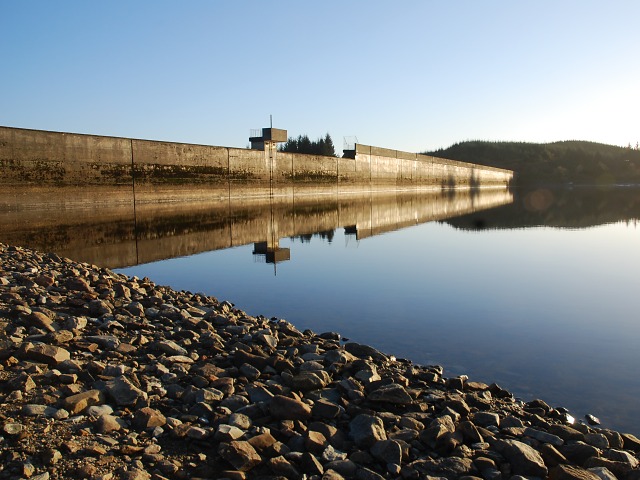
Blackmill Loch is an impounding reservoir, in Argyll and Bute, Scotland. The loch was constructed in 1964 and is one source of freshwater for the Lochgair...

Feorlin

Feorlin is an impounding reservoir located 2 kilometres west of Minard. The loch is part of the Lochgair Hydroelectric Scheme. The rockfill dam is 4.19...

Aray Bridge

Aray Bridge, also known as Inveraray Bridge, is a stone two-arch public road bridge on the Inveraray Castle estate near Inveraray in Argyll and Bute, Scotland...

Loch Gair Hydro-Electric Scheme

Loch Gair Hydro-Electric Scheme is a small-scale hydro-electric power station, built by the North of Scotland Hydro-Electric Board and commissioned in...

Have you been to Dùn Alva?

Leave your review of Dùn Alva below (or comments, questions and feedback).