Meall nan Eun
Hill, Mountain in Inverness-shire
Scotland
Meall nan Eun

Meall nan Eun is a prominent hill located in Inverness-shire, Scotland. It stands at an elevation of 928 meters (3,045 feet) above sea level and is part of the Grampian Mountains range. The hill is situated approximately 15 kilometers southeast of the town of Fort William and is easily accessible by both experienced hikers and mountaineers.
The name "Meall nan Eun" translates to "Hill of the Birds" in Gaelic, which is fitting considering the rich birdlife found in the area. The hill offers breathtaking panoramic views of the surrounding landscape, including Loch Linnhe to the west and the Nevis Range to the north.
The ascent of Meall nan Eun can be challenging, particularly during inclement weather conditions, as the hill is known for its steep and rocky terrain. However, it rewards climbers with stunning vistas and a sense of accomplishment upon reaching its summit.
The hill is a popular destination for outdoor enthusiasts, attracting both locals and tourists alike. It provides opportunities for hiking, mountaineering, birdwatching, and photography. The surrounding area is also home to a variety of wildlife, including red deer, golden eagles, and ptarmigans.
Meall nan Eun is best enjoyed during the summer months when the weather is more favorable and the days are longer. It is advisable to come prepared with appropriate clothing, footwear, and navigation equipment, as the hill can be challenging to navigate, especially for those unfamiliar with the area.
Overall, Meall nan Eun offers a rewarding and memorable experience for those seeking adventure and the opportunity to immerse themselves in the natural beauty of the Scottish Highlands.
If you have any feedback on the listing, please let us know in the comments section below.
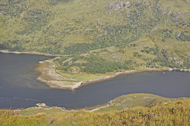
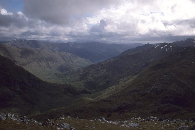
Meall nan Eun Images
Images are sourced within 2km of 57.090186/-5.4618158 or Grid Reference NG9005. Thanks to Geograph Open Source API. All images are credited.


Meall nan Eun is located at Grid Ref: NG9005 (Lat: 57.090186, Lng: -5.4618158)
Unitary Authority: Highland
Police Authority: Highlands and Islands
What 3 Words
///weeds.depths.nylon. Near Glenelg, Highland
Nearby Locations
Related Wikis

Sgùrr nan Eugallt
Sgùrr nan Eugallt is the highest of a well defined group of mountains that lie south of Loch Hourn, stretching from Barrisdale to Loch Quoich. Although...

Druim Fada (Loch Hourn)
Druim Fada (711 m) is a mountain in the Northwest Highlands of Scotland. Located on the northern shore of Loch Hourn in Ross and Cromarty. A long, craggy...

Sgùrr a' Choire-bheithe
Sgùrr a' Choire-bleithe is a 913-m mountain in the remote Knoydart area of Lochaber, Northwest Highlands, Scotland. It is one of highest Corbetts at 913...

Kinloch Hourn
Kinloch Hourn is a small settlement at the end of Loch Hourn, in the West Highlands of Scotland. The name comes from the Gaelic, Ceann Loch Shubhairne...
Have you been to Meall nan Eun?
Leave your review of Meall nan Eun below (or comments, questions and feedback).