A' Chruach

Hill, Mountain in Argyllshire

Scotland

A' Chruach

Kilneuair - Auchindrain Drove Road For more info. see <span class="nowrap"><a title="https://canmore.org.uk/site/361895" rel="nofollow ugc noopener" href="https://canmore.org.uk/site/361895">Link</a><img style="margin-left:2px;" alt="External link" title="External link - shift click to open in new window" src="https://s1.geograph.org.uk/img/external.png" width="10" height="10"/></span>
Kilneuair - Auchindrain Drove Road Credit: Mick Garratt

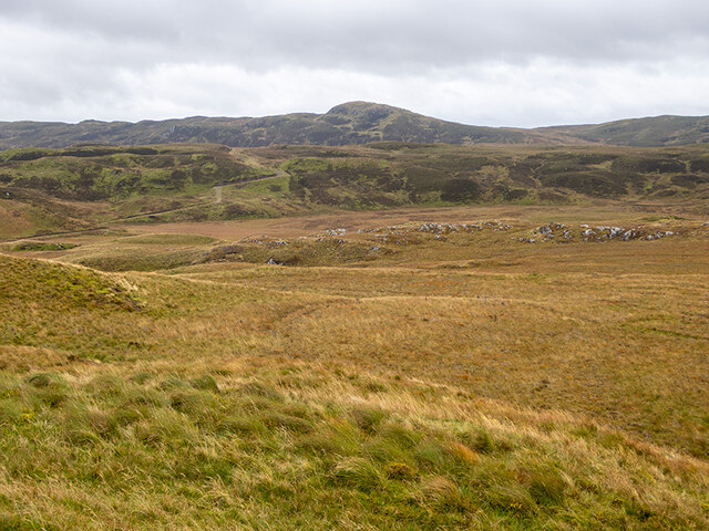
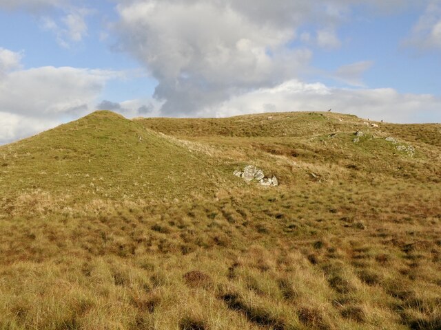
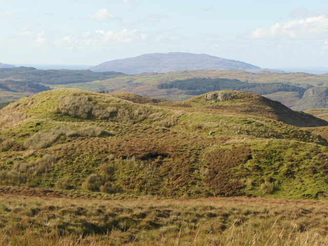
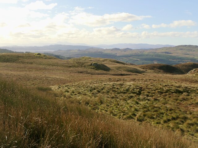
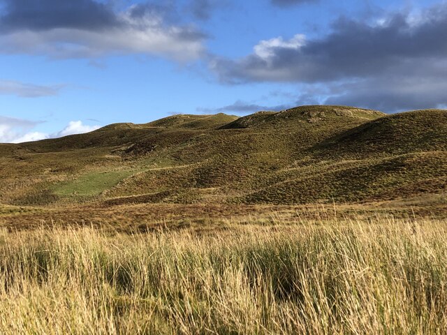
A' Chruach, located in Argyllshire, Scotland, is a prominent hill or mountain that stands tall and majestic. Rising to an impressive height of approximately 415 meters (1,361 feet), it offers stunning panoramic views of the surrounding landscape.

Situated in the western part of Argyllshire, A' Chruach is part of the Highland Boundary Fault, a geological feature that separates the lowlands of Scotland from the Highlands. This fault line has played a significant role in sculpting the diverse landscape of the region.

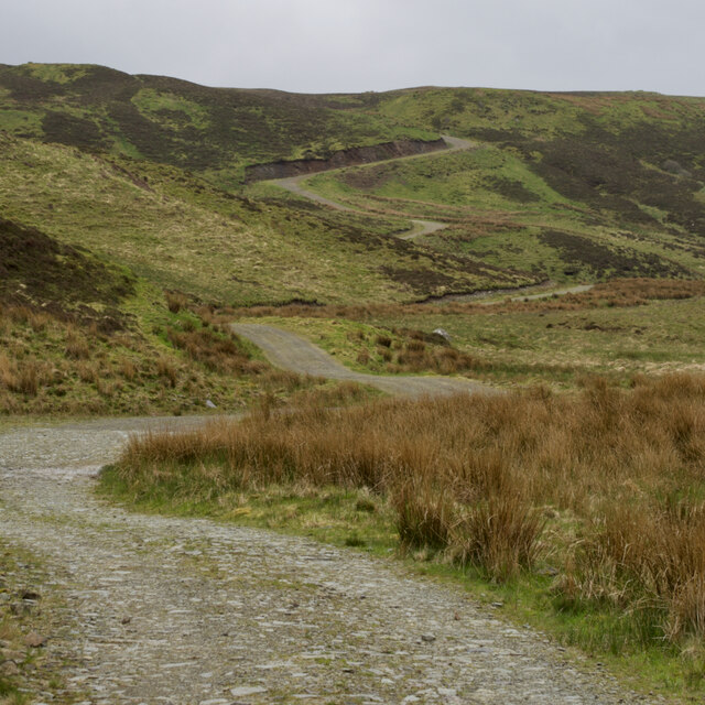
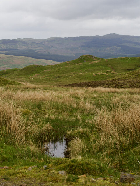
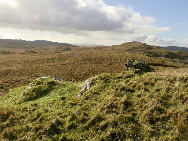
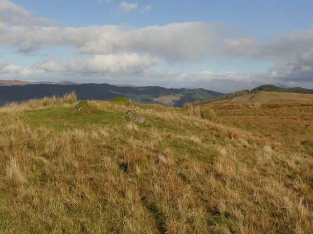
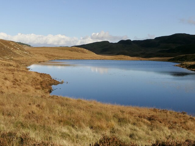
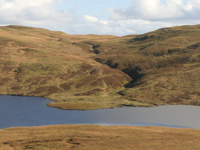
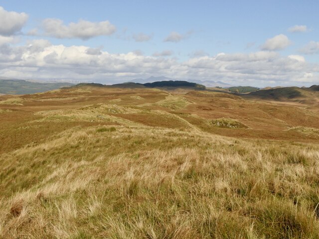
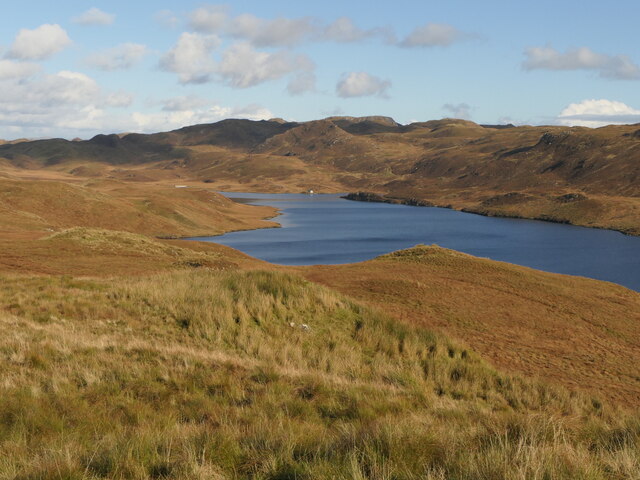
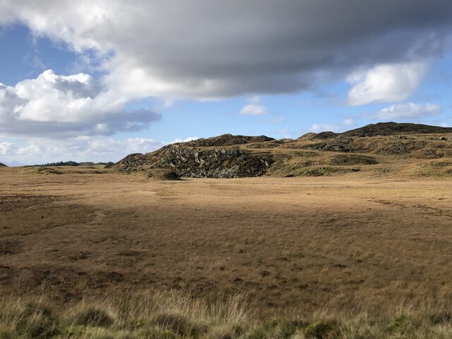
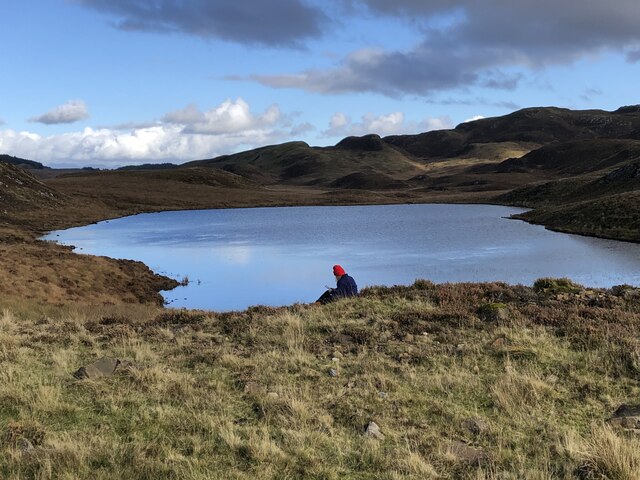
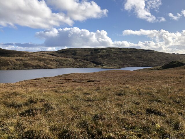
The hill is characterized by its rugged terrain, covered in a patchwork of heather, grasses, and mosses. Its slopes are steep in some areas, providing an invigorating challenge for hikers and mountaineers. The ascent to the summit is rewarded with breathtaking vistas of Loch Fyne, the Arrochar Alps, and the surrounding hills and glens.

A' Chruach is home to a variety of wildlife, including red deer, golden eagles, and red squirrels. The hillside is also adorned with an array of colorful wildflowers during the warmer months, creating a picturesque scene.

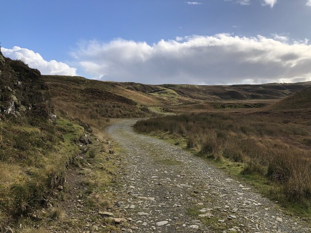
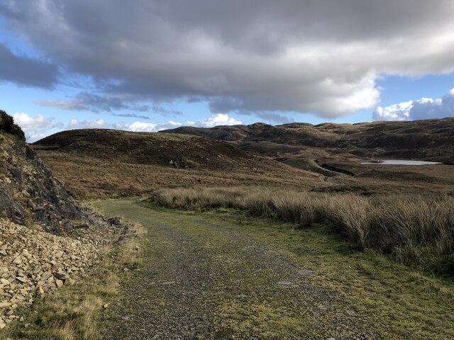
For outdoor enthusiasts, A' Chruach offers excellent opportunities for hillwalking, hiking, and photography. The hill can be accessed from various starting points, with several well-marked trails leading to the summit. However, caution should be exercised, particularly in adverse weather conditions, as the terrain can become challenging and exposed.

Overall, A' Chruach stands as a prominent natural landmark in Argyllshire, attracting visitors who seek to immerse themselves in the beauty of the Scottish Highlands and experience the exhilaration of conquering its slopes.

If you have any feedback on the listing, please let us know in the comments section below.

A' Chruach Images

Images are sourced within 2km of 56.16071/-5.3892789 or Grid Reference NM8901. Thanks to Geograph Open Source API. All images are credited.

Kilneuair - Auchindrain Drove Road For more info. see <span class="nowrap"><a title="https://canmore.org.uk/site/361895" rel="nofollow ugc noopener" href="https://canmore.org.uk/site/361895">Link</a><img style="margin-left:2px;" alt="External link" title="External link - shift click to open in new window" src="https://s1.geograph.org.uk/img/external.png" width="10" height="10"/></span>
Kilneuair - Auchindrain Drove Road
For more info. see LinkExternal link
Moorland view A small, rocky ridge lies between the viewpoint and Lòn Bealaich Ruaidh, the pool of the red bealach, which is the flat boggy area in front of the heather-clad line of low hills.
The hill road to Loch Gainmheach can be seen to left of the photograph. This follows the line of the ancient drove road from Lochaweside to Lochfyneside.
Moorland view
A small, rocky ridge lies between the viewpoint and Lòn Bealaich Ruaidh, the pool of the red bealach, which is the flat boggy area in front of the heather-clad line of low hills. The hill road to Loch Gainmheach can be seen to left of the photograph. This follows the line of the ancient drove road from Lochaweside to Lochfyneside.
A'Chruach
A'Chruach
Cnoc Ghreum Rough moorland above Loch Awe. There are more gentle bits where lime content in the rock has led to better quality grass, kept cropped by the deer and sheep.
Cnoc Ghreum
Rough moorland above Loch Awe. There are more gentle bits where lime content in the rock has led to better quality grass, kept cropped by the deer and sheep.
Rock outcrops, Cnoc Ghreum Easier going here than on most of the moorland around here. The grass is better quality and grazed enthusiastically. There are lime kilns down at Loch Awe so this is probably calcium and magnesium rich rock. A' Chruach is in the background.
Rock outcrops, Cnoc Ghreum
Easier going here than on most of the moorland around here. The grass is better quality and grazed enthusiastically. There are lime kilns down at Loch Awe so this is probably calcium and magnesium rich rock. A' Chruach is in the background.
Summit, Cnoc Ghreum Set in rough moorland.
Summit, Cnoc Ghreum
Set in rough moorland.
Loch Tunnaig One of the many lochs in the hills between Loch Fyne and Loch Awe.
Loch Tunnaig
One of the many lochs in the hills between Loch Fyne and Loch Awe.
Alluvial Fan, Loch Gainmheach A burn draining ground about Sìdh Mòr has started to fill in the loch.  Shallow water can extend some distance as I found out the hard way recently in Loch Lomond.  Loch Gainmheach has been slightly enlarged by a small dam.
Alluvial Fan, Loch Gainmheach
A burn draining ground about Sìdh Mòr has started to fill in the loch. Shallow water can extend some distance as I found out the hard way recently in Loch Lomond. Loch Gainmheach has been slightly enlarged by a small dam.
Moorland by Loch Gainmheach
Moorland by Loch Gainmheach There was a wind scoping mast up so this view towards Jura will probably change.
Moorland by Loch Gainmheach
There was a wind scoping mast up so this view towards Jura will probably change.
Moorland by Loch Gainmheach North from a grassy summit west of Loch Gainmheach. The dam road has blended in well. Using it opens up some very fine views for not a lot of effort.
Moorland by Loch Gainmheach
North from a grassy summit west of Loch Gainmheach. The dam road has blended in well. Using it opens up some very fine views for not a lot of effort.
Loch Gainmheach Enlarged slightly for hydro electric generation, this is the biggest of a group of lochs in the hills between Loch Fyne and Loch Awe.
Loch Gainmheach
Enlarged slightly for hydro electric generation, this is the biggest of a group of lochs in the hills between Loch Fyne and Loch Awe.
Cnoc Ghreum Moorland, often rough, Ederline Estate.
Cnoc Ghreum
Moorland, often rough, Ederline Estate.
Bealach Ruadh The modernised (hydroelectric maintenance) drove road to Carron and Furnace facing a steep climb to the ridge west of Loch Gainmheach.
Bealach Ruadh
The modernised (hydroelectric maintenance) drove road to Carron and Furnace facing a steep climb to the ridge west of Loch Gainmheach.
Wetland, Bealach Ruadh Succession from a loch.
Wetland, Bealach Ruadh
Succession from a loch.
Drove road, Bealach Ruadh The modernised (hydroelectric maintenance) drove road to Carron and Furnace.
Drove road, Bealach Ruadh
The modernised (hydroelectric maintenance) drove road to Carron and Furnace.
Loch Tunnaig One of the many small lochs here.
Loch Tunnaig
One of the many small lochs here.
Loch Gainmheach Slightly enlarged as part of a hydroelectric power station.
Loch Gainmheach
Slightly enlarged as part of a hydroelectric power station.
Show me another place!

A' Chruach is located at Grid Ref: NM8901 (Lat: 56.16071, Lng: -5.3892789)

Unitary Authority: Argyll and Bute

Police Authority: Argyll and West Dunbartonshire

What 3 Words

///bubbles.whisker.apprehend. Near Lochgilphead, Argyll & Bute

Nearby Locations

A' Chruach

Related Wikis

Aray Bridge

Aray Bridge, also known as Inveraray Bridge, is a stone two-arch public road bridge on the Inveraray Castle estate near Inveraray in Argyll and Bute, Scotland...
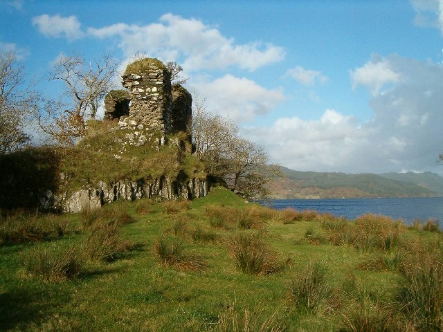
Fincharn Castle

Fincharn Castle, also known as Fionchairn Castle and Glassery Castle, is a ruined castle near Ford on the southwest shore of Loch Awe, Scotland. The castle...
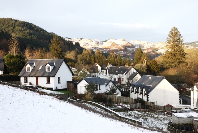
Ford, Argyll

Ford (Scottish Gaelic: Àth na Crà) is a small village at the southern end of Loch Awe in Argyll, Scotland. The village originated as a stopping point on...

Carnasserie Castle

Carnasserie Castle (also spelled Carnassarie) is a ruined 16th-century tower house, noted for its unusual plan and renaissance detailing. It is located...

Have you been to A' Chruach?

Leave your review of A' Chruach below (or comments, questions and feedback).