An Fùr
Hill, Mountain in Ross-shire
Scotland
An Fùr

An Fùr is a prominent hill located in Ross-shire, Scotland. It is part of the picturesque Scottish Highlands and stands at an elevation of approximately 1,695 feet (517 meters). The hill is situated near the village of Evanton, offering mesmerizing views of the surrounding countryside.
An Fùr is a popular destination for hikers and outdoor enthusiasts due to its accessible location and breathtaking vistas. The hill is known for its distinct shape, with a gentle slope on one side and a steeper ascent on the other. This makes it suitable for both beginners and experienced hikers looking for a challenging climb.
The ascent to An Fùr is rewarded with stunning panoramic views of the surrounding landscape. On a clear day, one can see the nearby Cromarty Firth, the Black Isle, and even the distant peaks of the Cairngorms National Park. The hill's location also provides an opportunity to observe local wildlife, including birds of prey such as buzzards and kestrels.
An Fùr's proximity to Evanton makes it easily accessible by road, and there are parking facilities available for visitors. The hill is well-maintained, with clearly marked paths and trails, ensuring a safe and enjoyable hiking experience for all.
Overall, An Fùr in Ross-shire is a picturesque and rewarding destination for nature lovers and outdoor enthusiasts. With its stunning views and well-maintained trails, it offers a memorable experience for those seeking to explore the natural beauty of the Scottish Highlands.
If you have any feedback on the listing, please let us know in the comments section below.
An Fùr Images
Images are sourced within 2km of 57.493855/-5.6578604 or Grid Reference NG8050. Thanks to Geograph Open Source API. All images are credited.


An Fùr is located at Grid Ref: NG8050 (Lat: 57.493855, Lng: -5.6578604)
Unitary Authority: Highland
Police Authority: Highlands and Islands
What 3 Words
///mothering.aware.ourselves. Near Lochcarron, Highland
Nearby Locations
Related Wikis
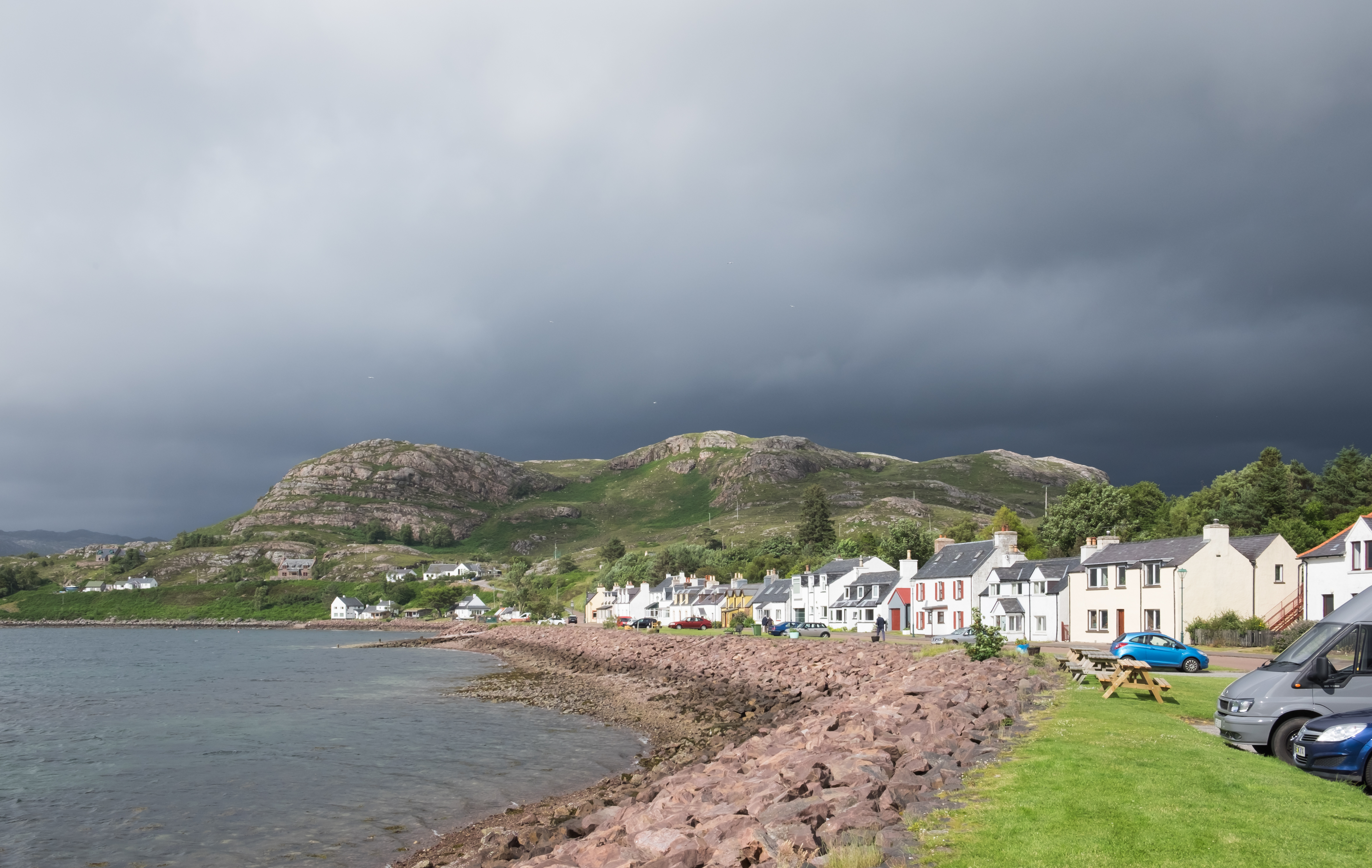
Shieldaig
Shieldaig (Scottish Gaelic: Sìldeag; Old Norse: síld-vík, lit. 'herring bay') is a village in Wester Ross in the Northwest Highlands, in the Scottish council...
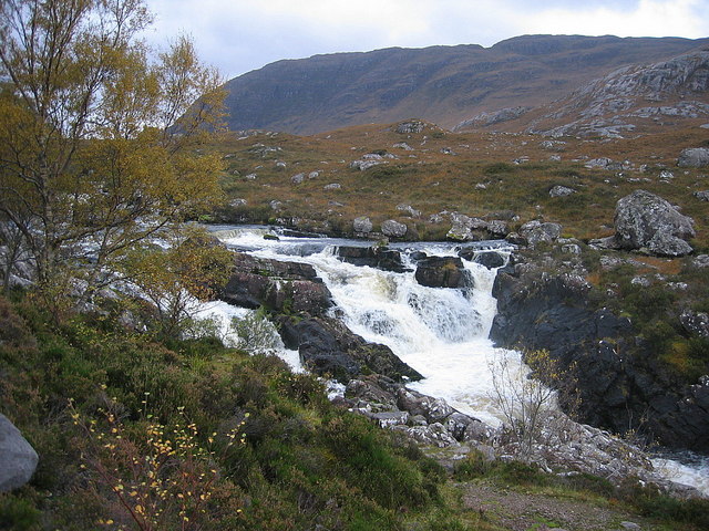
Falls of Balgy
Falls of Balgy is a waterfall near Torridon in Scotland. == See also == Waterfalls of Scotland == References ==

Beinn Bhàn (Applecross)
Beinn Bhàn is a mountain in the highlands of Scotland, lying on the Applecross peninsula, on the north side of Loch Kishorn.Located on the eastern side...
Ardheslaig
Ardheslaig (Scottish Gaelic: Àird Heisleag) is a crofting settlement at the northern end of the Applecross peninsula in the Scottish Highlands. It is 3...

Inveralligin
Inveralligin (Scottish Gaelic: Inbhir Àiliginn) is a remote crofting township which lies on the north shore of Loch Torridon in Wester Ross and is in the...

Annat, Highland
Annat (Scottish Gaelic: An Annaid) is a small village at the eastern end of Upper Loch Torridon in Wester Ross, in the Highland council area of Scotland...

Beinn Damh
Beinn Damh (or Ben Damph) is a Scottish mountain situated in the wild mountainous area between Upper Loch Torridon and Glen Carron, 25 kilometres north...

Bealach na Bà
Bealach na Bà (pronounced [bjaLəx na baː]) is a winding single track road through the mountains of the Applecross peninsula, in Wester Ross in the Scottish...
Nearby Amenities
Located within 500m of 57.493855,-5.6578604Have you been to An Fùr?
Leave your review of An Fùr below (or comments, questions and feedback).