Cnoc na Mòine
Hill, Mountain in Argyllshire
Scotland
Cnoc na Mòine

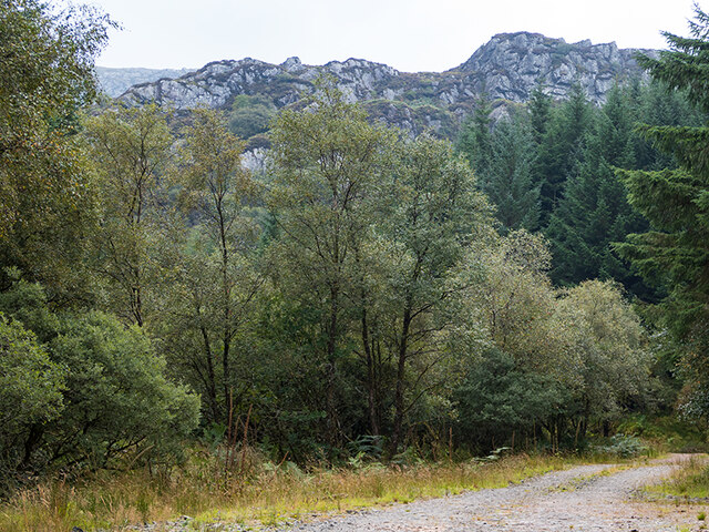
Cnoc na Mòine, located in Argyllshire, Scotland, is a prominent hill/mountain that offers breathtaking views and a unique landscape. Standing at an impressive height of approximately 600 meters (1,969 feet), it is a popular destination for hikers, nature enthusiasts, and adventure seekers.
The name "Cnoc na Mòine" translates to "Hill of the Bog" in English, which aptly describes the terrain surrounding the mountain. The hill is characterized by its vast stretches of peat bogs, which add to its distinct appeal. The bogs play host to an array of flora and fauna, including heather, moss, and various species of birds.
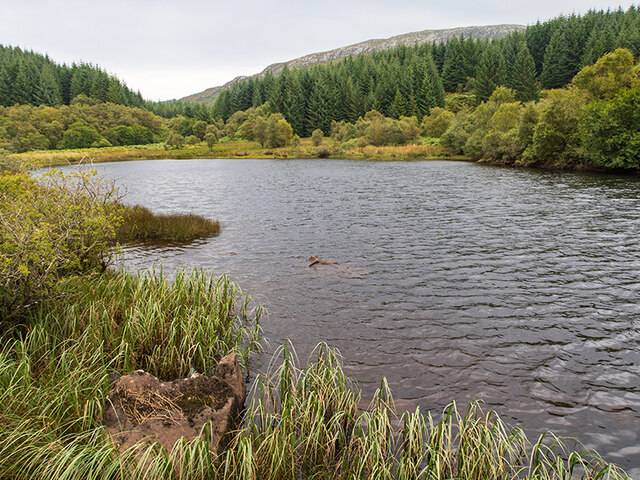
Reaching the summit of Cnoc na Mòine requires a moderate level of fitness and hiking experience. There are several well-established trails that guide visitors to the top, providing a challenging yet rewarding journey. Along the way, hikers can admire the stunning panoramic views of the surrounding countryside, including the nearby Loch Awe and the Argyll Forest Park.
On a clear day, the summit of Cnoc na Mòine offers a breathtaking vista that stretches as far as the eye can see. Visitors are treated to a stunning 360-degree panorama of the picturesque Scottish Highlands, with rolling hills, lochs, and distant mountains creating an awe-inspiring backdrop.
Cnoc na Mòine is not only a natural wonder but also holds historical significance. The area is known to have ancient burial sites, indicating that it has been inhabited for thousands of years. Exploring the hill provides an opportunity to connect with Scotland's rich cultural heritage and delve into the mysteries of its past.
Overall, Cnoc na Mòine is a must-visit destination for those seeking adventure, natural beauty, and a glimpse into Scotland's fascinating history.
If you have any feedback on the listing, please let us know in the comments section below.
Cnoc na Mòine Images
Images are sourced within 2km of 56.002418/-5.5813549 or Grid Reference NR7684. Thanks to Geograph Open Source API. All images are credited.


Cnoc na Mòine is located at Grid Ref: NR7684 (Lat: 56.002418, Lng: -5.5813549)
Unitary Authority: Argyll and Bute
Police Authority: Argyll and West Dunbartonshire
What 3 Words
///uttering.padlock.possible. Near Ardrishaig, Argyll & Bute
Nearby Locations
Related Wikis

Ashfield, Argyll and Bute
Ashfield is a village in the civil parish of North Knapdale, in Knapdale, in the council area of Argyll and Bute, Scotland. It has a sheep farm and cottage...
Eilean Loain
Eilean Loain is a small island in Loch Sween and one of the Inner Hebrides of Scotland. It is about 2 kilometres (1 mi) west of the settlement of Kilmichael...

Achnamara
Achnamara (Scottish Gaelic: Achadh na Mara) is a village in the Scottish council area of Argyll and Bute. Its location is approximately 56°1' N 5°34' W...

Taynish National Nature Reserve
Taynish National Nature Reserve (Scottish Gaelic: Tèarmann Nàdair Nàiseanta Taighnis) is situated southwest of the village of Tayvallich in the council...
Tayvallich
Tayvallich (pronounced TAY-vee-AL-ich; Scottish Gaelic: Taigh a' Bhealaich [t̪ʰɤj ə ˈvjal̪ˠɪç]) is a small village in the Knapdale area of Argyll and Bute...

Knapdale
Knapdale (Scottish Gaelic: Cnapadal, IPA: [ˈkɾaʰpət̪əl̪ˠ]) forms a rural district of Argyll and Bute in the Scottish Highlands, adjoining Kintyre to the...

Loch Sween
Loch Sween (Scottish Gaelic: Loch Suain or Loch Suibhne) is a sea loch located near Lochgilphead, Argyll and Bute, Scotland. Castle Sween is located on...
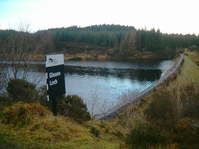
Gleann Loch
The loch runs south west to north east and is an impounding reservoir located to the west of Lochgilphead, Scotland. It is one of a number of lochs supplying...
Have you been to Cnoc na Mòine?
Leave your review of Cnoc na Mòine below (or comments, questions and feedback).