An Stac
Hill, Mountain in Inverness-shire
Scotland
An Stac

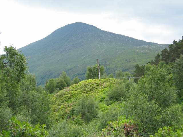
An Stac is a prominent hill located in Inverness-shire, Scotland. It is situated in the northwest part of the country, about 15 miles southwest of the town of Ullapool. With an elevation of 814 meters (2,671 feet), An Stac is classified as a Corbett, which is a Scottish hill between 2,500 and 3,000 feet in height.
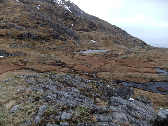
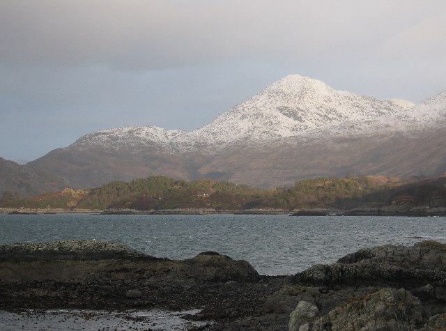
The hill is known for its distinctive conical shape and steep slopes, making it a challenging but rewarding climb for outdoor enthusiasts and hikers. Its position within the stunning landscape of Inverness-shire offers breathtaking views of the surrounding area, including the nearby Loch Broom and the mountain ranges of Sutherland and Wester Ross.
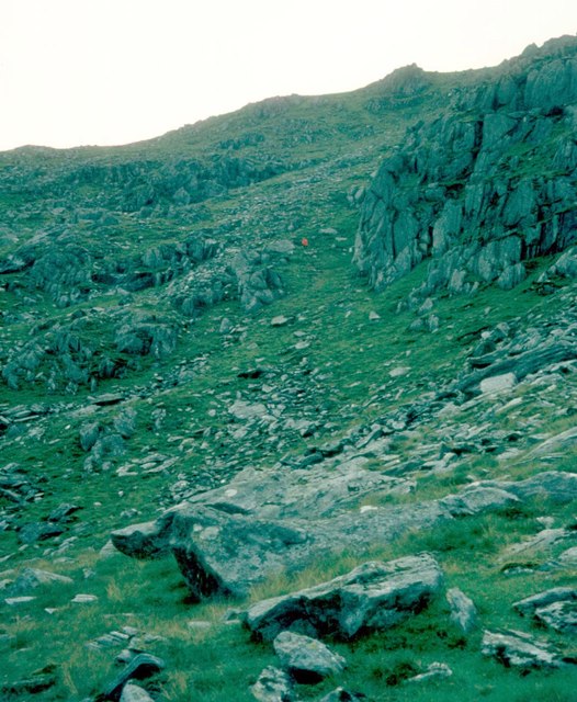
The ascent to the summit of An Stac typically starts from the eastern side, where a well-defined path leads hikers through heather-covered slopes and rocky terrain. As climbers reach higher altitudes, the vegetation becomes sparser, and the terrain becomes steeper, requiring more careful navigation.
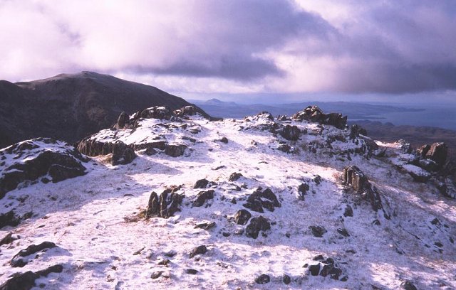
On clear days, the view from the summit is truly spectacular, with panoramic vistas that stretch as far as the eye can see. From this vantage point, hikers can enjoy unparalleled views of the surrounding peaks, including the iconic Suilven and Stac Pollaidh.
An Stac offers a challenging yet accessible mountain experience for those seeking outdoor adventure and natural beauty. Its unique shape, stunning views, and rugged terrain make it a popular destination for hikers, photographers, and nature enthusiasts visiting the Inverness-shire region.
If you have any feedback on the listing, please let us know in the comments section below.
An Stac Images
Images are sourced within 2km of 56.851006/-5.670079 or Grid Reference NM7679. Thanks to Geograph Open Source API. All images are credited.


An Stac is located at Grid Ref: NM7679 (Lat: 56.851006, Lng: -5.670079)
Unitary Authority: Highland
Police Authority: Highlands and Islands
What 3 Words
///scoring.money.implanted. Near Arisaig, Highland
Nearby Locations
Related Wikis
An Stac
An Stac is the name of a 814 m mountain in the Northwest Highlands, Scotland, on the shore of Loch Ailort on the west coast of Lochaber. A steep-sided...
Rois-bheinn
Rois-bheinn is the joint highest hill in the Scottish region of Moidart, a title it shares with its neighbour Beinn Odhar Bheag. The mountain may be climbed...

Alisary
Alisary is a tiny settlement in Highland, Scotland.

Inverailort House
Inverailort House is a mansion, south of Lochailort, at the head of Loch Ailort. == History == Having been a shooting lodge for MacDonald of Clanranald...

Loch Ailort
Loch Ailort ( lokh EYE-lərt; Scottish Gaelic: Loch Ailleart) is a sea loch in Morar, Lochaber, Highland, Scotland. Loch Ailort is a shallow V shaped loch...
Lochailort
Lochailort ( lokh-EYE-lərt, Scottish Gaelic: Ceann Loch Ailleart) is a hamlet in Scotland that lies at the head of Loch Ailort, a sea loch, on the junction...
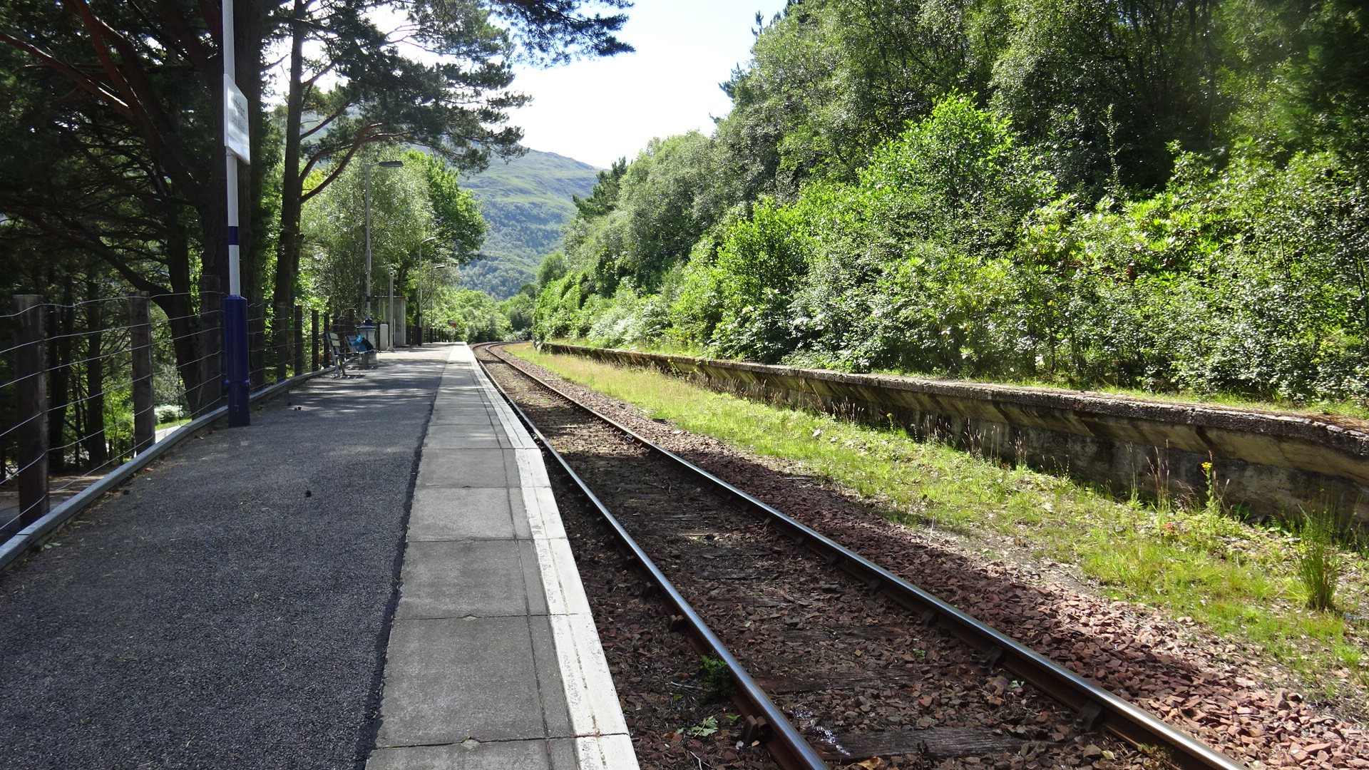
Lochailort railway station
Lochailort railway station is a railway station serving the village of Lochailort in the Highland Council area in Scotland. This station is on the West...
Moidart
Moidart ( MOY-dart; Scottish Gaelic: Mùideart [ˈmuːitʲarˠʃt̪]) is part of the remote and isolated area of Scotland, west of Fort William, known as the...
Nearby Amenities
Located within 500m of 56.851006,-5.670079Have you been to An Stac?
Leave your review of An Stac below (or comments, questions and feedback).