Carn-ffald

Hill, Mountain in Pembrokeshire

Wales

Carn-ffald

Carnedd Lleithr A view of Carnedd Lleithr which forms part of the headland of St David's Head, the headland is in the care of the National Trust.
Carnedd Lleithr Credit: Chris McAuley

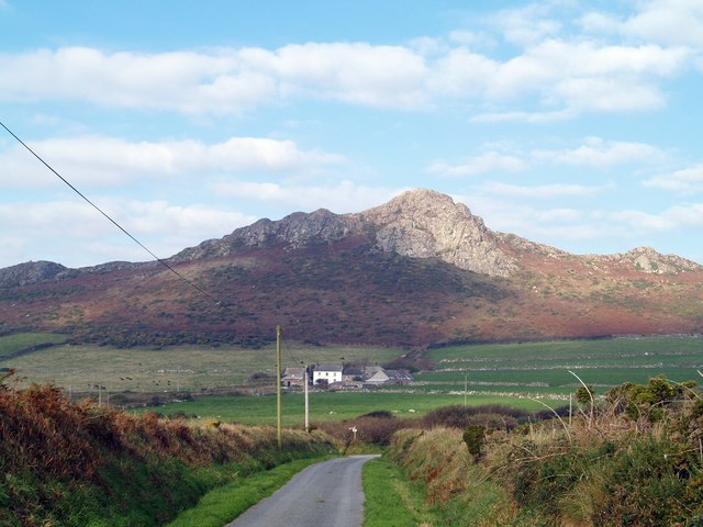
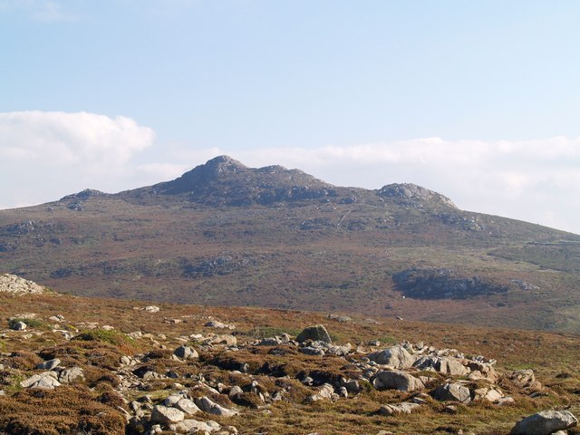
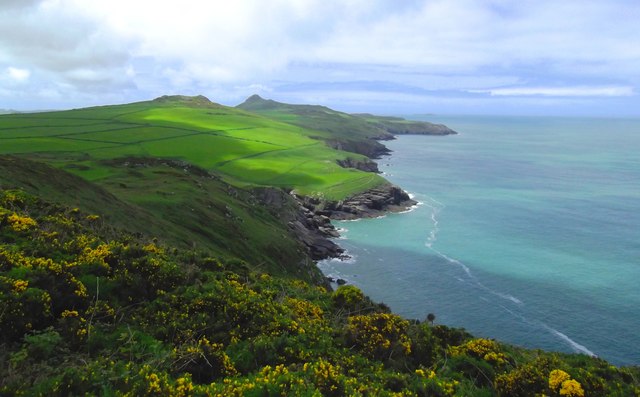
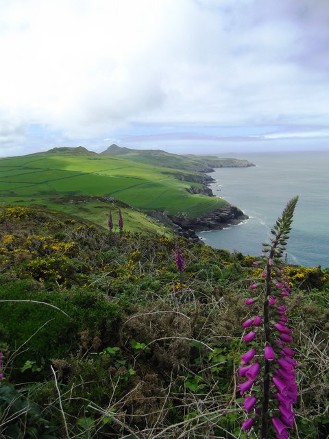
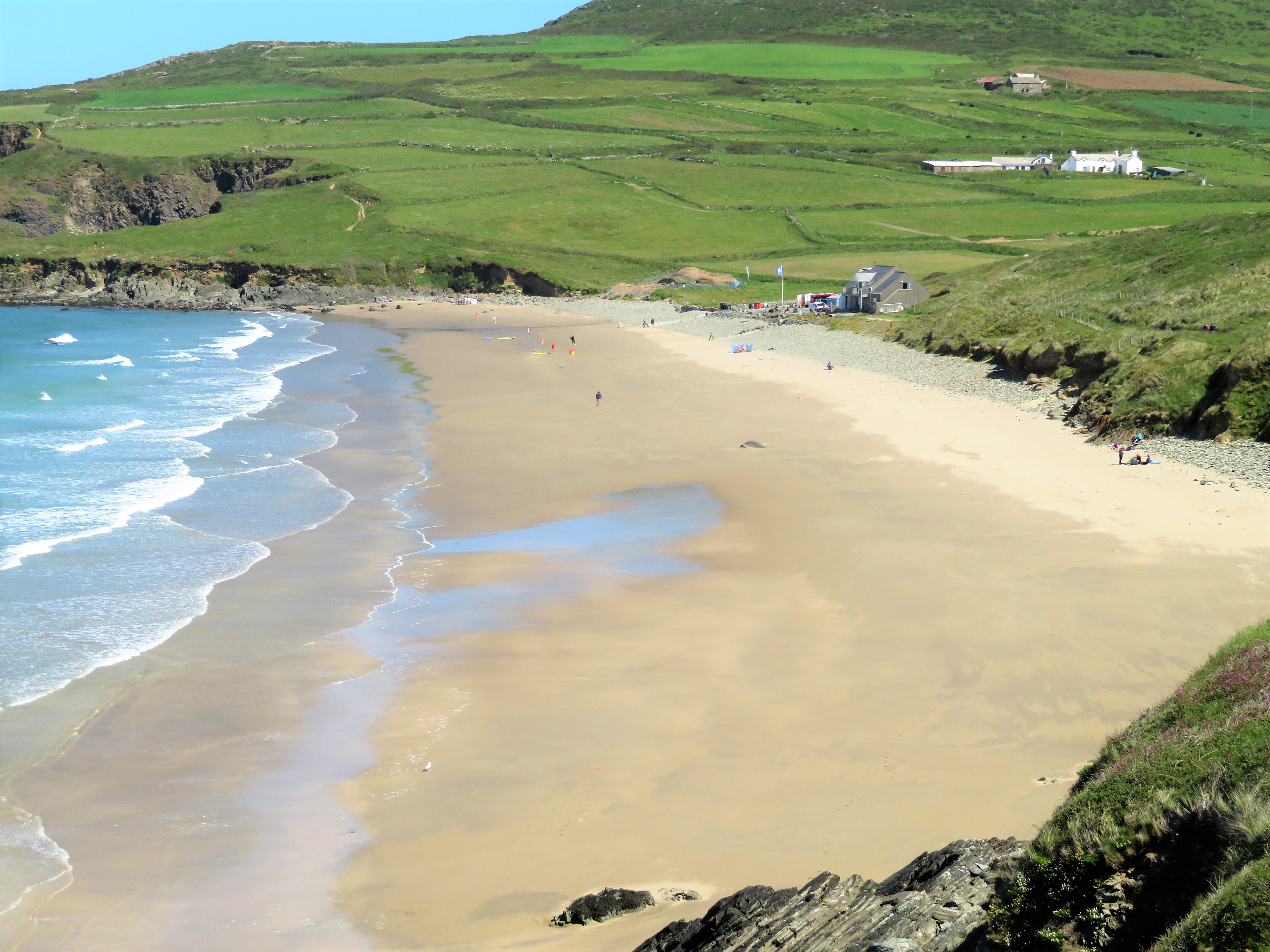
Carn-ffald is a prominent hill located in the county of Pembrokeshire, Wales. Situated in the southwestern part of the country, Carn-ffald offers breathtaking views and natural beauty to visitors who venture to its summit. It lies within the Pembrokeshire Coast National Park, which is renowned for its stunning landscapes and diverse wildlife.

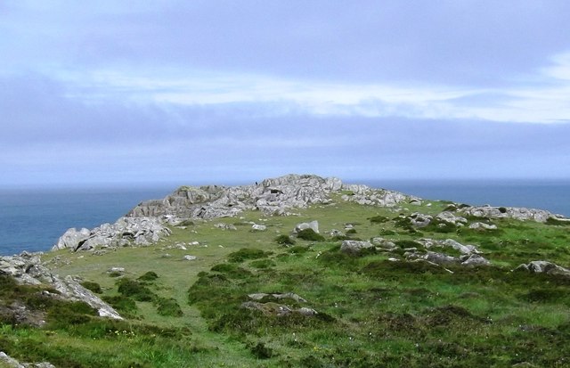
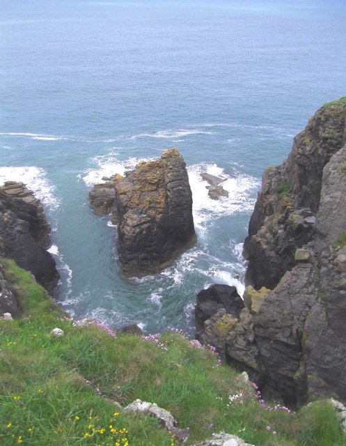
Standing at an elevation of approximately 225 meters (738 feet), Carn-ffald is not classified as a mountain but rather a hill. However, its commanding presence and steep slopes give it an imposing appearance. The hill is characterized by its rugged terrain, with rocky outcrops and heather-covered slopes that add to its picturesque charm.

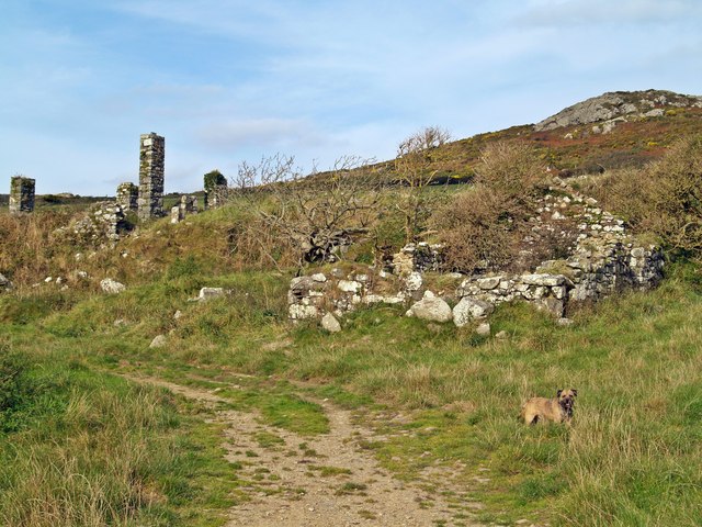
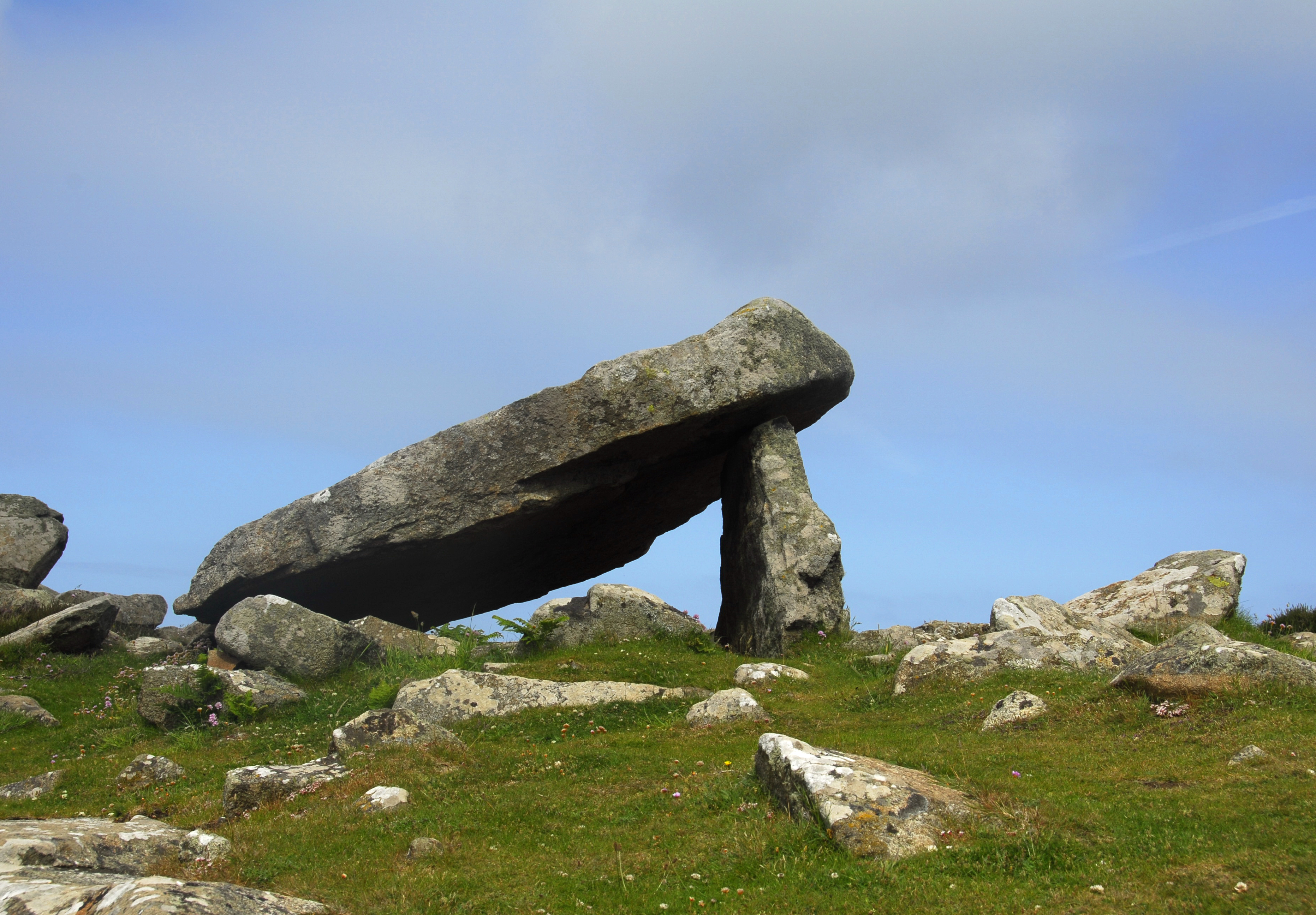
The area surrounding Carn-ffald is rich in history and heritage. It is believed that the hill was once used for farming purposes, as evidenced by the remnants of old stone walls that can be found scattered across its slopes. Additionally, there are several ancient burial mounds in the vicinity, suggesting that the hill held significance for early inhabitants of the area.

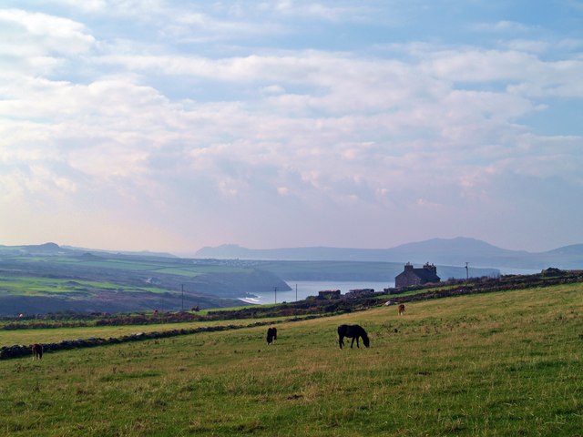
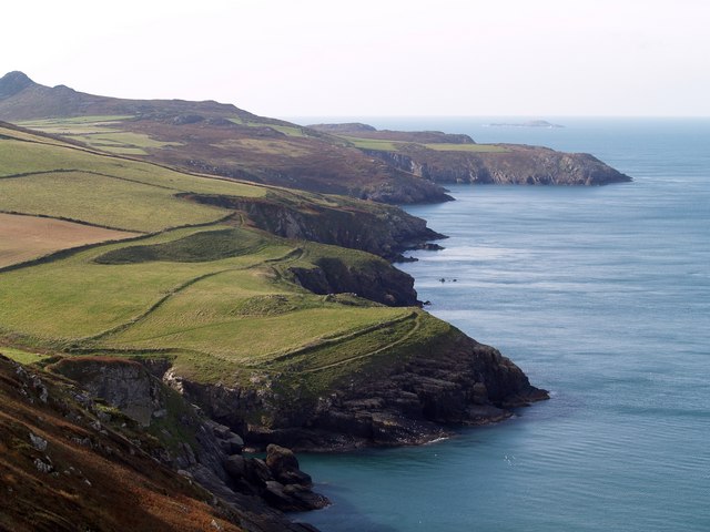
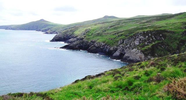
For outdoor enthusiasts, Carn-ffald offers numerous walking trails and paths that allow visitors to explore its surroundings. The hill provides ample opportunities for hiking, birdwatching, and photography, with its panoramic views of the Pembrokeshire countryside and coastline. It is a popular destination for both locals and tourists seeking a tranquil escape in nature.

Carn-ffald is easily accessible by road, with parking facilities available nearby. It is a place where visitors can immerse themselves in the natural beauty of Pembrokeshire and appreciate the serene ambiance that the hill has to offer.

If you have any feedback on the listing, please let us know in the comments section below.
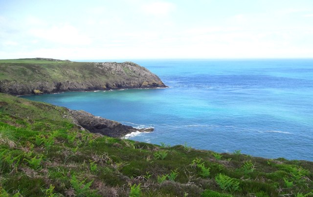
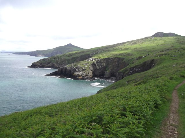
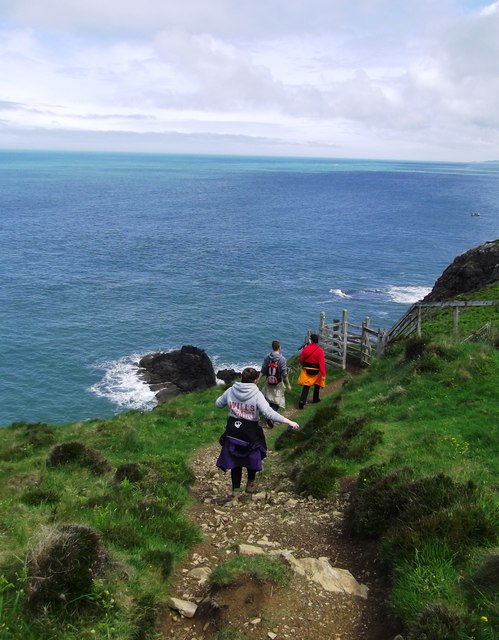
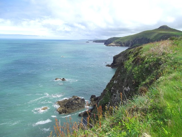
Carn-ffald Images

Images are sourced within 2km of 51.907125/-5.2735152 or Grid Reference SM7428. Thanks to Geograph Open Source API. All images are credited.

Carnedd Lleithr A view of Carnedd Lleithr which forms part of the headland of St David's Head, the headland is in the care of the National Trust.
Carnedd Lleithr
A view of Carnedd Lleithr which forms part of the headland of St David's Head, the headland is in the care of the National Trust.
Llaethdy A view from the footpath to Carnedd lleithr in the foreground Llaethdy and Whitesands Bay in the background.
Llaethdy
A view from the footpath to Carnedd lleithr in the foreground Llaethdy and Whitesands Bay in the background.
Ponies Grazing Welsh Mountain ponies graze on the edge of Penrhyn Halen.
<span class="nowrap"><a title="http://www.nationaltrust.org.uk/main/w-stdavids_head-coastal_walk-2.pdf" rel="nofollow ugc noopener" href="http://www.nationaltrust.org.uk/main/w-stdavids_head-coastal_walk-2.pdf">Link</a><img style="margin-left:2px;" alt="External link" title="External link - shift click to open in new window" src="https://s1.geograph.org.uk/img/external.png" width="10" height="10"/></span>
Ponies Grazing
Welsh Mountain ponies graze on the edge of Penrhyn Halen. LinkExternal link
A View Of Carn Llidi Carn Llidi from the Pembrokeshire Coast Path.
A View Of Carn Llidi
Carn Llidi from the Pembrokeshire Coast Path.
Derelict Building beside footpath to Carneed-lleithr.
Derelict Building
beside footpath to Carneed-lleithr.
Coast Line View Carreg yr Afr from the side of Penberry, with the Pembrokeshire Coast Path between the field walls and cliff edge.The summit of Carn Llidi at 181 metres can be seen top left of photo.
Coast Line View
Carreg yr Afr from the side of Penberry, with the Pembrokeshire Coast Path between the field walls and cliff edge.The summit of Carn Llidi at 181 metres can be seen top left of photo.
Porth Lleuog
Porth Lleuog
Trwyn-llwyd
Trwyn-llwyd
Penllechwen Headland Close inspection will show a Chough sat on the rocks
Penllechwen Headland
Close inspection will show a Chough sat on the rocks
North Pembrokeshire Coast Taken from the Pembrokeshire Coast Path
North Pembrokeshire Coast
Taken from the Pembrokeshire Coast Path
Gesail-fawr Taken from the Pembrokeshire Coast Path
Gesail-fawr
Taken from the Pembrokeshire Coast Path
Penrhyn Halen Taken from the Pembrokeshire Coast Path
Penrhyn Halen
Taken from the Pembrokeshire Coast Path
Pembrokeshire Coast Path
Pembrokeshire Clifftops
Carreg yr Afr Islet on the North Pembrokeshire Coast
Carreg yr Afr
Islet on the North Pembrokeshire Coast
North Pembrokeshire Coastline Taken from the Pembrokeshire Coast Path
North Pembrokeshire Coastline
Taken from the Pembrokeshire Coast Path
Pembrokeshire Coast Taken from the Pembrokeshire Coast Path
Pembrokeshire Coast
Taken from the Pembrokeshire Coast Path
Whitesands Bay Looking south over the magnificent, popular beach of Whitesands Bay. In the foreground is the promontory of Trwynhwrddyn which cuts off the separate beach of Porth Lleuog.
Whitesands Bay
Looking south over the magnificent, popular beach of Whitesands Bay. In the foreground is the promontory of Trwynhwrddyn which cuts off the separate beach of Porth Lleuog.
Show me another place!

Carn-ffald is located at Grid Ref: SM7428 (Lat: 51.907125, Lng: -5.2735152)

Unitary Authority: Pembrokeshire

Police Authority: Dyfed Powys

What 3 Words

///undulation.stability.giggled. Near St Davids, Pembrokeshire

Related Wikis

Carn Llidi

Carn Llidi is a hill east of St David's Head in Pembrokeshire, Wales. Carn Llidi and its surrounding area is part of the Pembrokeshire Coast National Park...

Whitesands Bay (Pembrokeshire)

Whitesands Bay (Welsh: Porth Mawr) is a Blue Flag beach situated on the St David's peninsula in the Pembrokeshire Coast National Park, Wales. Whitesand...

Penrhiw Priory

Penrhiw Priory was originally built as a vicarage in St Davids, Pembrokeshire, Wales, in 1884. The building was enlarged in the 1960s, serving for a time...

Coetan Arthur

Coetan Arthur dolmen, also known as Arthur's Quoit (not to be confused with Carreg Coetan Arthur, near Newport) is the remains of a Neolithic burial chamber...

Nearby Amenities

Located within 500m of 51.907125,-5.2735152
Carn Ffald
Natural: peak
Lat/Long: 51.9079958/-5.27125
Carn Perfedd
Natural: peak
Lat/Long: 51.906837/-5.2734372
Carnedd Lleithr
Natural: peak
Lat/Long: 51.9062852/-5.2762749
Carn Treliwyd
Natural: peak
Lat/Long: 51.9095407/-5.2686562
Historic: ruins
Lat/Long: 51.9031432/-5.2760631
The data included in this document is from www.openstreetmap.org. The data is made available under ODbL.

Have you been to Carn-ffald?

Leave your review of Carn-ffald below (or comments, questions and feedback).