Penrhyn Halen

Coastal Feature, Headland, Point in Pembrokeshire

Wales

Penrhyn Halen

Carnedd Lleithr A view of Carnedd Lleithr which forms part of the headland of St David's Head, the headland is in the care of the National Trust.
Carnedd Lleithr Credit: Chris McAuley

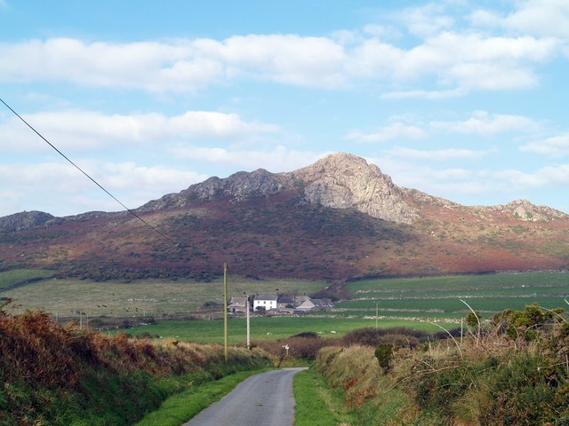
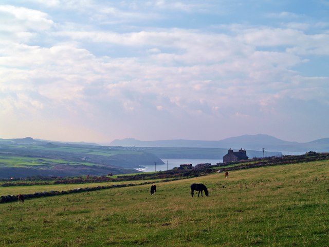
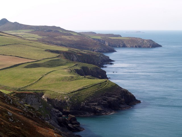
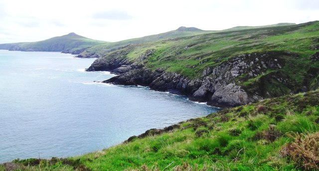
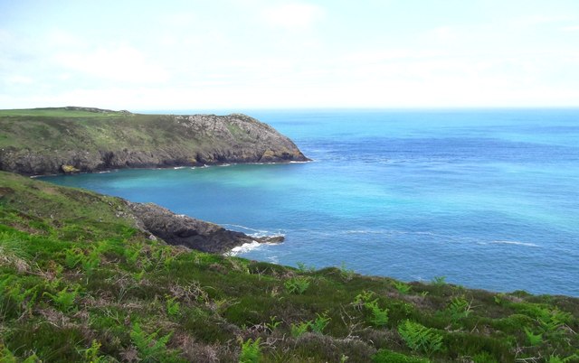
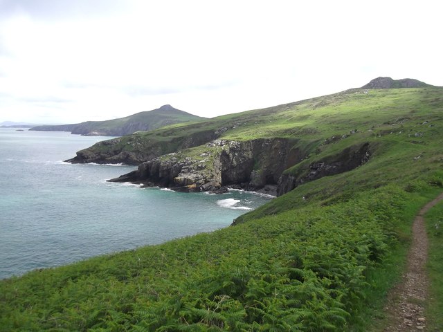
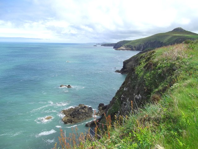
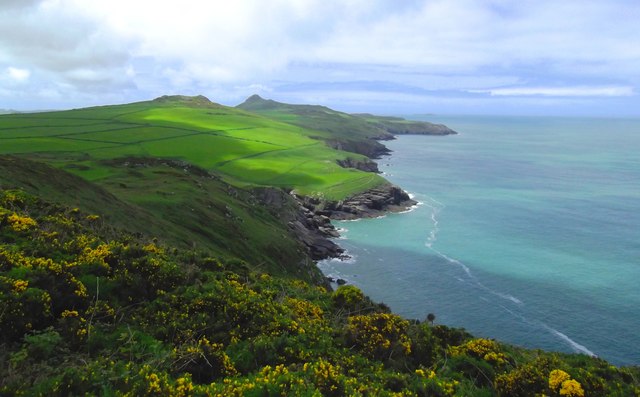
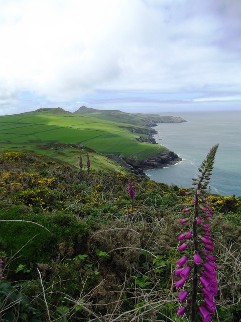
Penrhyn Halen is a prominent headland situated in Pembrokeshire, Wales. Located along the stunning coastline, it offers breathtaking views of the surrounding cliffs, sea, and the picturesque landscape. This coastal feature boasts a unique combination of rugged beauty and dramatic geological formations.

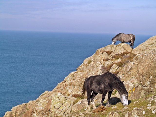
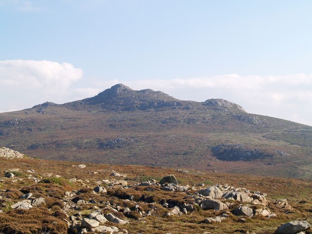
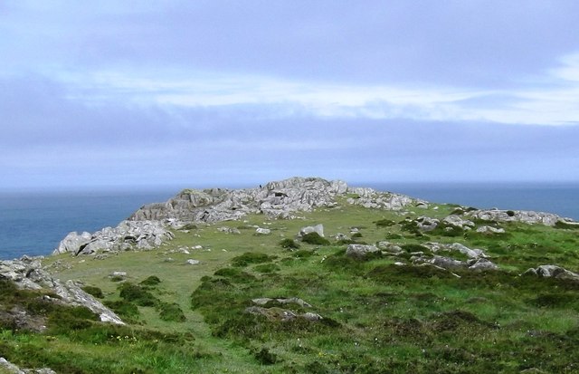
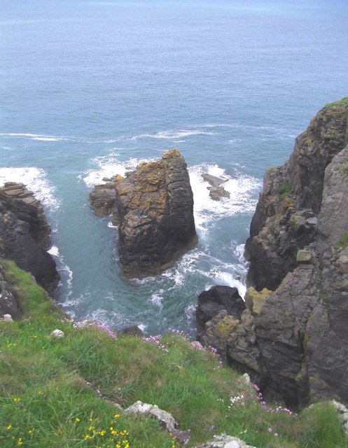
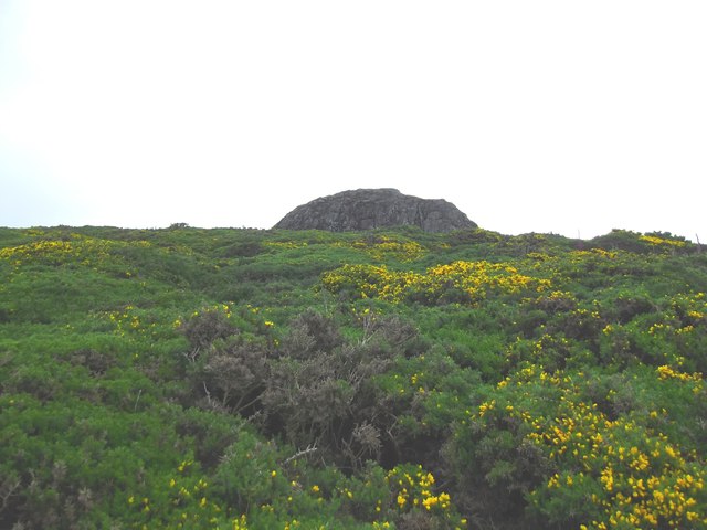
Standing tall at an elevation of approximately 100 meters, Penrhyn Halen is composed of layers of sedimentary rocks, including sandstone and shale. These rocks bear witness to millions of years of geological processes, exhibiting fascinating patterns and colors. The headland is also home to an array of marine life, making it a popular spot for birdwatching and wildlife enthusiasts.

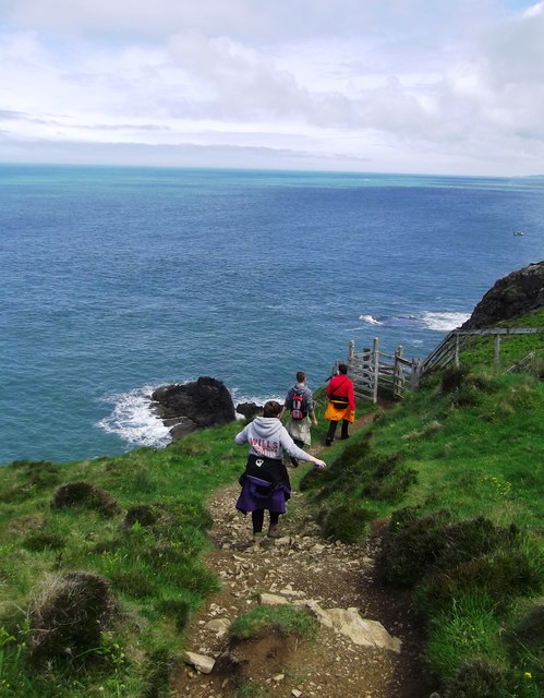
The site is easily accessible, with a well-maintained pathway leading visitors to the top of the headland. Once there, one can enjoy panoramic views of the Atlantic Ocean, with the waves crashing against the cliffs below. On clear days, it is possible to catch a glimpse of the nearby islands, adding to the allure of this remarkable coastal feature.

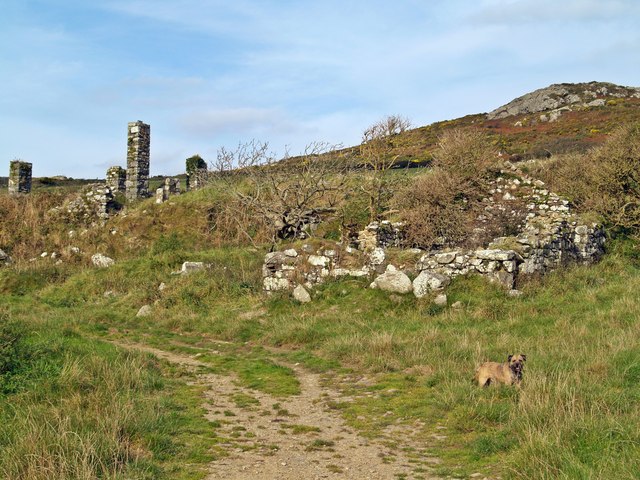
Penrhyn Halen is also known for its rich history, with remnants of ancient settlements and burial sites scattered throughout the area. Archaeological finds suggest that the headland has been inhabited since prehistoric times and has served as a strategic location for defense and trade.

Overall, Penrhyn Halen is a must-visit destination for those seeking natural beauty, geological wonders, and a glimpse into the region's past. Whether exploring the rugged coastline, observing the diverse wildlife, or simply taking in the breathtaking views, this headland offers an unforgettable experience for visitors of all ages.

If you have any feedback on the listing, please let us know in the comments section below.

Penrhyn Halen Images

Images are sourced within 2km of 51.912515/-5.2740675 or Grid Reference SM7428. Thanks to Geograph Open Source API. All images are credited.

Carnedd Lleithr A view of Carnedd Lleithr which forms part of the headland of St David's Head, the headland is in the care of the National Trust.
Carnedd Lleithr
A view of Carnedd Lleithr which forms part of the headland of St David's Head, the headland is in the care of the National Trust.
Llaethdy A view from the footpath to Carnedd lleithr in the foreground Llaethdy and Whitesands Bay in the background.
Llaethdy
A view from the footpath to Carnedd lleithr in the foreground Llaethdy and Whitesands Bay in the background.
Ponies Grazing Welsh Mountain ponies graze on the edge of Penrhyn Halen.
<span class="nowrap"><a title="http://www.nationaltrust.org.uk/main/w-stdavids_head-coastal_walk-2.pdf" rel="nofollow ugc noopener" href="http://www.nationaltrust.org.uk/main/w-stdavids_head-coastal_walk-2.pdf">Link</a><img style="margin-left:2px;" alt="External link" title="External link - shift click to open in new window" src="https://s1.geograph.org.uk/img/external.png" width="10" height="10"/></span>
Ponies Grazing
Welsh Mountain ponies graze on the edge of Penrhyn Halen. LinkExternal link
A View Of Carn Llidi Carn Llidi from the Pembrokeshire Coast Path.
A View Of Carn Llidi
Carn Llidi from the Pembrokeshire Coast Path.
Derelict Building beside footpath to Carneed-lleithr.
Derelict Building
beside footpath to Carneed-lleithr.
Coast Line View Carreg yr Afr from the side of Penberry, with the Pembrokeshire Coast Path between the field walls and cliff edge.The summit of Carn Llidi at 181 metres can be seen top left of photo.
Coast Line View
Carreg yr Afr from the side of Penberry, with the Pembrokeshire Coast Path between the field walls and cliff edge.The summit of Carn Llidi at 181 metres can be seen top left of photo.
Trwyn-llwyd
Trwyn-llwyd
Penllechwen Headland Close inspection will show a Chough sat on the rocks
Penllechwen Headland
Close inspection will show a Chough sat on the rocks
North Pembrokeshire Coast Taken from the Pembrokeshire Coast Path
North Pembrokeshire Coast
Taken from the Pembrokeshire Coast Path
Gesail-fawr Taken from the Pembrokeshire Coast Path
Gesail-fawr
Taken from the Pembrokeshire Coast Path
Penrhyn Halen Taken from the Pembrokeshire Coast Path
Penrhyn Halen
Taken from the Pembrokeshire Coast Path
Pembrokeshire Coast Path
Pembrokeshire Clifftops
Carreg yr Afr Islet on the North Pembrokeshire Coast
Carreg yr Afr
Islet on the North Pembrokeshire Coast
North Pembrokeshire Coastline Taken from the Pembrokeshire Coast Path
North Pembrokeshire Coastline
Taken from the Pembrokeshire Coast Path
Pembrokeshire Coast Taken from the Pembrokeshire Coast Path
Pembrokeshire Coast
Taken from the Pembrokeshire Coast Path
Gorse Covered Penberry Hill
Paths and plateau east of St David's Head The Pembrokeshire Coast Path, a 186mile (299 km) long national trail, can be seen ahead. Here the path is coincident with the Wales Coast Path, 870 miles (1400 km) long.

The prominent hill is Carn Penberry <a href="https://www.geograph.org.uk/gridref/SM7629">SM7629</a>. Strumble Head <a href="https://www.geograph.org.uk/gridref/SM8941">SM8941</a> can be seen on the horizon.
Paths and plateau east of St David's Head
The Pembrokeshire Coast Path, a 186mile (299 km) long national trail, can be seen ahead. Here the path is coincident with the Wales Coast Path, 870 miles (1400 km) long. The prominent hill is Carn Penberry SM7629. Strumble Head SM8941 can be seen on the horizon.
Show me another place!

Penrhyn Halen is located at Grid Ref: SM7428 (Lat: 51.912515, Lng: -5.2740675)

Unitary Authority: Pembrokeshire

Police Authority: Dyfed Powys

What 3 Words

///connects.retrain.dimension. Near St Davids, Pembrokeshire

Related Wikis

Carn Llidi

Carn Llidi is a hill east of St David's Head in Pembrokeshire, Wales. Carn Llidi and its surrounding area is part of the Pembrokeshire Coast National Park...
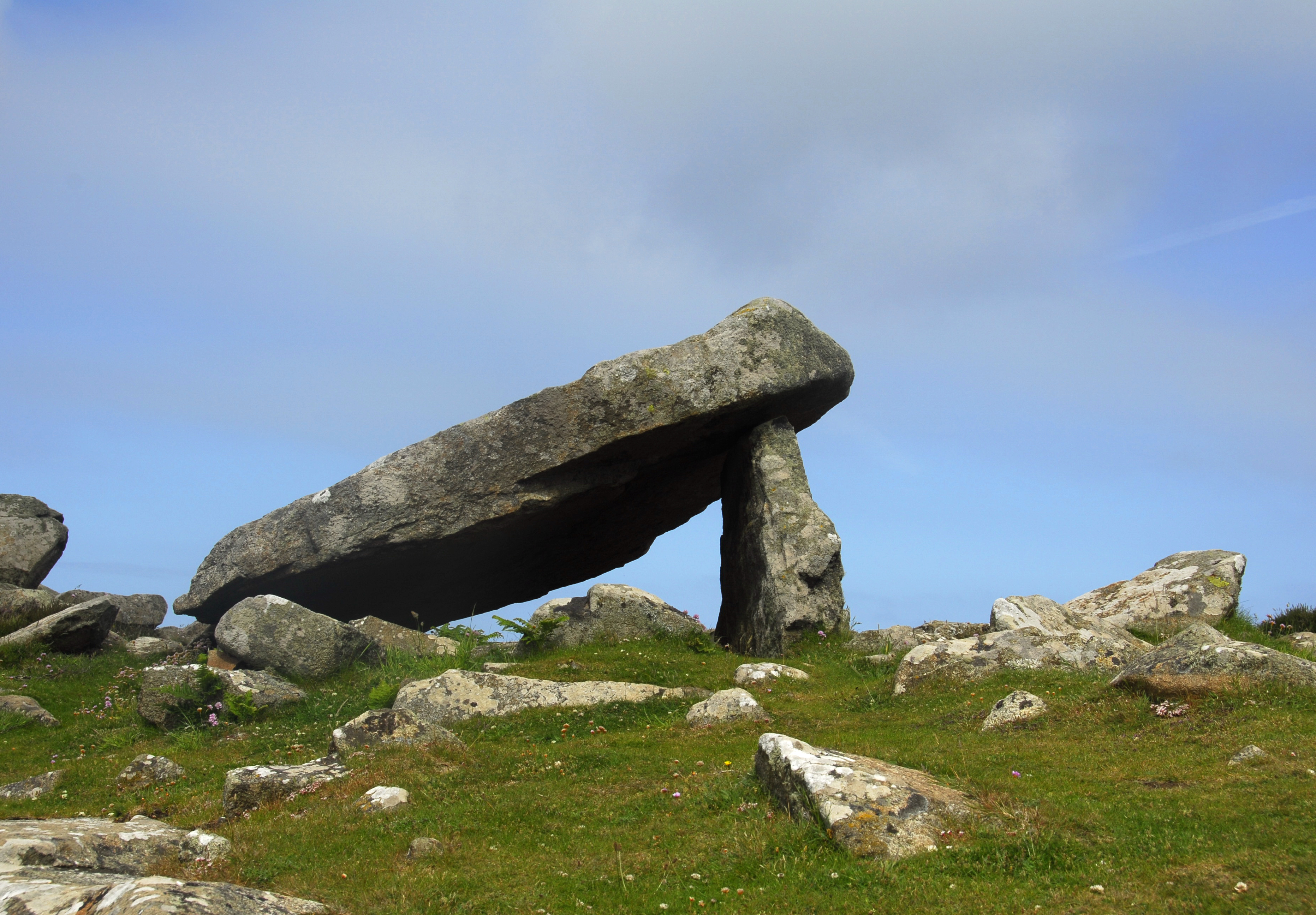
Coetan Arthur

Coetan Arthur dolmen, also known as Arthur's Quoit (not to be confused with Carreg Coetan Arthur, near Newport) is the remains of a Neolithic burial chamber...

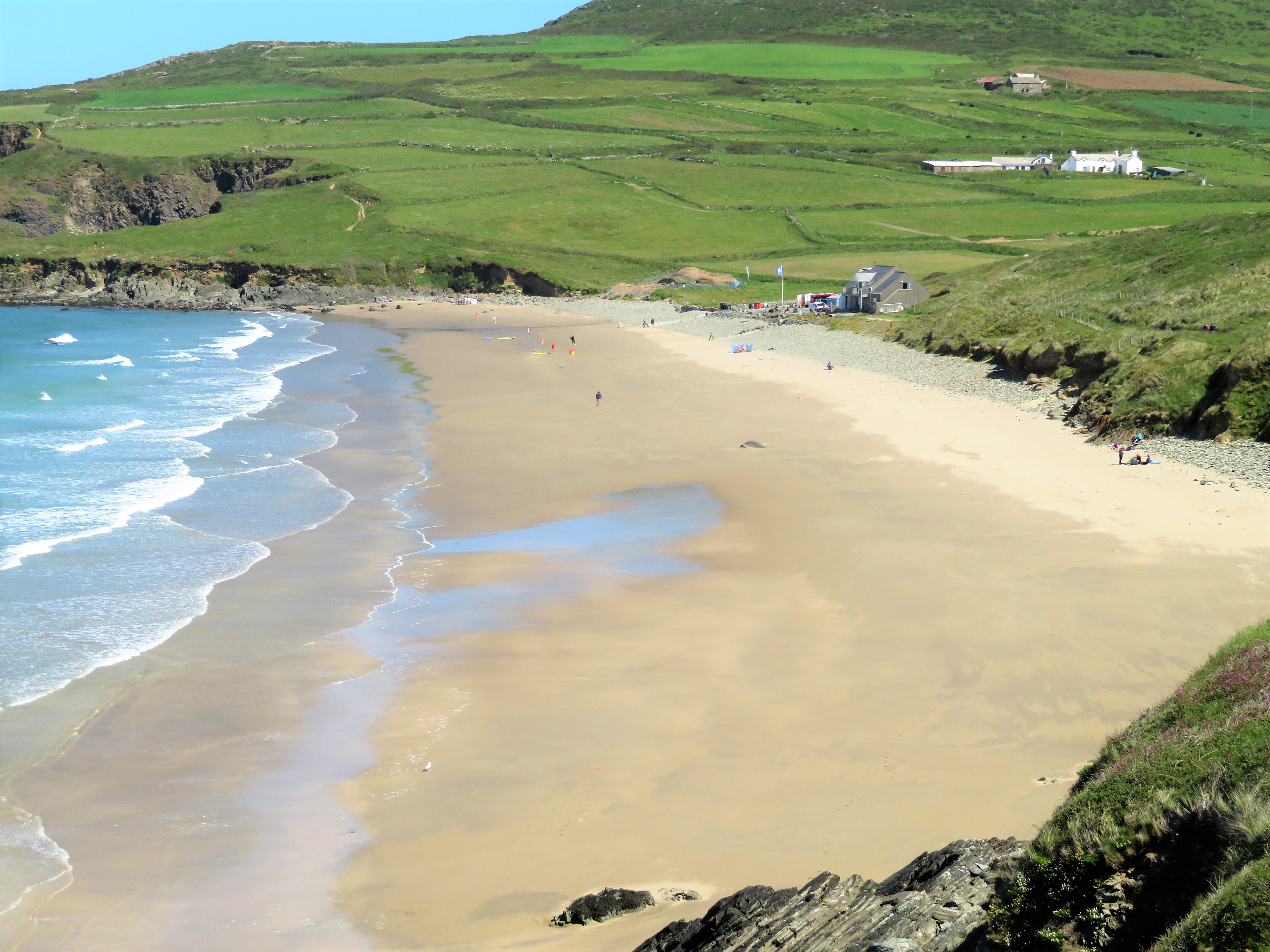
Whitesands Bay (Pembrokeshire)

Whitesands Bay (Welsh: Porth Mawr) is a Blue Flag beach situated on the St David's peninsula in the Pembrokeshire Coast National Park, Wales. Whitesand...
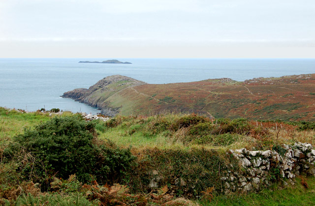
St David's Head

St David's Head (Welsh: Penmaen Dewi) is a headland in the Pembrokeshire Coast National Park, southwest Wales, which marks the divide between the Irish...

Nearby Amenities

Located within 500m of 51.912515,-5.2740675
Carn Treliwyd
Natural: peak
Lat/Long: 51.9095407/-5.2686562
The data included in this document is from www.openstreetmap.org. The data is made available under ODbL.

Have you been to Penrhyn Halen?

Leave your review of Penrhyn Halen below (or comments, questions and feedback).