Beinn nan Caorach

Hill, Mountain in Inverness-shire

Scotland

Beinn nan Caorach

A hopeless task! Hillside above Loch Eireagoraidh
A hopeless task! Credit: Anthony O'Neil

Beinn nan Caorach is a prominent hill located in Inverness-shire, Scotland. It is part of the Scottish Highlands and offers stunning views of the surrounding countryside. Standing at a height of 585 meters (1919 feet), Beinn nan Caorach is a popular destination for hikers and outdoor enthusiasts.

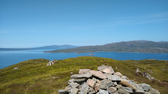
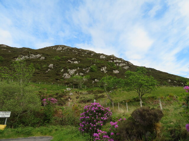
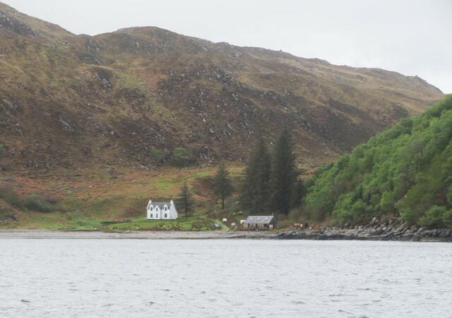
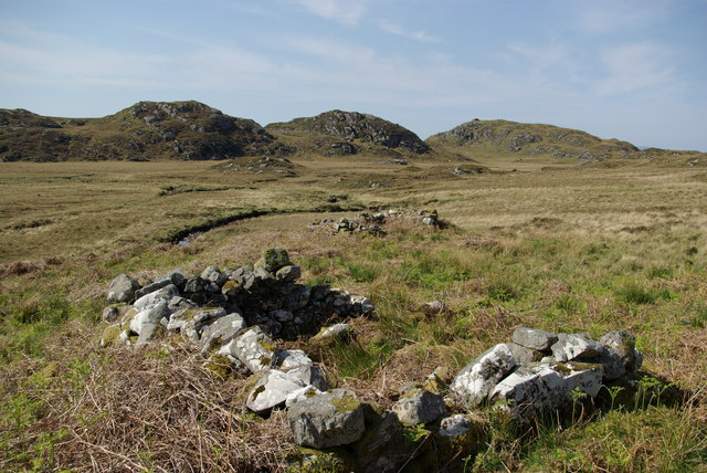
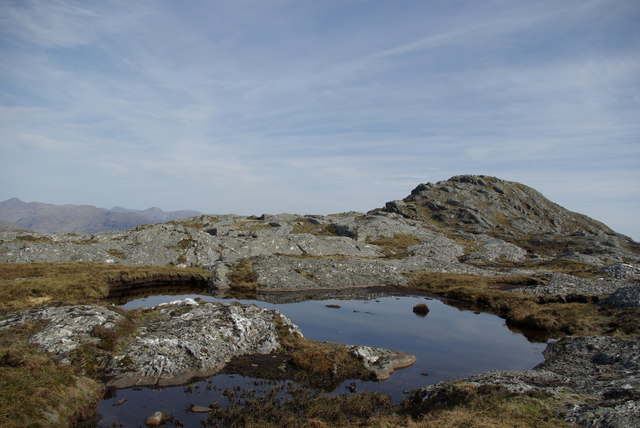
The hill is characterized by its rugged terrain, with steep slopes and rocky outcrops. It is covered in heather and grass, giving it a distinctive purple hue in the summer months. The summit of Beinn nan Caorach offers panoramic views of the surrounding mountains, valleys, and lochs, making it a popular spot for photographers.

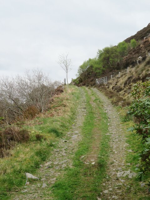
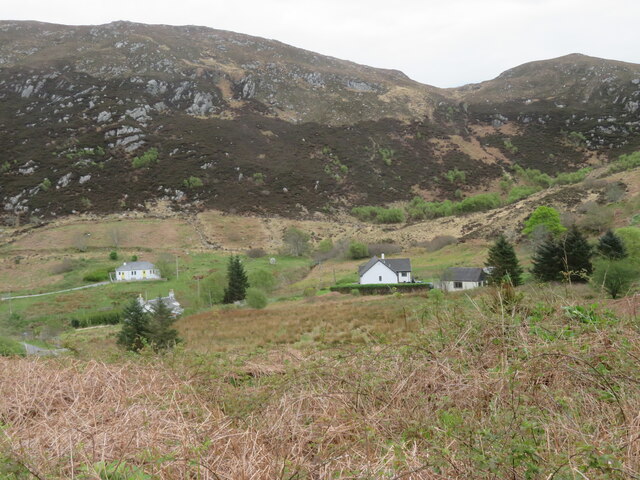
The hill is easily accessible from nearby villages and towns, with several well-marked trails leading to the summit. Hikers can expect a moderate to challenging climb, depending on the route taken. Wildlife is abundant in the area, with red deer, birds of prey, and other native species often spotted along the way.

Overall, Beinn nan Caorach is a must-visit destination for those looking to experience the natural beauty and rugged landscapes of the Scottish Highlands.

If you have any feedback on the listing, please let us know in the comments section below.

Beinn nan Caorach Images

Images are sourced within 2km of 56.997709/-5.789683 or Grid Reference NM6996. Thanks to Geograph Open Source API. All images are credited.

A hopeless task! Hillside above Loch Eireagoraidh
A hopeless task!
Hillside above Loch Eireagoraidh
Cruach Mhalaig Looking north towards western edge of Knoydart from Cruach Mhalaig.
Cruach Mhalaig
Looking north towards western edge of Knoydart from Cruach Mhalaig.
Track to Mallaigmore This track leads onwards from the road end at Mallaig Bheag, but for anyone reaching here by car and anticipating a walk there will be disappointment as there is no parking at the road end, whilst opportunities further back towards Mallaig are also few and far between.
Track to Mallaigmore
This track leads onwards from the road end at Mallaig Bheag, but for anyone reaching here by car and anticipating a walk there will be disappointment as there is no parking at the road end, whilst opportunities further back towards Mallaig are also few and far between.
Malaig Bheag Maps seem to differ here as this can be either 'Malaig' or 'Mallaig'. There's a scattering of houses along the valley, whilst the dyke which defines edge of the improved ground at the base of the rocky hill, also roughly coincides with the eastern edge of the grid square.
Malaig Bheag
Maps seem to differ here as this can be either 'Malaig' or 'Mallaig'. There's a scattering of houses along the valley, whilst the dyke which defines edge of the improved ground at the base of the rocky hill, also roughly coincides with the eastern edge of the grid square.
Malaig Bheag - Little Mallaig Looking west from near the road end.
Malaig Bheag - Little Mallaig
Looking west from near the road end.
The end of the road At Malaig Bheag, an eastern extension of Mallaig/Malaig.
The end of the road
At Malaig Bheag, an eastern extension of Mallaig/Malaig.
Mallaigmore The bay and white house at Mallaigmore as seen from the Loch Nevis ferry.
Mallaigmore
The bay and white house at Mallaigmore as seen from the Loch Nevis ferry.
View towards Sgùrr Eireagoraidh Loch a' Bhada Dharaich is just visible on the left. Taken from the path that runs north from Loch Morar along the Allt an Loin.
View towards Sgùrr Eireagoraidh
Loch a' Bhada Dharaich is just visible on the left. Taken from the path that runs north from Loch Morar along the Allt an Loin.
Faint path to nowhere A short bit of path leads directly towards Loch a' Bhada Dharaich which is right behind the woodland, but doesn't seem to reach it - but with the burgeoning late spring vegetation, it is difficult to tell if the path peters out or is just overgrown, a critical  philosophical difference.
Faint path to nowhere
A short bit of path leads directly towards Loch a' Bhada Dharaich which is right behind the woodland, but doesn't seem to reach it - but with the burgeoning late spring vegetation, it is difficult to tell if the path peters out or is just overgrown, a critical philosophical difference.
Another path to nowhere This iteration of the stalker's path that leads up from Loch Morar veers slightly to the west to avoid Loch a' Bhada Dharaich, but then, shortly thereafter, the path becomes very difficult to discern. It may be possible, with moderate bushwhacking, to link up to the trails that enter the square from the north, but perhaps not in high tick season.
Another path to nowhere
This iteration of the stalker's path that leads up from Loch Morar veers slightly to the west to avoid Loch a' Bhada Dharaich, but then, shortly thereafter, the path becomes very difficult to discern. It may be possible, with moderate bushwhacking, to link up to the trails that enter the square from the north, but perhaps not in high tick season.
Cruach Clachach & An Leth-allt
Shielings by the An Leth-allt
An Leth-allt
An Leth-allt
Summit cairn on Sgurr Eireagoraidh
View from Sgurr Eireagoraidh Looking down upon Loch Eireagoraidh
View from Sgurr Eireagoraidh
Looking down upon Loch Eireagoraidh
Rock outcrops on Sgurr Eireagoraidh
North ridge of Sgurr Eireagoraidh View towards the Isle of Skye
North ridge of Sgurr Eireagoraidh
View towards the Isle of Skye
Pool on north ridge of Sgurr Eireagoraidh
Show me another place!

Beinn nan Caorach is located at Grid Ref: NM6996 (Lat: 56.997709, Lng: -5.789683)

Unitary Authority: Highland

Police Authority: Highlands and Islands

What 3 Words

///mixes.shape.egging. Near Armadale, Highland

Nearby Locations

Beinn nan Caorach

Related Wikis

Loch an Nostarie

Loch an Nostarie is an irregular shaped shallow freshwater loch that lies about a mile north of the west-end of Loch Morar and about a mile south-east...

Loch a' Ghille Ghobaich

Loch a' Ghille Ghobaich (loch of the meddlesome or gossiping ghillie) is a large irregular shaped freshwater hill loch, situated on a north-south orientation...

Mallaig

Mallaig ( ; Scottish Gaelic: Malaig [ˈmal̪ˠɛkʲ]) is a port in Morar, on the west coast of the Highlands of Scotland. It faces Skye from across the Sound...

Mallaig High School

Mallaig High School is a secondary school in Mallaig, Lochaber, Scotland. The school building opened in 1989. The current Acting Head Teacher is Pamela...

Nearby Amenities

Located within 500m of 56.997709,-5.789683
Ford: yes
Lat/Long: 56.9999913/-5.7959178
The data included in this document is from www.openstreetmap.org. The data is made available under ODbL.

Have you been to Beinn nan Caorach?

Leave your review of Beinn nan Caorach below (or comments, questions and feedback).