High Crompton

Settlement in Lancashire

England

High Crompton

Hanging Chadder View looking towards Hanging Chadder seen from Tindle Hill.
Hanging Chadder Credit: Peter McDermott

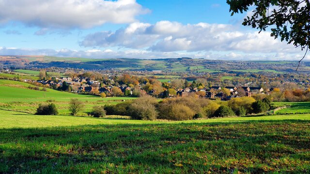
High Crompton is a small village located within the borough of Oldham in the county of Lancashire, England. Situated on the western outskirts of the town of Shaw and Crompton, it is nestled between the picturesque Pennine Hills and the urban areas of Greater Manchester.

The village has a population of around 5,000 residents and is known for its peaceful and scenic surroundings. High Crompton boasts a mix of residential properties, ranging from traditional stone-built cottages to modern housing estates. The village is characterized by its tight-knit community, with several local amenities serving the needs of the residents, including a primary school, a post office, and a handful of shops and restaurants.

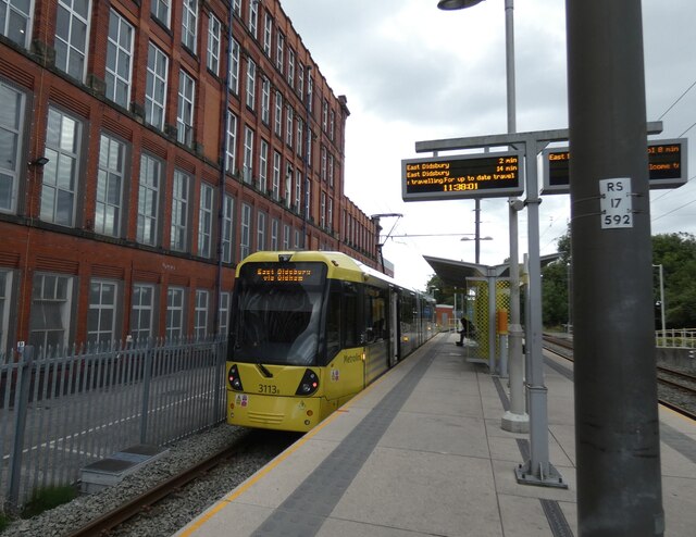
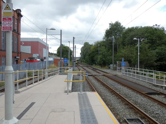
Nature enthusiasts are drawn to High Crompton due to its proximity to beautiful green spaces. The nearby Crompton Moor offers breathtaking views of the surrounding countryside and provides ample opportunities for hiking, walking, and birdwatching. The village also benefits from excellent transport links, with easy access to the nearby towns of Oldham and Rochdale, as well as Manchester city center.

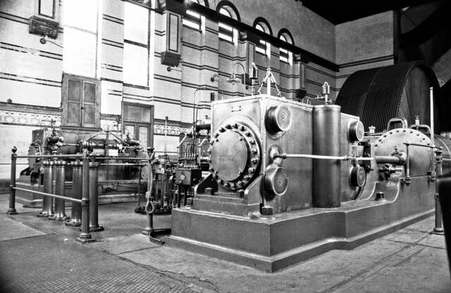
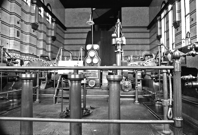
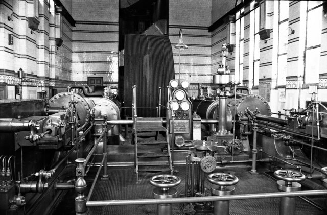
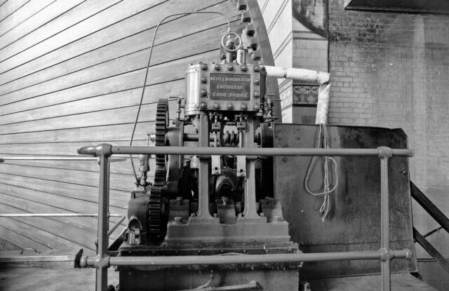
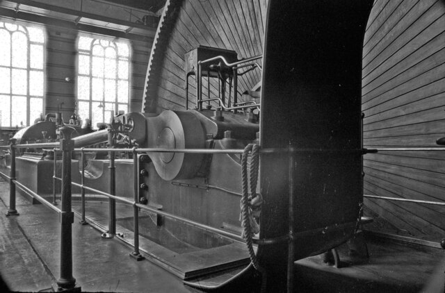
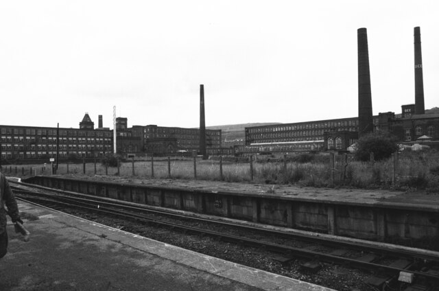
High Crompton has a rich industrial heritage, with its roots in the textile industry. The village was once home to numerous cotton mills, which played a significant role in the region's industrial development. Today, remnants of these mills can still be seen, serving as a reminder of the village's past.

Overall, High Crompton offers a tranquil and scenic living environment, making it an attractive place to reside for those seeking a balance between rural charm and convenient access to nearby urban areas.

If you have any feedback on the listing, please let us know in the comments section below.

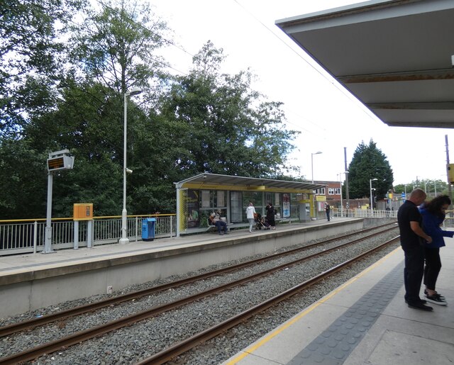
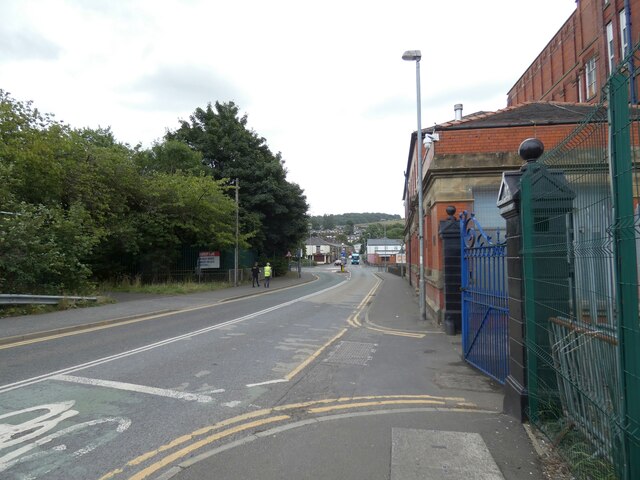
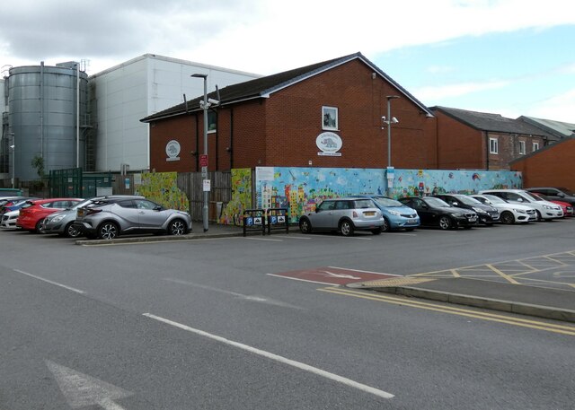
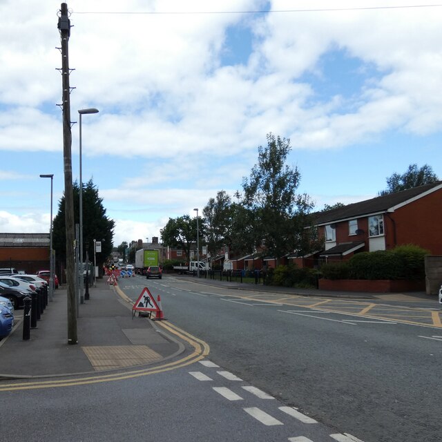
High Crompton Images

Images are sourced within 2km of 53.583382/-2.110234 or Grid Reference SD9209. Thanks to Geograph Open Source API. All images are credited.

Hanging Chadder View looking towards Hanging Chadder seen from Tindle Hill.
Hanging Chadder
View looking towards Hanging Chadder seen from Tindle Hill.
Dee Mill, Shaw - steam engine This cotton spinning mill was one of many in Shaw and was opened in 1907 with power provided by this horizontal twin tandem compound steam engine by Scott & Hodgson of Guide Bridge. The cylinders were 18" & 42" x 5' (x2) and turned a 26' diameter flywheel driving by cotton ropes. The engine ran at 60 revolutions per minute and generated 1500 horsepower. It stopped running commercially in 1967 but was then preserved with the assistance of the Northern Mill Engine Society and was run on occasions until 1982 when the mill closed and was sold. Although the engine was made a Scheduled Ancient Monument it became very badly vandalised and was finally scrapped in 1994.

This was a lovely engine and typical of so many in Lancashire. There are now only three large spinning mill engines surviving in situ.
Dee Mill, Shaw - steam engine
This cotton spinning mill was one of many in Shaw and was opened in 1907 with power provided by this horizontal twin tandem compound steam engine by Scott & Hodgson of Guide Bridge. The cylinders were 18" & 42" x 5' (x2) and turned a 26' diameter flywheel driving by cotton ropes. The engine ran at 60 revolutions per minute and generated 1500 horsepower. It stopped running commercially in 1967 but was then preserved with the assistance of the Northern Mill Engine Society and was run on occasions until 1982 when the mill closed and was sold. Although the engine was made a Scheduled Ancient Monument it became very badly vandalised and was finally scrapped in 1994. This was a lovely engine and typical of so many in Lancashire. There are now only three large spinning mill engines surviving in situ.
Dee Mill, Shaw - steam engine This cotton spinning mill was one of many in Shaw and was opened in 1907 with power provided by this horizontal twin tandem compound steam engine by Scott & Hodgson of Guide Bridge. The cylinders were 18" & 42" x 5' (x2) and turned a 26' diameter flywheel driving by cotton ropes. The engine ran at 60 revolutions per minute and generated 1500 horsepower. It stopped running commercially in 1967 but was then preserved with the assistance of the Northern Mill Engine Society and was run on occasions until 1982 when the mill closed and was sold. Although the engine was made a Scheduled Ancient Monument it became very badly vandalised and was finally scrapped in 1994.

This view shows the inverted vertical duplex barring engine that engaged with the gear ring on the rim of the flywheel. The wood boarding that covered the flywheel spokes is also seen. The flywheel consisted of two identical wheels running edge to edge each with its own set of spokes. This was typical of the larger wheels and the largest had three wheels set edge to edge as at Mons Mill, Todmorden.

This was a lovely engine and typical of so many in Lancashire. There are now only three large spinning mill engines surviving in situ.
Dee Mill, Shaw - steam engine
This cotton spinning mill was one of many in Shaw and was opened in 1907 with power provided by this horizontal twin tandem compound steam engine by Scott & Hodgson of Guide Bridge. The cylinders were 18" & 42" x 5' (x2) and turned a 26' diameter flywheel driving by cotton ropes. The engine ran at 60 revolutions per minute and generated 1500 horsepower. It stopped running commercially in 1967 but was then preserved with the assistance of the Northern Mill Engine Society and was run on occasions until 1982 when the mill closed and was sold. Although the engine was made a Scheduled Ancient Monument it became very badly vandalised and was finally scrapped in 1994. This view shows the inverted vertical duplex barring engine that engaged with the gear ring on the rim of the flywheel. The wood boarding that covered the flywheel spokes is also seen. The flywheel consisted of two identical wheels running edge to edge each with its own set of spokes. This was typical of the larger wheels and the largest had three wheels set edge to edge as at Mons Mill, Todmorden. This was a lovely engine and typical of so many in Lancashire. There are now only three large spinning mill engines surviving in situ.
Dee Mill, Shaw - steam engine This cotton spinning mill was one of many in Shaw and was opened in 1907 with power provided by this horizontal twin tandem compound steam engine by Scott & Hodgson of Guide Bridge. The cylinders were 18" & 42" x 5' (x2) and turned a 26' diameter flywheel driving by cotton ropes. The engine ran at 60 revolutions per minute and generated 1500 horsepower. It stopped running commercially in 1967 but was then preserved with the assistance of the Northern Mill Engine Society and was run on occasions until 1982 when the mill closed and was sold. Although the engine was made a Scheduled Ancient Monument it became very badly vandalised and was finally scrapped in 1994.

This was a lovely engine and typical of so many in Lancashire. There are now only three large spinning mill engines surviving in situ.
Dee Mill, Shaw - steam engine
This cotton spinning mill was one of many in Shaw and was opened in 1907 with power provided by this horizontal twin tandem compound steam engine by Scott & Hodgson of Guide Bridge. The cylinders were 18" & 42" x 5' (x2) and turned a 26' diameter flywheel driving by cotton ropes. The engine ran at 60 revolutions per minute and generated 1500 horsepower. It stopped running commercially in 1967 but was then preserved with the assistance of the Northern Mill Engine Society and was run on occasions until 1982 when the mill closed and was sold. Although the engine was made a Scheduled Ancient Monument it became very badly vandalised and was finally scrapped in 1994. This was a lovely engine and typical of so many in Lancashire. There are now only three large spinning mill engines surviving in situ.
Dee and Lily Mills, Shaw Dee Mill on the right was demolished long ago but the two Lily Mills on the left are part of a huge warehouse complex. The station is now part of a Metro but was then British Rail.
Dee and Lily Mills, Shaw
Dee Mill on the right was demolished long ago but the two Lily Mills on the left are part of a huge warehouse complex. The station is now part of a Metro but was then British Rail.
East Didsbury tram at Shaw and Crompton
Shaw and Crompton Tram Stop 
The Metrolink tram stop is on the converted railway line from Oldham Mumps. The old railway station was on the north side of Beal Lane level crossing. The new Metrolink station was created on the south side of the crossing. On the right is a siding for trams terminating here <a href="https://www.geograph.org.uk/photo/7262224">SD9408 : East Didsbury tram at Shaw and Crompton</a>.
Shaw and Crompton Tram Stop
The Metrolink tram stop is on the converted railway line from Oldham Mumps. The old railway station was on the north side of Beal Lane level crossing. The new Metrolink station was created on the south side of the crossing. On the right is a siding for trams terminating here SD9408 : East Didsbury tram at Shaw and Crompton.
Beal Lane
Beal Lane
Rises Private Day Nursery 
Founded in 2003. A  mural on the outside  is mostly obscured by parked cars, alas, and one section appears to have been damaged.
Rises Private Day Nursery
Founded in 2003. A mural on the outside is mostly obscured by parked cars, alas, and one section appears to have been damaged.
Roadworks on Beal Lane
Shaw and Crompton Tram Stop Looking down the line towards Oldham.

On the right are some large-leafed plants <a href="https://www.geograph.org.uk/photo/7262950">SD9408 : Butterbur (Petasites hybridus)</a>.
Shaw and Crompton Tram Stop
Looking down the line towards Oldham. On the right are some large-leafed plants SD9408 : Butterbur (Petasites hybridus).
Butterbur (Petasites hybridus) By the side of Shaw and Crompton Tram Stop <a href="https://www.geograph.org.uk/photo/7262944">SD9408 : Shaw and Crompton Tram Stop</a>.

Apparently the leaves of this plant were once used for wrapping butter. Other common names include  Bog rhubarb, Devil's hat, Pestilence wart, Batter dock, Butter dock, Cleats, Cleets, Flea dock, Gallon, Oxwort, Pestilence wort, Poison rhubarb, Son-before-the-father, Umbrella leaf, Water docken.
Butterbur (Petasites hybridus)
By the side of Shaw and Crompton Tram Stop SD9408 : Shaw and Crompton Tram Stop. Apparently the leaves of this plant were once used for wrapping butter. Other common names include Bog rhubarb, Devil's hat, Pestilence wart, Batter dock, Butter dock, Cleats, Cleets, Flea dock, Gallon, Oxwort, Pestilence wort, Poison rhubarb, Son-before-the-father, Umbrella leaf, Water docken.
Shaw and Crompton Tram Stop 
The approaching tram is negotiating points that will lead it onto the track to the left. It is on a service from East Didsbury via Exchange Square and Oldham which will terminate here <a href="https://www.geograph.org.uk/photo/7262224">SD9408 : East Didsbury tram at Shaw and Crompton</a>. The tracks on the right are for those going on to Rochdale.
Shaw and Crompton Tram Stop
The approaching tram is negotiating points that will lead it onto the track to the left. It is on a service from East Didsbury via Exchange Square and Oldham which will terminate here SD9408 : East Didsbury tram at Shaw and Crompton. The tracks on the right are for those going on to Rochdale.
OS Cut Mark - Royton, #30 Tandle Hill Road <span class="nowrap"><a title="https://www.bench-marks.org.uk/bm133984" rel="nofollow ugc noopener" href="https://www.bench-marks.org.uk/bm133984">Link</a><img style="margin-left:2px;" alt="External link" title="External link - shift click to open in new window" src="https://s1.geograph.org.uk/img/external.png" width="10" height="10"/></span>
OS Cut Mark - Royton, #30 Tandle Hill Road
30 Tandle Hill Road
30 Tandle Hill Road
OS Cut Mark - Royton, Puckersley Inn <span class="nowrap"><a title="https://www.bench-marks.org.uk/bm61295" rel="nofollow ugc noopener" href="https://www.bench-marks.org.uk/bm61295">Link</a><img style="margin-left:2px;" alt="External link" title="External link - shift click to open in new window" src="https://s1.geograph.org.uk/img/external.png" width="10" height="10"/></span>
OS Cut Mark - Royton, Puckersley Inn
Show me another place!

High Crompton is located at Grid Ref: SD9209 (Lat: 53.583382, Lng: -2.110234)

Unitary Authority: Oldham

Police Authority: Greater Manchester

What 3 Words

///float.duck.quiz. Near Royton, Manchester

Related Wikis

High Crompton

High Crompton is a locality in the west of the Shaw and Crompton parish of the Metropolitan Borough of Oldham, in Greater Manchester, England. It is formed...

Crompton House Church of England Academy

Crompton House CE School is a coeducational Church of England secondary school and sixth form located in the High Crompton area of Shaw and Crompton in...

Crompton Urban District

Crompton Urban District was, from 1894 to 1974, a local government district in the administrative county of Lancashire, England. The area was coterminate...

Trent Mill

Trent Mill was a cotton spinning mill on Duchess Street in Shaw and Crompton, Greater Manchester, England. It was built by F.W. Dixon & Son in 1908. It...

Nearby Amenities

Located within 500m of 53.583382,-2.110234
Mini Roundabout
Direction: clockwise
Source: bing
Lat/Long: 53.5839547/-2.1125995
Bus Stop
Higher Crompton, Rochdale Road / outside High Crompton Post Office
Bus: yes
Naptan AtcoCode: 1800ED14011
Naptan Bearing: NW
Naptan CommonName: Rochdale Road/High Crompton Post Office
Naptan Indicator: Nr Sub Station
Naptan Landmark: SUB STATION
Naptan NaptanCode: manapawj
Naptan PlusbusZoneRef: MNCRPIC
Naptan ShortCommonName: High Crompton PO
Naptan Street: ROCHDALE ROAD
Naptan Verified: no
Network: TfGM
Operator: TfGM
Public Transport: platform
Source: naptan_import
Lat/Long: 53.5815523/-2.1099762
Bus Stop
Higher Crompton, Thornham Road / opposite Cherry Hall Drive
Bus: yes
Naptan AtcoCode: 1800ED14131
Naptan Bearing: W
Naptan CommonName: Thornham Road/Cherry Hall Drive
Naptan Indicator: Opp House 154
Naptan Landmark: HOUSE 160
Naptan NaptanCode: manapdgd
Naptan PlusbusZoneRef: MNCRPIC
Naptan ShortCommonName: Cherry Hall Drive
Naptan Street: THORNHAM ROAD
Naptan Verified: no
Network: TfGM
Operator: TfGM
Public Transport: platform
Source: naptan_import
Lat/Long: 53.5821474/-2.1173942
Bus Stop
High Crompton, Thornham Road / near Cherry Hall Drive
Bus: yes
Naptan AtcoCode: 1800ED14141
Naptan Bearing: E
Naptan CommonName: Thornham Road/Cherry Hall Drive
Naptan Indicator: Nr House 154
Naptan Landmark: HOUSE 154
Naptan NaptanCode: manapdgj
Naptan Notes: INDICATOR AMENDED
Naptan PlusbusZoneRef: MNCRPIC
Naptan ShortCommonName: Cherry Hall Drive
Naptan Street: THORNHAM ROAD
Naptan Verified: no
Network: TfGM
Operator: TfGM
Public Transport: platform
Source: naptan_import
Lat/Long: 53.5820131/-2.1169105
Bus Stop
Higher Crompton, Thornham Road / opposite Fitton Street
Bus: yes
Naptan AtcoCode: 1800ED14151
Naptan Bearing: W
Naptan CommonName: Thornham Road/Fitton Street
Naptan Indicator: Nr House 33
Naptan Landmark: HOUSE 36
Naptan NaptanCode: manapdgm
Naptan PlusbusZoneRef: MNCRPIC
Naptan ShortCommonName: Fitton Street
Naptan Street: THORNHAM ROAD
Naptan Verified: no
Network: TfGM
Operator: TfGM
Public Transport: platform
Source: naptan_import
Lat/Long: 53.5815223/-2.1132236
Bus Stop
High Crompton, Thornham Road / near Fitton Street
Bus: yes
Naptan AtcoCode: 1800ED14161
Naptan Bearing: E
Naptan CommonName: Thornham Road/Fitton Street
Naptan Indicator: O/s House 36
Naptan Landmark: HOUSE 34
Naptan NaptanCode: manapdgp
Naptan PlusbusZoneRef: MNCRPIC
Naptan ShortCommonName: Fitton Street
Naptan Street: THORNHAM ROAD
Naptan Verified: no
Network: TfGM
Operator: TfGM
Public Transport: platform
Source: naptan_import
Lat/Long: 53.5816301/-2.1132088
Bus Stop
High Crompton, Thornham Road / outside High Crompton Post Office
Bus: yes
Naptan AtcoCode: 1800ED14171
Naptan Bearing: E
Naptan CommonName: Thornham Road/High Crompton Post Office
Naptan Indicator: Hopwood Crt Opp
Naptan Landmark: HOPWOOD COURT
Naptan NaptanCode: manapdgt
Naptan PlusbusZoneRef: MNCRPIC
Naptan ShortCommonName: High Crompton PO
Naptan Street: THORNHAM ROAD
Naptan Verified: no
Network: TfGM
Operator: TfGM
Public Transport: platform
Source: naptan_import
Lat/Long: 53.5818392/-2.1106718
Bus Stop
Rochdale Road/Moss Gate Road
Bus: yes
Naptan AtcoCode: 1800ED14211
Naptan Bearing: NW
Naptan CommonName: Rochdale Road/Moss Gate Road
Naptan Indicator: Opp House 528
Naptan Landmark: ALLOTMENTS
Naptan NaptanCode: manapdjd
Naptan Notes: INDICATOR AMENDED
Naptan PlusbusZoneRef: MNCRPIC
Naptan ShortCommonName: Moss Gate Road
Naptan Street: ROCHDALE ROAD
Naptan Verified: no
Network: TfGM
Public Transport: platform
Source: naptan_import
Lat/Long: 53.5862479/-2.115623
Bus Stop
Rochdale Road/Moss Gate Road
Bus: yes
Naptan AtcoCode: 1800ED14221
Naptan Bearing: SE
Naptan CommonName: Rochdale Road/Moss Gate Road
Naptan Indicator: O/s House 528a
Naptan Landmark: HOUSE 528A
Naptan NaptanCode: manapdjg
Naptan PlusbusZoneRef: MNCRPIC
Naptan ShortCommonName: Moss Gate Road
Naptan Street: ROCHDALE ROAD
Naptan Verified: no
Network: TfGM
Public Transport: platform
Source: naptan_import
Lat/Long: 53.5860686/-2.1151694
Bus Stop
Rochdale Road/Old Bulls Head
Bus: yes
Naptan AtcoCode: 1800ED14231
Naptan Bearing: NW
Naptan CommonName: Rochdale Road/Old Bulls Head
Naptan Indicator: O/s House 425
Naptan Landmark: HOUSE 417
Naptan NaptanCode: manapdjm
Naptan PlusbusZoneRef: MNCRPIC
Naptan ShortCommonName: Old Bulls Head
Naptan Street: ROCHDALE ROAD
Naptan Verified: no
Network: TfGM
Public Transport: platform
Source: naptan_import
Lat/Long: 53.5849103/-2.1139124
Bus Stop
Old Bulls Head
Bus: yes
Naptan AtcoCode: 1800ED14241
Naptan Bearing: SE
Naptan CommonName: Rochdale Road/Old Bulls Head
Naptan Indicator: Old Bulls Head
Naptan Landmark: OLD BULLS HEAD
Naptan NaptanCode: manapdjp
Naptan PlusbusZoneRef: MNCRPIC
Naptan ShortCommonName: Old Bulls Head
Naptan Street: ROCHDALE ROAD
Naptan Verified: no
Network: TfGM
Public Transport: platform
Source: naptan_import
Wheelchair: yes
Lat/Long: 53.5842849/-2.1129024
Bus Stop
Rochdale Road/High Crompton Post Office
Bus: yes
Naptan AtcoCode: 1800ED14251
Naptan Bearing: SE
Naptan CommonName: Rochdale Road/High Crompton Post Office
Naptan Indicator: Bungalow
Naptan Landmark: SANDWICH SHOP
Naptan NaptanCode: manapdjt
Naptan PlusbusZoneRef: MNCRPIC
Naptan ShortCommonName: High Crompton PO
Naptan Street: ROCHDALE ROAD
Naptan Verified: no
Network: TfGM
Public Transport: platform
Source: naptan_import
Lat/Long: 53.5818486/-2.1102338
Bus Stop
Rushcroft, Trent Road / opposite Hawkshead Road
Bus: yes
Naptan AtcoCode: 1800ED16331
Naptan Bearing: E
Naptan CommonName: Trent Road/Hawkshead Road
Naptan Indicator: O/s House 110
Naptan Landmark: O/S HOUSE 110
Naptan NaptanCode: manapjwt
Naptan PlusbusZoneRef: MNCRPIC
Naptan ShortCommonName: Hawkshead Road
Naptan Street: TRENT ROAD
Naptan Verified: no
Network: TfGM
Operator: TfGM
Public Transport: platform
Source: naptan_import
Lat/Long: 53.5863211/-2.1045352
Bus Stop
Rushcroft, Grampian Way / near Long Rushes
Bus: yes
Naptan AtcoCode: 1800ED16341
Naptan Bearing: N
Naptan CommonName: Trent Road/Long Rushes
Naptan Indicator: The Qualty Shop
Naptan Landmark: Doctor's Surgery
Naptan NaptanCode: manapmad
Naptan PlusbusZoneRef: MNCRPIC
Naptan ShortCommonName: Long Rushes
Naptan Street: Grampian Way
Naptan Verified: no
Network: TfGM
Operator: TfGM
Public Transport: platform
Source: naptan_import
Lat/Long: 53.5849524/-2.1072509
Bus Stop
Rushcroft, Duchess Street / opposite Derwent Drive
Bus: yes
Naptan AtcoCode: 1800ED16351
Naptan Bearing: W
Naptan CommonName: Duchess Street/Derwent Drive
Naptan Indicator: O/s House 141
Naptan Landmark: HOUSE 141
Naptan NaptanCode: manapmag
Naptan PlusbusZoneRef: MNCRPIC
Naptan ShortCommonName: Derwent Drive
Naptan Street: Duchess Street
Naptan Verified: no
Network: TfGM
Operator: TfGM
Public Transport: platform
Source: naptan_import
Lat/Long: 53.5831975/-2.1034832
Bus Stop
High Crompton, Rochdale Road / opposite The Orchards
Bus: yes
Naptan AtcoCode: 1800ED16491
Naptan Bearing: SE
Naptan CommonName: Rochdale Road/The Orchards
Naptan Indicator: Fairways
Naptan Landmark: HOUSE 224
Naptan NaptanCode: manapmdw
Naptan PlusbusZoneRef: MNCRPIC
Naptan ShortCommonName: The Orchards
Naptan Street: ROCHDALE ROAD
Naptan Verified: no
Network: TfGM
Operator: TfGM
Public Transport: platform
Source: naptan_import
Lat/Long: 53.5809618/-2.1068632
Bus Stop
Higher Crompton, Rochdale Road / near The Orchards
Bus: yes
Naptan AtcoCode: 1800ED16501
Naptan Bearing: NW
Naptan CommonName: Rochdale Road/The Orchards
Naptan Indicator: Cromptn Comp Op
Naptan Landmark: SCHOOL
Naptan NaptanCode: manapmga
Naptan PlusbusZoneRef: MNCRPIC
Naptan ShortCommonName: The Orchards
Naptan Street: ROCHDALE ROAD
Naptan Verified: no
Network: TfGM
Operator: TfGM
Public Transport: platform
Source: naptan_import
Lat/Long: 53.5809881/-2.1076185
Londis
Brand: Londis
Brand Wikidata: Q21008564
Shop: convenience
Source: OS OpenData StreetView
Toilets Wheelchair: no
Wheelchair: limited
Lat/Long: 53.5819358/-2.1105984
Turning Circle
Lat/Long: 53.5808488/-2.1080982
Turning Circle
Lat/Long: 53.5792681/-2.1118619
Turning Circle
Lat/Long: 53.5797196/-2.11137
Mini Roundabout
Direction: clockwise
Source: bing
Lat/Long: 53.5816361/-2.1162094
Mini Roundabout
Direction: clockwise
Source: bing
Lat/Long: 53.5818493/-2.1103547
Post Box
Lat/Long: 53.5841454/-2.1129598
Fast Food
Chop Suey House
Cuisine: chinese
Toilets Wheelchair: no
Wheelchair: no
Wheelchair Description: There is no seating area or toilet in the restaurant. Ordering food is a challenge because the entrance is not ramped
Lat/Long: 53.5839987/-2.112824
Pub
Old Bulls Head
Lat/Long: 53.584338/-2.1128268
Generator Method: photovoltaic
Generator Output Electricity: yes
Generator Source: solar
Generator Type: solar_photovoltaic_panel
Location: roof
Power: generator
Lat/Long: 53.5824598/-2.1119393
Generator Method: photovoltaic
Generator Output Electricity: yes
Generator Source: solar
Generator Type: solar_photovoltaic_panel
Location: roof
Power: generator
Lat/Long: 53.5840529/-2.1087944
Generator Method: photovoltaic
Generator Output Electricity: yes
Generator Source: solar
Generator Type: solar_photovoltaic_panel
Location: roof
Power: generator
Lat/Long: 53.5858856/-2.1086979
Generator Method: photovoltaic
Generator Output Electricity: yes
Generator Source: solar
Generator Type: solar_photovoltaic_panel
Location: roof
Power: generator
Lat/Long: 53.5873854/-2.1092129
Generator Method: photovoltaic
Generator Output Electricity: yes
Generator Source: solar
Generator Type: solar_photovoltaic_panel
Location: roof
Power: generator
Lat/Long: 53.5873839/-2.1093148
Generator Method: photovoltaic
Generator Output Electricity: yes
Generator Source: solar
Generator Type: solar_photovoltaic_panel
Location: roof
Power: generator
Lat/Long: 53.5875176/-2.1090358
Generator Method: photovoltaic
Generator Output Electricity: yes
Generator Source: solar
Generator Type: solar_photovoltaic_panel
Location: roof
Power: generator
Lat/Long: 53.5876068/-2.1077564
Generator Method: photovoltaic
Generator Output Electricity: yes
Generator Source: solar
Generator Type: solar_photovoltaic_panel
Location: roof
Power: generator
Lat/Long: 53.5875447/-2.1080434
Generator Method: photovoltaic
Generator Output Electricity: yes
Generator Source: solar
Generator Type: solar_photovoltaic_panel
Location: roof
Power: generator
Lat/Long: 53.5872175/-2.1065186
Generator Method: photovoltaic
Generator Output Electricity: yes
Generator Source: solar
Generator Type: solar_photovoltaic_panel
Location: roof
Power: generator
Lat/Long: 53.585689/-2.1042763
Generator Method: photovoltaic
Generator Output Electricity: yes
Generator Source: solar
Generator Type: solar_photovoltaic_panel
Location: roof
Power: generator
Lat/Long: 53.5856699/-2.1041985
Generator Method: photovoltaic
Generator Output Electricity: yes
Generator Source: solar
Generator Type: solar_photovoltaic_panel
Location: roof
Power: generator
Lat/Long: 53.5856205/-2.1040241
Generator Method: photovoltaic
Generator Output Electricity: yes
Generator Source: solar
Generator Type: solar_photovoltaic_panel
Location: roof
Power: generator
Lat/Long: 53.5856157/-2.1039276
Turning Loop
Lat/Long: 53.581272/-2.1074873
Grit Bin
Lat/Long: 53.586287/-2.1141509
Bus Stop
Rushcroft, westbound Trend Road
Bus: yes
Naptan AtcoCode: 1800EDH5231
Network: TfGM
Operator: TfGM
Public Transport: platform
Lat/Long: 53.5861813/-2.1051322
Bus Stop
Rushcroft, westbound Long Rushes
Bus: yes
Network: TfGM
Operator: TfGM
Public Transport: platform
Lat/Long: 53.585765/-2.1085309
Bus Stop
Rushcroft, southbound Rushcroft Road
Bus: yes
Naptan AtcoCode: 1800EDH0621
Network: TfGM
Operator: TfGM
Public Transport: platform
Lat/Long: 53.5849176/-2.1101632
Bus Stop
High Crompton, SW-bound Wood Street
Bus: yes
Network: TfGM
Operator: TfGM
Public Transport: platform
Lat/Long: 53.5826832/-2.1134504
Bus Stop
High Crompton, NW-bound Sherwood Way
Bus: yes
Naptan AtcoCode: 1800EDH4141
Network: TfGM
Operator: TfGM
Public Transport: platform
Lat/Long: 53.583263/-2.1152619
Bus Stop
High Crompton, southbound Sherwood Way
Bus: yes
Network: TfGM
Operator: TfGM
Public Transport: platform
Lat/Long: 53.5836234/-2.1169244
Bus Stop
High Crompton, SW-bound Cherry Hall Drive
Bus: yes
Naptan AtcoCode: 1800EDH5261
Network: TfGM
Operator: TfGM
Public Transport: platform
Lat/Long: 53.5818013/-2.1159569
Bus Stop
High Crompton, westbound The Orchards
Bus: yes
Naptan AtcoCode: 1800EDH5271
Network: TfGM
Operator: TfGM
Public Transport: platform
Lat/Long: 53.5803114/-2.1062145
Post Office
High Crompton Post Office
Addr Housename: Londis
Addr Postcode: OL2 7HR
Brand: Post Office
Brand Wikidata: Q1783168
Ref Pol Id: 4908
Website: https://www.postoffice.co.uk/branch-finder/1754246/high-crompton
Lat/Long: 53.581913/-2.1105739
The data included in this document is from www.openstreetmap.org. The data is made available under ODbL.

Have you been to High Crompton?

Leave your review of High Crompton below (or comments, questions and feedback).