Cnoc an t-Sabhail

Hill, Mountain in Argyllshire

Scotland

Cnoc an t-Sabhail

Na Crogachan Ice-smoothed rocks at the northern tip of the Isle of Gigha.
Na Crogachan Credit: Anne Burgess

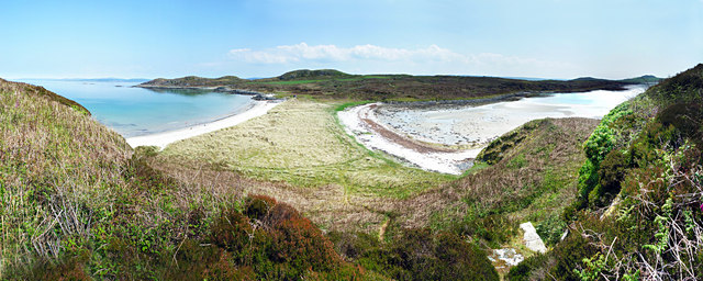
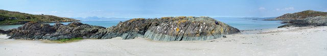
Cnoc an t-Sabhail is a prominent hill located in the rural region of Argyllshire, Scotland. Situated amidst the picturesque landscapes of the Scottish Highlands, it is a popular destination for outdoor enthusiasts and nature lovers alike.

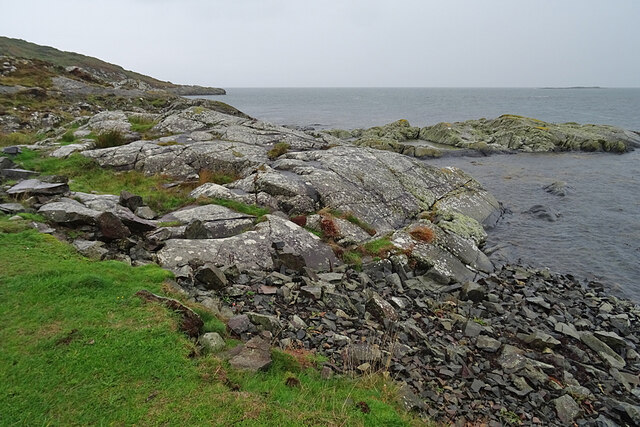
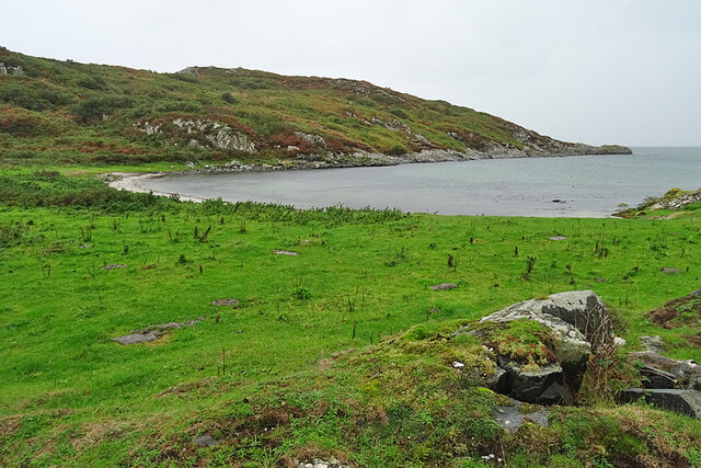
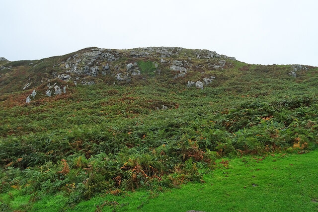
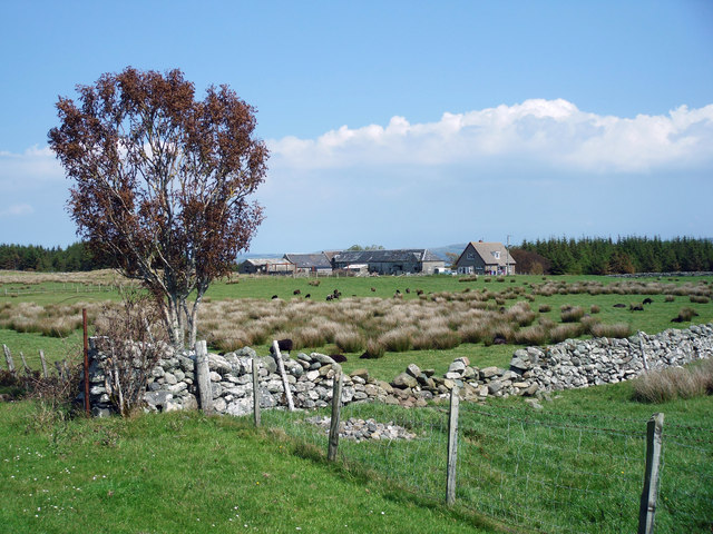
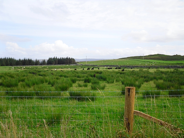
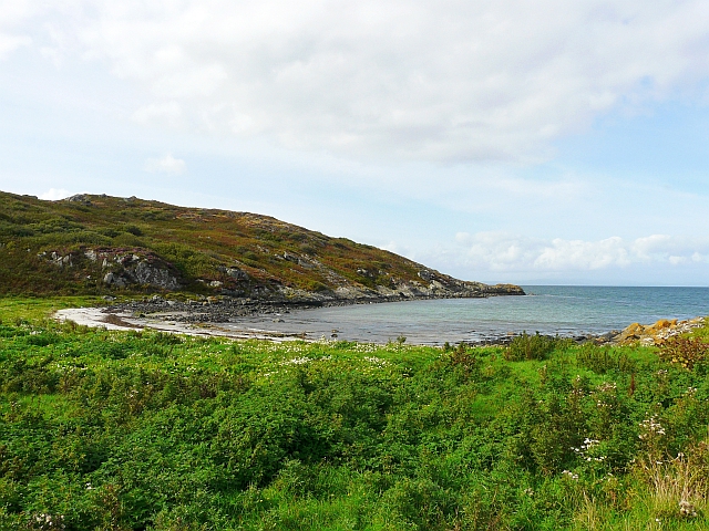
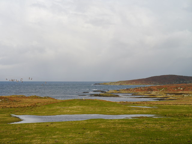
The hill stands at an elevation of approximately 350 meters (1150 feet) above sea level, offering breathtaking panoramic views of the surrounding countryside. It is characterized by its gently sloping terrain, covered in a patchwork of heather, grass, and rugged rocks. The hill's summit provides an ideal vantage point to admire the nearby lochs, glens, and rolling hills that define the region's charm.

Cnoc an t-Sabhail is a haven for wildlife, with various species of birds, including red grouse and golden eagles, frequently spotted in the area. It is also home to a diverse range of flora, with wildflowers, mosses, and lichens dotting the landscape.

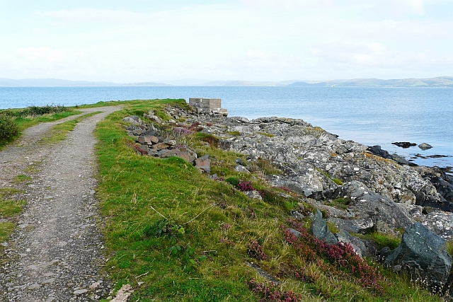
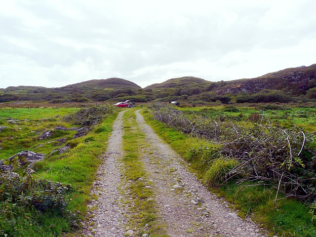
For outdoor enthusiasts, the hill offers numerous opportunities for recreational activities such as hiking, hillwalking, and photography. Several well-marked trails lead to the summit, catering to both novice and experienced hikers. The hill's accessibility and manageable height make it an attractive option for families and individuals seeking a day of exploration and adventure.

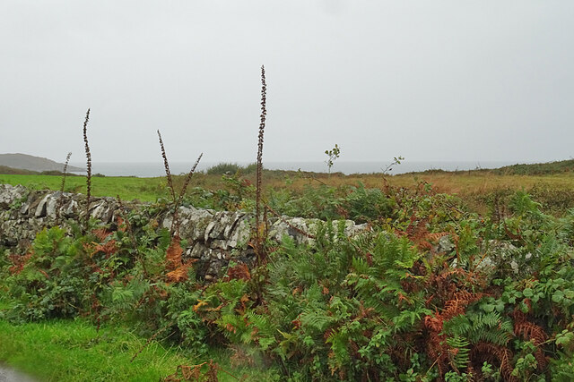
In addition to its natural beauty, Cnoc an t-Sabhail holds historical significance as well. The surrounding area is rich in archaeological remains, including ancient settlements and burial sites, providing a glimpse into the region's past.

Overall, Cnoc an t-Sabhail is a captivating destination that combines natural beauty, outdoor activities, and a touch of history. Whether it is for a leisurely stroll or a challenging hike, visitors are sure to be enchanted by its rugged charm and awe-inspiring vistas.

If you have any feedback on the listing, please let us know in the comments section below.

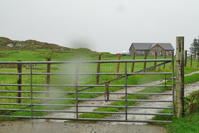
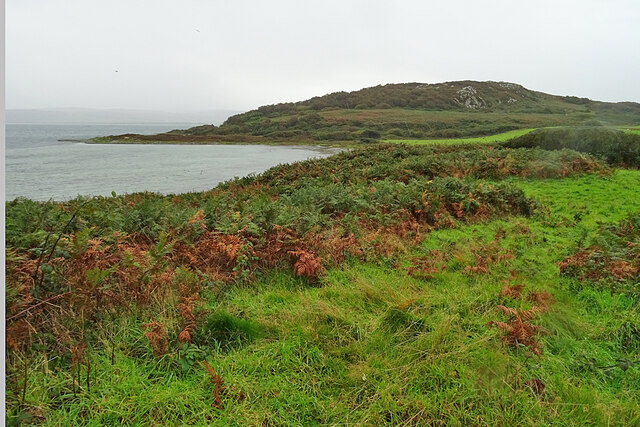
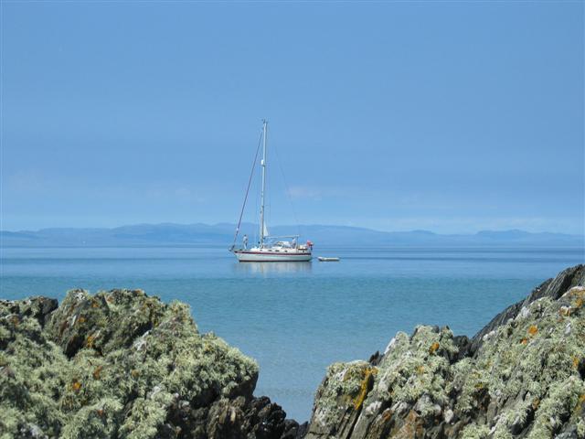
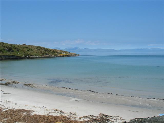
Cnoc an t-Sabhail Images

Images are sourced within 2km of 55.720067/-5.7234246 or Grid Reference NR6653. Thanks to Geograph Open Source API. All images are credited.

Na Crogachan Ice-smoothed rocks at the northern tip of the Isle of Gigha.
Na Crogachan
Ice-smoothed rocks at the northern tip of the Isle of Gigha.
Port Righ A sandy cove at the north end of the Isle of Gigha. The name means King's Port, the same as the town of Portree on the Isle of Skye.
Port Righ
A sandy cove at the north end of the Isle of Gigha. The name means King's Port, the same as the town of Portree on the Isle of Skye.
Cnoc nan Gobhar Wet bracken on the slope of Cnoc nan Gobhar, near the north end of the Isle of Gigha.
Cnoc nan Gobhar
Wet bracken on the slope of Cnoc nan Gobhar, near the north end of the Isle of Gigha.
Roadside Dyke On a pleasant day it would be tempting to take a walk to the shore of Bàgh Rubha Ruaidh, of which there is just a glimpse over the top of the dyke.
Roadside Dyke
On a pleasant day it would be tempting to take a walk to the shore of Bàgh Rubha Ruaidh, of which there is just a glimpse over the top of the dyke.
Access Road in the Rain You can tell how wet it is by the drops on the lens, and the drips on the gate. It looks as if the old buildings here have been replaced by a new house, named Balmore.
Access Road in the Rain
You can tell how wet it is by the drops on the lens, and the drips on the gate. It looks as if the old buildings here have been replaced by a new house, named Balmore.
Carragh an Tarbert A distinctive standing stone beside the road at Tarbert on the Isle of Gigha. It is also known as the Druids' Stone, and A Thom, author of 'The standing stones in Argyllshire' and 'Megalithic lunar observatories', considers it to be a lunar obervatory dating from the 1st millennium BC.
Carragh an Tarbert
A distinctive standing stone beside the road at Tarbert on the Isle of Gigha. It is also known as the Druids' Stone, and A Thom, author of 'The standing stones in Argyllshire' and 'Megalithic lunar observatories', considers it to be a lunar obervatory dating from the 1st millennium BC.
East Tarbert Bay In the bay are an offshore fish farm. The ship seems to have been there for at least several days.
East Tarbert Bay
In the bay are an offshore fish farm. The ship seems to have been there for at least several days.
Looking over Tràigh Bhàn If the tide were not so high, the white sand that gives the beach its name would be visible here. The hummock is Cnoc Largie, in the next square.
Looking over Tràigh Bhàn
If the tide were not so high, the white sand that gives the beach its name would be visible here. The hummock is Cnoc Largie, in the next square.
Mooring yacht at Bagh na Doirlinne
Bagh na Doirlinne
Bagh na Doirlinne
Kinerarach, Gigha North Gighan farmstead
Kinerarach, Gigha
North Gighan farmstead
Bagh na Doirlinne and Bagh Rubha Ruaidh Gigha.

Panoramic shot of the twin beaches taken from Eilean Garbh with Doirlinne to the left and Rubha Ruaidh to the right.
Bagh na Doirlinne and Bagh Rubha Ruaidh
Gigha. Panoramic shot of the twin beaches taken from Eilean Garbh with Doirlinne to the left and Rubha Ruaidh to the right.
Beach at East End of Bagh na Doirlinne One of the many white sanded beaches of Gigha.
Beach at East End of Bagh na Doirlinne
One of the many white sanded beaches of Gigha.
Black sheep in a rushy field View from the main road at Kinerarach.
Black sheep in a rushy field
View from the main road at Kinerarach.
Port Righ, Isle of Gigha A small bay at the very north of the island.
Port Righ, Isle of Gigha
A small bay at the very north of the island.
End of the track, northern tip of Gigha This track is a continuation of the made-up road which runs the length of the island.
The concrete structure at the end is the remains of a short-lived ferry slipway - see <a href="https://www.geograph.org.uk/photo/1291351">NR6654 : "Danger - Unstable Surface"</a> .
End of the track, northern tip of Gigha
This track is a continuation of the made-up road which runs the length of the island. The concrete structure at the end is the remains of a short-lived ferry slipway - see NR6654 : "Danger - Unstable Surface" .
Parking area and track, top end of Gigha This track is a continuation of the made-up road which runs the length of the island.
Parking area and track, top end of Gigha
This track is a continuation of the made-up road which runs the length of the island.
Grazing Land At Tarbert Farm Flooded grazing land at Tarbert Farm, with a small skein of Greenland White-fronted Geese in the left of shot.  In the distance, West Tarbert Bay can be noted.
Grazing Land At Tarbert Farm
Flooded grazing land at Tarbert Farm, with a small skein of Greenland White-fronted Geese in the left of shot. In the distance, West Tarbert Bay can be noted.
Show me another place!

Cnoc an t-Sabhail is located at Grid Ref: NR6653 (Lat: 55.720067, Lng: -5.7234246)

Unitary Authority: Argyll and Bute

Police Authority: Argyll and West Dunbartonshire

What 3 Words

///crunches.elders.busy. Near Craighouse, Argyll & Bute

Related Wikis

Gigha

Gigha (; Scottish Gaelic: Giogha; Scots: Gigha) or the Isle of Gigha (and formerly Gigha Island) is an island off the west coast of Kintyre in Scotland...

Sound of Gigha

The Sound of Gigha is a sound between the Inner Hebridean Isle of Gigha and Kintyre. It forms part of the Atlantic Ocean. == External links ==

Kilchattan Chapel

Kilchattan Chapel (St Cathan's Chapel) is a ruined medieval chapel near Ardminish, Isle of Gigha, Argyll and Bute, Scotland. Built in the 13th century...

Achamore House

Achamore House is a mansion on the Isle of Gigha, Scotland. It was built in 1884 for Lt-Col William James Scarlett, and the extensive gardens were laid...

Nearby Amenities

Located within 500m of 55.720067,-5.7234246
Cnoc nan Gobhar
Corbett: no
Ele: 50
Ele Note: 50Meall a'Ghlamaidh
Graham: no
Marilyn: no
Munro: no
Natural: peak
Lat/Long: 55.7221672/-5.7261726
Cnoc an t-Sabhail
Corbett: no
Ele: 45
Graham: no
Marilyn: no
Munro: no
Natural: peak
Lat/Long: 55.7201257/-5.7253651
The data included in this document is from www.openstreetmap.org. The data is made available under ODbL.

Have you been to Cnoc an t-Sabhail?

Leave your review of Cnoc an t-Sabhail below (or comments, questions and feedback).