Rainberg Mòr

Hill, Mountain in Argyllshire

Scotland

Rainberg Mòr

Dubh Bheinn Despite Jim's bloomer we eventually found the right top, starting from the bridge over the Lussa, but at least one of the tops at point 477 looks like a P30 ! Great walking condition underfoot with lovely views, walking with Jim Bloomer and Martin Richardson.
Name: Dubh Bheinn
Hill number: 1455
Height: 485m / 1591ft
Area: 20A: Jura, Scarba and Colonsay
Class: Ma
Grid ref: NR 58135 88961
Summit feature: rock 25m WNW of cairn
Drop: 468m
Col: 17m  NR604825
Dubh Bheinn Credit: Rude Health

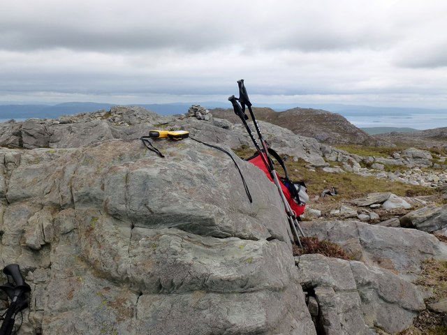
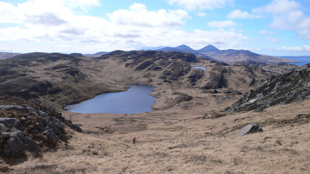
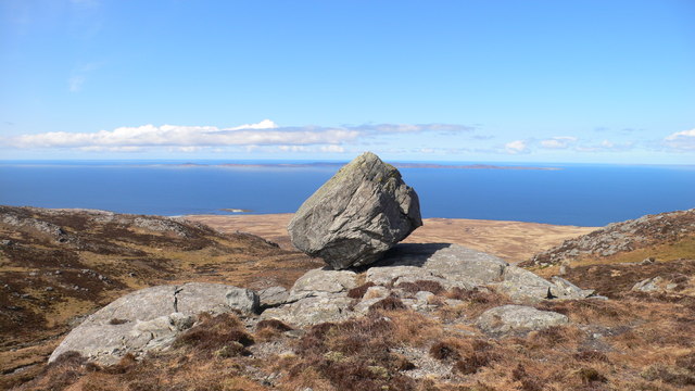
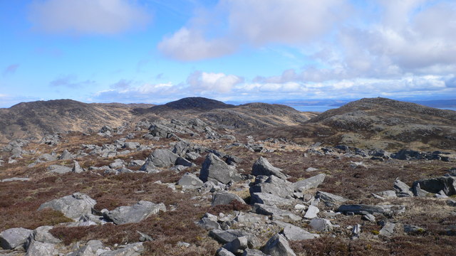
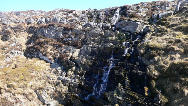
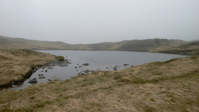
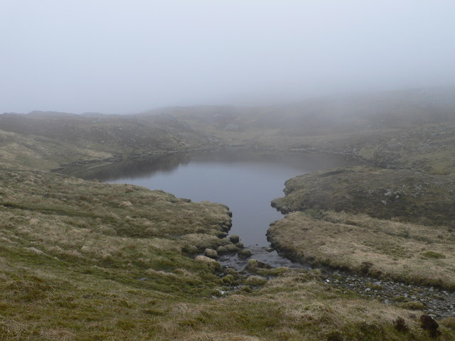
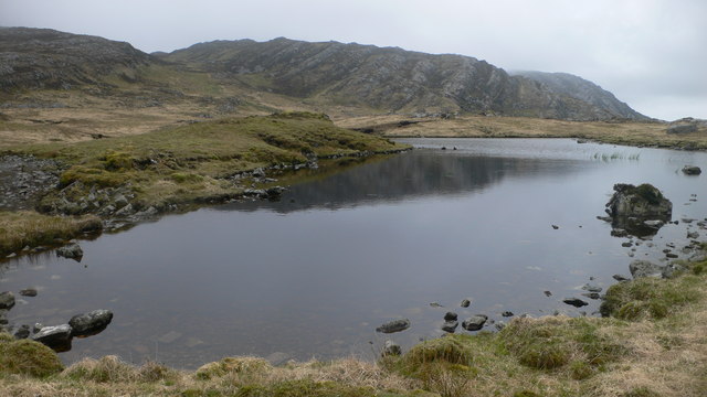
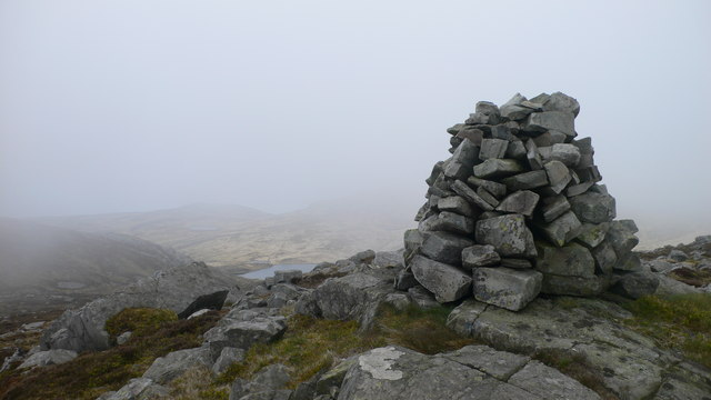
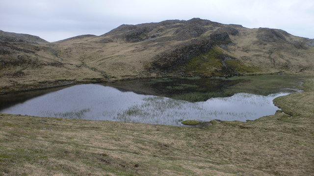
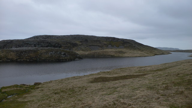
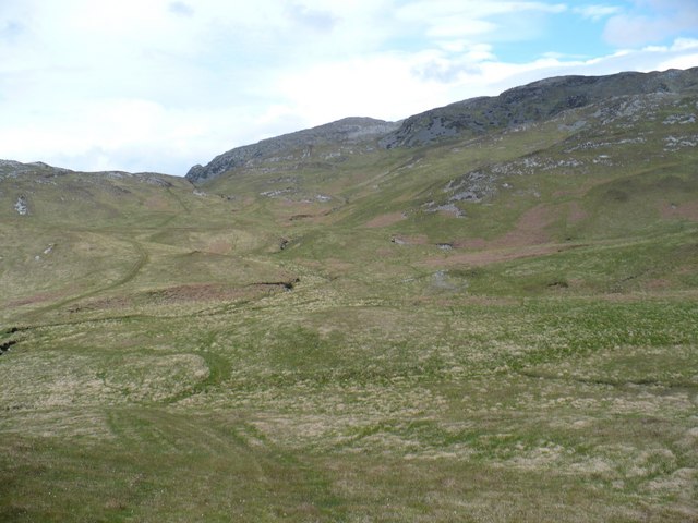
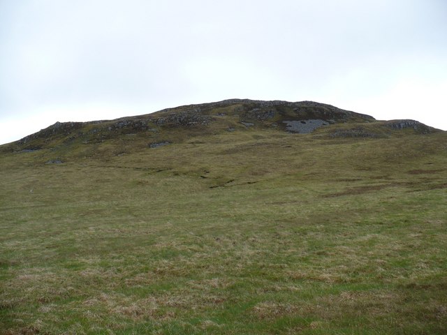
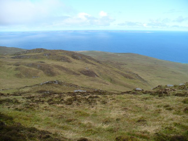
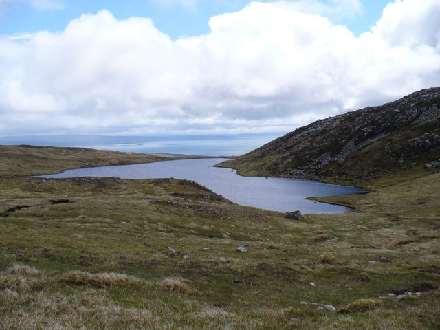
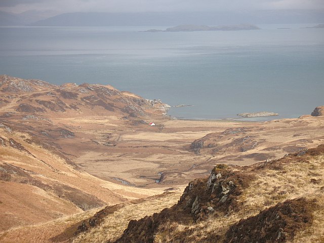
Rainberg Mòr is a prominent hill located in Argyllshire, Scotland. Standing at an elevation of approximately 750 meters, it offers stunning panoramic views of the surrounding landscapes. The hill is part of the rugged terrain of the Scottish Highlands, characterized by rolling hills, rocky outcrops, and lush greenery.

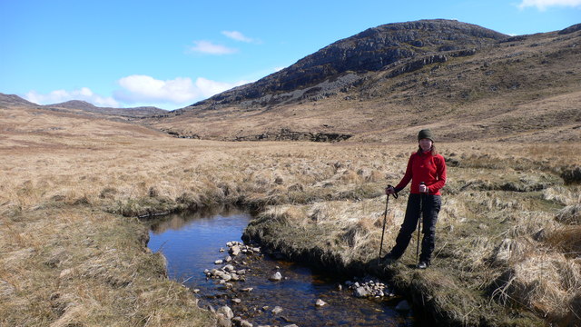
Rainberg Mòr is a popular destination for hikers and outdoor enthusiasts, with several well-marked trails leading to the summit. The climb to the top is challenging but rewarding, as it provides a sense of accomplishment and unparalleled views of the surrounding countryside.

The hill is home to a variety of wildlife, including red deer, mountain hares, and a wide range of bird species. The diverse ecosystem of Rainberg Mòr is protected by conservation efforts to ensure the preservation of its natural beauty and biodiversity.

Visitors to Rainberg Mòr can also explore nearby attractions such as ancient ruins, picturesque villages, and historic sites. The hill is a must-visit destination for those looking to experience the untamed beauty of the Scottish Highlands.

If you have any feedback on the listing, please let us know in the comments section below.

Rainberg Mòr Images

Images are sourced within 2km of 56.017843/-5.8978375 or Grid Reference NR5787. Thanks to Geograph Open Source API. All images are credited.

Dubh Bheinn Despite Jim's bloomer we eventually found the right top, starting from the bridge over the Lussa, but at least one of the tops at point 477 looks like a P30 ! Great walking condition underfoot with lovely views, walking with Jim Bloomer and Martin Richardson.
Name: Dubh Bheinn
Hill number: 1455
Height: 485m / 1591ft
Area: 20A: Jura, Scarba and Colonsay
Class: Ma
Grid ref: NR 58135 88961
Summit feature: rock 25m WNW of cairn
Drop: 468m
Col: 17m  NR604825
Dubh Bheinn
Despite Jim's bloomer we eventually found the right top, starting from the bridge over the Lussa, but at least one of the tops at point 477 looks like a P30 ! Great walking condition underfoot with lovely views, walking with Jim Bloomer and Martin Richardson. Name: Dubh Bheinn Hill number: 1455 Height: 485m / 1591ft Area: 20A: Jura, Scarba and Colonsay Class: Ma Grid ref: NR 58135 88961 Summit feature: rock 25m WNW of cairn Drop: 468m Col: 17m NR604825
Loch Mòr Bealach na h-Imriche from the southern flank of Rainberg Mor
Balancing rock on Rainberg Mor summit ridge Perhaps a glacial deposit? Colonsay is just below the horizon.
Balancing rock on Rainberg Mor summit ridge
Perhaps a glacial deposit? Colonsay is just below the horizon.
Top to the south-east of Rainberg Mor summit At 459 metres this, the central of three main tops on the mountain, is actually higher than the top named as Rainberg Mor on the map.
Top to the south-east of Rainberg Mor summit
At 459 metres this, the central of three main tops on the mountain, is actually higher than the top named as Rainberg Mor on the map.
Waterfall at the head of Gleann nan Clach Reamhar
Meander in the Allt an Tairbh, below Rainberg Mor
Lochan below summit of Dubh Bheinn
Lochan beneath summit of Dubh Bheinn
Lochan in Gleann nan Clach Reamhar
Cairn on eastern top of Rainberg Mor
Loch Beag Bealach na h-Imriche
Loch Fada Cruib
Loch Fada Cruib
Rough grassland on Jura Quad bike tracks cover the rough grassland - easier following them than walking through the long grass.
Rough grassland on Jura
Quad bike tracks cover the rough grassland - easier following them than walking through the long grass.
Mi-mheall Breac This lump is on the western ridge of Dubh Bheinn, which is the highest summit on the northern part of Jura.
Mi-mheall Breac
This lump is on the western ridge of Dubh Bheinn, which is the highest summit on the northern part of Jura.
Western side of Dubh Bheinn Looking down to the col between Dubh Bheinn and Mi-mheall Breac. Colonsay can be seen in the distance.
Western side of Dubh Bheinn
Looking down to the col between Dubh Bheinn and Mi-mheall Breac. Colonsay can be seen in the distance.
Jura hill loch This loch is on the watershed between the east and west coasts of Jura. looking east to the Sound of Jura.
Jura hill loch
This loch is on the watershed between the east and west coasts of Jura. looking east to the Sound of Jura.
Show me another place!

Rainberg Mòr is located at Grid Ref: NR5787 (Lat: 56.017843, Lng: -5.8978375)

Unitary Authority: Argyll and Bute

Police Authority: Argyll and West Dunbartonshire

What 3 Words

///blurs.unfilled.devoured. Near Scalasaig, Argyll & Bute

Nearby Locations

Rainberg Mòr Jura

Related Wikis

Tarbert, Jura

Tarbert is a hamlet on Tarbert Bay, on the east coast of the island of Jura, in the council area of Argyll and Bute, Scotland. The Tarbert estate is owned...

Battle of the Western Isles

The Battle of the Western Isles was a series of conflicts in 1585 and 1586 on the islands of Jura, Islay, Mull and Tiree, Scotland as well as the peninsula...

Ardlussa Fishing Loch

The Ardlussa Fishing Loch is an impounding reservoir, located 2 kilometres north of Lussagiven on a remote part of the Ardlussa Estate on Jura, Argyll...

Inverlussa

Inverlussa is a hamlet 1 mile (1.6 km) southwest of Ardlussa and 14 miles from Craighouse at the mouth of Lussa River on the east coast of the island of...

Nearby Amenities

Located within 500m of 56.017843,-5.8978375
Ele: 459
Natural: peak
Lat/Long: 56.0181999/-5.8970856
The data included in this document is from www.openstreetmap.org. The data is made available under ODbL.

Have you been to Rainberg Mòr?

Leave your review of Rainberg Mòr below (or comments, questions and feedback).