A' Chìoch

Hill, Mountain in Argyllshire

Scotland

A' Chìoch

Lenticular clouds on Ben More View from Ulva
Lenticular clouds on Ben More Credit: Richard Webb

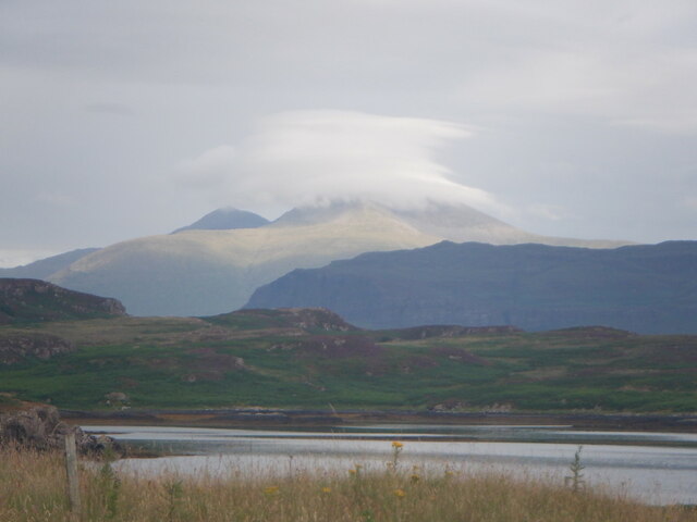
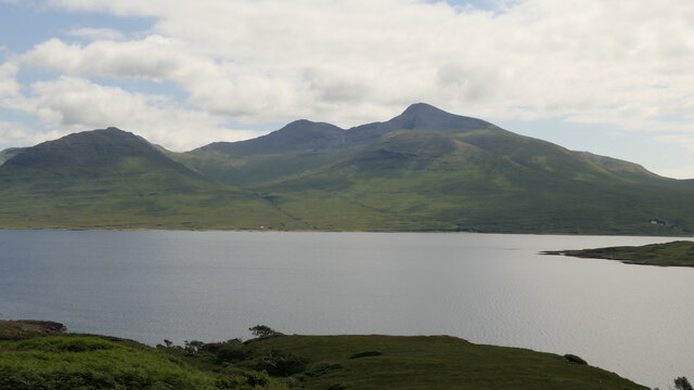
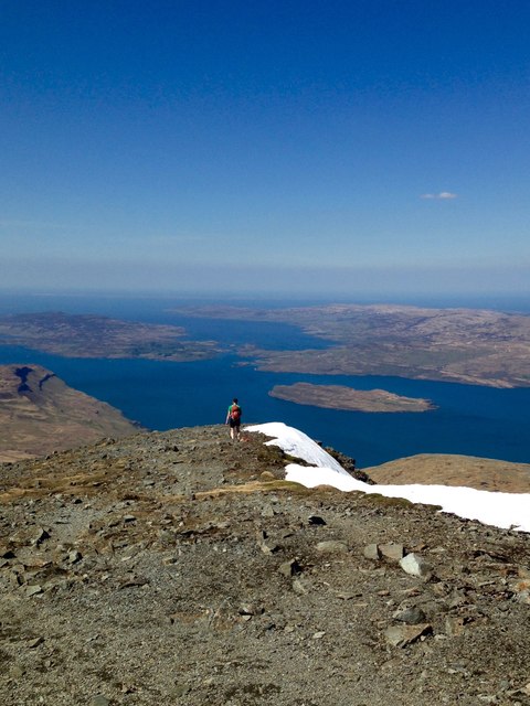
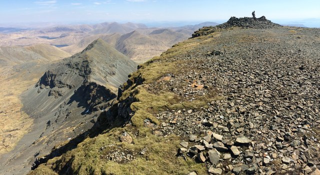
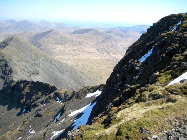
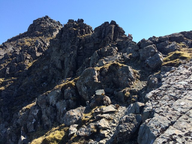
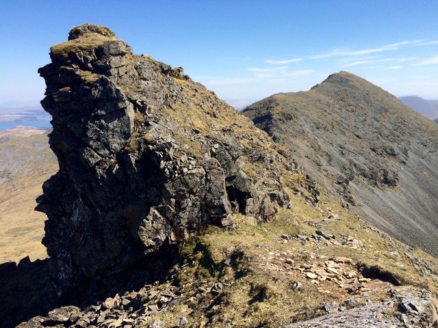
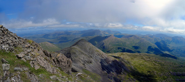
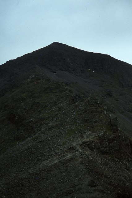
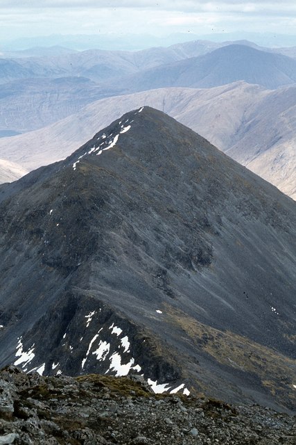
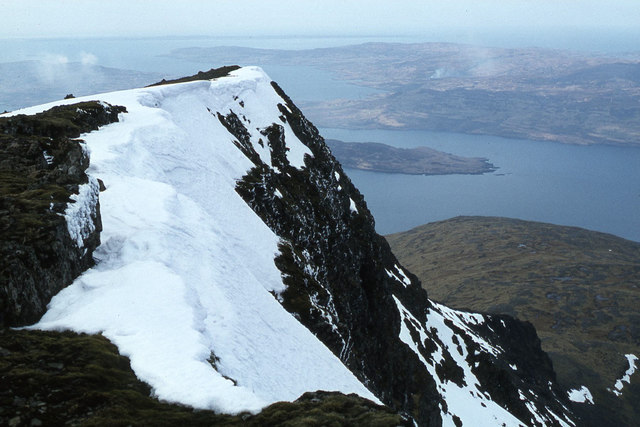
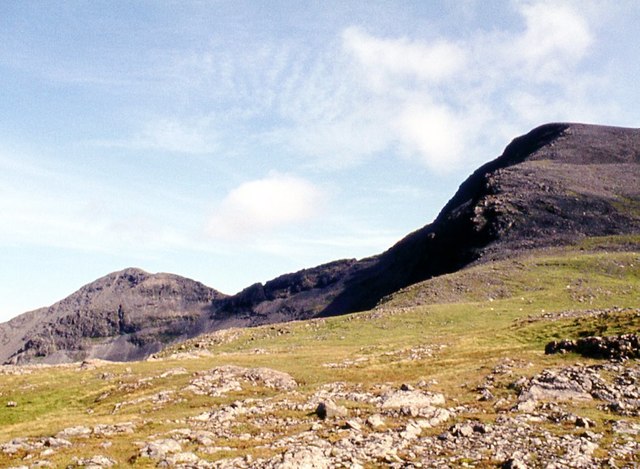
A' Chìoch is a prominent hill located in Argyllshire, Scotland. It is part of the broader mountain range known as the Grampians, which stretches across the central Highlands of Scotland. A' Chìoch stands at an elevation of approximately 726 meters (2,382 feet) and is a popular destination for hikers and outdoor enthusiasts.

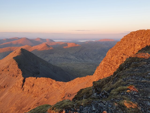
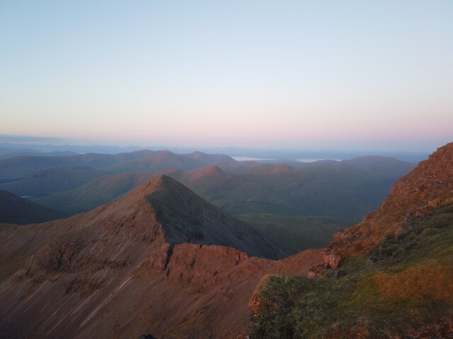
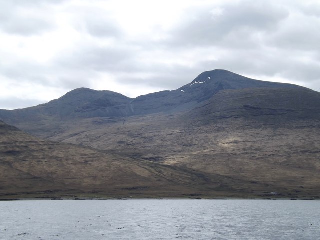
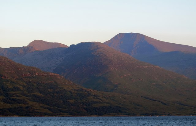
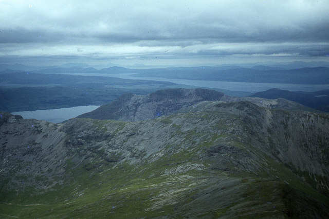
The hill offers breathtaking panoramic views of the surrounding landscape, including the nearby Loch Awe and the rolling hills of Argyllshire. Its distinctive shape and rugged terrain make it a prominent landmark in the area.

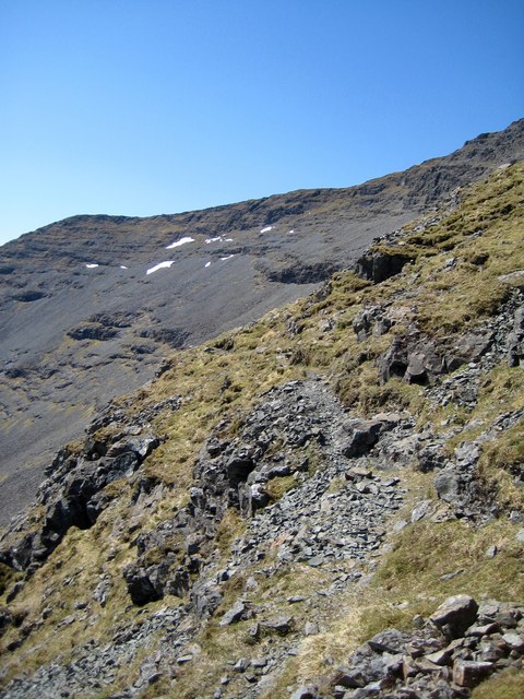
A' Chìoch is covered in lush green vegetation, with heather, grasses, and scattered rocks dotting its slopes. The hill is home to a variety of wildlife, including red deer, mountain hares, and various bird species. It provides an ideal habitat for these creatures, with ample space and resources available.

Hikers and climbers are drawn to A' Chìoch for its challenging yet rewarding trails. The ascent to the summit requires a moderate level of fitness and navigation skills, as the terrain can be steep and rocky. However, the efforts are rewarded with stunning views at the top, making it a popular spot for photographers and nature enthusiasts.

Overall, A' Chìoch in Argyllshire is a beautiful and picturesque hill, offering visitors a chance to immerse themselves in the natural beauty of the Scottish Highlands.

If you have any feedback on the listing, please let us know in the comments section below.

A' Chìoch Images

Images are sourced within 2km of 56.427775/-5.999424 or Grid Reference NM5333. Thanks to Geograph Open Source API. All images are credited.

Lenticular clouds on Ben More View from Ulva
Lenticular clouds on Ben More
View from Ulva
Ben More, Mull View from across Loch na Keal with the ridge to A' Chioch forming the skyline.
Ben More, Mull
View from across Loch na Keal with the ridge to A' Chioch forming the skyline.
View of Ben More's Eastern route The Eastern approach for climbing Ben More when you have a large rucksack (with 4 days food) is a difficult one. I almost got crag-fast!
View of Ben More's Eastern route
The Eastern approach for climbing Ben More when you have a large rucksack (with 4 days food) is a difficult one. I almost got crag-fast!
View of Ben More's eastern route Returned for a second summit camp up Ben More, this time via the straightforward northern route.
View of Ben More's eastern route
Returned for a second summit camp up Ben More, this time via the straightforward northern route.
Descending Ben More North Ridge Descent towards Dhseig after the climb up via the A' Chioch ridge. View towards Ulva Ferry. 9th May 2016
Descending Ben More North Ridge
Descent towards Dhseig after the climb up via the A' Chioch ridge. View towards Ulva Ferry. 9th May 2016
Ben More Summit Cairn and A' Chioch Ridge View on leaving the Cairn after negotiating the A' Chioch Ridge. 9th May 2016
Ben More Summit Cairn and A' Chioch Ridge
View on leaving the Cairn after negotiating the A' Chioch Ridge. 9th May 2016
North East face of Ben More and A' Chioch Ridge Looking across the North East Face of Ben More down to the ridge between A' Chioch and Ben More. 9th May 2016
North East face of Ben More and A' Chioch Ridge
Looking across the North East Face of Ben More down to the ridge between A' Chioch and Ben More. 9th May 2016
Ben More South Ridge Looking towards the South Ridge from below the South East Ridge
Ben More South Ridge
Looking towards the South Ridge from below the South East Ridge
Descending A' Chioch Pinnacles on the SW ridge of A' Chioch on the descent towards Ben More.
Descending A' Chioch
Pinnacles on the SW ridge of A' Chioch on the descent towards Ben More.
A' Chioch and Ben More from Loch Na Keal Taken on a white tailed eagle spotting trip on the "Lady Jane" out of Ulva Ferry
A' Chioch and Ben More from Loch Na Keal
Taken on a white tailed eagle spotting trip on the "Lady Jane" out of Ulva Ferry
Pinnacle between A' Chioch and Ben More Prominent feature on the traverse from A' Chioch and Ben More
Pinnacle between A' Chioch and Ben More
Prominent feature on the traverse from A' Chioch and Ben More
Ben More and associated peaks An evening view of Ben More (at the rear of the photo) and the peaks around it, taken from beside Loch Na Keal.
Ben More and associated peaks
An evening view of Ben More (at the rear of the photo) and the peaks around it, taken from beside Loch Na Keal.
Panorama east from Ben More
Ridge leading towards Beinn Fhada from A' Chioch
On the ridge leading from A' Chioch to Ben More
A'Chioch as seen from Ben More
The summit of Ben More
Ben More, north ridge
Show me another place!

A' Chìoch is located at Grid Ref: NM5333 (Lat: 56.427775, Lng: -5.999424)

Unitary Authority: Argyll and Bute

Police Authority: Argyll and West Dunbartonshire

What 3 Words

///nicely.blues.dent. Near Salen, Argyll & Bute

Nearby Locations

A' Chìoch

Related Wikis

Ben More (Mull)

Ben More (Scottish Gaelic: Beinn Mhòr, meaning "great mountain") is the highest mountain and only Munro (mountains in Scotland that reach an elevation...

Isle of Mull

The Isle of Mull (Scottish Gaelic: An t-Eilean Muileach [əɲ ˈtʲʰelan ˈmuləx]) or just Mull (Scots pronunciation: [mʌl]; Scottish Gaelic: Muile [ˈmulə]...

Aird of Kinloch

Aird of Kinloch (Gaelic:An Àird) is a rocky outcrop between Loch Scridain and Loch Beg on the Isle of Mull, Argyll and Bute, Scotland. == References ==

Loch Bà (Mull)

Loch Bà is a freshwater loch, about 5 km long, in the centre of the Isle of Mull, in Scotland. It is drained by the River Bà, flowing into Loch na Keal...

Nearby Amenities

Located within 500m of 56.427775,-5.999424
A' Chioch
Ele: 867
Natural: peak
Source: NPE
Lat/Long: 56.4277612/-5.9993902
Natural: saddle
Lat/Long: 56.4268821/-6.0063162
The data included in this document is from www.openstreetmap.org. The data is made available under ODbL.

Have you been to A' Chìoch?

Leave your review of A' Chìoch below (or comments, questions and feedback).