Ackworth, High

Settlement in Yorkshire

England

Ackworth, High

Old milepost The northernmost surviving milepost on the Barnsley to Pontefract route, A628.   It is about a mile north of High Ackworth and at the top of Castle Syke Hill.   The top 12cm of the casting was broken off many years ago and since 2019 the top of the backing stone has also been broken off.  It was known to have been last painted in 2012.
Old milepost Credit: Chris Minto

Ackworth is a small village located in the metropolitan borough of Wakefield, West Yorkshire, England. It lies approximately 8 miles southeast of the city of Wakefield and is situated in the historic county of Yorkshire. The village is part of the larger civil parish of Ackworth, High and Low Ackworth.

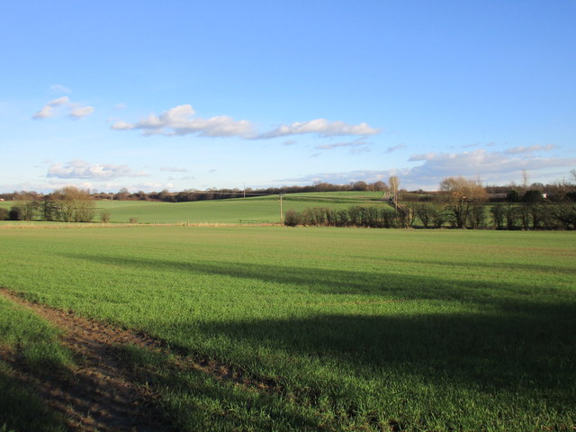
With a population of around 6,000, Ackworth is known for its picturesque countryside setting and charming rural atmosphere. The village is surrounded by open fields, rolling hills, and woodlands, making it a popular destination for nature lovers and hikers.

Ackworth is home to several historic buildings, including the prominent Ackworth School, a Quaker boarding school founded in 1779. The school's Georgian architecture and beautiful grounds add to the village's character and attract visitors from far and wide.

The village center is characterized by its quaint shops, traditional pubs, and local amenities. It has a close-knit community feel, with various community events and activities taking place throughout the year. A weekly market is held, providing residents and visitors with access to fresh produce and local crafts.

Transport links in Ackworth are convenient, with regular bus services connecting the village to nearby towns and cities. The M62 motorway is easily accessible, providing connections to Leeds, Sheffield, and Manchester.

Overall, Ackworth offers a peaceful and idyllic setting for its residents, combining a rich history with natural beauty and a friendly community.

If you have any feedback on the listing, please let us know in the comments section below.

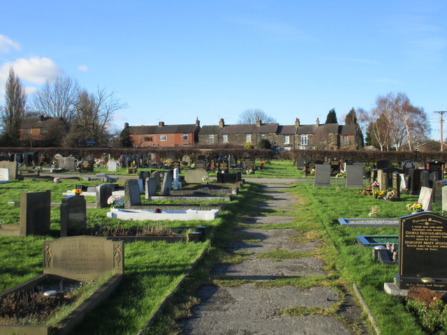
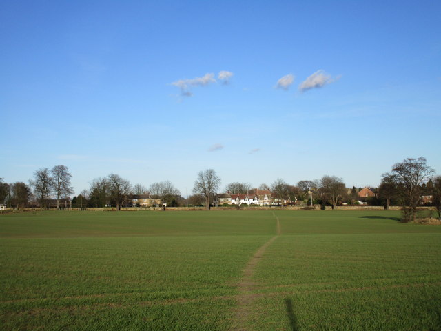
Ackworth, High Images

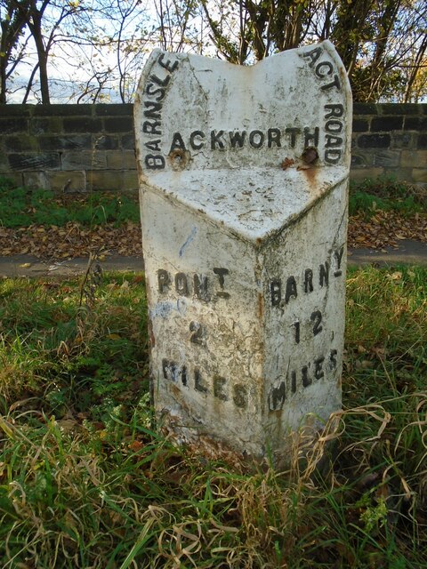
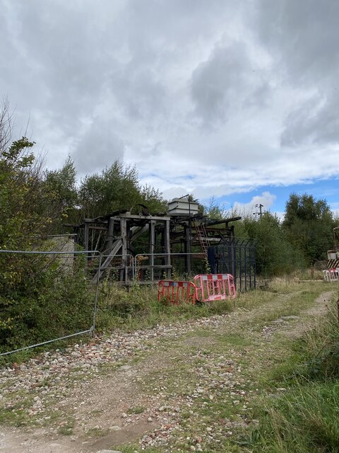
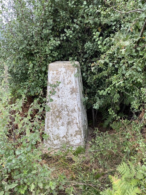
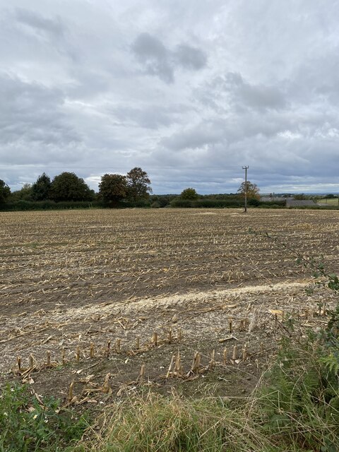
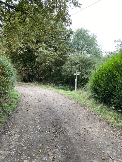
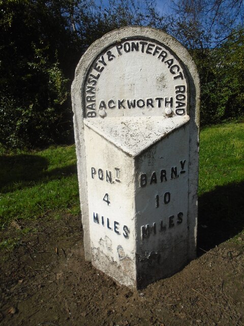
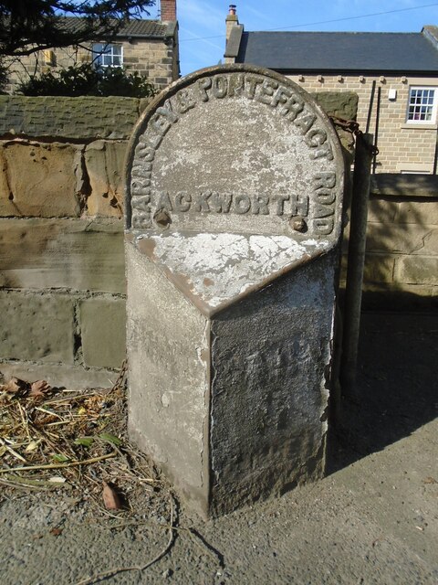
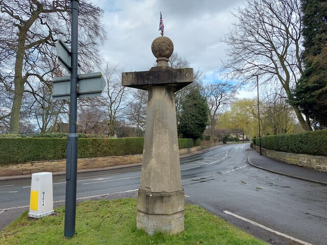
Images are sourced within 2km of 53.655532/-1.329816 or Grid Reference SE4417. Thanks to Geograph Open Source API. All images are credited.

Old milepost The northernmost surviving milepost on the Barnsley to Pontefract route, A628.   It is about a mile north of High Ackworth and at the top of Castle Syke Hill.   The top 12cm of the casting was broken off many years ago and since 2019 the top of the backing stone has also been broken off.  It was known to have been last painted in 2012.
Old milepost
The northernmost surviving milepost on the Barnsley to Pontefract route, A628. It is about a mile north of High Ackworth and at the top of Castle Syke Hill. The top 12cm of the casting was broken off many years ago and since 2019 the top of the backing stone has also been broken off. It was known to have been last painted in 2012.
Off Green Lane,  Brackenhill Possible old quarrying equipment
Off Green Lane, Brackenhill
Possible old quarrying equipment
Brackenhill Trig Point Flush Bracket S1914
View towards Constitution Hill Farm
Footpath near Constitution Hill Farm
Hundhill Trig Point Flush Bracket S4242
Old milepost This milepost from the Barnsley to Pontefract tollroad is near the bus stop on the A628 in Ackworth just north of the roundabout with the A638. It is known that it was painted in 2005.  Most of the mileposts on this route do not have a backing stone so this one, larger than the casting, is probably a 20C addition.  This post is the only one of those remaining that is not 'Listed'.
Old milepost
This milepost from the Barnsley to Pontefract tollroad is near the bus stop on the A628 in Ackworth just north of the roundabout with the A638. It is known that it was painted in 2005. Most of the mileposts on this route do not have a backing stone so this one, larger than the casting, is probably a 20C addition. This post is the only one of those remaining that is not 'Listed'.
Old milepost This very dilapidated metal milepost is on a very narrow verge on Pontefract Road, High Ackworth.  It was at the entrance to a Garden Centre but this is now a gated set of houses.  The faint outlines of raised legends can just be made out on the post.  It is Grade II Listed 1135473.
Old milepost
This very dilapidated metal milepost is on a very narrow verge on Pontefract Road, High Ackworth. It was at the entrance to a Garden Centre but this is now a gated set of houses. The faint outlines of raised legends can just be made out on the post. It is Grade II Listed 1135473.
Old milestone Another of the 615 original milestones erected for the West Riding County Council in 1893/94.   The contractor was Gill Stead and Son of Heckmondwike.   It was last repainted in 2004 and is set in a concrete base.  This is one of those cast by Brayshaw & Booth, Liversedge.
Old milestone
Another of the 615 original milestones erected for the West Riding County Council in 1893/94. The contractor was Gill Stead and Son of Heckmondwike. It was last repainted in 2004 and is set in a concrete base. This is one of those cast by Brayshaw & Booth, Liversedge.
Long Lane, Ackworth
Long Lane, Ackworth
Sandy Gate Lane, Ackworth
Ackworth Plague Stone
East Hardwick, disused well
View from Doncaster Road, Ackworth Moor Top Cherry Tree Farm on the extreme right.
View from Doncaster Road, Ackworth Moor Top
Cherry Tree Farm on the extreme right.
Cemetery and cottages., Ackworth Moor Top
Footpath to East Hardwick
Line of trees Hundhill Farm beyond.
Line of trees
Hundhill Farm beyond.
View towards Went Hill This area is drained by the River Went and its tributaries. Went Hill forms an obstacle to the river's eastward flow which it overcomes by flowing through a narrow gap at Wentbridge.
View towards Went Hill
This area is drained by the River Went and its tributaries. Went Hill forms an obstacle to the river's eastward flow which it overcomes by flowing through a narrow gap at Wentbridge.
Show me another place!

Ackworth, High is located at Grid Ref: SE4417 (Lat: 53.655532, Lng: -1.329816)

Division: West Riding

Unitary Authority: Wakefield

Police Authority: West Yorkshire

What 3 Words

///banana.cork.facing. Near Low Ackworth, West Yorkshire

Related Wikis

Ackworth School

Ackworth School is an independent day and boarding school located in the village of High Ackworth, near Pontefract, West Yorkshire, England. It is one...

Ackworth railway station

Ackworth railway station was a railway station serving Ackworth in the English county of West Yorkshire. == History == The station was opened by the Swinton...

Hessle and Hill Top

Hessle and Hill Top is a civil parish in the City of Wakefield district of West Yorkshire, England. Scattered settlement in the rural parish includes the...

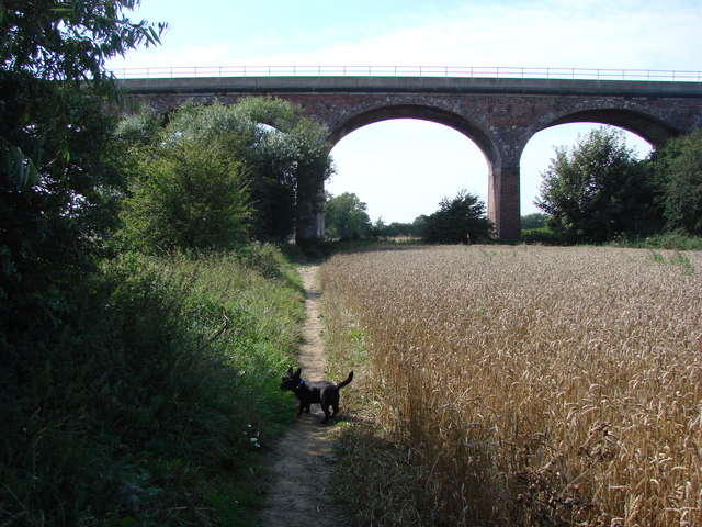
Six Arches, Ackworth

The Six Arches is a railway viaduct in Ackworth, West Yorkshire, England, named after its design. It carries the Pontefract to Rotherham line over the...

Nearby Amenities

Located within 500m of 53.655532,-1.329816
High Ackworth
Is In: West Yorkshire, England, UK
Place: village
Source: npe
Wikidata: Q2610999
Wikipedia: en:Ackworth, West Yorkshire
Lat/Long: 53.656424/-1.3351451
Bus Stop
Pontefract Road Mill Hill
Local Ref: 45017010
Naptan AtcoCode: 450017010
Naptan Bearing: N
Naptan CommonName: Pontefract Road Mill Hill
Naptan Crossing: Mill Hill
Naptan Indicator: Stop 45017010
Naptan PlusbusZoneRef: LEEDS
Naptan ShortCommonName: Mill Hill
Naptan Street: Pontefract Road
Naptan Verified: yes
Ref: 45017010
Source: naptan_import
Lat/Long: 53.6545115/-1.3353776
Bus Stop
Station Road Lee Lane
Local Ref: 45017004
Naptan AtcoCode: 450017004
Naptan Bearing: E
Naptan CommonName: Station Road Lee Lane
Naptan Crossing: Lee Lane
Naptan Indicator: Stop 45017004
Naptan PlusbusZoneRef: LEEDS
Naptan ShortCommonName: Lee Lane
Naptan Street: Station Road
Naptan Verified: no
Source: naptan_import
Lat/Long: 53.6525997/-1.3247462
Bus Stop
Purston Lane Pontefract Lane
Local Ref: 45017008
Naptan AtcoCode: 450017008
Naptan Bearing: SW
Naptan CommonName: Purston Lane Pontefract Lane
Naptan Crossing: Pontefract Road
Naptan Indicator: Stop 45017008
Naptan Landmark: Brown Cow PH
Naptan PlusbusZoneRef: LEEDS
Naptan ShortCommonName: Brown Cow Ackworth
Naptan Street: Purston Lane
Naptan Verified: no
Source: naptan_import
Lat/Long: 53.6564938/-1.3338996
Bus Stop
Purston Lane Pontefract Road
Local Ref: 45017009
Naptan AtcoCode: 450017009
Naptan Bearing: E
Naptan CommonName: Purston Lane Pontefract Road
Naptan Crossing: Pontefract Road
Naptan Indicator: Stop 45017009
Naptan Landmark: Manor Trust Farm
Naptan PlusbusZoneRef: LEEDS
Naptan ShortCommonName: Purston Lane
Naptan Street: Purston Lane
Naptan Verified: no
Source: naptan_import
Lat/Long: 53.6566542/-1.335259
Bus Stop
Pontefract Road Mill Hill
Local Ref: 45017011
Naptan AtcoCode: 450017011
Naptan Bearing: S
Naptan CommonName: Pontefract Road Mill Hill
Naptan Crossing: Mill Hill
Naptan Indicator: Stop 45017011
Naptan PlusbusZoneRef: LEEDS
Naptan ShortCommonName: Mill Hill
Naptan Street: Pontefract Road
Naptan Verified: no
Source: naptan_import
Lat/Long: 53.6544058/-1.3350371
Bus Stop
Pontefract Road Meadow Way
Local Ref: 45018288
Naptan AtcoCode: 450018288
Naptan Bearing: N
Naptan CommonName: Pontefract Road Meadow Way
Naptan Crossing: Meadow Way
Naptan Indicator: Stop 45018288
Naptan PlusbusZoneRef: LEEDS
Naptan ShortCommonName: Beech Drive
Naptan Street: Pontefract Road
Naptan Verified: no
Source: naptan_import
Lat/Long: 53.6583033/-1.3295736
Bus Stop
Pontefract Road Purston Lane
Local Ref: 45018289
Naptan AtcoCode: 450018289
Naptan Bearing: W
Naptan CommonName: Pontefract Road Purston Lane
Naptan Crossing: Purston Lane
Naptan Indicator: Stop 45018289
Naptan Landmark: Brown Cow PH
Naptan PlusbusZoneRef: LEEDS
Naptan ShortCommonName: Purston Lane
Naptan Street: Pontefract Road
Naptan Verified: no
Source: naptan_import
Lat/Long: 53.6563124/-1.3335999
Bus Stop
Pontefract Road Ackworth
Bus: yes
Local Ref: 45025938
Naptan AtcoCode: 450025938
Naptan Bearing: S
Naptan CommonName: Pontefract Road Ackworth
Naptan Crossing: Meadow Way
Naptan Indicator: Stop 45025938
Naptan PlusbusZoneRef: LEEDS
Naptan ShortCommonName: Meadow Way
Naptan Street: Pontefract Road
Naptan Verified: no
Public Transport: platform
Source: naptan_import
Lat/Long: 53.6582933/-1.3293921
Purston Lane Pontefract Road
Local Ref: 45050486
Naptan AtcoCode: 450050486
Naptan Bearing: W
Naptan BusStopType: CUS
Naptan CommonName: Purston Lane Pontefract Road
Naptan Indicator: Stop 45050486
Naptan PlusbusZoneRef: LEEDS
Naptan ShortCommonName: Purston Lane
Naptan Street: Purston Lane
Naptan Verified: no
Source: naptan_import
Lat/Long: 53.6565554/-1.3352757
Barrier: stile
Lat/Long: 53.6560007/-1.3344537
Barrier: stile
Lat/Long: 53.6542954/-1.332298
Barrier: stile
Lat/Long: 53.6545581/-1.3261821
Post Box
Operator: Royal Mail
Post Box Type: lamp
Ref: WF7 51
Royal Cypher: EIIR
Royal Cypher Wikidata: Q33102113
Lat/Long: 53.6565547/-1.3342548
Post Box
Operator: Royal Mail
Post Box Type: lamp
Ref: WF7 54
Royal Cypher: EIIR
Royal Cypher Wikidata: Q33102113
Lat/Long: 53.6570801/-1.3296508
Power: pole
Lat/Long: 53.6571699/-1.3368693
Barrier: stile
Lat/Long: 53.6573146/-1.3274038
Barrier: stile
Lat/Long: 53.6566211/-1.3370359
Ackworth Village Cross
Historic: memorial
Lat/Long: 53.6566404/-1.3346094
The data included in this document is from www.openstreetmap.org. The data is made available under ODbL.

Have you been to Ackworth, High?

Leave your review of Ackworth, High below (or comments, questions and feedback).