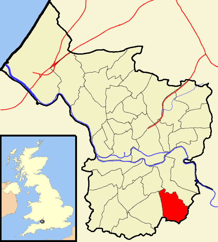
Hicks Gate

Settlement in Somerset

England

Hicks Gate

Midday, Christmas 2021 The slopes of the Coots were damp, grey and pretty uninspiring this year. Whilst the faint hum of traffic down the hill did not mask the many birdsongs, it was nevertheless a quiet one.
Midday, Christmas 2021 Credit: Neil Owen

Hicks Gate is a small hamlet situated in Somerset, England. Located approximately 6 miles east of the city of Bristol, it is part of the Keynsham civil parish. The hamlet is mainly known for its proximity to the historic Hicks Gate Roundabout, which serves as a major transportation hub in the region.

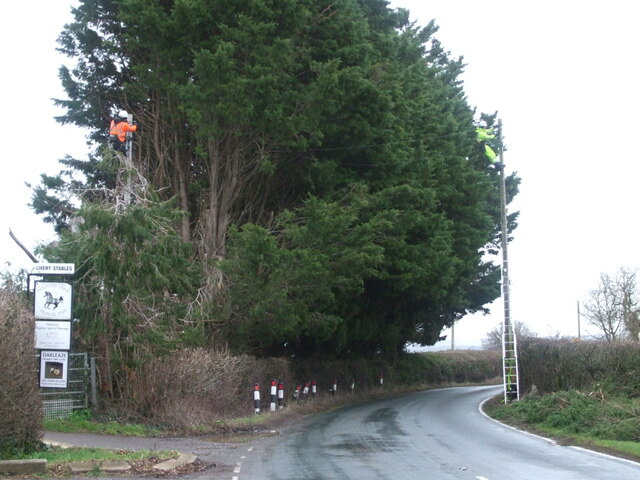
Hicks Gate Roundabout is a key intersection connecting several major roads, including the A4, A4174, and A4175. This strategic location makes Hicks Gate a popular spot for commuters traveling to and from Bristol, Bath, and other surrounding areas. The roundabout is also frequently used by heavy goods vehicles and buses, further enhancing its importance as a transport hub.

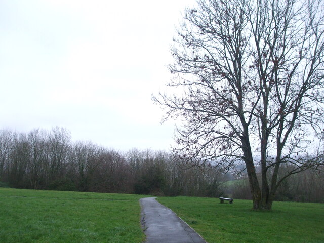
Despite its small size and primarily transport-related significance, Hicks Gate does have a few notable features. It is home to a handful of residential properties, situated mainly along Hicks Gate Road, which leads to the roundabout. The hamlet is surrounded by picturesque countryside, with rolling fields and farmland providing a peaceful setting.

Additionally, Hicks Gate benefits from its proximity to local amenities. Keynsham, a larger town, lies just a short distance to the west and offers a range of services, including shops, schools, and recreational facilities. The nearby River Avon and the picturesque Avon Valley Country Park provide opportunities for outdoor activities and leisurely walks.

In summary, Hicks Gate is a small hamlet in Somerset that is primarily known for its proximity to Hicks Gate Roundabout. While it may not have many notable features of its own, its location and surroundings make it an important transportation hub and a pleasant place to live.

If you have any feedback on the listing, please let us know in the comments section below.

Hicks Gate Images

Images are sourced within 2km of 51.418798/-2.5334735 or Grid Reference ST6369. Thanks to Geograph Open Source API. All images are credited.

Midday, Christmas 2021 The slopes of the Coots were damp, grey and pretty uninspiring this year. Whilst the faint hum of traffic down the hill did not mask the many birdsongs, it was nevertheless a quiet one.
Midday, Christmas 2021
The slopes of the Coots were damp, grey and pretty uninspiring this year. Whilst the faint hum of traffic down the hill did not mask the many birdsongs, it was nevertheless a quiet one.
Old Boundary Marker on the A4 Bath Road County Boundary Marker against a stone wall where wall turns north on the north side of the A4 Bath Road at Hicks Gate. On the boundary of the City of Bristol and Keynsham parish in Somerset. Inscribed BRISTOL and SOMERSET on adjacent faces and 1951 on its top. See also <a title="https://www.geograph.org.uk/photo/5686888" href="https://www.geograph.org.uk/photo/5686888">Link</a> and <a title="https://www.geograph.org.uk/photo/5686892" href="https://www.geograph.org.uk/photo/5686892">Link</a>.

Milestone Society National ID: SO_BRIKEY01cb
Old Boundary Marker on the A4 Bath Road
County Boundary Marker against a stone wall where wall turns north on the north side of the A4 Bath Road at Hicks Gate. On the boundary of the City of Bristol and Keynsham parish in Somerset. Inscribed BRISTOL and SOMERSET on adjacent faces and 1951 on its top. See also Link and Link. Milestone Society National ID: SO_BRIKEY01cb
Getting reconnected Storms Dudley and Eunice brought severe winds to the South West. Telephone lines were damaged and repairs are underway in the damp and gusty conditions by Oakleaze Farm.
Getting reconnected
Storms Dudley and Eunice brought severe winds to the South West. Telephone lines were damaged and repairs are underway in the damp and gusty conditions by Oakleaze Farm.
Crashing down on the footbridge Storm Eunice swept the South West and this big tree was a casualty. It came down and hit the footbridge linking the school to the playing fields. Workers set about the fallen lumber and attend to the surrounding damage.
Crashing down on the footbridge
Storm Eunice swept the South West and this big tree was a casualty. It came down and hit the footbridge linking the school to the playing fields. Workers set about the fallen lumber and attend to the surrounding damage.
The sign fades but the sentiment doesn't A hand-made display of thanks on the Old Bristol Road may be in need of a little care, but remains valid and public.
The sign fades but the sentiment doesn't
A hand-made display of thanks on the Old Bristol Road may be in need of a little care, but remains valid and public.
Tricky opponent this weekend, and every day Someone at the football club has a particular sense of humour.
Tricky opponent this weekend, and every day
Someone at the football club has a particular sense of humour.
Bumps behind Burnbush School A new cycle track has opened in the open space off Whittock Road, not far from the school (which is now known as Woodlands Academy).
Bumps behind Burnbush School
A new cycle track has opened in the open space off Whittock Road, not far from the school (which is now known as Woodlands Academy).
Track builders The new pump track in Stockwood was designed by Architrail Velosolutions for use by bikes, skateboards and scooters.
Track builders
The new pump track in Stockwood was designed by Architrail Velosolutions for use by bikes, skateboards and scooters.
The new pump track in Stockwood Access Sport, a sporting charity, helped to create this new track - one of only four in Bristol - for the use and enjoyment of the local youths. They are promoting their Making Trax Cycling Inclusive program, encouraging everyone to engage in healthy outdoor exercise. It offers plenty of fun and challenging routes around the twisty and bumpy tarmac track.
The new pump track in Stockwood
Access Sport, a sporting charity, helped to create this new track - one of only four in Bristol - for the use and enjoyment of the local youths. They are promoting their Making Trax Cycling Inclusive program, encouraging everyone to engage in healthy outdoor exercise. It offers plenty of fun and challenging routes around the twisty and bumpy tarmac track.
A cradle for future medallists? The new Stockwood pump track was officially opened in May, 2021, by B.M.X. Freestyler and Tokyo 2020 bronze medallist, Declan Brookes. It is hoped the track will become a 'thriving resource' for local people. There are plans to offer open tracktime, rock-up-and-ride sessions, after-school coaching and inclusive programmes for less abled riders.
A cradle for future medallists?
The new Stockwood pump track was officially opened in May, 2021, by B.M.X. Freestyler and Tokyo 2020 bronze medallist, Declan Brookes. It is hoped the track will become a 'thriving resource' for local people. There are plans to offer open tracktime, rock-up-and-ride sessions, after-school coaching and inclusive programmes for less abled riders.
Many friends have helped The new pump track in Stockwood was created with the help of many organisations: the London Marathon Charity were one of several along with the city council that have given the local people a great facility.
Many friends have helped
The new pump track in Stockwood was created with the help of many organisations: the London Marathon Charity were one of several along with the city council that have given the local people a great facility.
A little castle for little kings and queens Some of the play equipment on Whittock Road.
A little castle for little kings and queens
Some of the play equipment on Whittock Road.
Whittock Road play area A rotating dish for spinners, along with other offerings.
Whittock Road play area
A rotating dish for spinners, along with other offerings.
Over and under the old railway bridge The former Bristol and North Somerset Line bridge is all that remains of the route, which is now a foot and cycle path.
Over and under the old railway bridge
The former Bristol and North Somerset Line bridge is all that remains of the route, which is now a foot and cycle path.
Open space off Mowbray Road A public space and play area along Mowbray Road. Interestingly, the road and houses were developed before WWII and the former is based on a public footpath of old. More of a concern is the map describing it as Mowberry Road recreation area.
Open space off Mowbray Road
A public space and play area along Mowbray Road. Interestingly, the road and houses were developed before WWII and the former is based on a public footpath of old. More of a concern is the map describing it as Mowberry Road recreation area.
Litter frog A particularly striking litter bin in the park.
Litter frog
A particularly striking litter bin in the park.
David's Road - with apostrophe A council sign, with an apostrophe. Compare with the counterpart on the opposite side of the junction - <a href="https://www.geograph.org.uk/photo/7188958">ST6168 : Davids Road - without apostrophe</a>.
David's Road - with apostrophe
A council sign, with an apostrophe. Compare with the counterpart on the opposite side of the junction - ST6168 : Davids Road - without apostrophe.
Davids Road - without apostrophe The same road junction, north side, and it lacks the apostrophe that the opposite has. See <a href="https://www.geograph.org.uk/photo/7188951">ST6168 : David's Road - with apostrophe</a> for the comparison.
Davids Road - without apostrophe
The same road junction, north side, and it lacks the apostrophe that the opposite has. See ST6168 : David's Road - with apostrophe for the comparison.
Show me another place!

Hicks Gate is located at Grid Ref: ST6369 (Lat: 51.418798, Lng: -2.5334735)

Unitary Authority: Bristol

Police Authority: Avon and Somerset

What 3 Words

///spoke.beyond.shall. Near Whitchurch, Somerset

Nearby Locations

Scotland Bottom Hicks Gate

Related Wikis

Stockwood

Stockwood is a residential area and council ward in south Bristol, between Whitchurch and Brislington, and west of the Somerset town of Keynsham. ��2...

Oasis Academy Brislington

Oasis Academy Brislington is a mixed gender secondary school with academy status, located in the Brislington West area of Bristol, England. == History... ==

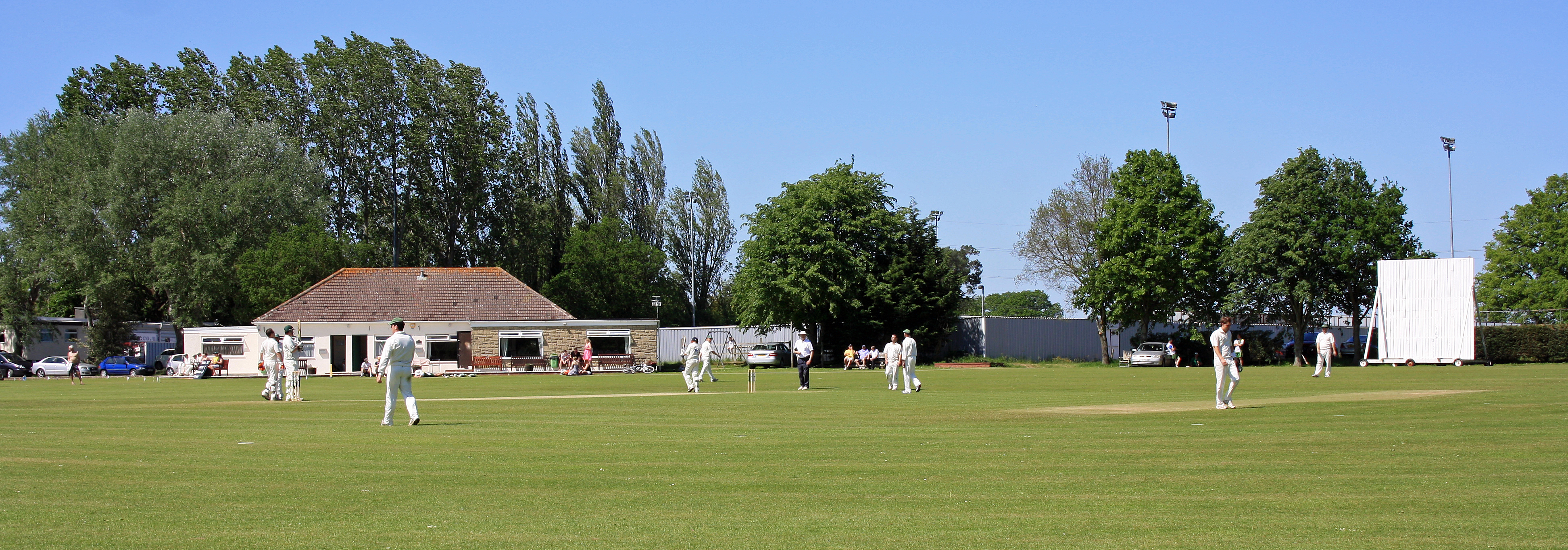
Ironmould Lane, Bristol

Ironmould Lane is a cricket ground in Bristol. The first recorded match on the ground was in 1894, when Brislington played Peasedown St John. In 1969...

St Brendan's Sixth Form College

St Brendan's is a state funded sixth form college located in Brislington, Bristol, England. Over 1700 students study A-levels, BTECs & GCSEs on one purpose...

Brislington House

Brislington House (now known as Long Fox Manor) was built as a private lunatic asylum. When it opened in 1806 it was one of the first purpose-built asylums...

Brislington F.C.

Brislington Football Club is a football club based in Brislington, in Bristol, England. Nicknamed "Briz", they are currently members of the Western League...

Carmel Christian School, Bristol

Carmel Christian School (CCS) was an independent Early Year's provider in Brislington, Bristol, England. Founded in 1997, the school originally provided...

Bristol Telephones F.C.

Bristol Telephones Football Club is a football club based in Stockwood, Bristol, England. They are currently members of the Western League Division One...

Nearby Amenities

Located within 500m of 51.418798,-2.5334735
Bus Stop
Lacey Road
Bus: yes
Naptan AtcoCode: 0100BAC30742
Naptan Bearing: S
Naptan CommonName: Lacey Road
Naptan Crossing: Lacey Road
Naptan NaptanCode: bstmpdj
Naptan PlusbusZoneRef: BRSTLTM
Naptan Street: Stockwood Lane
Naptan Verified: no
Public Transport: platform
Source: naptan_import
Lat/Long: 51.4159794/-2.5343674
Bus Stop
Lacey Road
Bus: yes
Naptan AtcoCode: 0100BAC30743
Naptan Bearing: N
Naptan BusStopType: CUS
Naptan CommonName: Lacey Road
Naptan Crossing: Lacey Road
Naptan NaptanCode: bstmpda
Naptan PlusbusZoneRef: BRSTLTM
Naptan Street: Stockwood Lane
Naptan Verified: no
Public Transport: platform
Source: naptan_import
Lat/Long: 51.415925/-2.5344819
Mini Roundabout
Lat/Long: 51.4162968/-2.5344793
Bench
Lat/Long: 51.41917/-2.5364473
Waste Basket
Lat/Long: 51.4190723/-2.5366497
Golf: pin
Lat/Long: 51.4180218/-2.5284244
Golf: pin
Lat/Long: 51.4146768/-2.5306226
Direction: 170
Generator Method: photovoltaic
Generator Output Electricity: yes
Generator Solar Modules: 15
Generator Source: solar
Generator Type: solar_photovoltaic_panel
Location: roof
Power: generator
Lat/Long: 51.4159016/-2.5385683
Direction: 175
Generator Method: photovoltaic
Generator Output Electricity: yes
Generator Solar Modules: 20
Generator Source: solar
Generator Type: solar_photovoltaic_panel
Location: roof
Power: generator
Lat/Long: 51.4167381/-2.5347838
Direction: 180
Generator Method: photovoltaic
Generator Output Electricity: yes
Generator Solar Modules: 16
Generator Source: solar
Generator Type: solar_photovoltaic_panel
Location: roof
Power: generator
Lat/Long: 51.4165225/-2.5353901
Direction: 180
Generator Method: photovoltaic
Generator Output Electricity: yes
Generator Solar Modules: 17
Generator Source: solar
Generator Type: solar_photovoltaic_panel
Location: roof
Power: generator
Lat/Long: 51.4156693/-2.5369794
Direction: 175
Generator Method: photovoltaic
Generator Output Electricity: yes
Generator Solar Modules: 12
Generator Source: solar
Generator Type: solar_photovoltaic_panel
Location: roof
Power: generator
Lat/Long: 51.415998/-2.5359444
Direction: 170
Generator Method: photovoltaic
Generator Output Electricity: yes
Generator Solar Modules: 12
Generator Source: solar
Generator Type: solar_photovoltaic_panel
Location: roof
Power: generator
Lat/Long: 51.4148142/-2.5358704
Direction: 175
Generator Method: photovoltaic
Generator Output Electricity: yes
Generator Solar Modules: 12
Generator Source: solar
Generator Type: solar_photovoltaic_panel
Location: roof
Power: generator
Lat/Long: 51.4147791/-2.5363424
Direction: 175
Generator Method: photovoltaic
Generator Output Electricity: yes
Generator Solar Modules: 10
Generator Source: solar
Generator Type: solar_photovoltaic_panel
Location: roof
Power: generator
Lat/Long: 51.414769/-2.5364283
Direction: 230
Generator Method: photovoltaic
Generator Output Electricity: yes
Generator Solar Modules: 16
Generator Source: solar
Generator Type: solar_photovoltaic_panel
Location: roof
Power: generator
Lat/Long: 51.414846/-2.5366241
Direction: 170
Generator Method: photovoltaic
Generator Output Electricity: yes
Generator Solar Modules: 12
Generator Source: solar
Generator Type: solar_photovoltaic_panel
Location: roof
Power: generator
Lat/Long: 51.4145666/-2.5352588
Direction: 170
Generator Method: photovoltaic
Generator Output Electricity: yes
Generator Solar Modules: 12
Generator Source: solar
Generator Type: solar_photovoltaic_panel
Location: roof
Power: generator
Lat/Long: 51.4145365/-2.5355673
Direction: 160
Generator Method: photovoltaic
Generator Output Electricity: yes
Generator Solar Modules: 14
Generator Source: solar
Generator Type: solar_photovoltaic_panel
Location: roof
Power: generator
Lat/Long: 51.4162021/-2.5342693
Direction: 260
Generator Method: photovoltaic
Generator Output Electricity: yes
Generator Solar Modules: 6
Generator Source: solar
Generator Type: solar_photovoltaic_panel
Location: roof
Power: generator
Lat/Long: 51.41459/-2.5357092
Street Lamp
Lat/Long: 51.4165453/-2.5395526
Street Lamp
Lat/Long: 51.4170527/-2.5370558
Street Lamp
Lat/Long: 51.4167426/-2.5386133
Street Lamp
Lat/Long: 51.4168578/-2.5381061
Street Lamp
Lat/Long: 51.4170836/-2.5364978
Street Lamp
Lat/Long: 51.4170812/-2.5360934
Street Lamp
Lat/Long: 51.4155323/-2.5365059
Street Lamp
Lat/Long: 51.4161518/-2.5365029
Street Lamp
Lat/Long: 51.4161499/-2.5360199
Street Lamp
Lat/Long: 51.4159713/-2.5344981
Street Lamp
Lat/Long: 51.4162159/-2.5351547
Street Lamp
Lat/Long: 51.4162483/-2.5347115
Street Lamp
Lat/Long: 51.4155616/-2.5373773
Street Lamp
Lat/Long: 51.4154947/-2.5370232
Street Lamp
Lat/Long: 51.4155248/-2.5378976
Street Lamp
Lat/Long: 51.414985/-2.5342318
Street Lamp
Lat/Long: 51.4146884/-2.5343221
Street Lamp
Lat/Long: 51.4165514/-2.5386037
Street Lamp
Lat/Long: 51.4162424/-2.5384418
Street Lamp
Lat/Long: 51.4160459/-2.5384418
Street Lamp
Lat/Long: 51.4162153/-2.5379118
Street Lamp
Lat/Long: 51.416153/-2.537526
Colour: grey
Man Made: street_cabinet
Lat/Long: 51.4161443/-2.5378535
Street Lamp
Lat/Long: 51.4162205/-2.537038
Direction: 180
Generator Method: photovoltaic
Generator Output Electricity: yes
Generator Solar Modules: 12
Generator Source: solar
Generator Type: solar_photovoltaic_panel
Location: roof
Power: generator
Lat/Long: 51.416325/-2.5367778
Power: substation
Lat/Long: 51.4163052/-2.5360789
Street Lamp
Lat/Long: 51.4163387/-2.5364886
Street Lamp
Lat/Long: 51.4169008/-2.5364837
Street Lamp
Lat/Long: 51.4151425/-2.5372078
Street Lamp
Lat/Long: 51.4153312/-2.5372695
Street Lamp
Lat/Long: 51.4146889/-2.5361323
Street Lamp
Lat/Long: 51.4146625/-2.535739
Street Lamp
Lat/Long: 51.4148252/-2.5353851
Street Lamp
Lat/Long: 51.4151373/-2.5354599
Street Lamp
Lat/Long: 51.41439/-2.5345267
Street Lamp
Lat/Long: 51.4153538/-2.5357384
Street Lamp
Lat/Long: 51.4152765/-2.5362841
The data included in this document is from www.openstreetmap.org. The data is made available under ODbL.

Have you been to Hicks Gate?

Leave your review of Hicks Gate below (or comments, questions and feedback).