Cnoc an Uileann

Hill, Mountain in Inverness-shire

Scotland

Cnoc an Uileann

Track near Galmisdale, Eigg
Track near Galmisdale, Eigg Credit: Chris Morgan

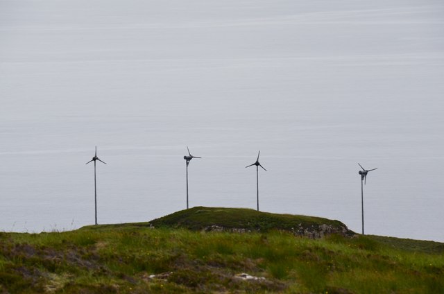
Cnoc an Uileann, also known as "The Hill of the Elms," is a prominent feature located in Inverness-shire, Scotland. Rising to an elevation of approximately 386 meters (1,266 feet), it is classified as a hill rather than a mountain. The hill is situated near the village of Invermoriston, just south of the famous Loch Ness.

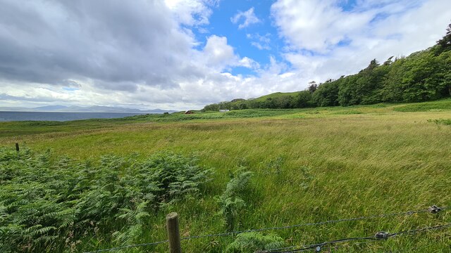
Cnoc an Uileann offers breathtaking panoramic views of the surrounding Scottish Highlands. On a clear day, visitors can marvel at the expansive vistas that stretch across the Loch Ness, the Great Glen, and the nearby Munros, such as Ben Nevis. The hill's strategic location makes it an ideal spot for photographers, nature enthusiasts, and hikers.

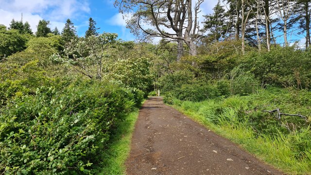
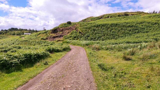
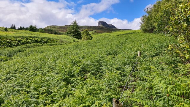
The terrain of Cnoc an Uileann is characterized by a mix of heather-covered moorland, grassy slopes, and scattered boulders. The hill's slopes are relatively gentle, making it accessible to walkers of various fitness levels. There are several well-marked paths and trails that lead to the summit, allowing visitors to explore the area at their own pace.

Wildlife is abundant in the vicinity of Cnoc an Uileann. Red deer, mountain hares, and various bird species, including golden eagles and peregrine falcons, can often be spotted in the area. The hill is also home to a diverse range of plant life, with wildflowers and ferns adding splashes of color to the landscape.

Overall, Cnoc an Uileann is a captivating natural landmark that offers a serene escape into the beauty of the Scottish Highlands. Whether one seeks a leisurely stroll, a challenging hike, or simply a peaceful retreat in nature, this hill provides a memorable experience for all who visit.

If you have any feedback on the listing, please let us know in the comments section below.

Cnoc an Uileann Images

Images are sourced within 2km of 56.87841/-6.1686288 or Grid Reference NM4684. Thanks to Geograph Open Source API. All images are credited.

Track near Galmisdale, Eigg
Eigg near Galmisdale
Track to The Lodge
Track to The Lodge
Valley of Allt Eas Chuthain, Eigg An Sgurr in background
Valley of Allt Eas Chuthain, Eigg
An Sgurr in background
The Sgurr overshadows the moors of Eigg
Eigg and Rum Eigg is in the foreground; the Sgurr is towards the left (west) end of the island. Beyond it is the island of Rum, and in the distance is Skye, with the Black Cuillin at extreme right.
Eigg and Rum
Eigg is in the foreground; the Sgurr is towards the left (west) end of the island. Beyond it is the island of Rum, and in the distance is Skye, with the Black Cuillin at extreme right.
The Nose, An Sgurr The striking summit that is actually the end of a steep-sided ridge of volcanic rock, looking much more impressive than its 394m height might suggest. The scale can be judged by the five figures on top.
The Nose, An Sgurr
The striking summit that is actually the end of a steep-sided ridge of volcanic rock, looking much more impressive than its 394m height might suggest. The scale can be judged by the five figures on top.
Coast at Galmisdale The coast and Eilean Chathastail (Castle Island) seen from the track to the caves.
Coast at Galmisdale
The coast and Eilean Chathastail (Castle Island) seen from the track to the caves.
Coast at Galmisdale (2) The pier café and shop building near the ferry slipway with the N end of Eilean Chathastail in view, and the mainland around Mallaig opposite.
Coast at Galmisdale (2)
The pier café and shop building near the ferry slipway with the N end of Eilean Chathastail in view, and the mainland around Mallaig opposite.
Eigg's rocky south coast The cliffs and rocky beach seen from the path to the Massacre Cave.
Eigg's rocky south coast
The cliffs and rocky beach seen from the path to the Massacre Cave.
Coast near the Massacre Cave, Eigg The rocky coast to the east of the cave entrance shown in <a href="https://www.geograph.org.uk/photo/3970306">NM4783 : Entrance to Massacre Cave</a>.
Coast near the Massacre Cave, Eigg
The rocky coast to the east of the cave entrance shown in NM4783 : Entrance to Massacre Cave.
The Lodge gardens, Eigg The Lodge was built in 1924 by Lord Runciman, Eigg's 5th landowner. The garden here has been planted with subtropical species - information from the 'Guide to the Isle of Eigg Postcard Maps', describing waymarked walks on the island.
The Lodge gardens, Eigg
The Lodge was built in 1924 by Lord Runciman, Eigg's 5th landowner. The garden here has been planted with subtropical species - information from the 'Guide to the Isle of Eigg Postcard Maps', describing waymarked walks on the island.
An Sgurr The striking profile of the ridge with wisps of cirrus above, seen from the NE from the path to the forestry plantation. The low sun picks out a terraced landform on the intervening ground.
An Sgurr
The striking profile of the ridge with wisps of cirrus above, seen from the NE from the path to the forestry plantation. The low sun picks out a terraced landform on the intervening ground.
Evening light on An Sgurr The dramatic rock ridge is catching the evening sunlight, seen here from near the Glebe Barn hostel.

See Anne Burgess's photograph <a href="https://www.geograph.org.uk/photo/3964613">NM4684 : The Nose</a> for an account of the geology of the Sgurr.
Evening light on An Sgurr
The dramatic rock ridge is catching the evening sunlight, seen here from near the Glebe Barn hostel. See Anne Burgess's photograph NM4684 : The Nose for an account of the geology of the Sgurr.
Path to An Sgurr, Eigg The path above Galmisdale that keeps to the north of the ridge until a breach in the defences is reached and the ridge can be attained. The route is waymarked by discreet blobs of red paint at intervals.
Path to An Sgurr, Eigg
The path above Galmisdale that keeps to the north of the ridge until a breach in the defences is reached and the ridge can be attained. The route is waymarked by discreet blobs of red paint at intervals.
Wind turbines, Eigg Four 6kW turbines on the hillside west of Galmisdale, and part of the mix of renewables in the Eigg Electric supply system - see <span class="nowrap"><a title="http://www.isleofeigg.org/eigg-electric/" rel="nofollow ugc noopener" href="http://www.isleofeigg.org/eigg-electric/">Link</a><img style="margin-left:2px;" alt="External link" title="External link - shift click to open in new window" src="https://s1.geograph.org.uk/img/external.png" width="10" height="10"/></span> for further details.
Wind turbines, Eigg
Four 6kW turbines on the hillside west of Galmisdale, and part of the mix of renewables in the Eigg Electric supply system - see LinkExternal link for further details.
A closer view of The Nose, An Sgurr The 100m vertical prow of this volcanic ridge looms above the path around the north side.
A closer view of The Nose, An Sgurr
The 100m vertical prow of this volcanic ridge looms above the path around the north side.
Relay station below An Sgurr What looks to be a telephone repeater for a link to the north side of the island.
Relay station below An Sgurr
What looks to be a telephone repeater for a link to the north side of the island.
Show me another place!

Cnoc an Uileann is located at Grid Ref: NM4684 (Lat: 56.87841, Lng: -6.1686288)

Unitary Authority: Highland

Police Authority: Highlands and Islands

What 3 Words

///desire.gloom.spillage. Near Arisaig, Highland

Related Wikis

An Sgùrr (Eigg)

An Sgùrr is the highest hill on the Inner Hebridean island of Eigg, Lochaber, Highland, Scotland. It was formed 58.72 ± 0.07 million years ago; the result...

Galmisdale

Galmisdale is the main port of the island of Eigg, one of the Small Isles of the Inner Hebrides. It is in the Scottish council area of Highland. ��2�...

Eigg

Eigg ( eg; Scottish Gaelic: Eige; Scots: Eigg) is one of the Small Isles in the Scottish Inner Hebrides. It lies to the south of the Isle of Skye and to...

Eilean Chathastail

Eilean Chathastail (Eng: Castle Island) is one of the Small Isles in the Inner Hebrides of Scotland. == Geography == Eilean Chathastail...

Nearby Amenities

Located within 500m of 56.87841,-6.1686288
Ford: yes
Lat/Long: 56.8789347/-6.1707204
The data included in this document is from www.openstreetmap.org. The data is made available under ODbL.

Have you been to Cnoc an Uileann?

Leave your review of Cnoc an Uileann below (or comments, questions and feedback).