Sgorr nam Faoileann

Hill, Mountain in Argyllshire

Scotland

Sgorr nam Faoileann

Summit area of Glas Bheinn Two mountain walkers approaching the summit of Glas Bheinn.
Summit area of Glas Bheinn Credit: Trevor Littlewood

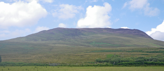
Sgorr nam Faoileann, located in Argyllshire, Scotland, is a prominent hill/mountain that offers breathtaking views and a challenging hike for outdoor enthusiasts. Standing at an elevation of 668 meters (2,192 feet), it is part of the Glen Coe mountain range and is known for its distinctive shape and rugged terrain.

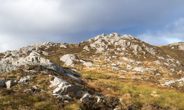
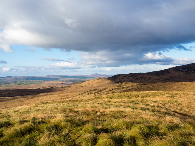
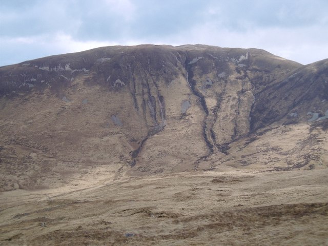
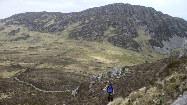
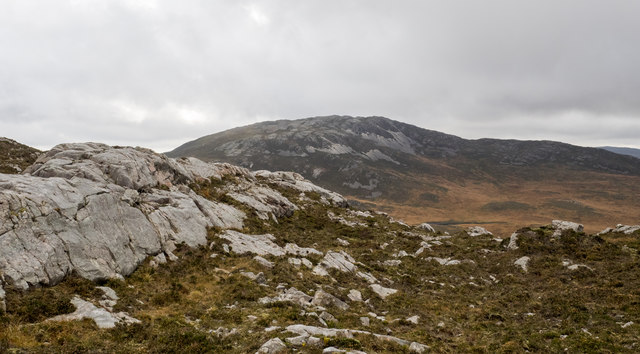
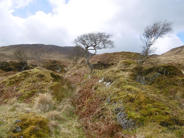
The hill/mountain is characterized by its steep slopes, rocky outcrops, and grassy ridges. It is a popular destination for hillwalking and offers a variety of routes to suit different skill levels. The ascent typically begins from the village of Glen Coe, where hikers can follow well-marked trails that gradually lead to the summit.

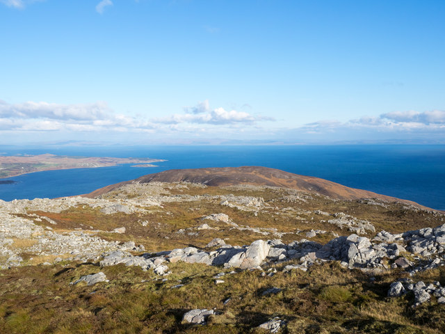
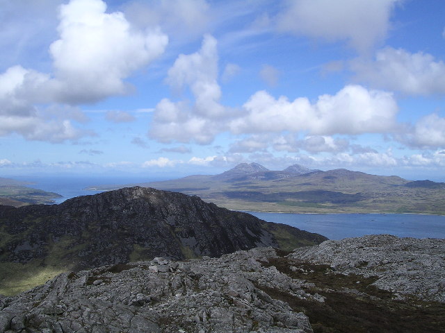
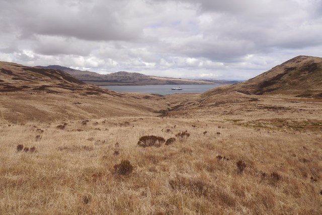
The summit of Sgorr nam Faoileann offers panoramic views of the surrounding landscape, including the nearby Loch Leven and the stunning Glencoe Valley. On clear days, hikers can see as far as Ben Nevis, the highest mountain in the British Isles.

The hill/mountain is also home to a diverse range of flora and fauna, including heather, mosses, and wildflowers, as well as bird species such as golden eagles and ptarmigans. It is important to note that the area is protected, and visitors are urged to respect the natural environment and adhere to local guidelines.

Overall, Sgorr nam Faoileann is a must-visit destination for nature lovers and outdoor enthusiasts seeking a challenging yet rewarding hike. With its stunning views, diverse wildlife, and rugged terrain, it offers a memorable experience for those who venture to its summit.

If you have any feedback on the listing, please let us know in the comments section below.

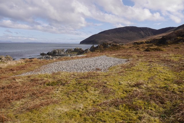
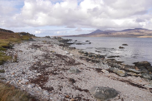
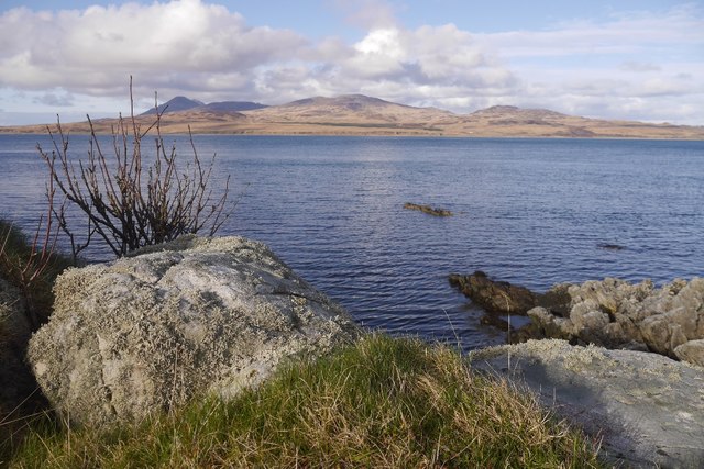
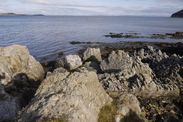
Sgorr nam Faoileann Images

Images are sourced within 2km of 55.770914/-6.0945248 or Grid Reference NR4360. Thanks to Geograph Open Source API. All images are credited.

Summit area of Glas Bheinn Two mountain walkers approaching the summit of Glas Bheinn.
Summit area of Glas Bheinn
Two mountain walkers approaching the summit of Glas Bheinn.
Declining slope of Glas Bheinn Glas Bheinn has two tops of a similar height, each regarded as being at 472 metres. The view is from the north-eastern of those tops and includes Beinn na Caillich with the sea south of Jura lying beyond.
Declining slope of Glas Bheinn
Glas Bheinn has two tops of a similar height, each regarded as being at 472 metres. The view is from the north-eastern of those tops and includes Beinn na Caillich with the sea south of Jura lying beyond.
Ground south of Lochan Dubh Lochan Dubh lies to the right, out of the image as does the peak Glas Bheinn. The distant, partly cloud-shadowed  ridge rises presumably to Sgorr nam Faoileann.
Ground south of Lochan Dubh
Lochan Dubh lies to the right, out of the image as does the peak Glas Bheinn. The distant, partly cloud-shadowed ridge rises presumably to Sgorr nam Faoileann.
Beinn na Cailleach A steep gullied slope above Gleann Choireadail.
Beinn na Cailleach
A steep gullied slope above Gleann Choireadail.
Summit of Glas Bheinn The summit of Glas Bheinn on Islay, looking across the Sound of Islay to the Paps of Jura
Summit of Glas Bheinn
The summit of Glas Bheinn on Islay, looking across the Sound of Islay to the Paps of Jura
Heading up the NE ridge of Glas Bheinn with Sgorr nan Faoileann in the background
Rocks of upper slope of Sgorr nam Faoileann The lower western slopes of Sgorr nam Faoileann are of boggy moorland but as height is gained the ground becomes more firm with heather and rock outcrops.
Rocks of upper slope of Sgorr nam Faoileann
The lower western slopes of Sgorr nam Faoileann are of boggy moorland but as height is gained the ground becomes more firm with heather and rock outcrops.
Rocks of west ridge of Sgorr nam Faoileann The approach to Sgorr nam Faoileann from the west is initially over boggy moorland but eventually the ground becomes less wet and rock outcrops appear; those here are on the west ridge of the mountain. Glas Bheinn is in the distance.
Rocks of west ridge of Sgorr nam Faoileann
The approach to Sgorr nam Faoileann from the west is initially over boggy moorland but eventually the ground becomes less wet and rock outcrops appear; those here are on the west ridge of the mountain. Glas Bheinn is in the distance.
Rock outcrop west of summit of Sgorr nam Faoileann The rocks are at a height of around 380 metres, rather less than 50 metres below the mountain summit. Glas Bheinn is beyond.
Rock outcrop west of summit of Sgorr nam Faoileann
The rocks are at a height of around 380 metres, rather less than 50 metres below the mountain summit. Glas Bheinn is beyond.
Ground rising on west ridge of Sgorr nam Faoileann The west ridge of Sgorr nam Faoileann is grassy lower down but above the location in the image it becomes progressively rockier on its way to the mountain's summit.
Ground rising on west ridge of Sgorr nam Faoileann
The west ridge of Sgorr nam Faoileann is grassy lower down but above the location in the image it becomes progressively rockier on its way to the mountain's summit.
A ferry passes Glen Logan Finlaggan, heading for Port Askaig.
A ferry passes Glen Logan
Finlaggan, heading for Port Askaig.
Raised beach, An Cladach The cobble beaches are a very distinctive feature of Islay and Jura's coast.
Raised beach, An Cladach
The cobble beaches are a very distinctive feature of Islay and Jura's coast.
Beach, An Cladach Sound of Islay.
Beach, An Cladach
Sound of Islay.
Shoreline, An Claddach Looking over the Sound of Islay.
Shoreline, An Claddach
Looking over the Sound of Islay.
Sound of Islay Looking southwards out of the Sound of Islay from the shoreline at An Cladach
Sound of Islay
Looking southwards out of the Sound of Islay from the shoreline at An Cladach
Birches. Lùb Gleann Ghàireasdail The steep slope up of the raised beach with some surviving trees.
Birches. Lùb Gleann Ghàireasdail
The steep slope up of the raised beach with some surviving trees.
Beach, Lùb Gleann  Ghàireasdail Beach on the Sound of Islay.
Beach, Lùb Gleann Ghàireasdail
Beach on the Sound of Islay.
Allt Gleann Ghàireasdail A small waterfall over former sea cliffs onto a raised beach, Sound of Islay.
Allt Gleann Ghàireasdail
A small waterfall over former sea cliffs onto a raised beach, Sound of Islay.
Show me another place!

Sgorr nam Faoileann is located at Grid Ref: NR4360 (Lat: 55.770914, Lng: -6.0945248)

Unitary Authority: Argyll and Bute

Police Authority: Argyll and West Dunbartonshire

What 3 Words

///recorder.once.debut. Near Ballygrant, Argyll & Bute

Nearby Locations

Sgorr nam Faoileann

Related Wikis

Islay

Islay ( EYE-lə; Scottish Gaelic: Ìle, Scots: Ila) is the southernmost island of the Inner Hebrides of Scotland. Known as "The Queen of the Hebrides",...

Beinn Bheigeir

Beinn Bheigeir (occasionally anglicised as "Ben Vicar") is a hill on the island of Islay in Scotland, UK. At 491 m, it is the highest of the seven 'Marilyn...

Claig Castle

Claig Castle was a stronghold of the Clan Donald or MacDonald in the south of Scotland. == History == The castle was once a massive fort described as a...

Ardfin

Ardfin is a country estate on the island of Jura, Inner Hebrides, Scotland. It is situated at the southern tip of the island, between Feolin and Craighouse...

Nearby Amenities

Located within 500m of 55.770914,-6.0945248
Sgorr nam Faoileann
Corbett: no
Ele: 429
Graham: no
Marilyn: yes
Munro: no
Natural: peak
Prominence: 171
Wikidata: Q2276112
Lat/Long: 55.7709739/-6.0945539
The data included in this document is from www.openstreetmap.org. The data is made available under ODbL.

Have you been to Sgorr nam Faoileann?

Leave your review of Sgorr nam Faoileann below (or comments, questions and feedback).